Ticker for October 12, 2020
MESONET TICKER ... MESONET TICKER ... MESONET TICKER ... MESONET TICKER ...
October 12, 2020 October 12, 2020 October 12, 2020 October 12, 2020
October non-surprise
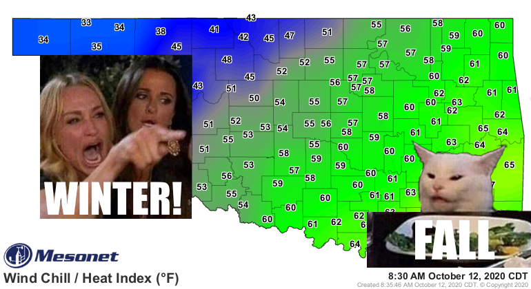
After the last few days of summer, I guess the current cooldown was well deserved.
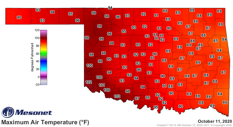
We had a slew of hundreds across southwestern OK yesterday, topped with Hollis and
Grandfield at 102 degrees. Who knew that days above 100 map was still needed?
2020 did.
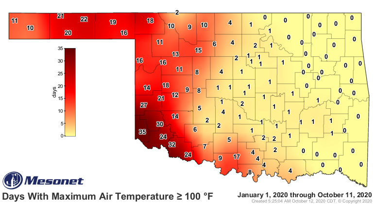
You might think it's a bit late in the season to be seeing those triple-digit
temperatures. Having 100s on October 11 isn't the record latest in the state, but
it's darned close. That latest triple-digit temperatures I can find in the state
occurred on Oct 17, 2016. The Mesonet sites at Buffalo, Beaver, Slapout and May
Ranch all hit 100 that day, with Buffalo topped out at 102 degrees. The Beaver
and Gate NWS COOP sites show 100s as well on the 18th, but those temperatures
were recorded the morning of the 18th, so those undoubtedly came on the 17th. So
let's call it the 17th, with Buffalo (the greatest place in the state...fight me)
leading the way at 102 degrees.
That mark is probably safe, but we could see another triple-digit mark coming
up this Wednesday. Of course...2020. What else would you expect? It will be
close as we have a brief warm up after today's front in advance of another
front coming in later that day. You know how it works...southerly winds will
kick up, bringing in the warmer air from the south.
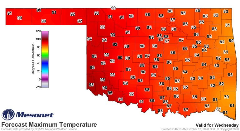
That would be October 14, so if we can eek out a hunnert (Okie to English
translation: "hundred"), we're at least close to that record late date.
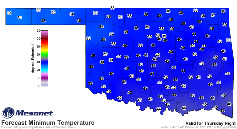
We could be seeing our first freeze in the state in the Panhandle Friday
morning, so that will be our first milestone towards REAL winter.
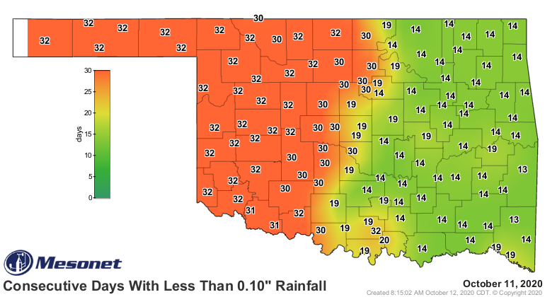
How about rain? LOL! Yeah, right. Today will mark the 33rd straight day that
most folks across western OK have seen at least a tenth of an inch of moisture.
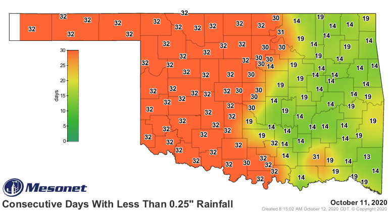
Days without a quarter-inch extends farther east.
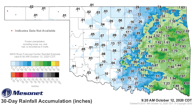
How's this for one of the ugliest maps you've ever seen...the 30-day percent of
normal rainfall.
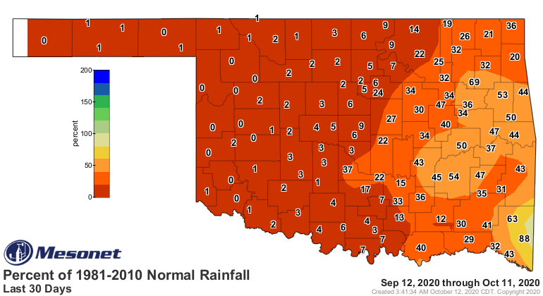
Little hope in sight for the next week as we continue with these dry cold
fronts.
We are seeing just a bit of an uptick in the chances for at least an inch of
accumulated moisture through Oct. 26, from a long-range forecast from the
Canadian forecast model. It ain't much, but 10-30% across the state (less than
10% in the Panhandle, unfortunately).
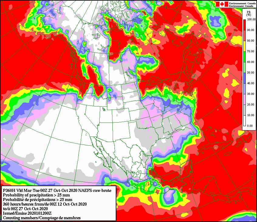
We're getting into fantasy-cast territory there, however. Best wait to see
what each week brings. I'm confident we'll start painting some colors on that
7-day moisture forecast sometime soon.
Gary McManus
State Climatologist
Oklahoma Mesonet
Oklahoma Climatological Survey
(405) 325-2253
gmcmanus@mesonet.org
October 12 in Mesonet History
| Record | Value | Station | Year |
|---|---|---|---|
| Maximum Temperature | 99°F | MANG | 2024 |
| Minimum Temperature | 23°F | EVAX | 2019 |
| Maximum Rainfall | 2.92 inches | MIAM | 2016 |
Mesonet records begin in 1994.
Search by Date
If you're a bit off, don't worry, because just like horseshoes, “almost” counts on the Ticker website!