Ticker for August 12, 2020
MESONET TICKER ... MESONET TICKER ... MESONET TICKER ... MESONET TICKER ...
August 12, 2020 August 12, 2020 August 12, 2020 August 12, 2020
Ding Ding?
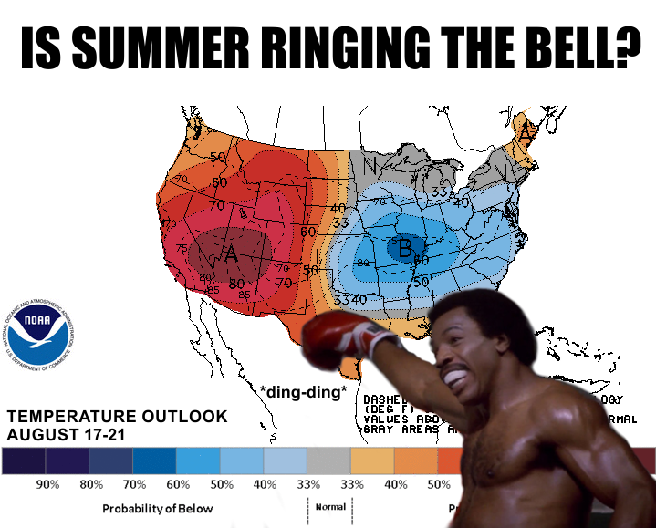
Well no, of course not! While it does look like we're going to see a really nice
cold front (cold fronts are nice in the summer, mean in the fall, and downright
nasty in the winter) next week, the presence of that large ridge of high pressure
across the western U.S. probably means we'll see more summer heat. But, it will
be nice while it lasts! Check out the 7-day temp forecast from our friends at
the Norman NWS office. Low 80s for highs! Wow, it'll be just like, uhhhhh, early
August again?
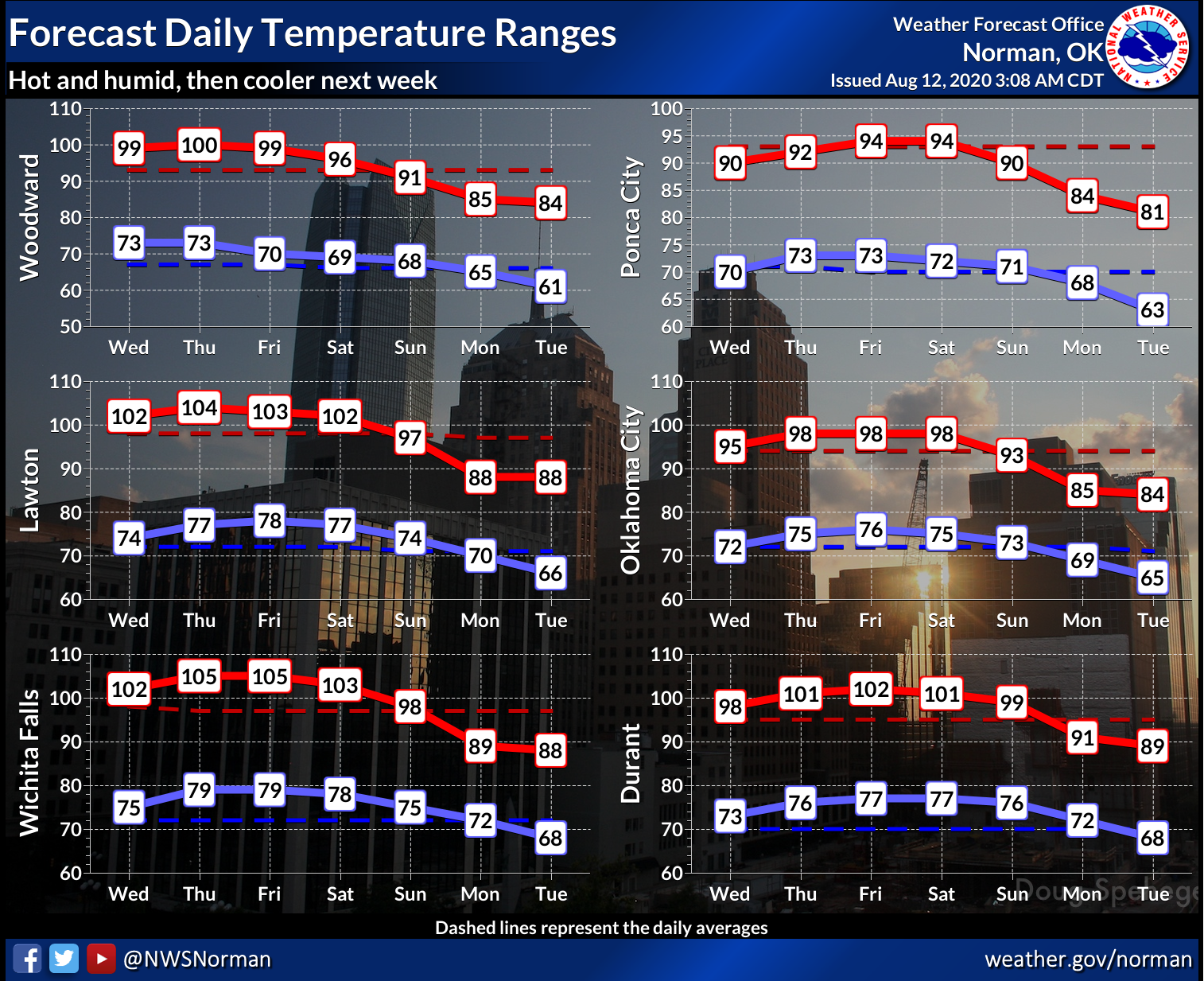
Right, this won't be our first go-round with 80s for highs this summer, but it's
a signal we're getting closer to fall. But before we get there, it's gonna be
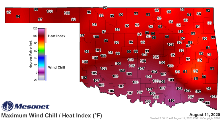
ugly for awhile. Yesterday's heat index values weren't obscene, but they weren't
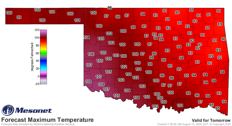
angelic either. And tomorrow's actual air temperatures are going to look even
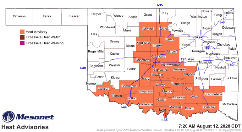
worse when you add on all that humidity. Today will be no picnic either, with
a heat advisory in effect for much of southern up into central Oklahoma.
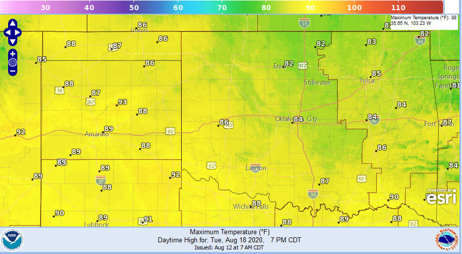
Now doesn't this look much better, the forecast highs for next Tuesday?
We're cutting a really fine edge here, though. If that heat dome shifts to the
east at all, it might mean that cool air is a little farther off to the east.
Stranger things have happened. Heck, with Oklahoma weather, MUCH MUCH stranger
things have happened. And long range fantasycasts have us back in the mid-90s
by the end of next week anyway, so don't get those sweaters out just yet.
Gary McManus
State Climatologist
Oklahoma Mesonet
Oklahoma Climatological Survey
(405) 325-2253
gmcmanus@mesonet.org
August 12 in Mesonet History
| Record | Value | Station | Year |
|---|---|---|---|
| Maximum Temperature | 112°F | GRA2 | 2023 |
| Minimum Temperature | 48°F | MIAM | 2004 |
| Maximum Rainfall | 3.93 inches | PRYO | 2011 |
Mesonet records begin in 1994.
Search by Date
If you're a bit off, don't worry, because just like horseshoes, “almost” counts on the Ticker website!