Ticker for June 12, 2023
MESONET TICKER ... MESONET TICKER ... MESONET TICKER ... MESONET TICKER ...
June 12, 2023 June 12, 2023 June 12, 2023 June 12, 2023
Gonna get hot as (BEEP)

Oh yeah, you just THOUGHT I'd lead with the rain this morning. Not me, because
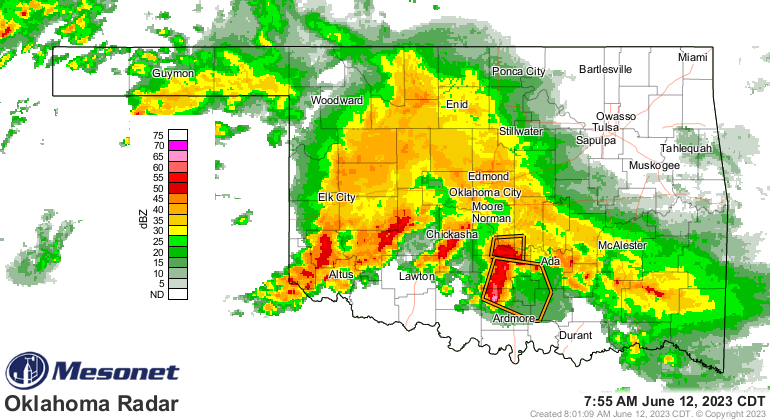
that's just what you'd be expecting. Oh, it's raining alright. Rain rain rain,
blah blah blah! All we've talked about is rain...or the lack thereof. So let's get
it out of the way and show you how much it's rained lately.
HAS rained? Heck, it's raining right now for crying out loud!
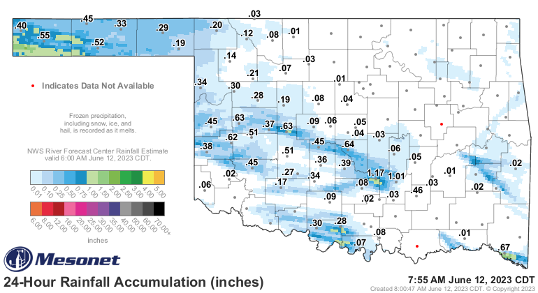
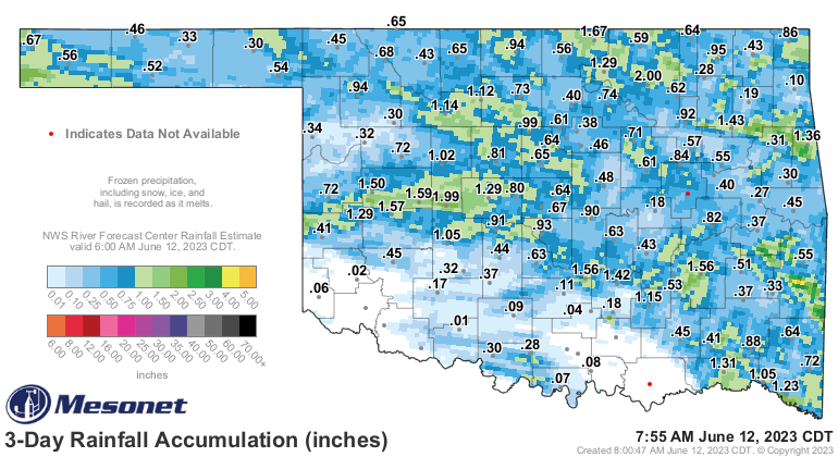
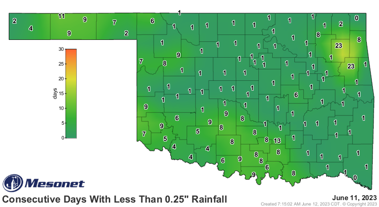
It has rained a bunch in some parts over the last 24 hours, the weekend, and all
the way back to April. In some parts...not all.
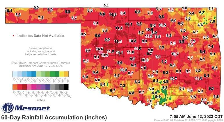

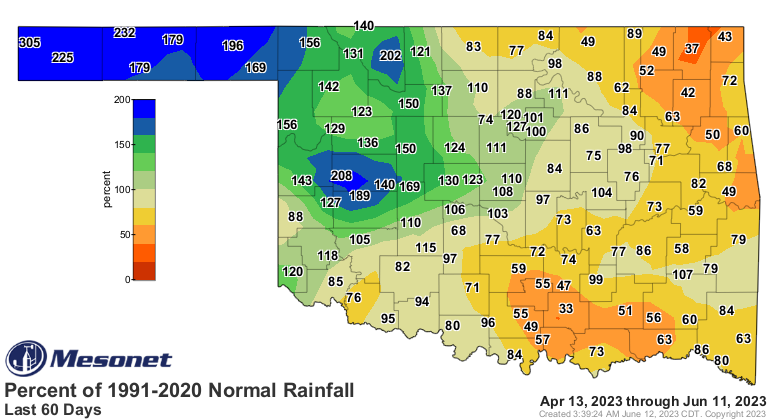
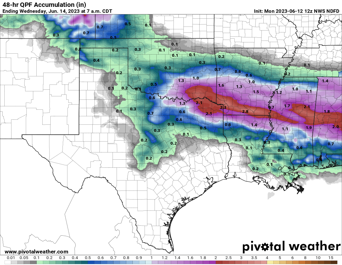
Now we're faced with entering the depths of summer without adequate moisture
across the eastern half of the state or so. Now some of those deficits on the
maps should start to dwindle over the next couple of days as we're faced with
multiple rounds of rain, but not all will catch up closer to normal.
Oh wait, back to our good friend Gladys, just your friendly Grandma possessed
by a demon from the depths of Hades. Burn is a bit much, Gladys, but summer is
coming, whether you're ready for it or not. I'm ready. I've been ready since
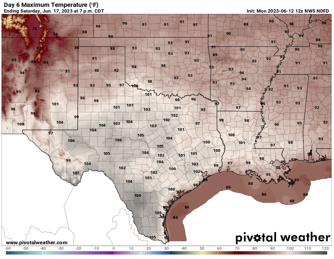
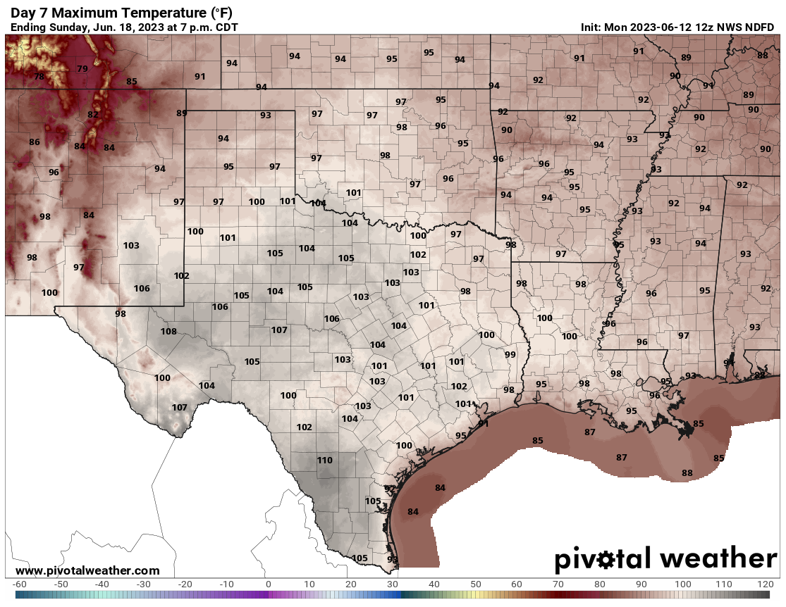
February. We see the tell-tale signs of an upper-level death ridge (so
macabre today!) over the Southern Plains in the top graphic, with it's sinking,
compressing air and accompanying greatly increased odds of above normal
temperatures.
Oh, wait! Macabre (English to Okie dictionary: grim).
Anyway, expect a march upwards of our high temps as we go through the week, and
we finally see a triple-digit temperature through the weekend sometime. Keep
your sunburned fingers crossed!
100s? Heck, we're still trying to get everybody to 90, for crying out loud
(sorry, just had to).
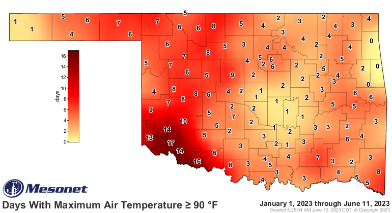
Are you kidding me, Cookson, Jay, and Westville? You think you're in Minnesota?
We haven't seen triple-digits on the thermometer, but if you've been outside in
it over the last couple of days, you've felt like it was a hunnerd, at least in
some parts of the state.

And you can add 5-10 degrees onto those highs coming this weekend, thanks to
the recent rains. That's something I *CAN'T* get on board with.
And as always, be on the lookout for kindly old grandmother types ordering raw
steak at your local diner.
Gary McManus
State Climatologist
Oklahoma Mesonet
Oklahoma Climatological Survey
gmcmanus@mesonet.org
June 12 in Mesonet History
| Record | Value | Station | Year |
|---|---|---|---|
| Maximum Temperature | 110°F | ALTU | 2022 |
| Minimum Temperature | 44°F | KENT | 2011 |
| Maximum Rainfall | 6.15 inches | ACME | 2016 |
Mesonet records begin in 1994.
Search by Date
If you're a bit off, don't worry, because just like horseshoes, “almost” counts on the Ticker website!