Ticker for September 10, 2020
MESONET TICKER ... MESONET TICKER ... MESONET TICKER ... MESONET TICKER ...
September 10, 2020 September 10, 2020 September 10, 2020 September 10, 2020
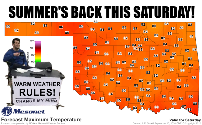
IT'SSSS BAAAAACKKKK!!!
Okay, we've had winter. Well, SOME of us have had winter. We see you, SE OK!
You didn't miss much. Cracked lips. Dry skin. No fishing, swimming, or bike
riding. Just lots of jackets and coats and wind-driven rain making everybody
miserable.
Yeah, that's a long pause. Just a bit more.
Got it out of your system, cold weather fans? Okay, fair enough. Well, the cursing
wasn't fair, but I get it. I'll admit I like this little break, too. But I am
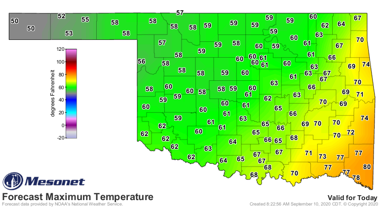
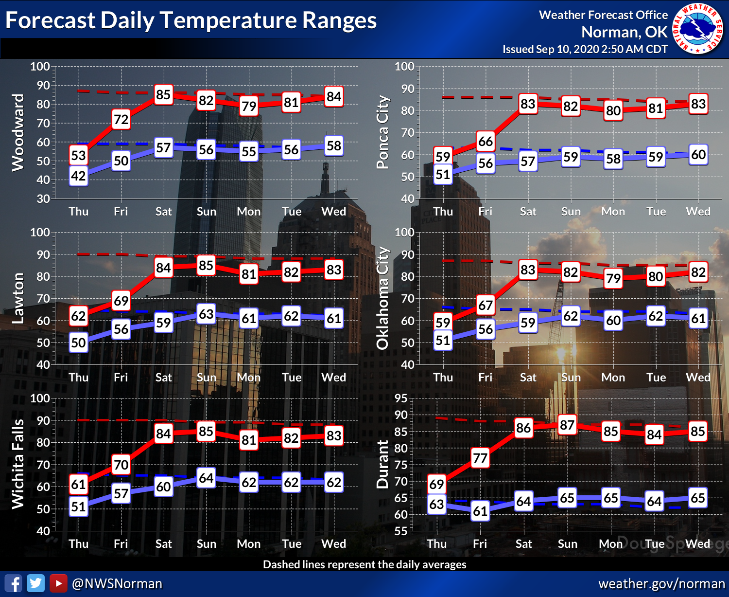
going to enjoy getting back to some warm weather, for at least a little while
longer. And it doesn't appear to be TOO bad this go-around? We can do 80s, right?
Well, for those cold weather adherents, here are some more records waiting to
be broken, if not already smashed!
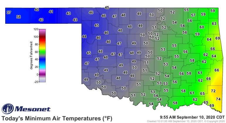
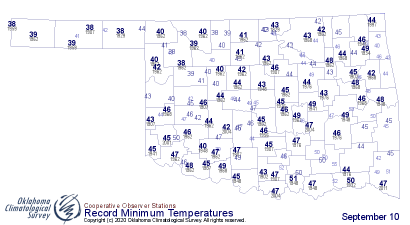
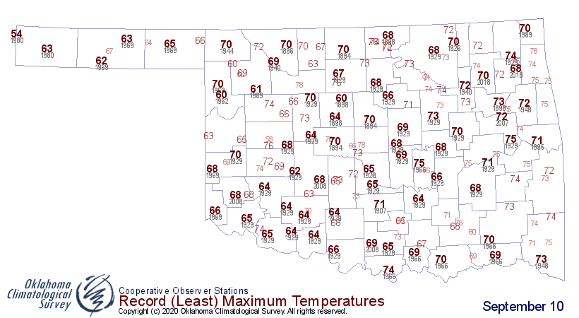
When you see those record low Tmax values across the western half or so of the
state,and see how badly many of those records have been smashed, it gives you a
sense of the historic nature of this cold air outbreak so early in the season.
Two more days of faux winter, then we're back to September again (with the
understanding that SE OK missed out completely).
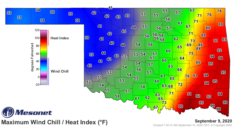
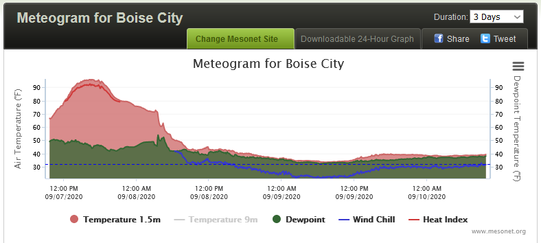
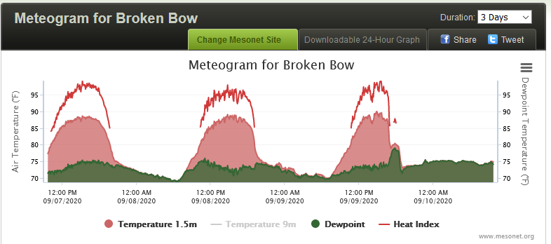
To illustrate that point, check out the differing experiences over the last
three days between Boise City and Broken Bow; the huge drop off following the
front's passage in Boise City and then steady state in the 30s and 40s, vs.
Broken Bow's normal September pattern of high highs and warm lows with a nasty
heat index thrown in.
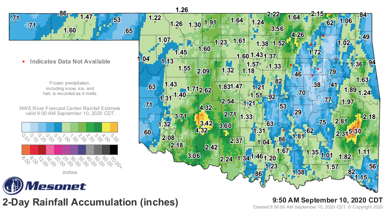
At least we've seen some rain through this deal, generally a good rain across
almost the entire state.
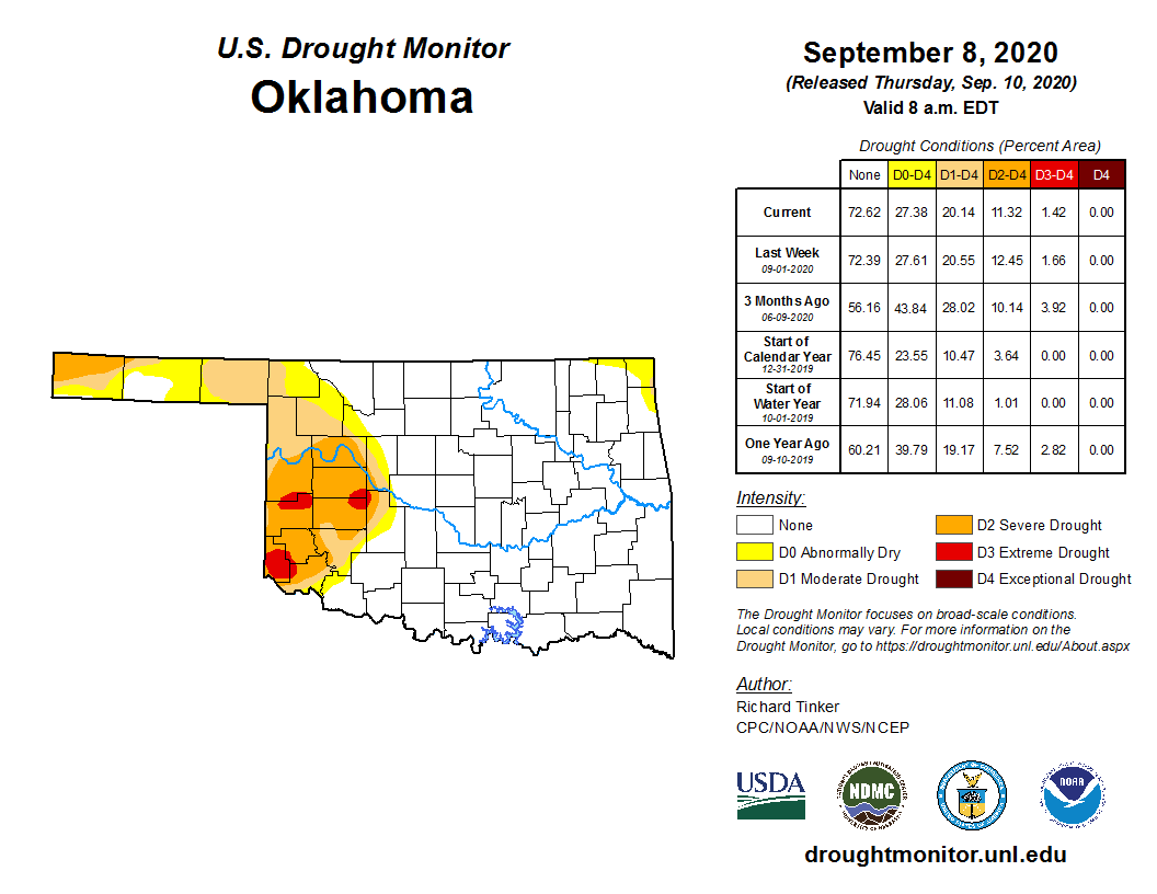
We didn't see a lot of changes in this week's Drought Monitor map because the
event was occurring as the map deadlines were occurring, but we will see
improvements in next week's map for sure.
Okay, now that I've angered half of you and ticked off the other two-thirds (new
math), my work here is complete.
This is the TICKer, after all.
Gary McManus
State Climatologist
Oklahoma Mesonet
Oklahoma Climatological Survey
(405) 325-2253
gmcmanus@mesonet.org
Gary McManus
September 10 in Mesonet History
| Record | Value | Station | Year |
|---|---|---|---|
| Maximum Temperature | 106°F | HOLL | 2000 |
| Minimum Temperature | 37°F | KENT | 2020 |
| Maximum Rainfall | 5.70 inches | ERIC | 2003 |
Mesonet records begin in 1994.
Search by Date
If you're a bit off, don't worry, because just like horseshoes, “almost” counts on the Ticker website!