Ticker for August 9, 2012
MESONET TICKER ... MESONET TICKER ... MESONET TICKER ... MESONET TICKER ...
August 9, 2012 August 9, 2012 August 9, 2012 August 9, 2012
Extreme-to-exceptional drought now covers Oklahoma
Spurred by rapidly intensifying flash drought and its impacts,
including the extreme fire danger realized in the state over the last week,
the U.S. Drought Monitor has now designated virtually all of Oklahoma in
extreme-to-exceptional drought. Nearly 97 percent of the state is now depicted by
the Drought Monitor in those worst two drought intensities, the highest such
coverage for the state since the Drought Monitor effort began in 2000. A narrow
swath of exceptional drought extends from Cleveland and McClain counties in
central Oklahoma to the northwest where it broadens and covers much of western
Kansas.
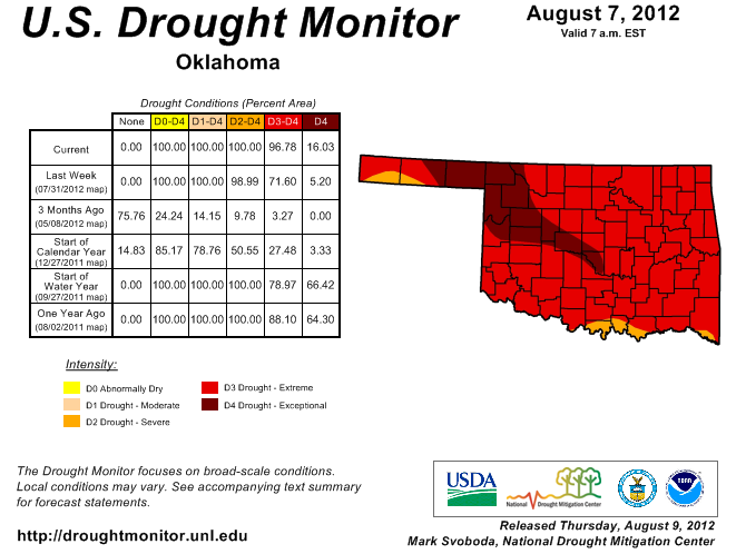
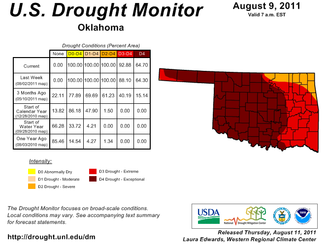
The next highest percentage of extreme-to-exceptional drought designation was 93
percent from the same week last year on August 9, 2011. The percentage of
exceptional drought alone is only 16 percent, while the August 9 map from 2011
had 65 percent of the state designated in the worst drought category.
Over 103,000 acres have burned due to wildfire across the state since Aug. 3. One
fatality has been attributed to the fire east of Norman. Nearby Lake Thunderbird,
Norman's primary source of drinking water, is now at 76 percent of capacity. The
lake sat at 88 percent of capacity on June 4. Its lowest level during the drought
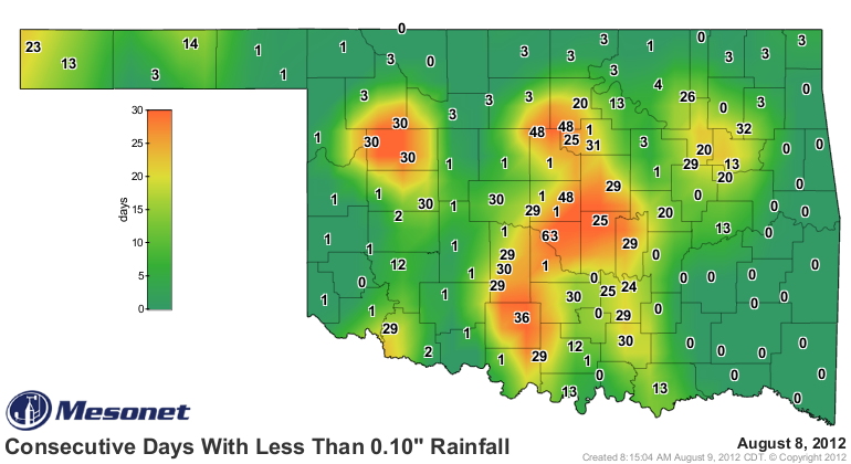
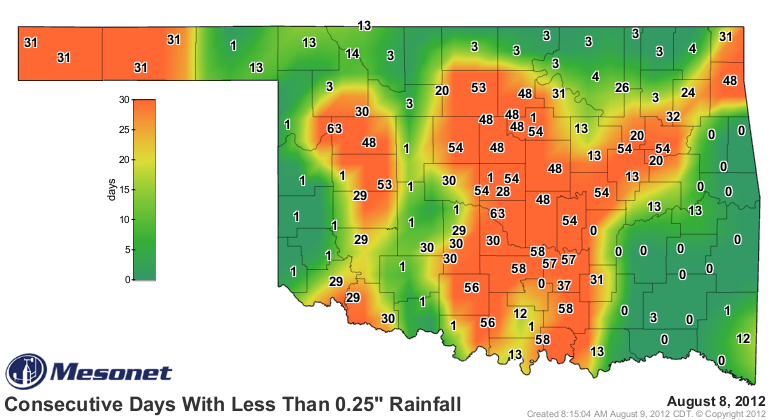
last year was 73 percent on October 7. It has now been 63 days since the
Oklahoma Mesonet site at Norman recorded at least a tenth of an inch of rain
in a single calendar day, with other areas enduring that same period with less
than a quarter inch of rain in any single day.
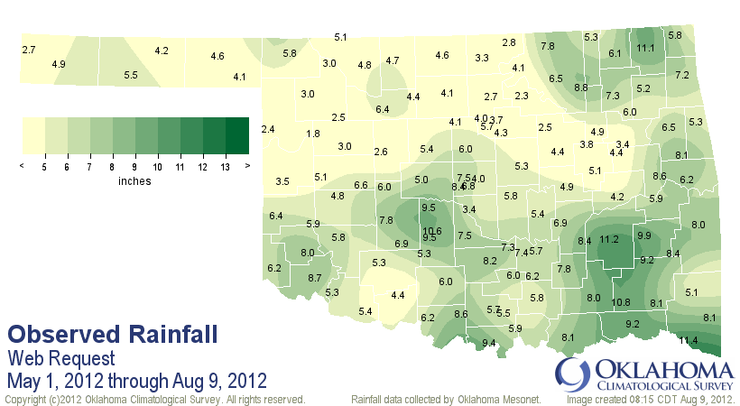
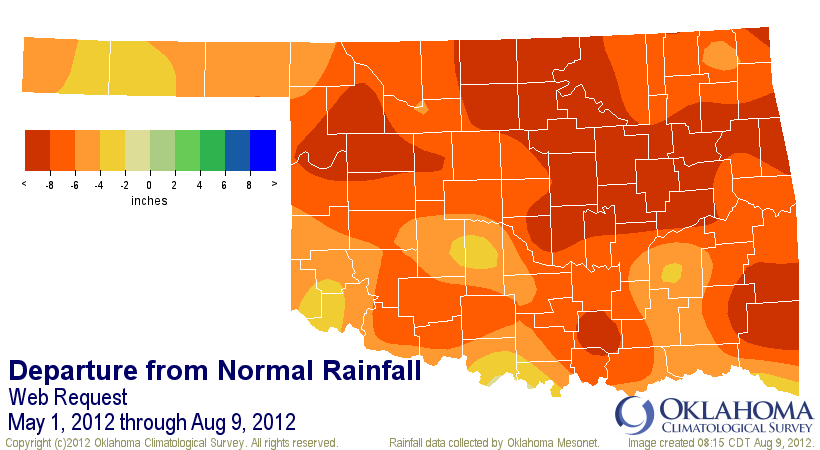
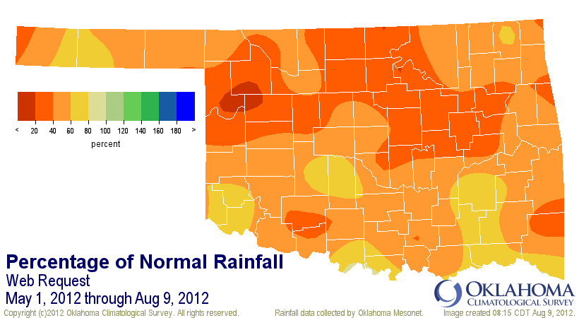
According to data from the Oklahoma Mesonet, the statewide average rainfall
total since May 1 through this morning was 5.87 inches, 7.03 inches below
normal and the second driest such period since 1921. Only the same period in
1934 was drier with 5.69 inches. North central Oklahoma has received an average
of 3.95 inches, 8.67 inches below normal. That is the driest such period since
1921 for that region of the state.
The National Climatic Data Center (NCDC)ranked the May-July period as the third
driest on record, dating back to 1895. The April-July period was the fifth
driest on record. Adding to the impact of the precipitation deficits, the heat
has been extraordinary as well. The May-July period was the fourth warmest on
record according to the NCDC, and the April-July period was the second warmest.
Extending further back, the last 5-month through 12-month periods were all the
warmest on record for Oklahoma, again dating back to 1895. That includes the
first seven months of the year as Oklahoma continues towards possibly its
warmest year on record. The current record holder for warmest year is 1954 with
a statewide average of 62.8 degrees. The 2012 January-July statewide average
was 63.7 degrees.
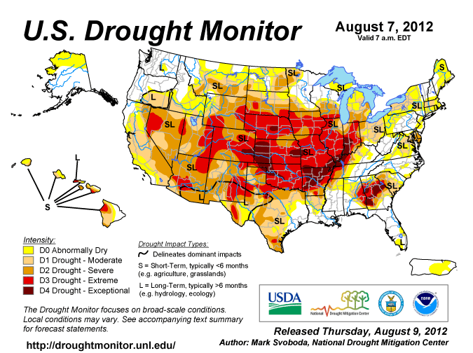
The percent of the contiguous United States in drought fell this week to 62
percent, down from a peak of 64 percent on July 24. Within that 62 percent,
however, the percentage of the county in severe-to-exceptional drought rose
from 38.1 percent to 38.5 percent. Important agricultural areas, including
those in Oklahoma, continued to be impacted by drought, as indicated by the
USDA.
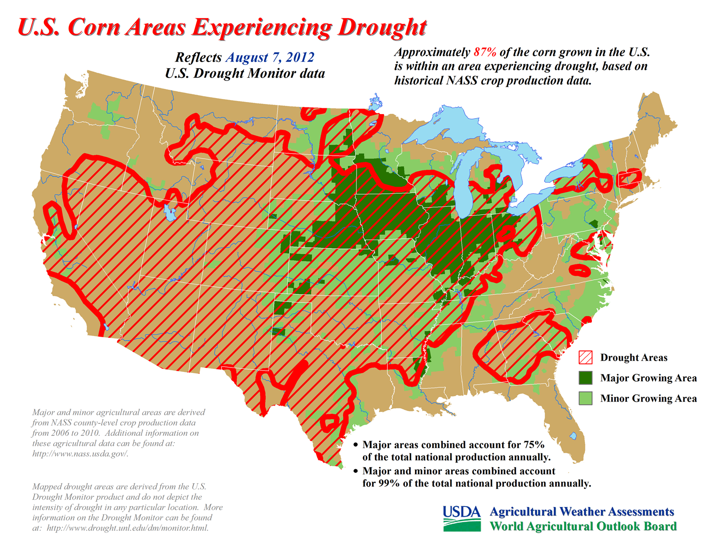
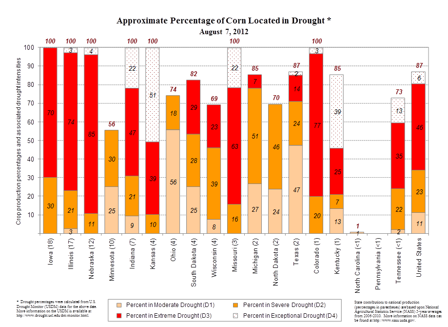
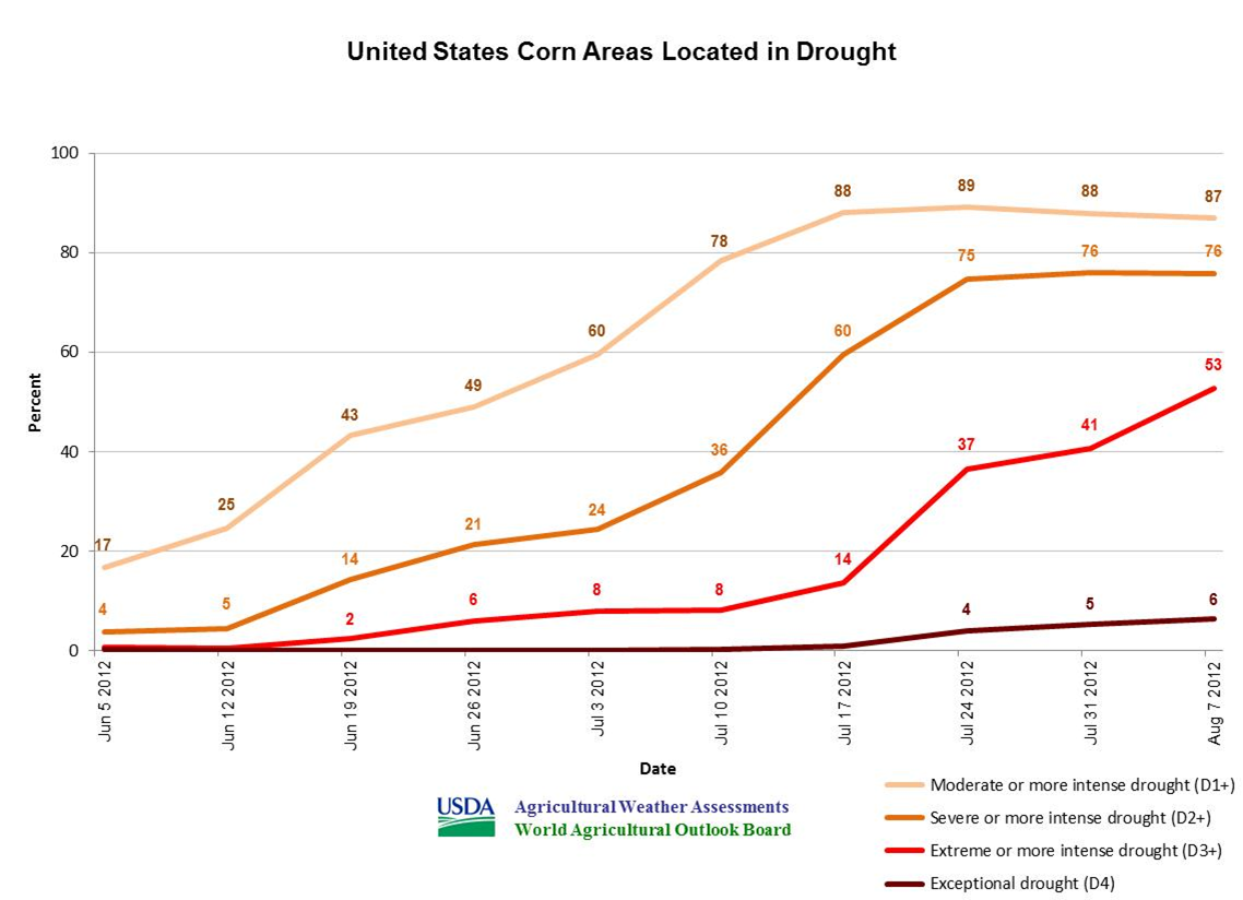
** Although U.S. corn in drought fell to 87%, down from a peak of 89% two
weeks ago, corn in D3 to D4 coverage has nearly quadrupled in the last
three weeks from 14 to 53%.
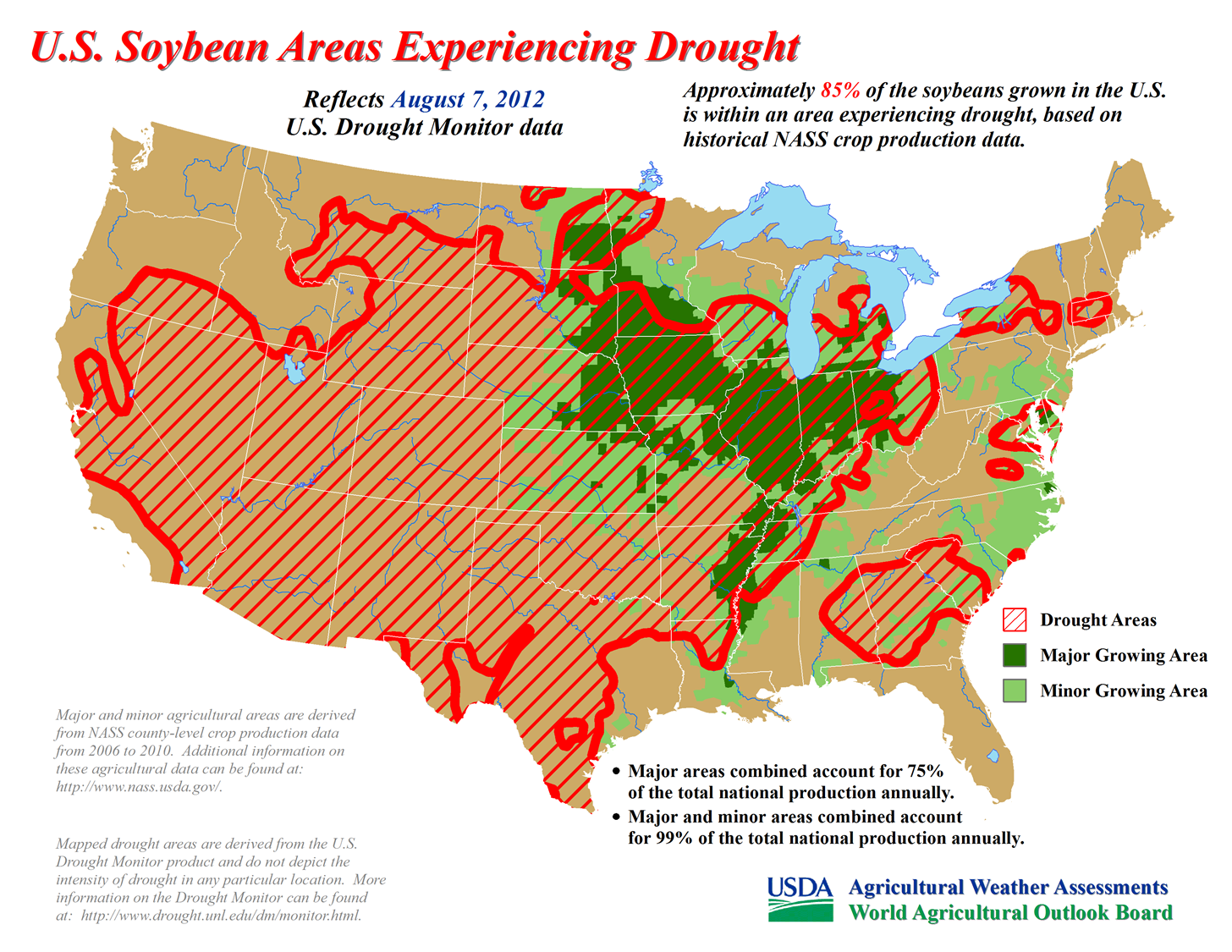
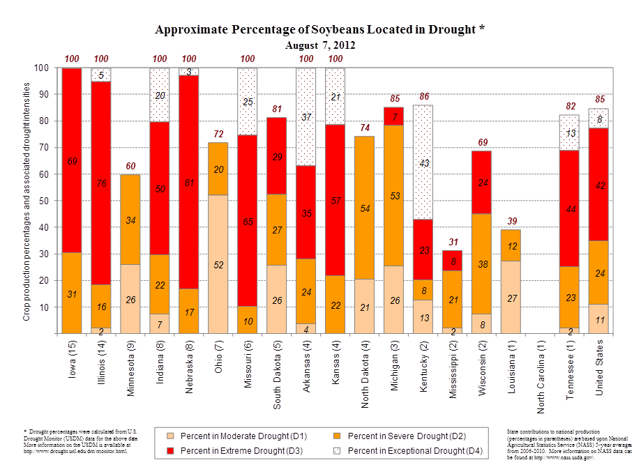
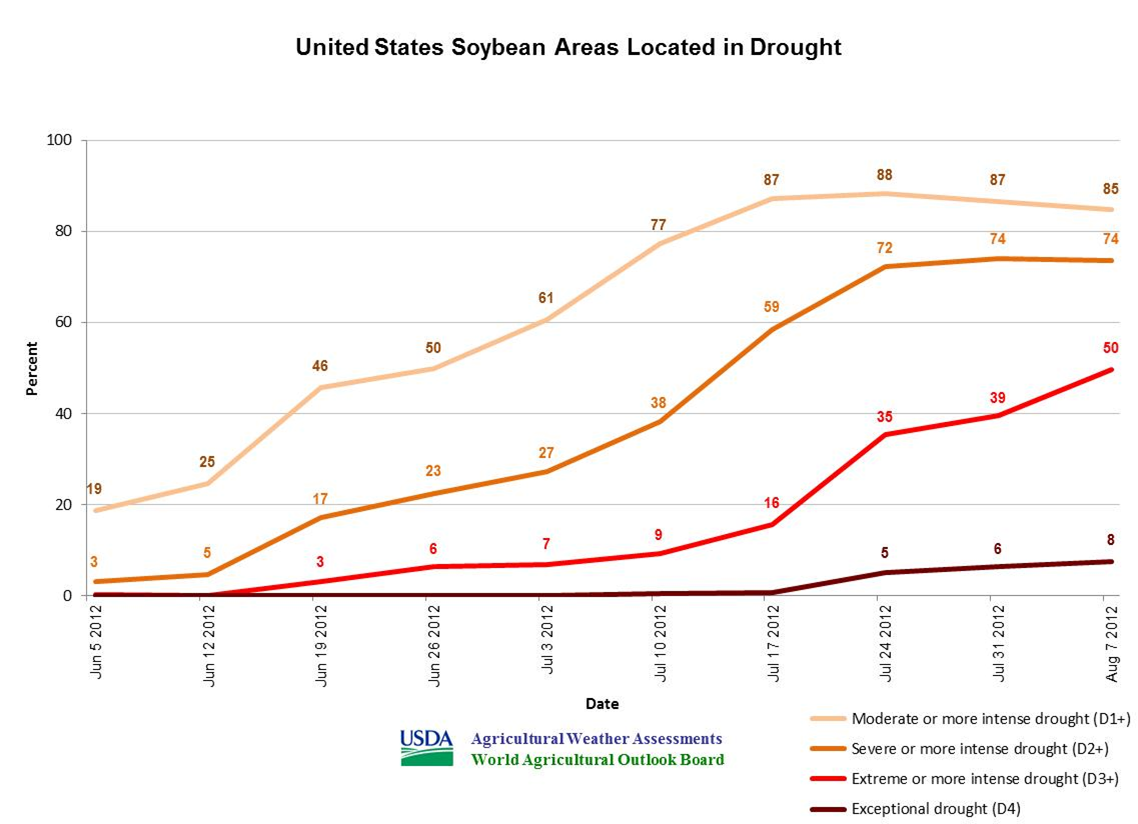
** Although U.S. soybeans is drought fell to 85%, down from a peak of 88% two
weeks ago, soybeans in D3 to D4 coverage have more than tripled in the last
three weeks from 16 to 50%.
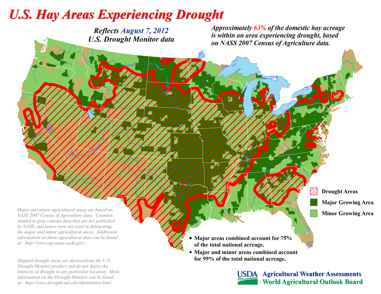
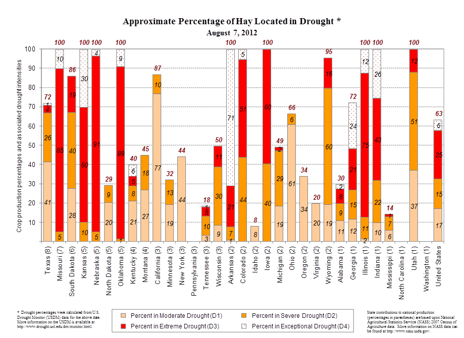
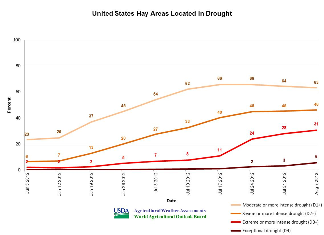
** U.S. hay in drought has fallen 3 percentage points from a peak of 66% on
July 17 and 24, but hay in D3 to D4 coverage continues to rise ? and
currently stands at 31%.
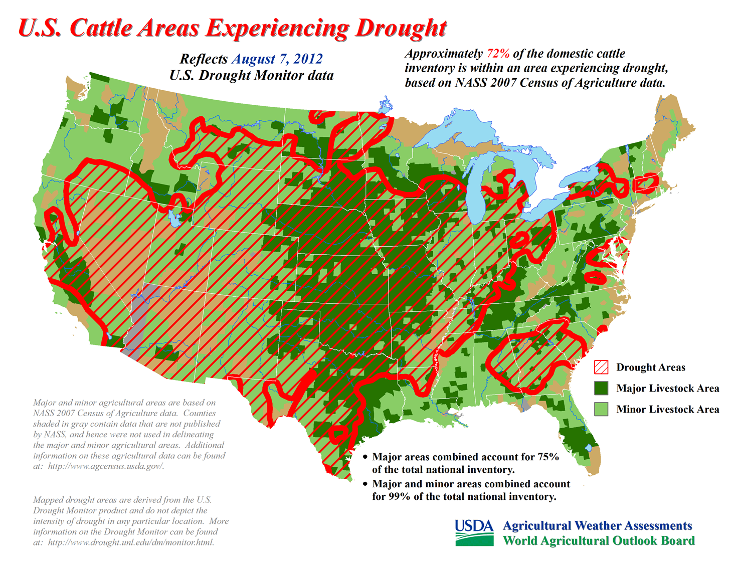
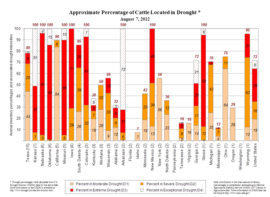
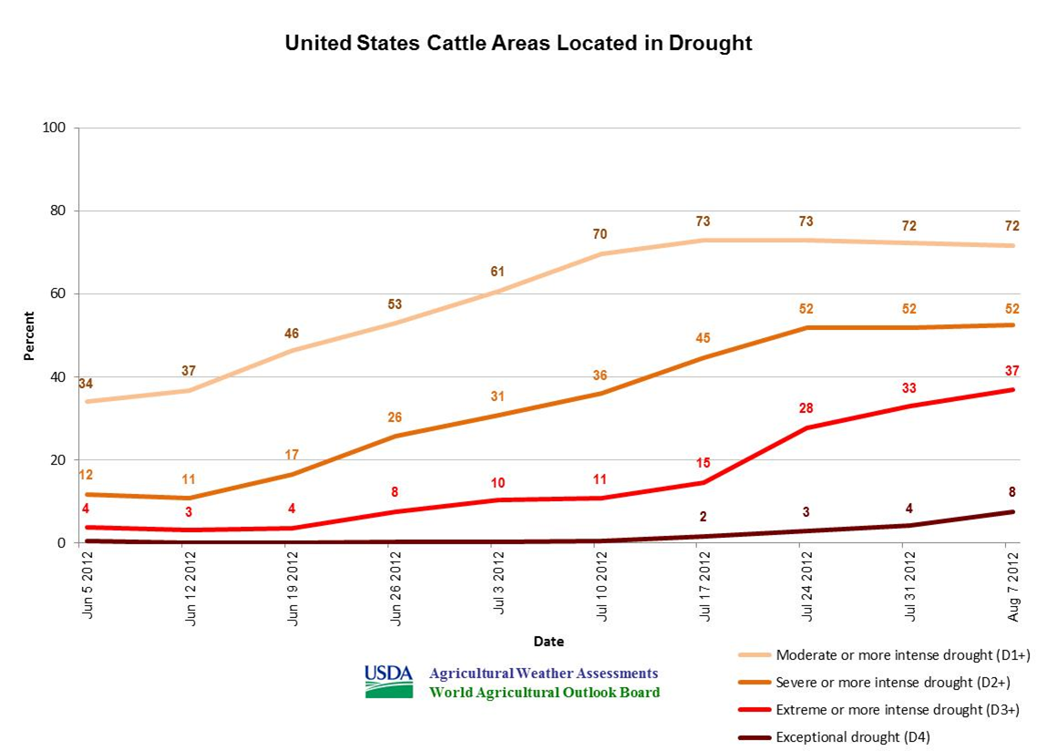
** Domestic cattle inventory in drought has fallen a percentage point from a
peak of 73% on July 17 and 24, but cattle in D3 to D4 coverage continues
to rise ? and currently stands at 37%.
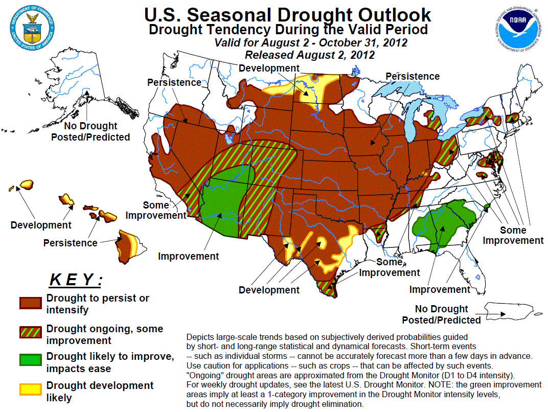
The latest U.S. Seasonal Drought Outlook from the CPC has drought persisting
and/or intensifying across much of the United States, including Oklahoma, though
the rest of August and into early fall.
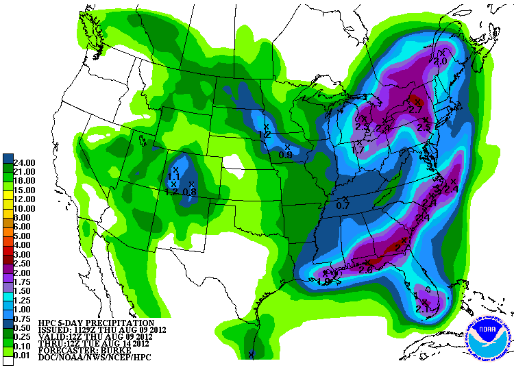
Rain chances are somewhat limited for the next five days, other than the chance
for isolated storms.
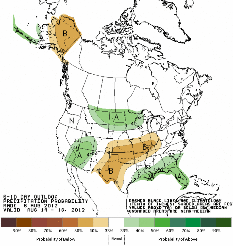
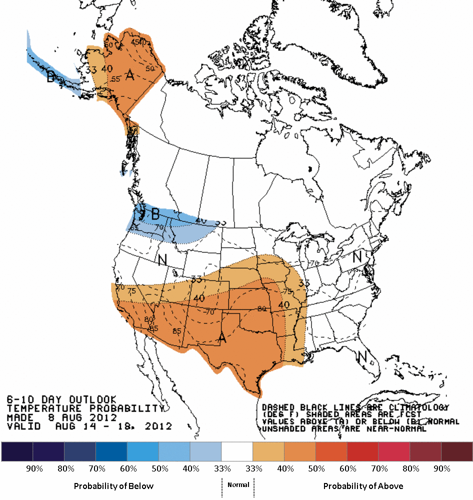
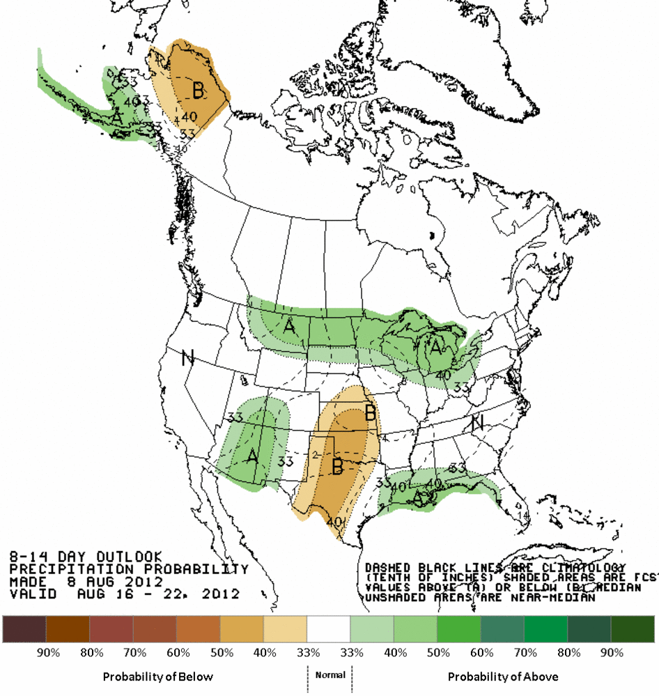
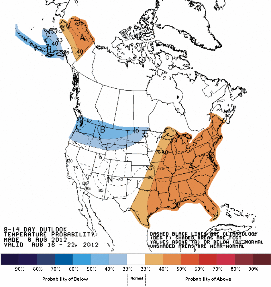
A little further out, the CPC outlooks for precipitation and temperature
show increased odds of below normal precipitation and above normal temperatures
though the middle of August.
Aug. 14-18 Outlooks
Aug. 16-22 Outlooks
Gary McManus
Associate State Climatologist
Oklahoma Climatological Survey
(405) 325-2253
gmcmanus@mesonet.org
August 9 in Mesonet History
| Record | Value | Station | Year |
|---|---|---|---|
| Maximum Temperature | 112°F | WAUR | 2011 |
| Minimum Temperature | 53°F | EVAX | 2024 |
| Maximum Rainfall | 3.34″ | PRYO | 2008 |
Mesonet records begin in 1994.
Search by Date
If you're a bit off, don't worry, because just like horseshoes, “almost” counts on the Ticker website!