Ticker for June 9, 2023
MESONET TICKER ... MESONET TICKER ... MESONET TICKER ... MESONET TICKER ...
June 9, 2023 June 9, 2023 June 9, 2023 June 9, 2023
Ah, hail
To hail with me? No, to hail with you, pal! Okay, how about no hail for everybody?
If it were only that easy (and if only it were that easy...covering all
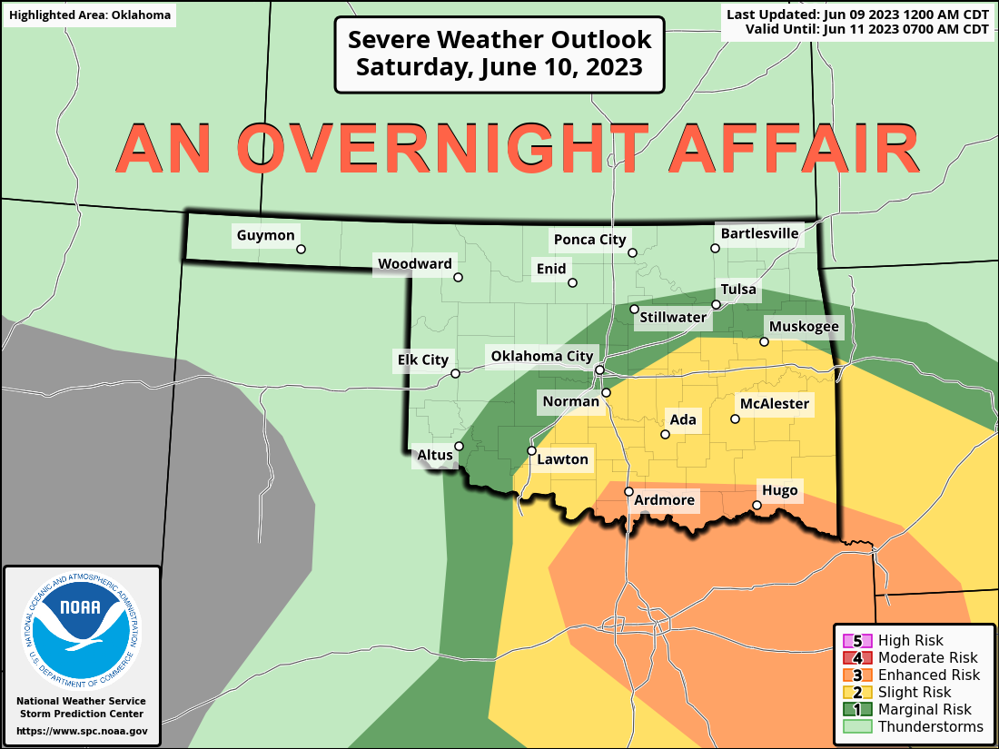
grammatical bases here). Here's the setup...should see a small chance for some
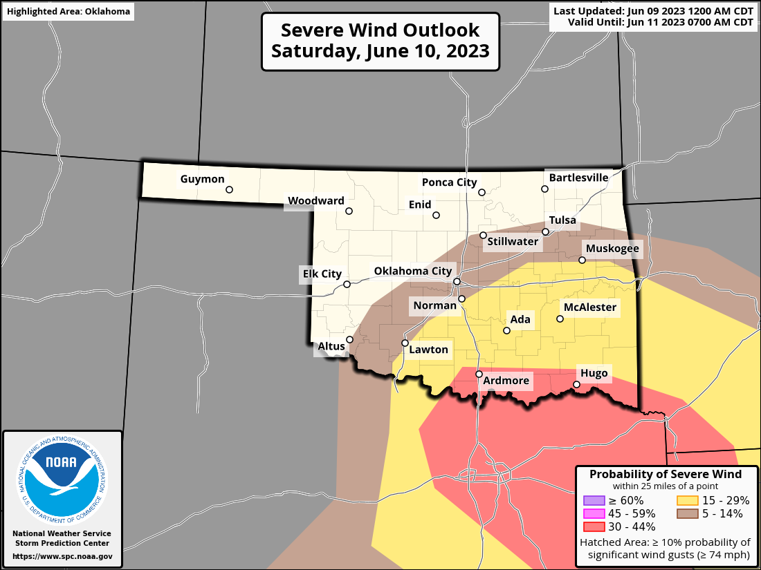
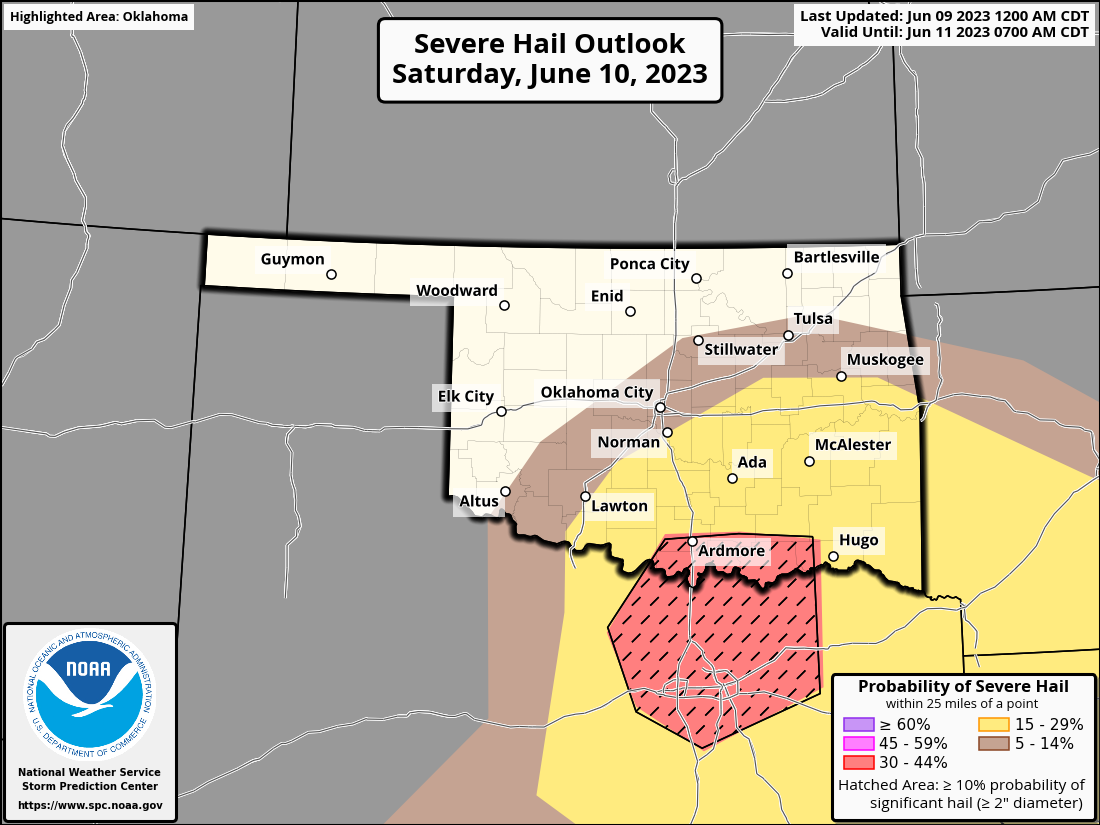
marginal severe weather today, then we will see a complex of storms possibly
form up in the High Plains and march southeast through the state, bringing a
chance of high winds and big hail (which is much better than big winds and high
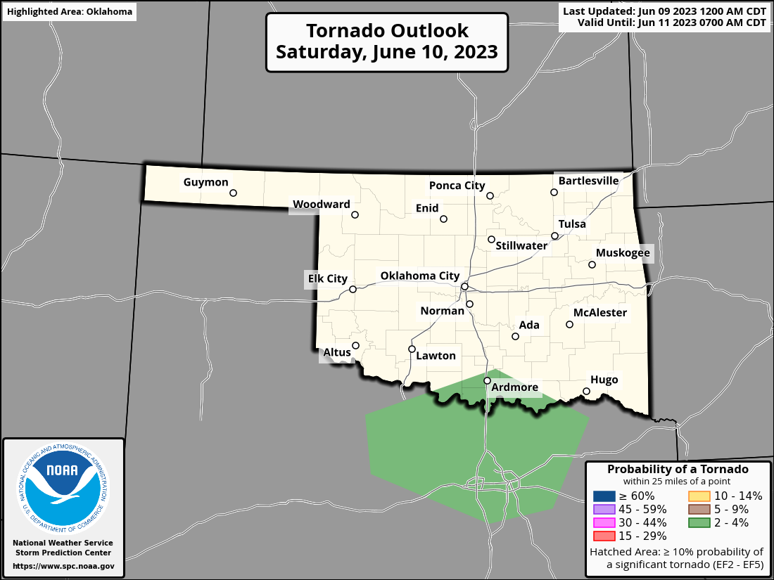
hail) overnight and into tomorrow morning. The tornado risk is very low, but
that very low risk is mainly down in south central OK.
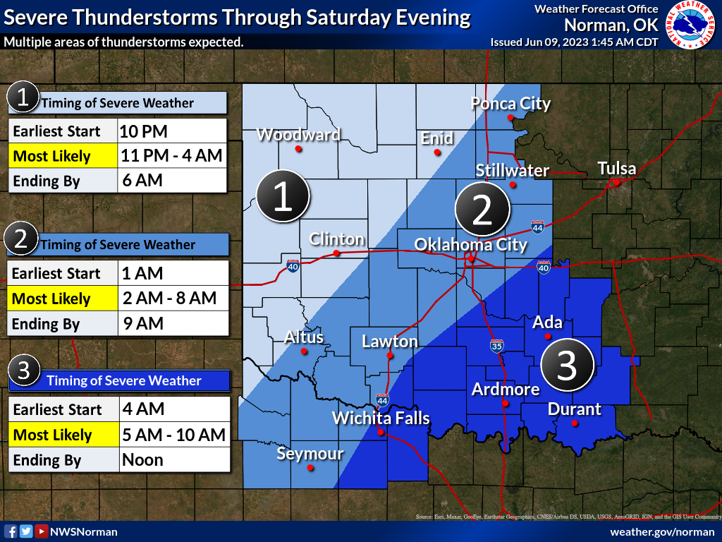
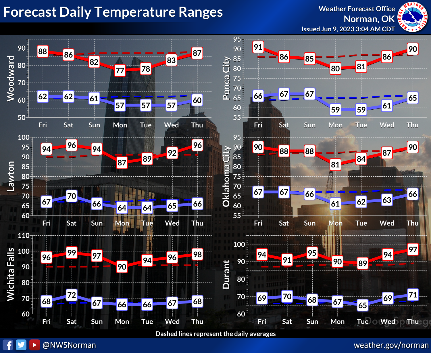
Here's a look at the timing for tonight's storms from our friends at the Norman
NWS office.
Now if you're like me, you've probably been contacted by the proper authorities.
But also, you're still hankering (Okie to English translation: craving) for
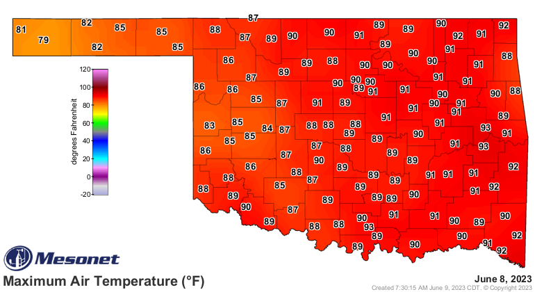
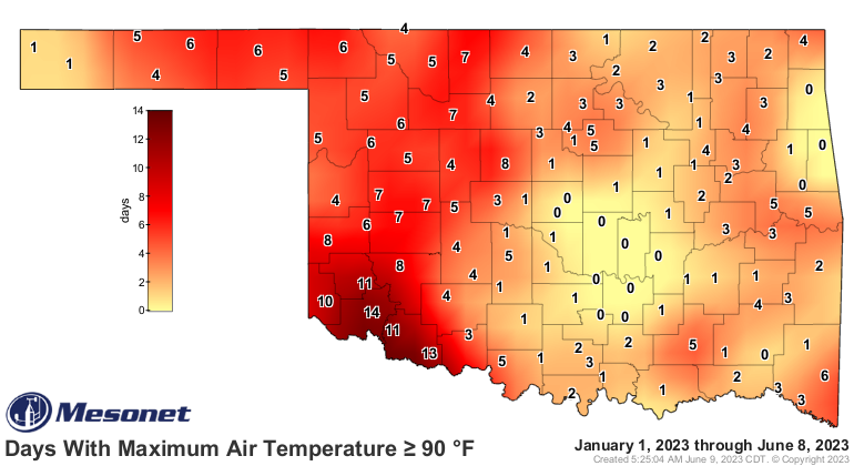
some heat. Well, today (and tomorrow) might be your day as we should belt out
the rest of the holdouts on the 90s map for the year thus far. Yesterday was
a start, but we need to finish the job in central OK.


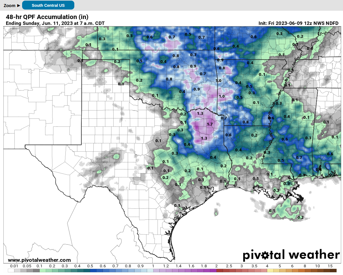
As for rain from tonight's action, should be decent in some areas, and
hopefully some heavier amounts across eastern Oklahoma where the moisture is
suddenly in short supply.
We will see where we go from there. It's mid-June, so showers and storms are
going to be popping up here and there throughout much of the next week, but
nothing too organized like tonight's possible storms. And a cool front tomorrow
should drop us back down out of heat status, but we'll be right back up there
next week.
First 100? Today or tomorrow?
Better than high hail!
Gary McManus
State Climatologist
Oklahoma Mesonet
Oklahoma Climatological Survey
gmcmanus@mesonet.org
June 9 in Mesonet History
| Record | Value | Station | Year |
|---|---|---|---|
| Maximum Temperature | 104°F | ALTU | 2011 |
| Minimum Temperature | 43°F | EVAX | 2020 |
| Maximum Rainfall | 5.12 inches | BOWL | 2008 |
Mesonet records begin in 1994.
Search by Date
If you're a bit off, don't worry, because just like horseshoes, “almost” counts on the Ticker website!