Ticker for June 9, 2011
MESONET TICKER ... MESONET TICKER ... MESONET TICKER ... MESONET TICKER ...
June 9, 2011 June 9, 2011 June 9, 2011 June 9, 2011
Drought making a comeback to parts of Oklahoma
In other parts, of course, it never left. In fact, the farther west you go,
the nastier it gets. Exceptional (D4) drought continues in the western half of
the Panhandle and the first tier of western counties. Severe (D2) to extreme
(D3) drought covers much of the remainder of western Oklahoma. Thanks to the
rainless streak of the last couple of weeks and a blast of summer-like heat,
those drought conditions are once again creeping back eastward.

First off, let's remember that not much has changed for western Oklahoma. They
had a bit of drought relief when our weather got active again during May. For
the most part, however, they continue to bake and suffer. There are widespread
reports (still) of dry stock ponds, barren landscapes and cattle sell-offs. As
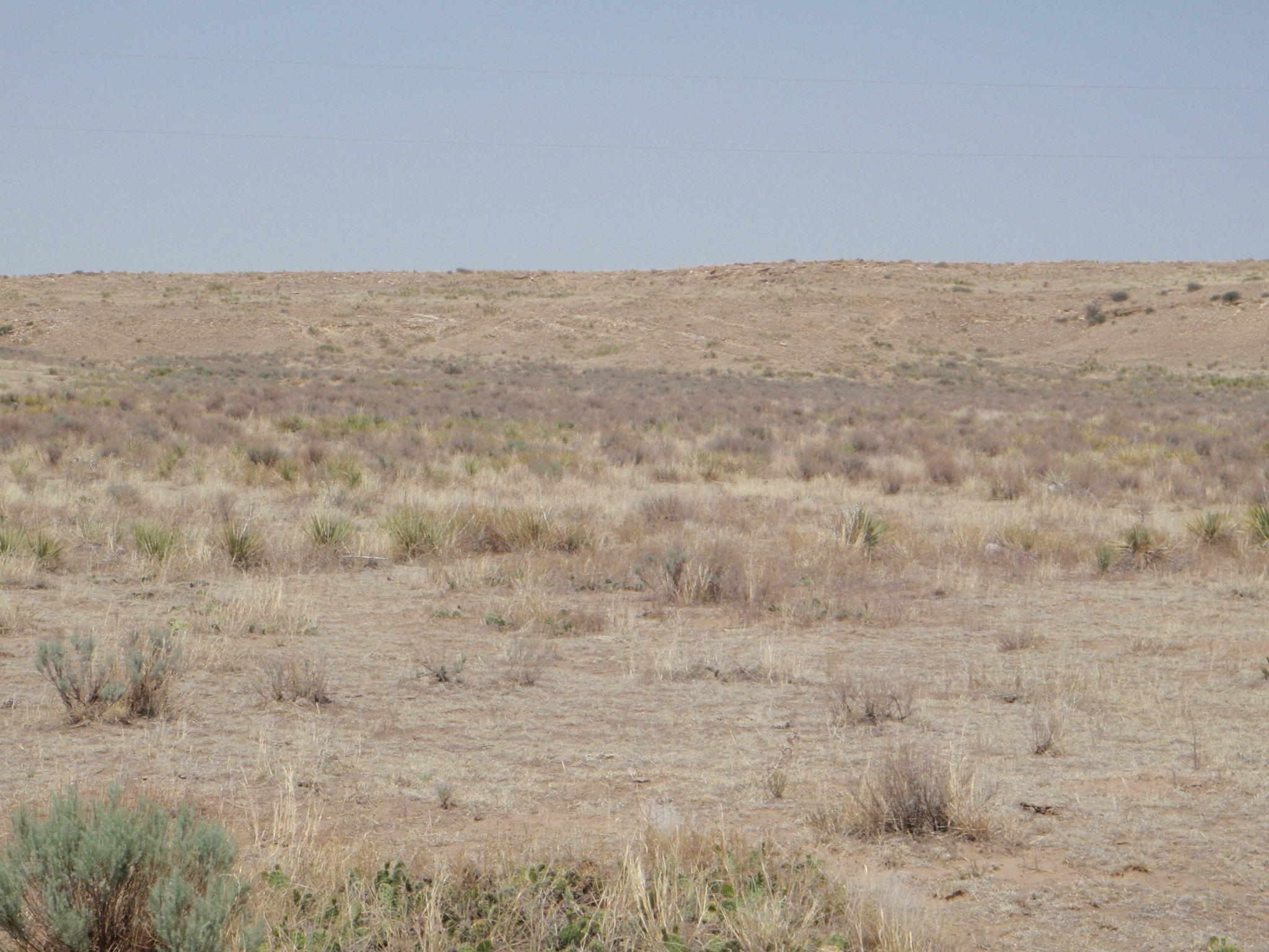
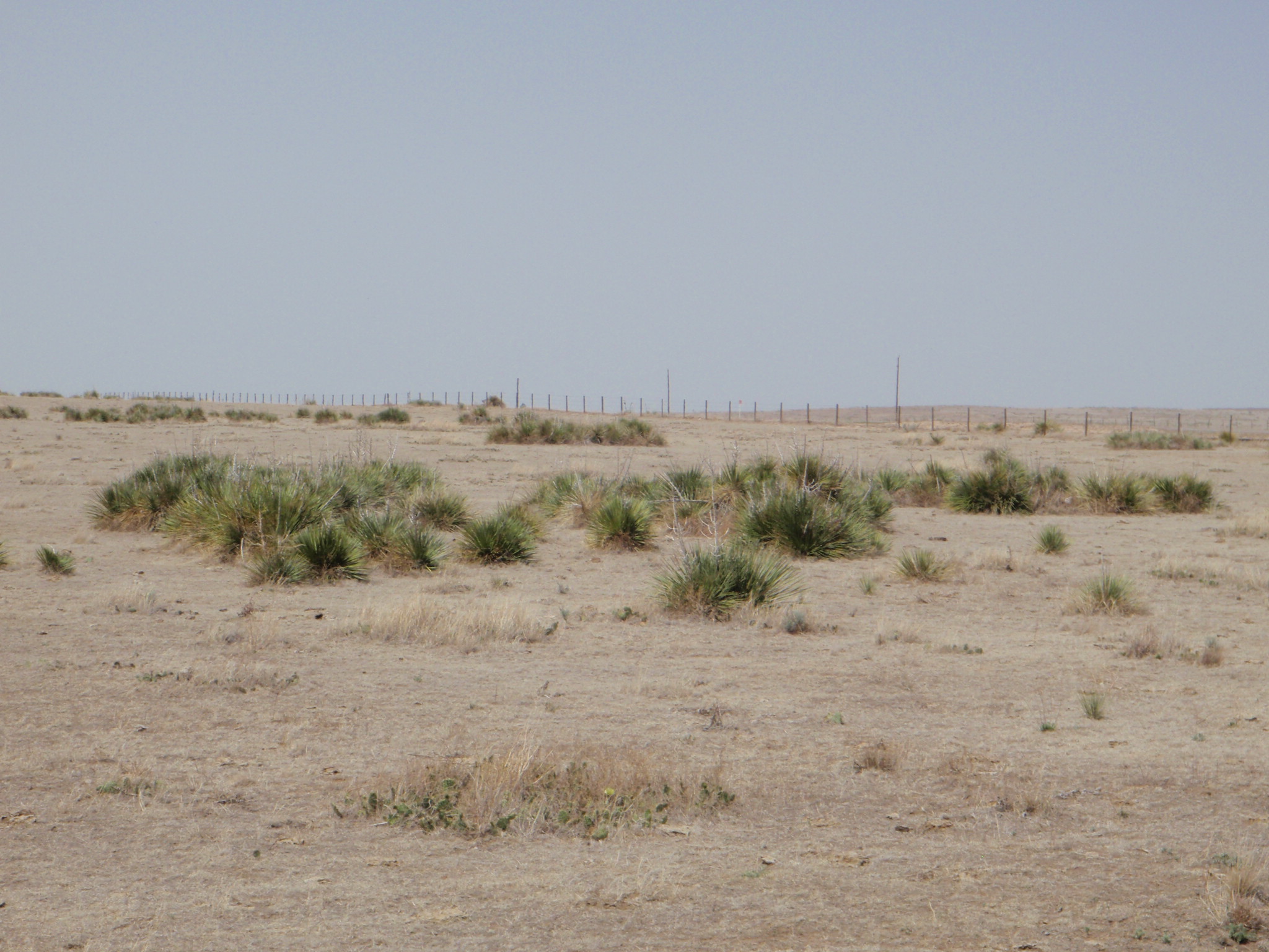
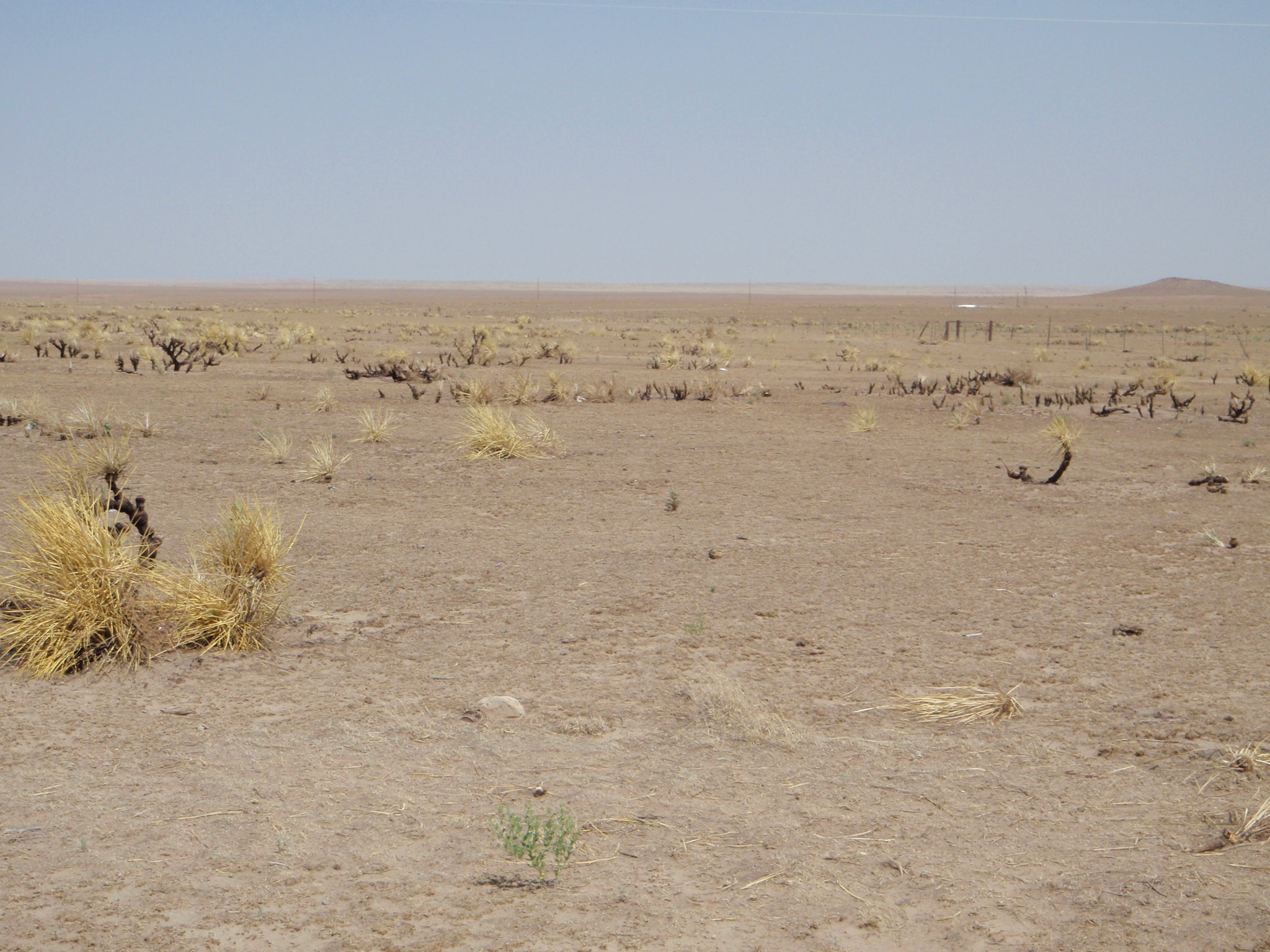
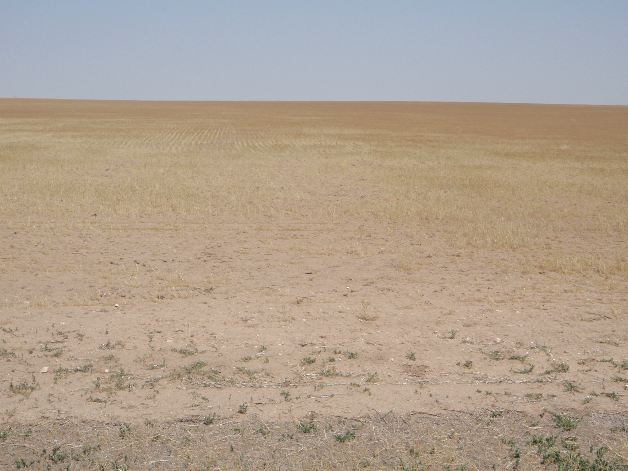
usual, this is better portrayed in pictures than words. Check out the view in
Cimarron County, courtesy of the fine folks from the NRCS office in Boise City.
Whether you're trying to farm, ranch or both, that's a tough landscape.
Let's get to the meat of the problem ... lack of rain and heat. Since our last
active weather pattern in mid-late May (remember those floods, tornadoes and
tornadoes? Yeah, I meant to do that.), the rains have vanished. Take a look at
the total precipitation and percent of normal maps from the Mesonet for May 25
through today (as of 9 am).
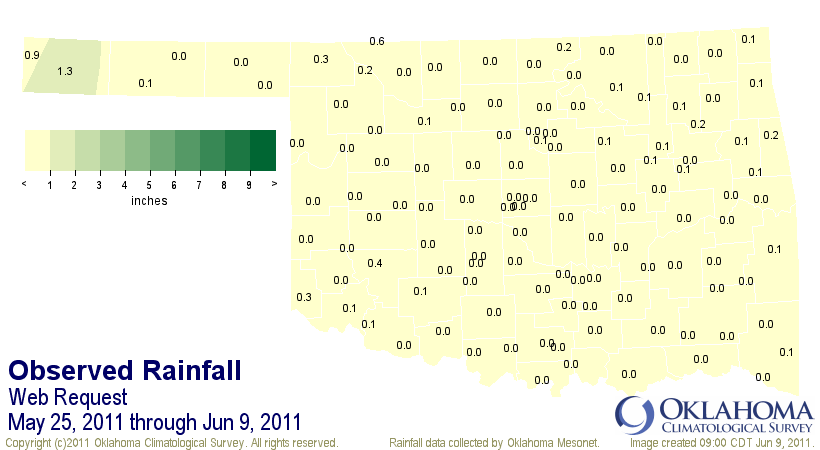
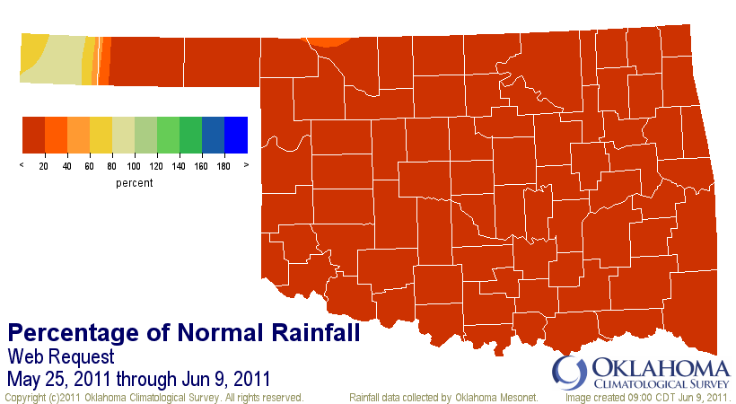
While those are only for a 16-day period, it happens to have occurred in the
last gasp of our normal rainy season. Around mid-June, the rains tend to head
north for the summer. Of the 120 Mesonet stations, 105 had less than a tenth
of an inch of rain over this time, with 53 stations reporting no rain at all.
In fact, it is the *driest* May 25-June 9 period on record for the state with
a statewide average of 0.07 inches of rain, 2.36 inches below normal (3% of
normal). This period pushed 1934 (0.64 inches) into second place. Again, we
need to quit hanging around those Dust Bowl years.
Add to that the tremendous heat (relative to early June) the state has
experienced during June thus far and you have the recipe for the development-
persistence-intensification of drought. High temperatures since June 1 are
10 degrees above normal across the state at 95.2 degrees. In western Oklahoma,
the highs are averaging 98-99 degrees.
The result of the heat and the lack of rain is evident when you look at the
soil moisture measurements from the Mesonet. That rain that fell last month is
headed back up into the atmosphere at a rapid rate.
Jun 8 soil moisture: 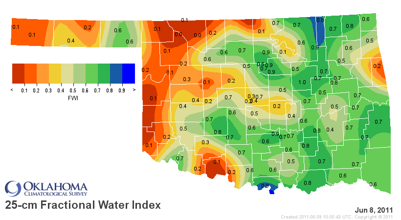
7-day change: 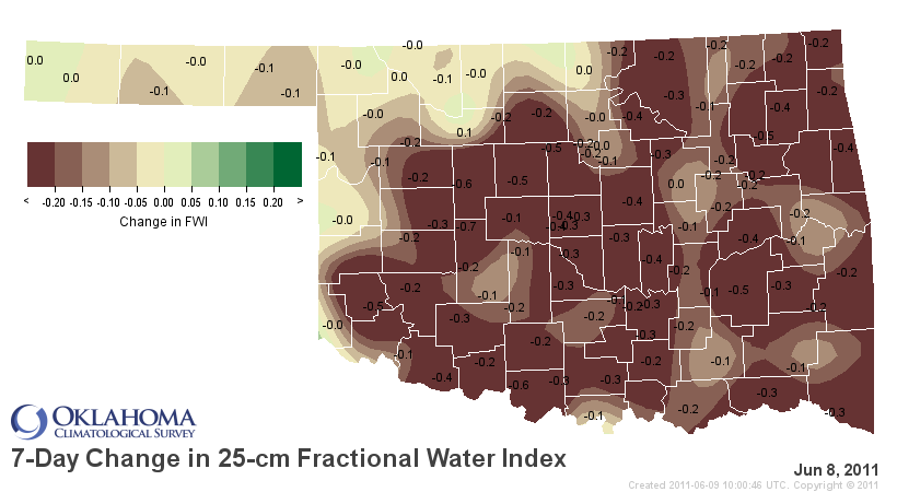
You may wonder how all that rain that fell over the last couple of months went
away so fast. Well, the answer is it wasn't exactly a bounty. It just seemed
that way because we had gotten so little previously. Proof? Check out the
rainfall maps from the past 60 days:
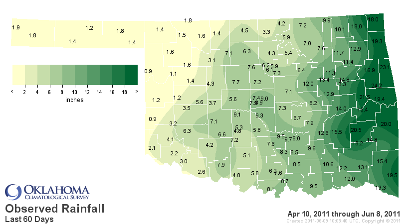

Less than 20% of normal to at least 80% of normal through the western two-
thirds of the state -- a tad less impressive than we were led to believe. Go
back any longer period, 90-120-180 days, and you can see why the rain was
welcome, but also why we need more. Here's the look out at the past 180 days:
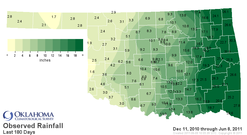
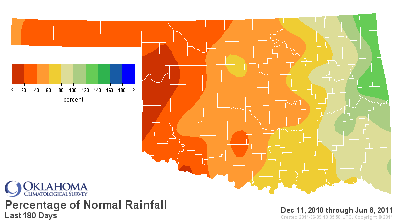
The last 180 days are the 5th driest across the state since 1921 at more than
6 inches below normal. Particular areas of the state are more worse off than
others.
Panhandle: 1st driest -6.90" below normal
N Central: 2nd driest -9.03" below normal
W Central: 1st driest -10.14" below normal
Central: 3rd driest -8.60" below normal
Southwest: 1st driest -8.99" below normal
S Central: 6th driest -7.89" below normal
So yes, the drought is still here, it is still spreading and it is still
intensifying. And a significant number of Oklahomans who earn their living from
agriculture are suffering mightily because of it.
The remedy is simple ... rain. There is a chance over the next few days for
at least a few showers and storms. We'll take it!
Gary McManus
Associate State Climatologist
Oklahoma Climatological Survey
(405) 325-2253
gmcmanus@mesonet.org
June 9 in Mesonet History
| Record | Value | Station | Year |
|---|---|---|---|
| Maximum Temperature | 104°F | ALTU | 2011 |
| Minimum Temperature | 43°F | EVAX | 2020 |
| Maximum Rainfall | 5.12 inches | BOWL | 2008 |
Mesonet records begin in 1994.
Search by Date
If you're a bit off, don't worry, because just like horseshoes, “almost” counts on the Ticker website!