Ticker for January 8, 2024
MESONET TICKER ... MESONET TICKER ... MESONET TICKER ... MESONET TICKER ...
January 8, 2024 January 8, 2024 January 8, 2024 January 8, 2024
Winter stuff
Yes, FINALLY the December summary is out (bottom of the Ticker), if anybody cares
anymore. Hey, don't blame me...a trip to London, a kidney stone and nasty cold,
yada yada yada, there's your summary. By the way, never had a kidney stone
before. I wouldn't recommend one. Imagine going to the bathroom and pushing a
porcupine out. Backwards.
That's all I'm gonna say about that.
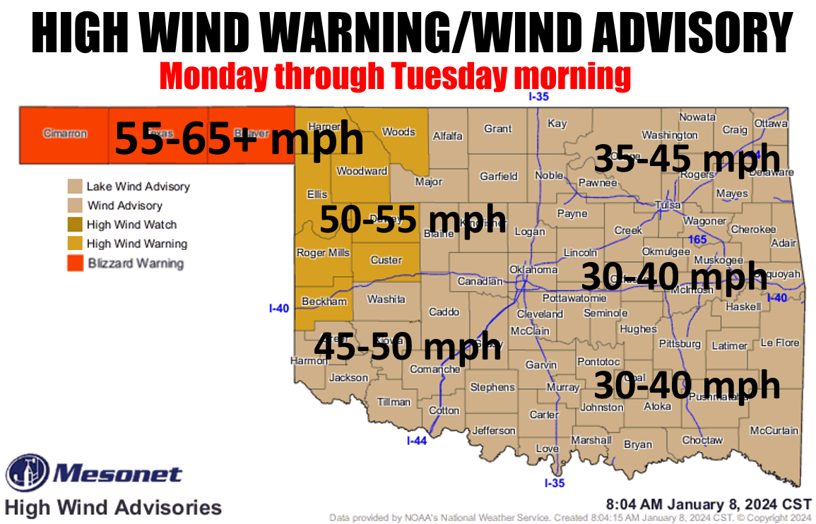
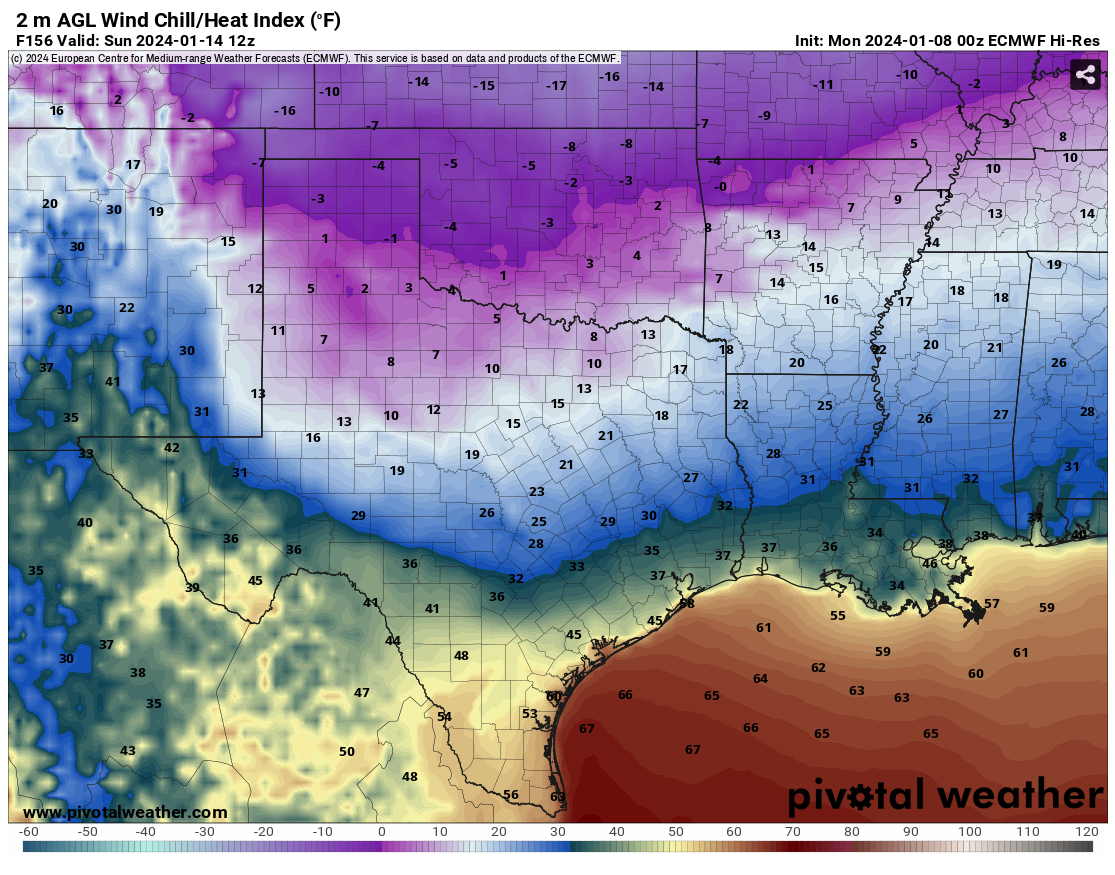
Watch out for the wind today. As you can see, we'll have gusts higher that 65
mph possible in the NW, and up to maybe 40-50 as you go east. That goes along
with a driving snowstorm in the Panhandle where 2-8 inches of snow are possible
to produce blizzard conditions. Travel...forget it! For the rest of us, a
driving cold rain. Heck, it's raining right now for crying out loud!
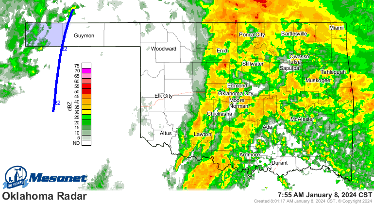
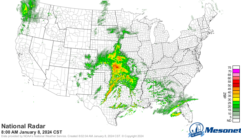
And notice that this storm system has taken on the classic comma-head shape (hey,
Comma-Head Shape was my band's name in the Coast Guard!), and later today with
that system spinning counter-clockwise, the back end is gonna see some good
wrap-around moisture and bring down some cold air from the North and produce
that snow in northern OK.
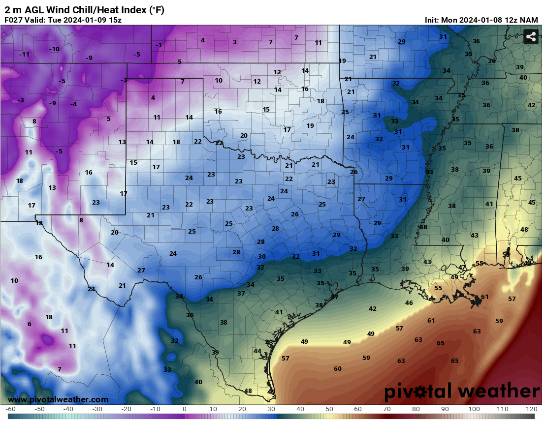
With that cold air and those gusty winds, we'll get a taste of what's coming
this weekend tomorrow morning, with wind chills down into the single digits and
teens.
Then, SOMETIME around Friday, we're gonna get a blast of true Arctic air, and
then we could see a February 2021-lite version of winter where we stay below
freezing for several days. A bit far out to say for sure, but get ready for
winter-fer-real.
Another storm system Friday and then again early next week could mean snow for
some of us or all of us, just depends on the storm track of those systems.
They're still wayyyy out in Pacific, so still a very uncertain forecast. We'll
again show you one of our favorite graphics showing the large spread in model
output several days out vs. a closer event.

Unfortunately, not talking a ton of moisture here as you go down to the SW
(dry slot misery), but if it's cold enough, it could produce a good snow or two.
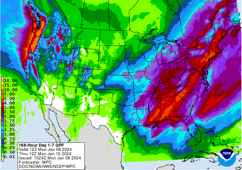
The cold air is certain, the timing of the cold air is uncertain, and the
precipitation totals and types and tracks, very uncertain. Stay tuned!
Now, back to ancient history.
----------------------------------------------------------------------------------
Warm December Caps Warm 2023
Jan. 8, 2023
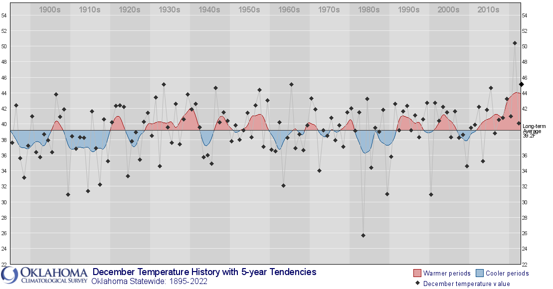
December was unusually warm across all of Oklahoma, and uncommonly wet across the
northwestern third. A prolonged absence of Arctic air led to the state’s fourth
warmest December since records began in 1895, and contributed to 2023’s rank as
the 10th warmest calendar year. The month continued a string of Decembers with
above normal temperatures in the last decade. The Decembers of 2019 and 2015
ranked as the 13th and sixth warmest across the state, respectively. In 2021,
we witnessed an unprecedented event as December marked the pinnacle of
extremes, finishing over 10 degrees above the normal temperature. This
surpassed the previous record for the warmest December, set in 1933, by more
than 5 degrees. The only outlier in the past 10 years was December 2016, which
stood at half a degree below normal. December moisture surpluses amounted to
200-400% of normal, while deficits reigned to the southeast. A storm system
from Dec. 13-15 deposited 2-4 inches of snow across the Panhandle, with other
wintry weather resulting in mostly light totals. Severe weather remained almost
entirely absent in December, with no confirmed tornadoes. The preliminary
tornado total for 2023 stands at 74, significantly higher than the 1950-2022
average of 57.3 twisters.
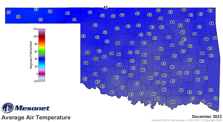
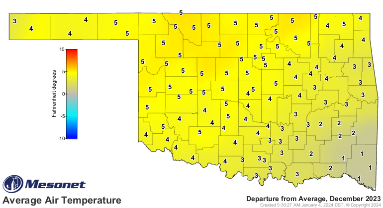
The statewide average temperature for the month concluded at 44.6 degrees,
surpassing the normal by 4.5 degrees. December's highest temperature, reaching
80 degrees, was recorded in Beaver on Dec. 7 and again in Burneyville the
following day. Kenton experienced the month's lowest temperature, dropping to
10 degrees on the second. In 2023, the statewide average temperature stood at
62 degrees, exceeding the normal by 1.6 degrees. The highest recorded
temperature for 2023 was 114 degrees in Grandfield on Aug. 17, while the lowest
was minus one degree in Kenton on Feb. 17.


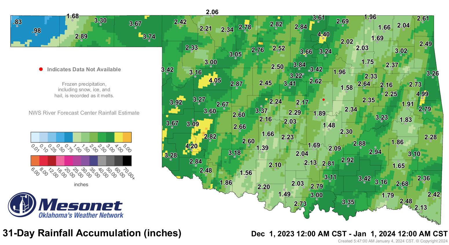
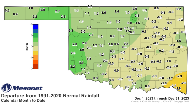
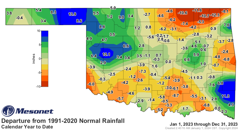
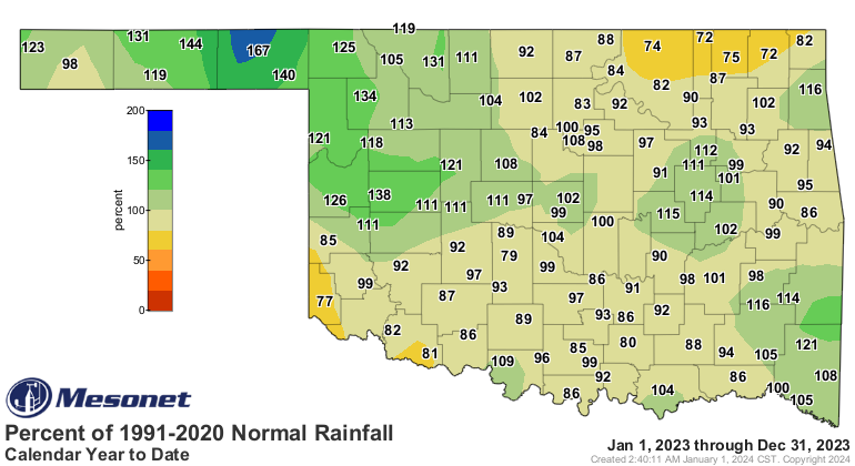
The statewide average precipitation total for the month reached 2.62 inches,
exceeding the normal by 0.51 inches and ranking as the 25th wettest December
since records began in 1895. The western half of the state experienced a
significant surplus of 1-3 inches, while the eastern half largely faced
deficits of around an inch. The Panhandle enjoyed its third wettest December on
record, boasting an average surplus of 1.71 inches, and the west-central
region's surplus of 2.1 inches ranked their month as the seventh wettest. The
southeast fared the worst, marking their 43rd driest December with a deficit of
1.89 inches. The Mesonet site at Cookson led the state with 4.99 inches, and
another 34 sites recorded at least 3 inches for the month. Kenton brought up
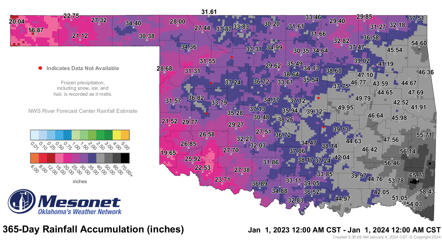
the rear with 0.83 inches. In 2023, Oklahoma finished as the 48th wettest year
on record, with a statewide average of 36.23 inches, falling short of normal by
0.13 inches. The Panhandle once again performed exceptionally well with an
average of 27.12 inches, surpassing the normal by 6.97 inches and ranking as
their sixth wettest year on record. The Mt. Herman Mesonet site led 2023's
totals at 65.72 inches, while Boise City had the lowest total with 16.87 inches.

Drought coverage in the state decreased from 34% at the end of November to 22%
at the close of December, as reported by the U.S. Drought Monitor. During the
same period, the extent of severe and extreme drought reduced from 11% to 3%.
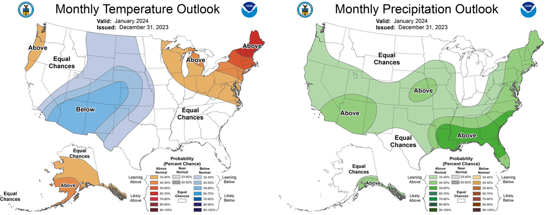
The January outlooks from the Climate Prediction Center indicate increased odds
of below-normal temperatures across all regions except far southeastern
Oklahoma, with above-normal precipitation expected across the entire state.
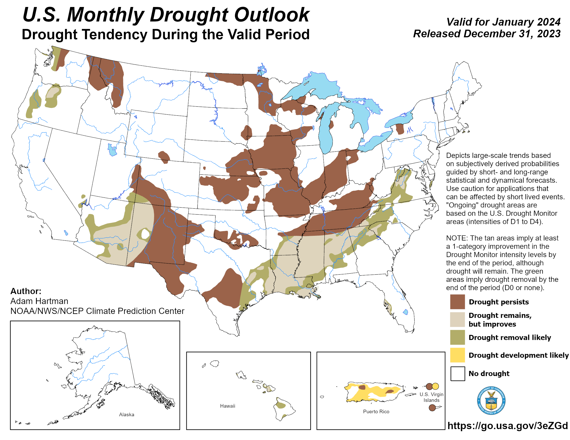
Despite the potential for increased precipitation, CPC's drought outlook
anticipates persisting drought conditions through January in areas where it
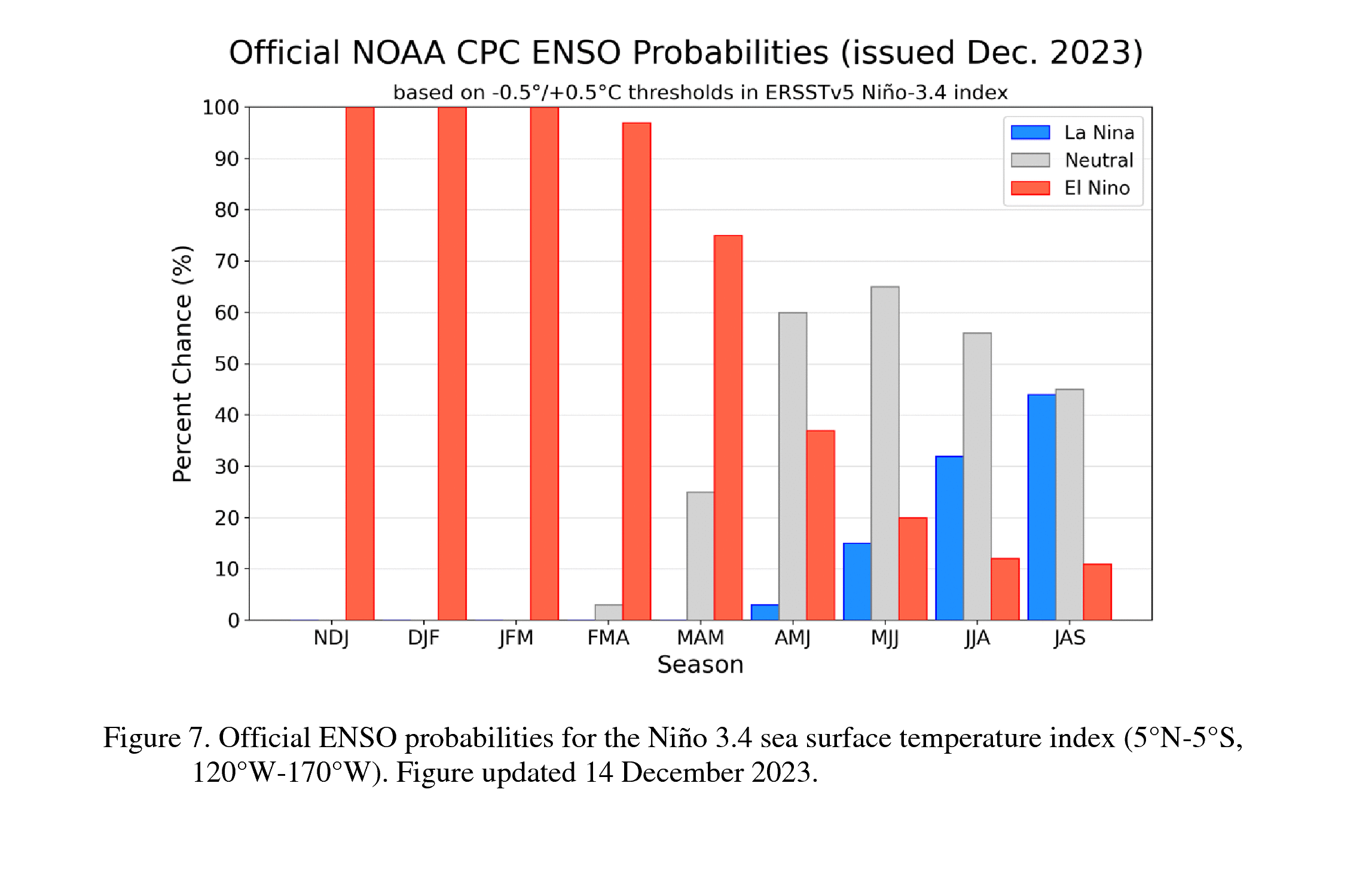
currently exists. The CPC predicts El Niño to continue throughout the winter
before transitioning to neutral conditions in the spring. This ocean-atmosphere
coupling phenomenon can bring cool and wet conditions to the Southern Tier of
the United States, including Oklahoma, during the cool season.
###
Gary McManus
State Climatologist
Oklahoma Mesonet
Oklahoma Climatological Survey
gmcmanus@mesonet.org
January 8 in Mesonet History
| Record | Value | Station | Year |
|---|---|---|---|
| Maximum Temperature | 79°F | CAMA | 2002 |
| Minimum Temperature | -6°F | GOOD | 2010 |
| Maximum Rainfall | 1.43″ | CLOU | 2024 |
Mesonet records begin in 1994.
Search by Date
If you're a bit off, don't worry, because just like horseshoes, “almost” counts on the Ticker website!