Ticker for December 7, 2020
MESONET TICKER ... MESONET TICKER ... MESONET TICKER ... MESONET TICKER ...
December 7, 2020 December 7, 2020 December 7, 2020 December 7, 2020
The Oklahoma Icebox
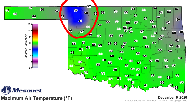
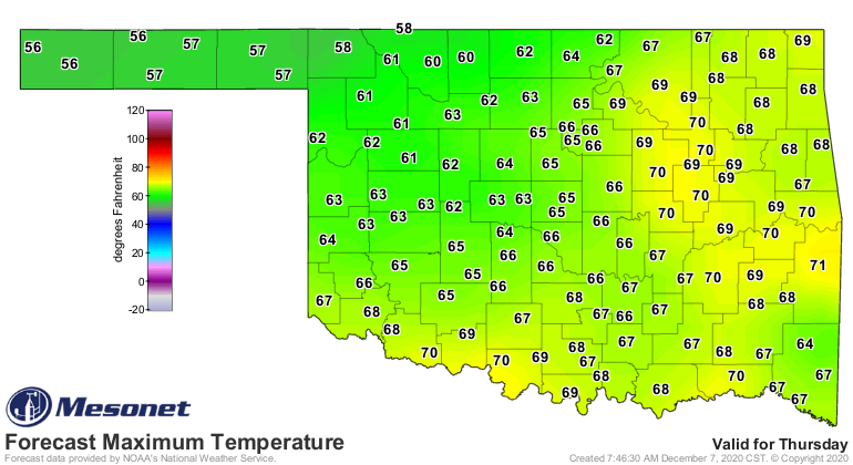
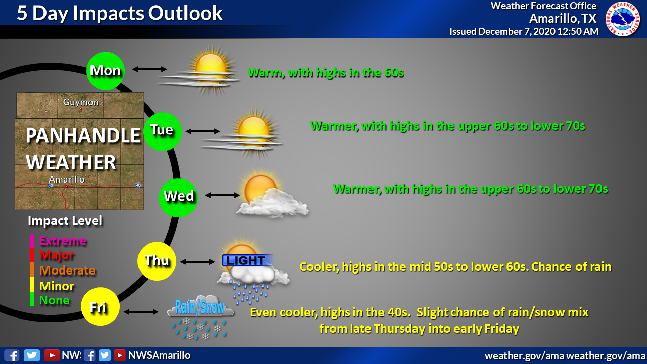
Heavy snow in the wintertime is the gift that keeps on giving...days after it
fell. While the Restivus (NO, not Festivus) were basking in lovely 50s and 60s
(it's relative...work with me), the far NW corner downstate was stuck in the 30s
and 40s. My beloved Buffalo reached a high of 39 degrees, a full 14 degrees colder
than Slapout about 30 miles to its southeast, all under crystal clear skies. The
sun is trying, but 15 inches of snow doesn't melt that quickly. And while the rest
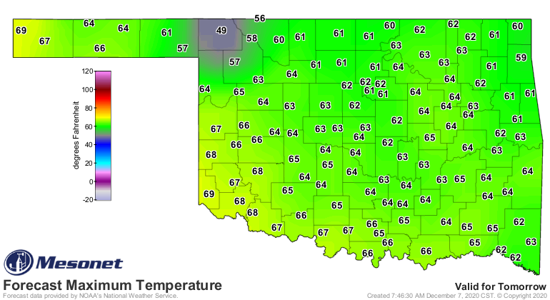
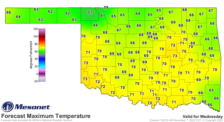
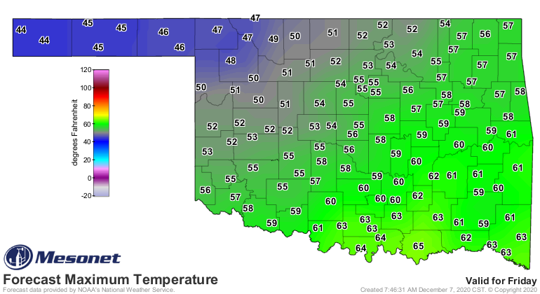
of the state will continue with its unseasonably warm weather this week, that
area of the state will lag behind by 5-15 degrees for awhile before finally
coming to equilibrium with the surrounding area on Thursday, just in time for
another cold front on Friday!

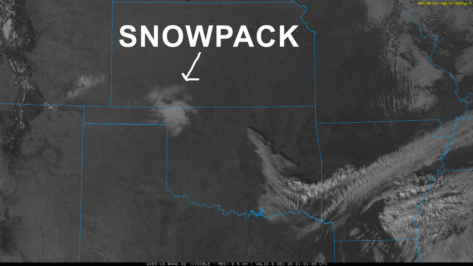
Hey, you guys up there wanted some snow, you got it! The snow is not only
chilling the area simply due to the amount of frozen water still on the ground,
the white background of the snow is also reflecting a larger amount of the sun's
rays back to space due to an increased albedo -- the higher the albedo, the
more radiation reflected back to space. So that radiation isn't absorbed by
the Earth's surface, and therefore it is not converted into heat energy to be
re-emitted by the surface to warm the layer of air close to the ground. It's
the same reason why if I wear shorts my legs are 20 degrees colder than the
rest of my body, you see.
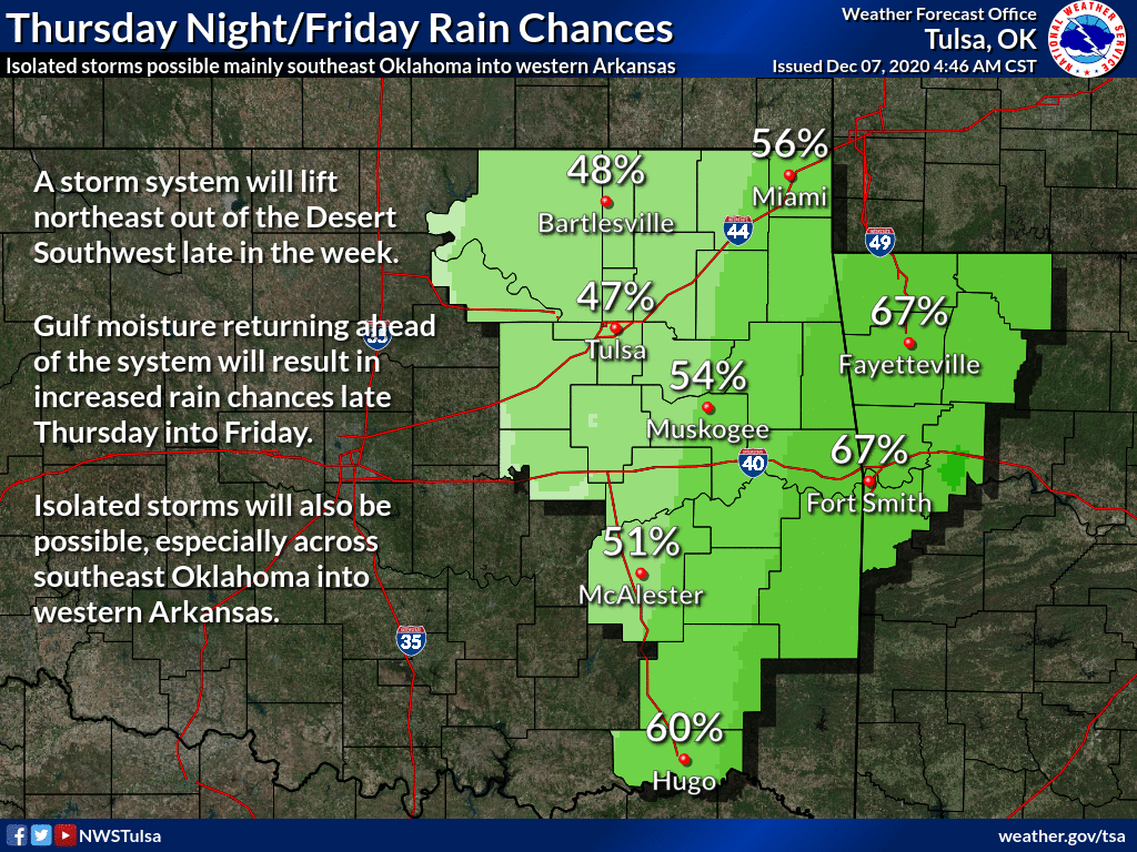
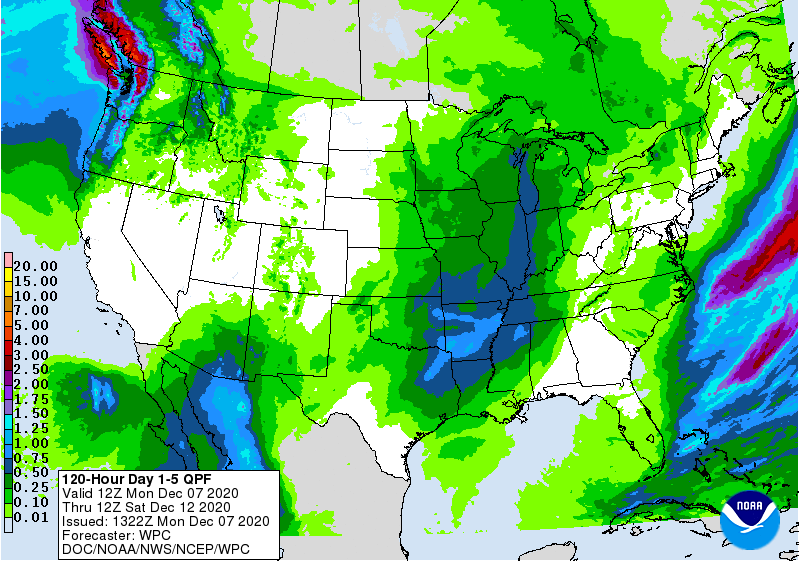
We might see some rain and even a few storms Thursday into Friday. Maybe a bit
of a rain-snow mix is in store for the far NW. Cooler weather will be had by
all at the end of the week. Not a lot of moisture to work with, however.
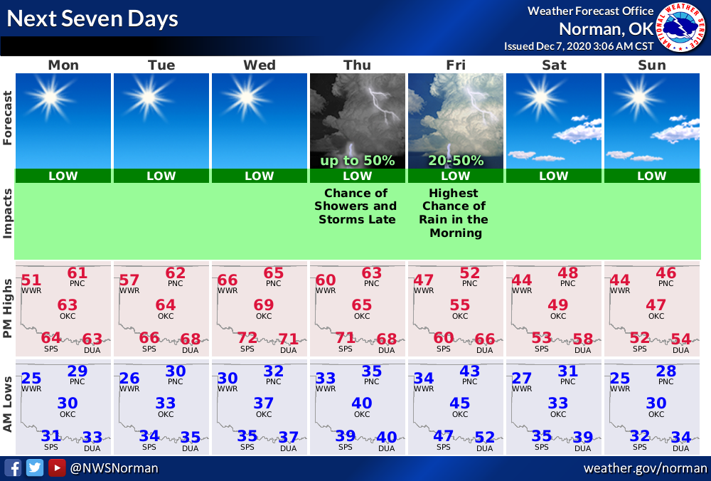
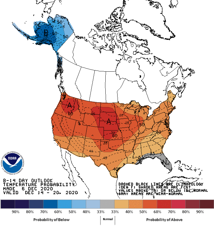
Still no hints of that next big storm just yet. Looks warm and dry as we get
into next week.
Until then, might as well just sit around and watch the snow melt.
Gary McManus
State Climatologist
Oklahoma Mesonet
Oklahoma Climatological Survey
(405) 325-2253
gmcmanus@mesonet.org
December 7 in Mesonet History
| Record | Value | Station | Year |
|---|---|---|---|
| Maximum Temperature | 80°F | BURN | 2007 |
| Minimum Temperature | -9°F | BOIS | 2005 |
| Maximum Rainfall | 1.27 inches | BBOW | 1997 |
Mesonet records begin in 1994.
Search by Date
If you're a bit off, don't worry, because just like horseshoes, “almost” counts on the Ticker website!