Ticker for November 7, 2018
MESONET TICKER ... MESONET TICKER ... MESONET TICKER ... MESONET TICKER ...
November 7, 2018 November 7, 2018 November 7, 2018 November 7, 2018
November being November
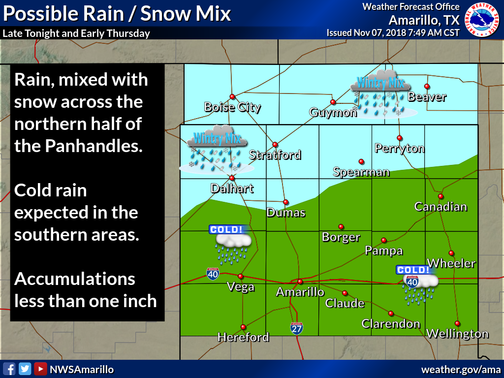
Here we go, finally some excitement in store for Oklahoma's weather (if you call
chances of some light rain and a good hard freeze "excitement"). The weather
setup is pretty simple, in a highly complex nonlinear fluid dynamic kind of way.
Last night's cold front comes in advance of a large trough of low pressure to
our west. Rain chances go up tonight into tomorrow ahead of the trough as we
add more moisture to the mix. Might even be cold enough aloft into tomorrow to
see a few flakes mixed in with the rain up in the northwest and Panhandle. No real
impacts, obviously, but it's all moisture.
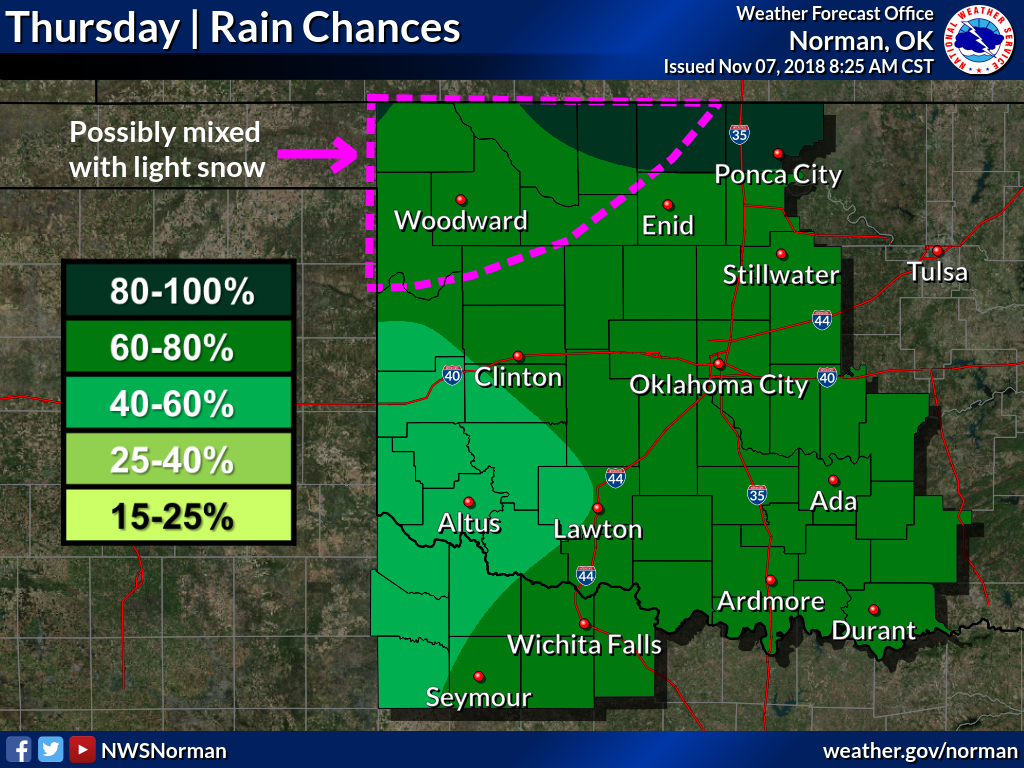
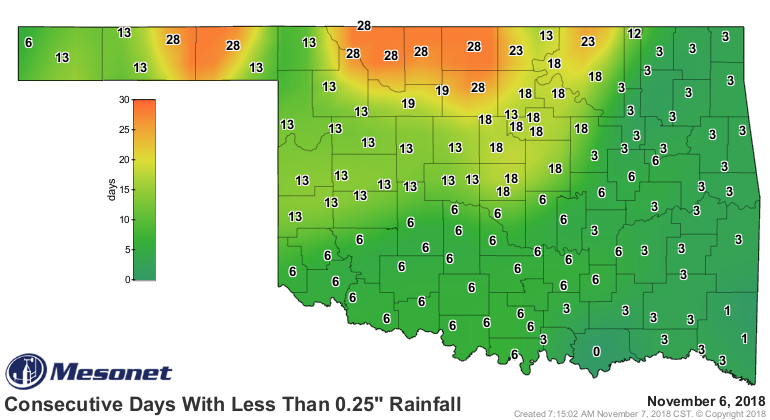
Probably need a bit of moisture since it's been awhile, relatively speaking, since
northern Oklahoma has seen appreciable moisture, especially east of I35.

After the rain/snow over the next couple of days? Just plain cold. Here's the
setup from the Tulsa NWS office, and then the forecast temperatures this
weekend.
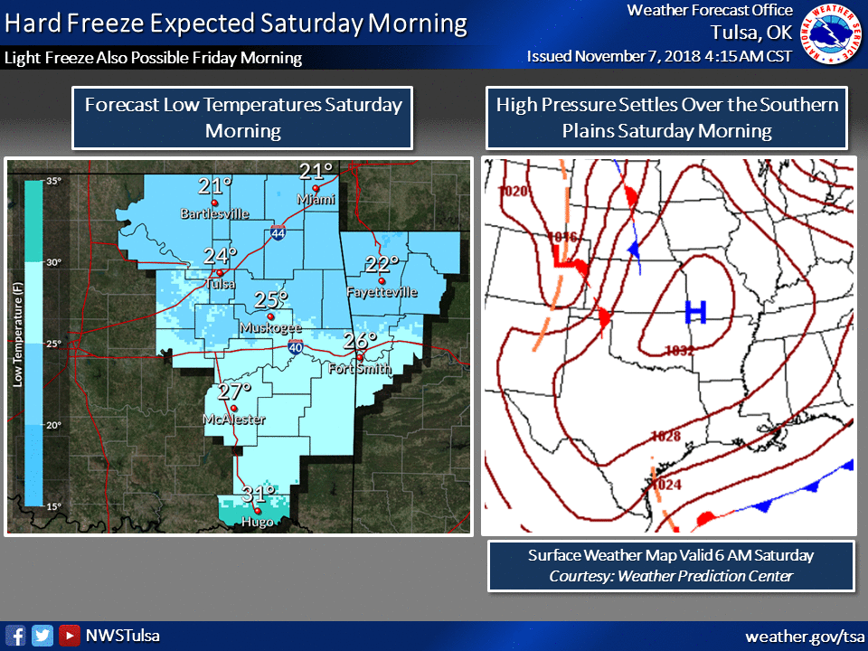
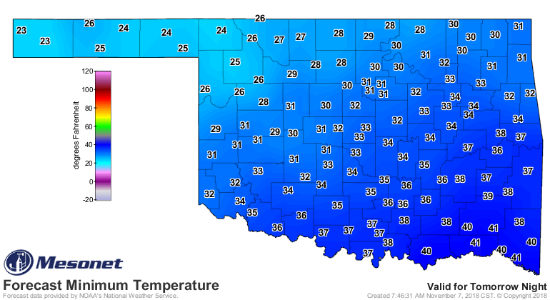
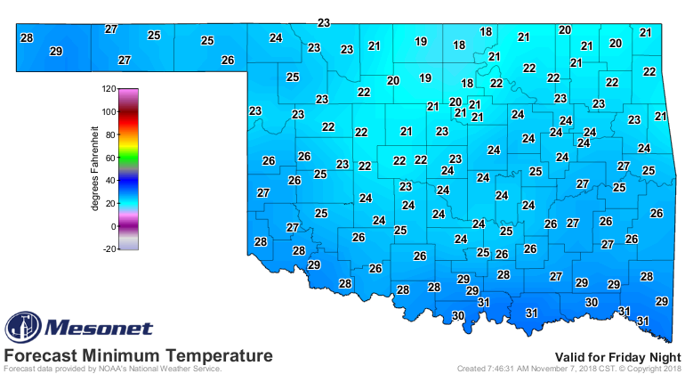
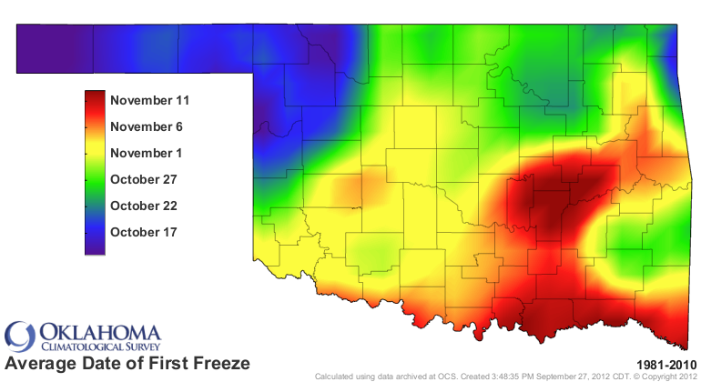
This freeze will be a little bit late in some places, but generally on schedule.
Maybe another chance of rain into early next week, but the current weather
pattern will probably continue as we see low pressure to our east and high
pressure to our west, setting us up for northwesterly flow aloft. That means
occasional cold fronts of varying strength, mixed with periods of warming
southerly winds. Nothing big and REALLY exciting in the upcoming pattern,
however. Lots of "it's cold today!" interspersed with "wow, great weather today,
get out and enjoy it!"
That can certainly change quickly, at least down the road. But until then, it's
really cold today! When it warms up next week, get out and enjoy it!
Gary McManus
State Climatologist
Oklahoma Mesonet
Oklahoma Climatological Survey
(405) 325-2253
gmcmanus@mesonet.org
November 7 in Mesonet History
| Record | Value | Station | Year |
|---|---|---|---|
| Maximum Temperature | 95°F | HOLL | 2023 |
| Minimum Temperature | 18°F | BEAV | 2003 |
| Maximum Rainfall | 5.03 inches | ELRE | 2011 |
Mesonet records begin in 1994.
Search by Date
If you're a bit off, don't worry, because just like horseshoes, “almost” counts on the Ticker website!