Ticker for September 7, 2023
MESONET TICKER ... MESONET TICKER ... MESONET TICKER ... MESONET TICKER ...
September 7, 2023 September 7, 2023 September 7, 2023 September 7, 2023
Just go away
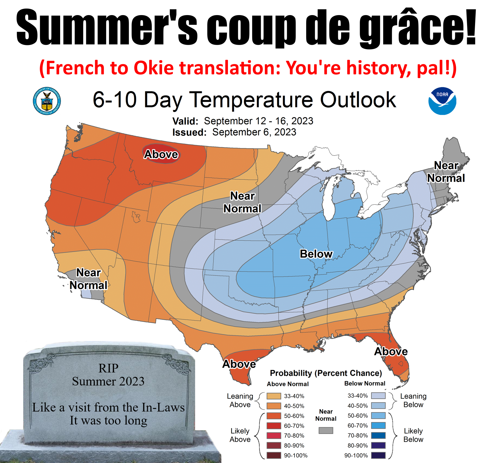
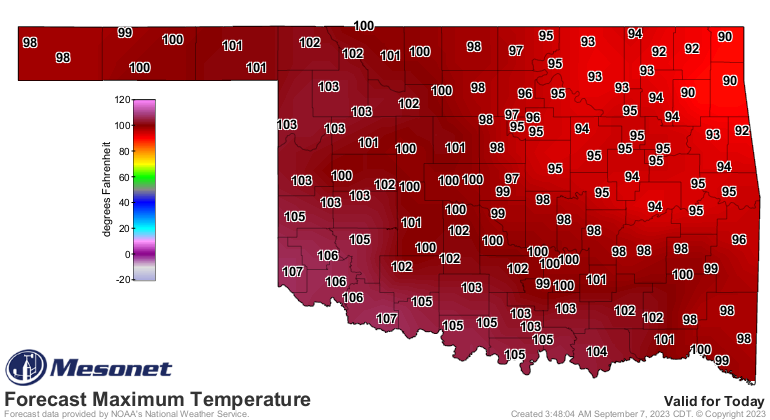
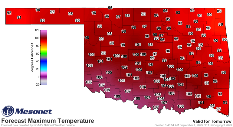
Ah ah ah! Hold it right there...I know it will get hot again. I've lived here a
long time, okay? But I also know how this works: you get one last hot blast of
summer (coming up tomorrow), then the first big cold front of the early fall,
and boom...you're temperatures start their steady decline through December. Oh,
you can have the heat jump up and bite you again. You can even be above normal for
the next month. But it won't be like what we see today and tomorrow again. I can
prove my postulation (and we all know just how painful that can be!) with a look
at just the last 3 years statewide average high temps from the Mesonet, along
with the long-term average thrown in.
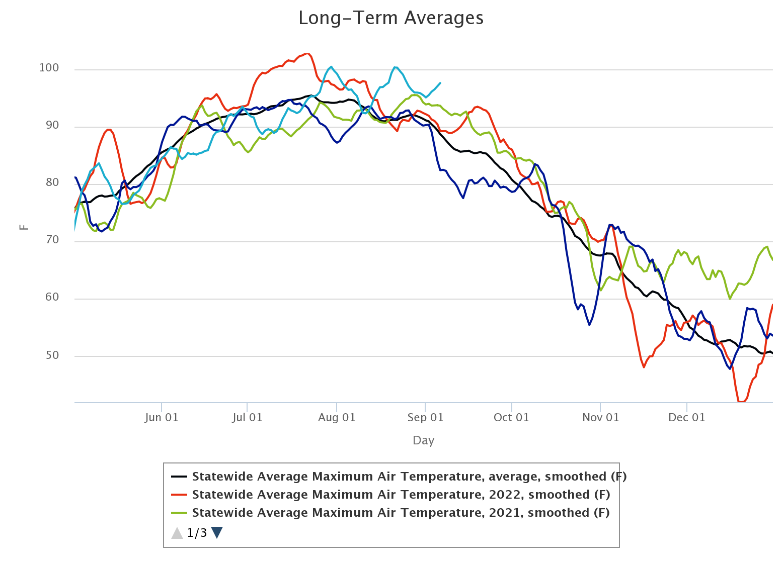
Okay, so the dark black line that rises and declines steadily is the long-term
average (2008-2022). It's a bit of a jumbled mess, but you can see there that last
year, right around Sept 19-20, we had a big cold front that ended summer (red
line). It even stayed above normal for another month, but the statewide average
HIGH temperature started a steady march downward. Same thing with 2021 (green
line), Sept. 15 we saw the line go from horizontal to sloping downward after that
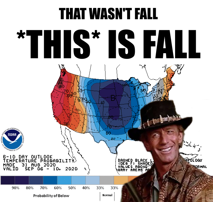
summer's killing blow. In 2020 it happened on the first week of September (dark
blue line), and we have the meme to prove it. In fact, they went nearly to
early winter!
One oddity you can see there is the November and December of 2021 (green line
again) were very much above normal. You'll remember that period as the warmest
December on record by more than 5 degrees, 10 degrees above normal! A month
so warm and beating the previous record by so much...unprecedented in our
climate history. It was also one of the very few times you see flash drought
develop in the cool season. As for this year (light blue line), the slope will
go downward starting next week. It'll jump up again, but from a lower point
going forward.
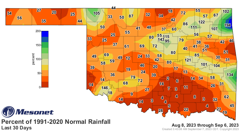
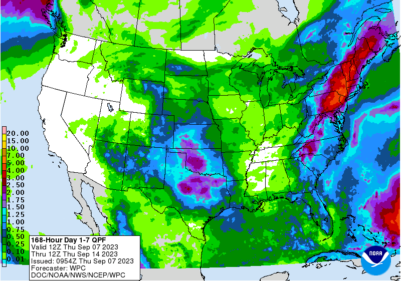
Speaking of flash drought, ours is still kicking with damage being done UNTIL
we get that rain next week. Check out the latest Drought Monitor, and also take
a look at how much the drought has intensified in the last month.
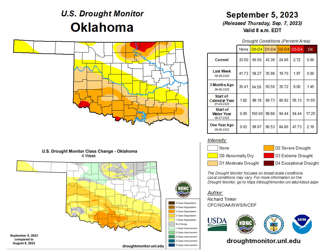
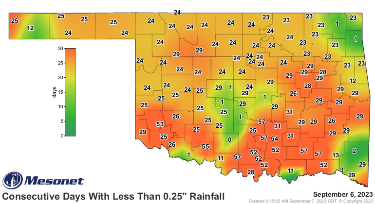
That flash drought is built off that temperature trace AND the dry spell that
has gone on for coming up on a month in northern Oklahoma and 2 months across
southern Oklahoma.
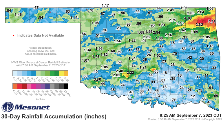
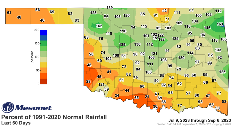
This will put a stop to that, if not reverse it somewhat.

But today and tomorrow are gonna be nasty.
We can wait!
Gary McManus
State Climatologist
Oklahoma Mesonet
Oklahoma Climatological Survey
gmcmanus@mesonet.org
September 7 in Mesonet History
| Record | Value | Station | Year |
|---|---|---|---|
| Maximum Temperature | 109°F | BURN | 2023 |
| Minimum Temperature | 39°F | BRIS | 2011 |
| Maximum Rainfall | 4.46 inches | BURB | 1995 |
Mesonet records begin in 1994.
Search by Date
If you're a bit off, don't worry, because just like horseshoes, “almost” counts on the Ticker website!