Ticker for September 6, 2023
MESONET TICKER ... MESONET TICKER ... MESONET TICKER ... MESONET TICKER ...
September 6, 2023 September 6, 2023 September 6, 2023 September 6, 2023
Cross everything ya got!
I received an e-mail last night that read thusly:
"Hi Gary,
I found several instances of spelling errors, poor grammar, and areas that lack
depth when reviewing your company's content. My job here at (Nunya Bidness) is to
review and find errors in publicly available content that companies publish."
I know this is just a form letter sent out to every e-mail address found published
on websites across the globe, by bots no less, but I have a couple of things I'd
like to say!
1. How dear you! I'll have you know that my attention to detail and grammer is
second to, and
B. Don't try and scam me when you can't even spell "grammer" correctly!
Harrumph!
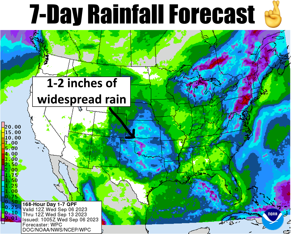
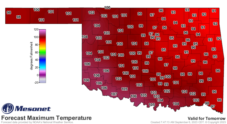
Okay, as we look at that 7-day forecast above, that's something we really need
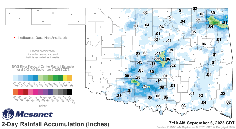
to have hit as we get into the weekend into next week. We started yesterday with
some storms in the morning and then along the front last night. It wasn't a
lot, but if you were under one of those storms (hopefully not one of the
microbursts), then you got lucky.
Speaking of the front, if you were to the NW of it yesterday, you got lucky, and
also today...lucky, because it was pretty frigging ridiculous to the southeast
of the boundary yesterday.

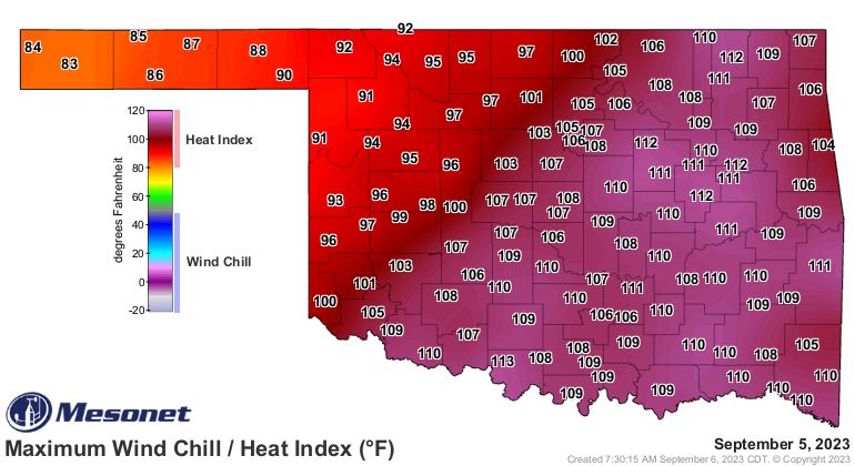
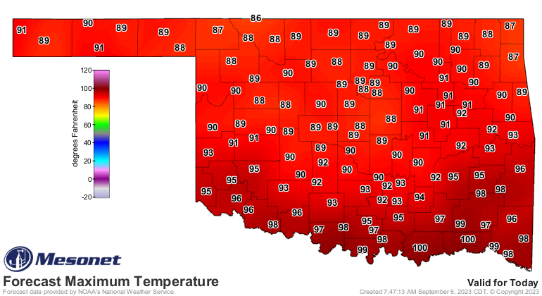
But today should be much nicer, then back to the frying pan for Thursday and
Friday, then the march to fall into next week. Temporary or not!

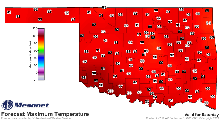
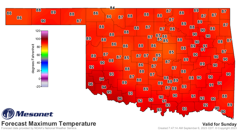
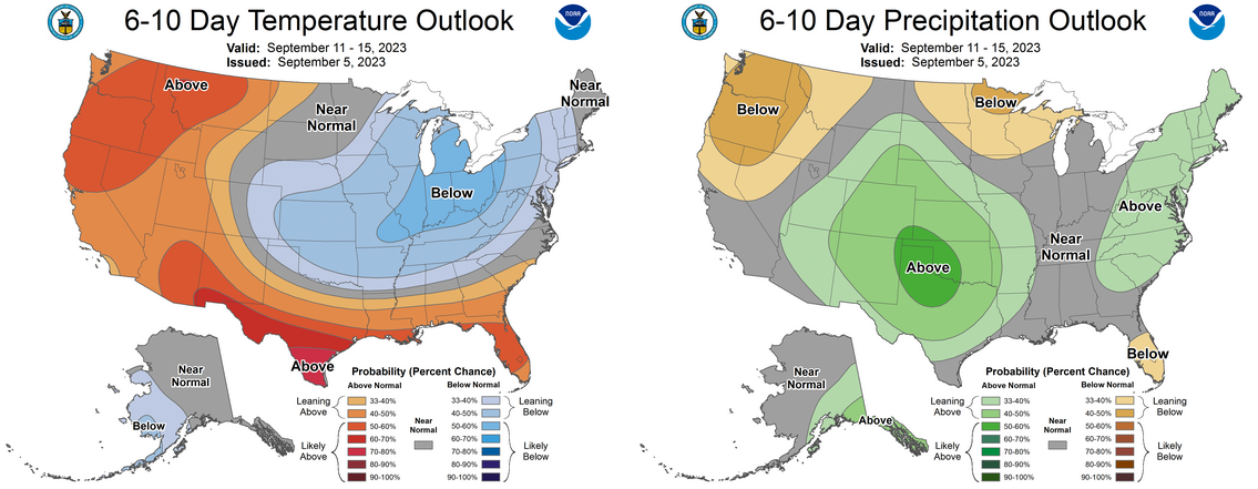
So next week looks deliciously mild and wet. We won't worry what comes after
that so we can just enjoy a very much welcome change in the weather. The rain
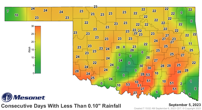
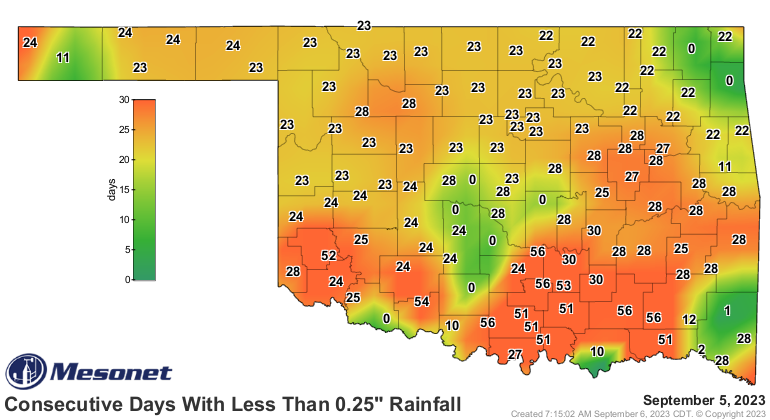
is needed desperately. Even though we saw some reset in localized areas
yesterday, we still need much more help turning these maps green.
Speaking of next week...are ya planning a trip to the East Coast? You might
audibly "GULP" when you see this, but looks like the tropical system Lee, soon
to be a major hurricane (is there any other kind, really?), will be roaming
the oceans off our East Coast. Hopefully it curves back to the east before
hitting land.
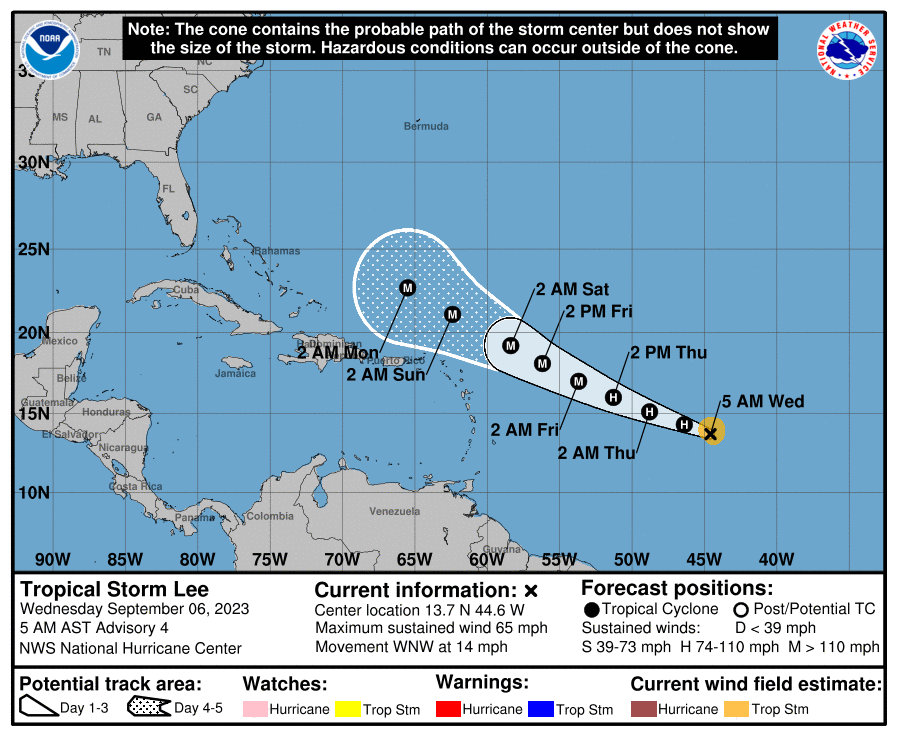

A long way off, so lots of time to keep it away from making landfall.
Speaking of fallen land, our soil moisture has cratered across the state in
these flash drought conditions. More on that tomorrow.
Gary McManus
State Climatologist
Oklahoma Mesonet
Oklahoma Climatological Survey
gmcmanus@mesonet.org
September 6 in Mesonet History
| Record | Value | Station | Year |
|---|---|---|---|
| Maximum Temperature | 107°F | FREE | 2015 |
| Minimum Temperature | 40°F | OILT | 2011 |
| Maximum Rainfall | 3.74″ | MEDF | 2008 |
Mesonet records begin in 1994.
Search by Date
If you're a bit off, don't worry, because just like horseshoes, “almost” counts on the Ticker website!