Ticker for February 6, 2019
MESONET TICKER ... MESONET TICKER ... MESONET TICKER ... MESONET TICKER ...
February 6, 2019 February 6, 2019 February 6, 2019 February 6, 2019
Freezing Drizzle Ice Fog Fire Tornado
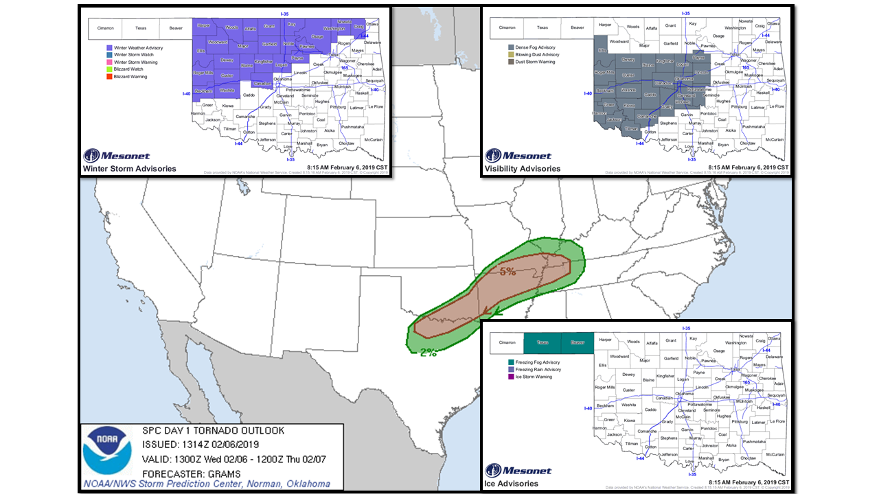
Take moisture
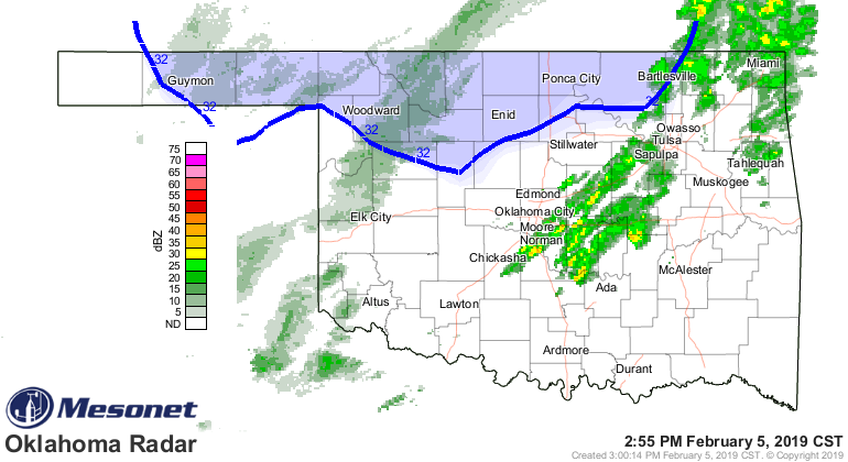
add cold AND warm air separated by some sort of quasi-cold/warm/stationary front
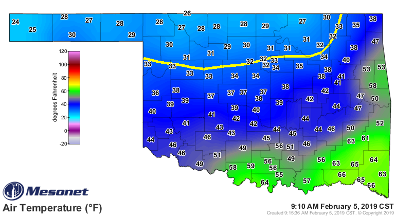
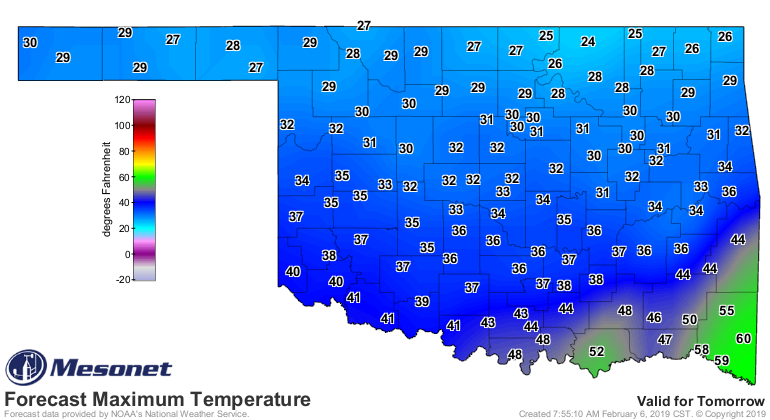
and throw in a storm system, and you have our current chaotic mess. Big storms
possible later today SE of the I-44 corridor, freezing rain/drizzle/fog to the
NW of I-44 (oddly enough, along I-44 a few feet to either side, sunny and 80
degrees! Crazy, right?? Well, no, just wishful thinking.), and big fire danger in
the western Panhandle. What can you expect?
Pain. No, that was Clubber Lang's promise in "Rocky III." What can you expect?
Depends on where you are on the map. If'n you're in the southeast, prepare for
storms. NW, stay home if you can and stay off the roads. Panhandle, keep your lit
butts in your car (and we all know just how painful that can be). For the rest
of us, not Festivus but a mixed bag of impacts. Central Oklahoma will see just
about everything but fire danger, possibly. Once the storm system moves through,
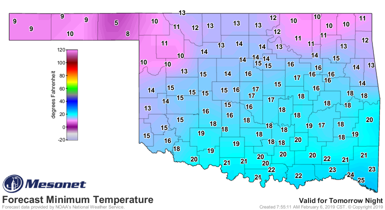
just plain cold for everybody with a lingering chance of freezing drizzle
overnight into tomorrow morning.
As for those storms in the southeast, as noted in the top graphic on the Ticker,
the tornado threat is low, but not zero. But the other hazards associated with
severe storms are also a threat.

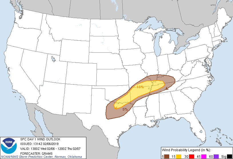
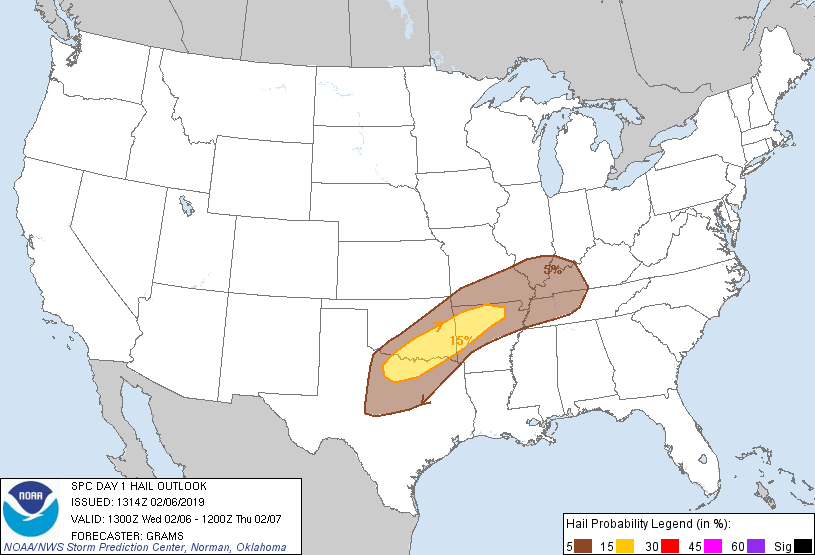
So if you want to see storms, drive to the southeast (unless you're in the
northwest, then stay off the roads). If you want to see ice, drive to the
northwest (no, stay off the roads). If you want to see fire, drive to the far
western Panhandle (no, there's ice along the way, stay off the roads).
Okay, new plan. Stay where you're at and stay weather aware.
Gary McManus
State Climatologist
Oklahoma Mesonet
Oklahoma Climatological Survey
(405) 325-2253
gmcmanus@mesonet.org
February 6 in Mesonet History
| Record | Value | Station | Year |
|---|---|---|---|
| Maximum Temperature | 84°F | BEAV | 2009 |
| Minimum Temperature | 0°F | CAMA | 2014 |
| Maximum Rainfall | 2.59″ | PRES | 1999 |
Mesonet records begin in 1994.
Search by Date
If you're a bit off, don't worry, because just like horseshoes, “almost” counts on the Ticker website!