Ticker for December 5, 2016
MESONET TICKER ... MESONET TICKER ... MESONET TICKER ... MESONET TICKER ...
December 5, 2016 December 5, 2016 December 5, 2016 December 5, 2016
Back to the arctic
Some might say the rain over the weekend was the big news, with all it's high-
falutin "ohhhh, look at me, I saved these crops" and "I'm so awesome, I helped
fill this pond!" (okay, maybe I'm overstating that just a tad...good rains
nonetheless)
And some parts of the state STILL need a good rain.
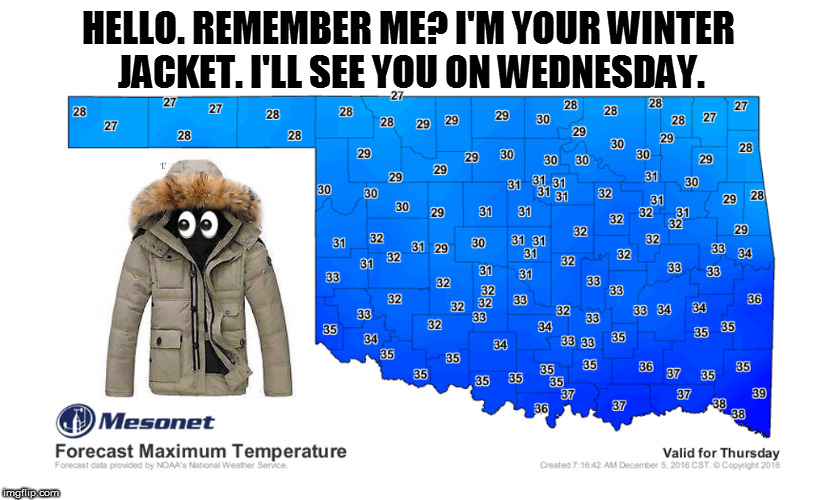
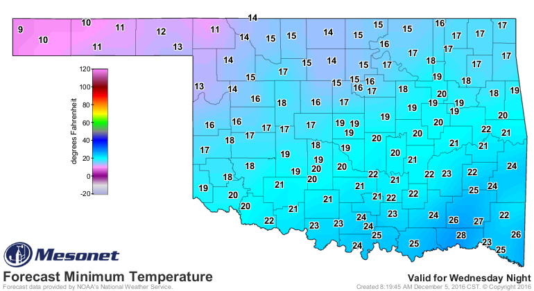
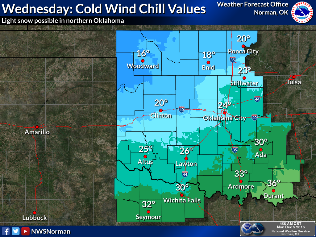
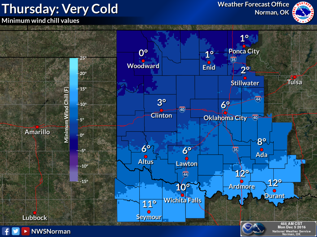
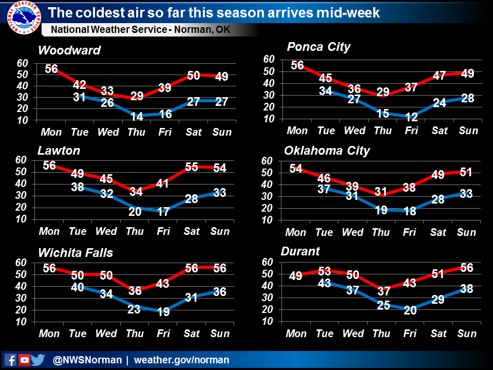
But let's talk about that frozen 800 pound gorilla in the room, the mass intrusion
of arctic set to occur over the next several days, set to arrive Wednesday in
our neck of the woods. You saw the Thursday high temperature map above, with
maximum temps limited to the 20s across northern OK and 30s to the south. And
of course, low temps will also be in teeth-chattering territory.

But the real culprit will be the winds AND the cold, a dastardly due that
promised to drop wind chill values into the single digits at times. And there
will be a chance of some freezing drizzle and light snow, mainly across northern
OK.

So an extended period of actual WINTER weather is set to occur from Wednesday
through the first half of the weekend. But have no fear, nor frostbite. The
weather is expected to moderate by early next week. And beyond that, we might
even be back seeing above normal temperatures.
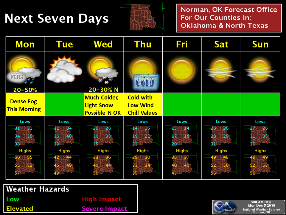
No winter wonderland is expected...the weather will not be frightful. There just
isn't enough moisture to intermingle with this cold air. In fact, it's looking
pretty darned dry throughout the next couple of weeks.
Make no mistake though, this is the first really big dip in the polar jet for
the season that's allowing this arctic air to plunge to the south, and we ain't
acclimated for it. We're amidst our 3rd warmest year on record, just experienced
our 2nd warmest fall on record, and everything from flies, yellowjackets, grass,
flowers and trees still thinks it's October, let alone November.
The proverbial "shock to the system" will arrive on Wednesday. So now you know,
and you SHOULDN'T be shocked.
Gary McManus
State Climatologist
Oklahoma Mesonet
Oklahoma Climatological Survey
(405) 325-2253
gmcmanus@mesonet.org
December 5 in Mesonet History
| Record | Value | Station | Year |
|---|---|---|---|
| Maximum Temperature | 84°F | MANG | 2021 |
| Minimum Temperature | 0°F | KENT | 2013 |
| Maximum Rainfall | 1.55″ | BIXB | 2021 |
Mesonet records begin in 1994.
Search by Date
If you're a bit off, don't worry, because just like horseshoes, “almost” counts on the Ticker website!