Ticker for October 5, 2022
MESONET TICKER ... MESONET TICKER ... MESONET TICKER ... MESONET TICKER ...
October 5, 2022 October 5, 2022 October 5, 2022 October 5, 2022
Dirty Twenties
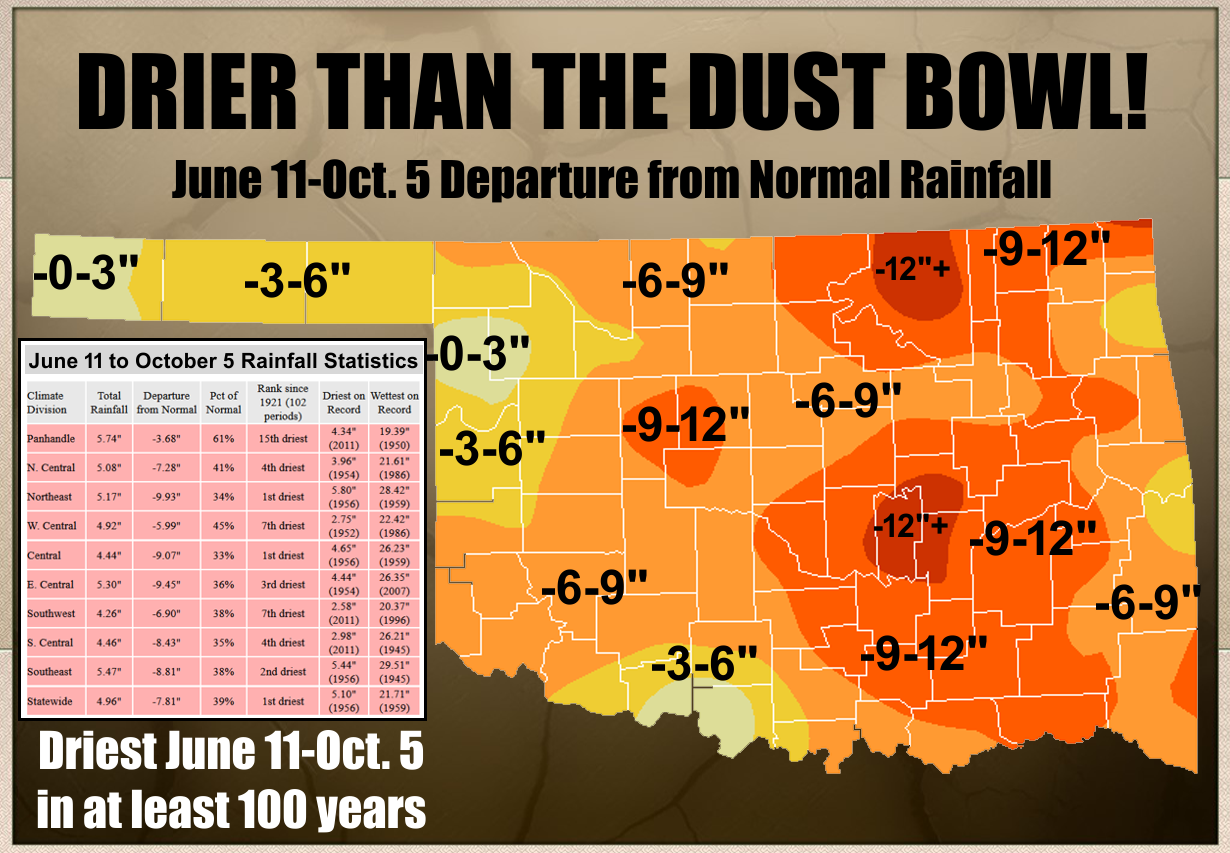
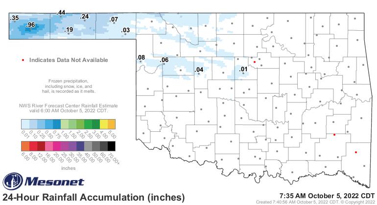
You can sugarcoat just about anything, I reckon, including rainfall stats. For
instance, we COULD have led with the ~ 1-inch of rain that fell last night in
Boise City overnight.
Are you kidding me, Boise City? You think you're Broken Bow? You think you're
Idabel??
Want to hear something crazy?
Okay..."dfkoeamf ofcoaf oea foogo ldcmn cmweurwr!!"
Now how about something REALLY crazy?
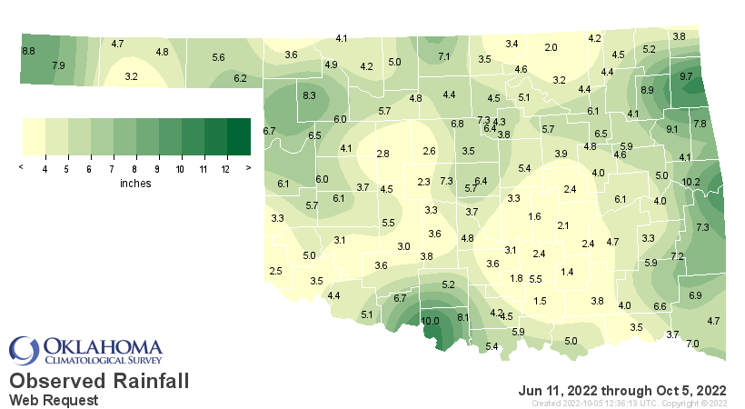
Okay, over the length of this flash drought (that's now just a drought), since
June 11, Boise City has the 9th highest rainfall total of our 120 Mesonet sites.
Now Sallisaw leads the way with 10.24 inches (5.92" which came on July 21), but
here's something even more MORE crazy...Kenton is 6th with 8.82 inches!
Are you kidding me, Kenton? You think you're Mt. Herman? You think you're Boise
City...errrr, Talihina??
Here are some of the ranking of highest and lowest over this here flash drought.
-***-
Highest Lowest
Sallisaw 10.24" Ada 2.45"
Waurika 9.97" Okemah 2.43"
Jay 9.72" Stuart 2.35"
Tahlequah 9.07" El Reno 2.26"
Pryor 8.95" Holdenville 2.15"
Kenton 8.82" Foraker 2.02"
Woodward 8.29" Sulphur 1.77"
Ringling 8.09" Seminole 1.57"
Boise City 7.88" Tishomingo 1.48"
Westville 7.77" Centrahoma 1.40"
-****-
1.4 inches, Centrahoma? Are you kidding me? You think you're Slapout? You think
you're Eva?
See for yourself.
What is this Bizarro Oklahoma where the Panhandle and SE OK have switched places?
And who is it gonna shock the most? What will the Panhandle do with all those
trees?
Have you seen the Panhandle's tree, by the way? It's right outside of Beaver
on the west side of town. Lovely.
Wait, does this mean that Lake Optima will finally fill up? Somebody better go
mow it real quick.
Now for SE OK, are you really ready for daily winds running from 40-70 mph,
and even worse on non-calm days?
Now what does all this mean? Well, it means I need help. Serious help. But it
also means...we need rain, and lots of it. Over the course of 120 days or so,
we've seen dryness the likes of which haven't existed in our state over that
particular time frame, like, ever! Or in at least the last 100 years or so.
Maybe our luck is changing?
There is rain starting to show up on the 7-day even more so than we've seen
over the last couple. Heaviest rains in the Bizarro Panhandle, of course.
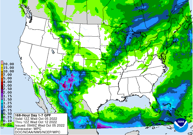
Things get a bit iffy from there, as they always do, with a cutoff low over the
Desert Southwest giving forecasters fits. It does appear like we'll see our
first wetter-than-normal weather regime in place next week for the first time
in over a month, as indicated yesterday.

With "cutoff low, forecaster's woe" in mind, let's take the hope and not the
pessimism going forward. One thing we do know?
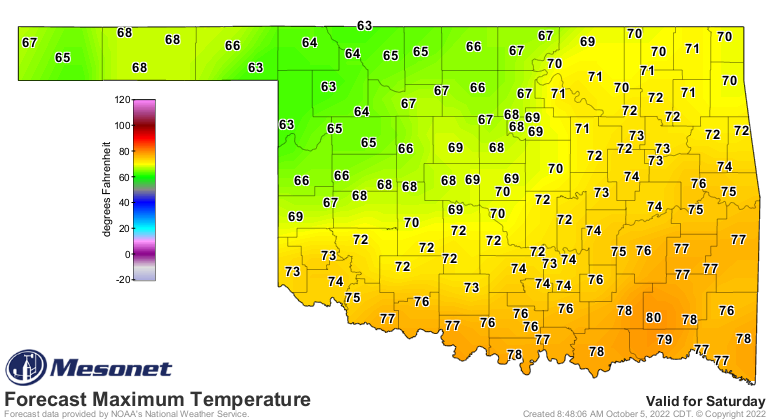
REAL fall is coming this weekend. And it might stick around for awhile.
Gary McManus
State Climatologist
Oklahoma Mesonet
Oklahoma Climatological Survey
gmcmanus@mesonet.org
October 5 in Mesonet History
| Record | Value | Station | Year |
|---|---|---|---|
| Maximum Temperature | 96°F | HOOK | 2018 |
| Minimum Temperature | 31°F | KENT | 2016 |
| Maximum Rainfall | 5.92″ | PRYO | 1998 |
Mesonet records begin in 1994.
Search by Date
If you're a bit off, don't worry, because just like horseshoes, “almost” counts on the Ticker website!