Ticker for October 4, 2023
MESONET TICKER ... MESONET TICKER ... MESONET TICKER ... MESONET TICKER ...
October 4, 2023 October 4, 2023 October 4, 2023 October 4, 2023
Ruh Roh!
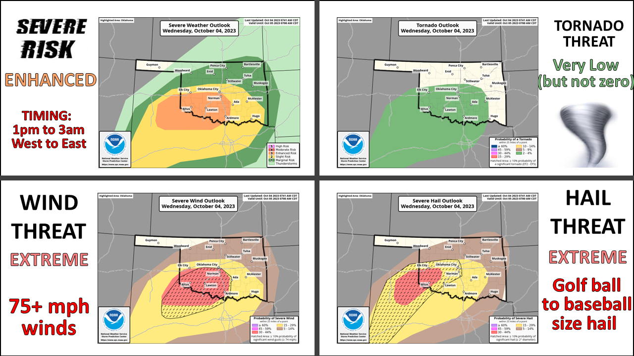
Yes, ladies and gentlemen (and most of the rest of you heathens, scoundrels, and
ne'er-do-wells), it's one of THOSE days in Oklahoma. One of those days where you
wake up in the morning and ask Mother Nature for some eggs (rain) and toast
(cooler weather) and she gives you yak snout (large hail) and gator toenails (75+
mph winds), with a small side of granulated buzzard saliva (tornadoes) thrown
in.
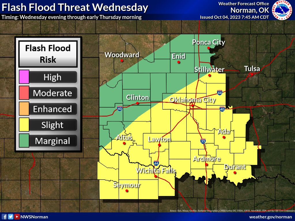
Still hungry? Yeah, me either. The rain will be welcome, of course, although the
flooding threat isn't too appetizing either.
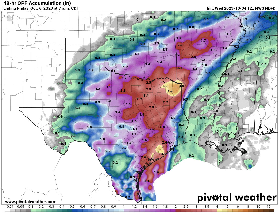
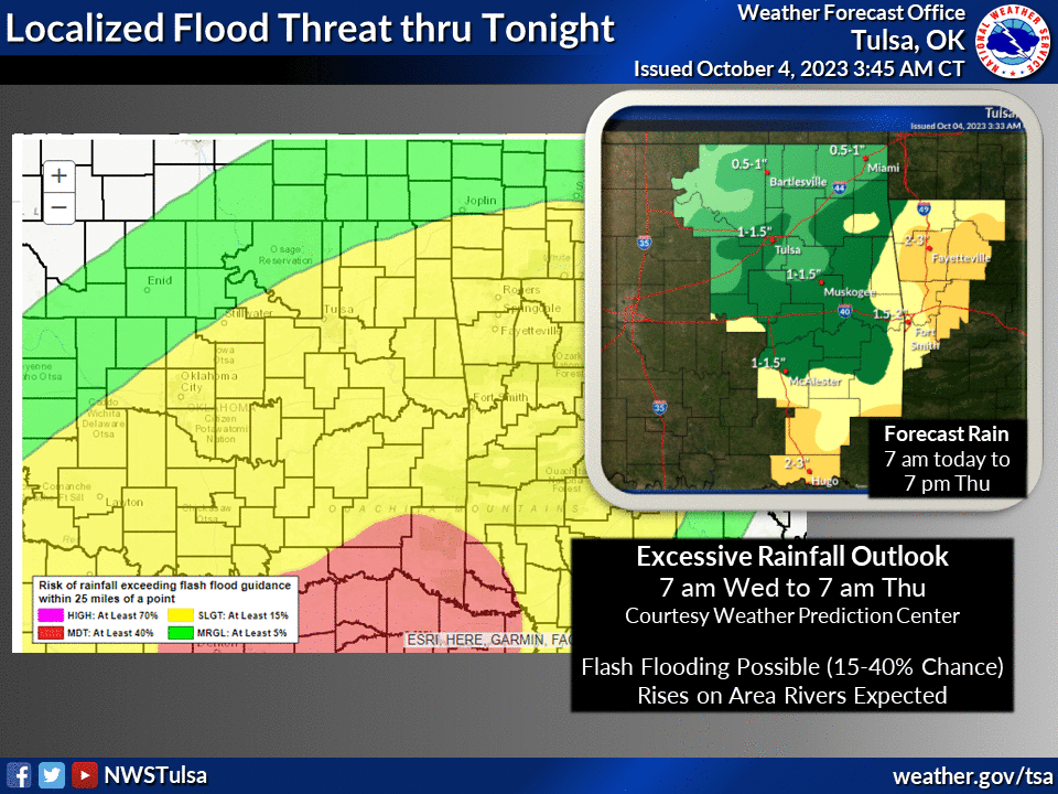
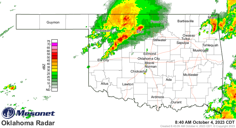
We've gotten SOME rain with storms overnight, but not that great thus far.
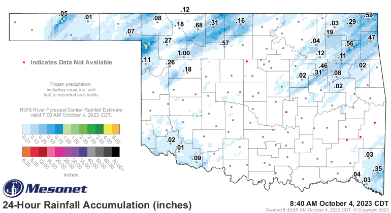
Those totals should continue to creep up because heck, it's raining right now
for crying out loud!
Now here's the secret to today's forecast that NOBODY else will talk about,
except every other meteorologist in the area...but NOBODY else besides everybody
else. What? Never mind. The secret is the ongoing showers and storms have a
chance to foul things up, with "foul things up" making things either better
or worse, and "better or worse" can mean lots of things too, and I'll bet I
can unnecessarily continue to lengthen this sentence, but the weird thing is
you are still reading it, but okay you can stop now, no I said stop now, fine,
don't then.
So this is a day you'll have to pay close attention to the updates to the
forecast from your local NWS forecast office and your favorite local media
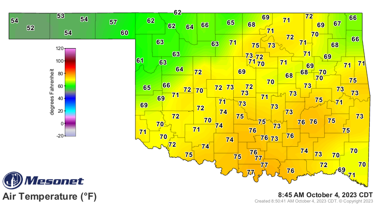
source. One thing far from uncertain is the cold front that has already entered
the state and now lays...lies...lay (pick one that is grammatically correct)
across NW OK, as you can see in the temperature and wind fields.
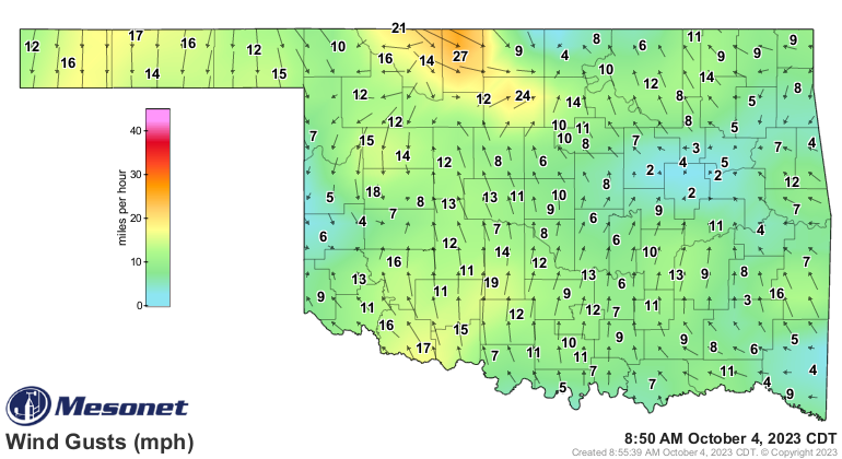
And you can see from the larger view what's in store for us with lots of cold
fall air moving in behind it. The coldest air will hold back until the weekend
with a reinforcing cold front moving in Friday. Of course it will, because
why stop with yak snout and gator toenails, Mother Nature? How about some
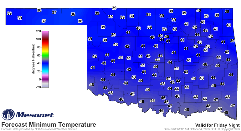
mole-rat kebobs as well?? Here's a helping of winter for Saturday morning.
Check please!
Gary McManus
State Climatologist
Oklahoma Mesonet
Oklahoma Climatological Survey
gmcmanus@mesonet.org
October 4 in Mesonet History
| Record | Value | Station | Year |
|---|---|---|---|
| Maximum Temperature | 99°F | WALT | 2000 |
| Minimum Temperature | 29°F | OILT | 2010 |
| Maximum Rainfall | 7.72 inches | PAWN | 2017 |
Mesonet records begin in 1994.
Search by Date
If you're a bit off, don't worry, because just like horseshoes, “almost” counts on the Ticker website!