Ticker for December 3, 2020
MESONET TICKER ... MESONET TICKER ... MESONET TICKER ... MESONET TICKER ...
December 3, 2020 December 3, 2020 December 3, 2020 December 3, 2020
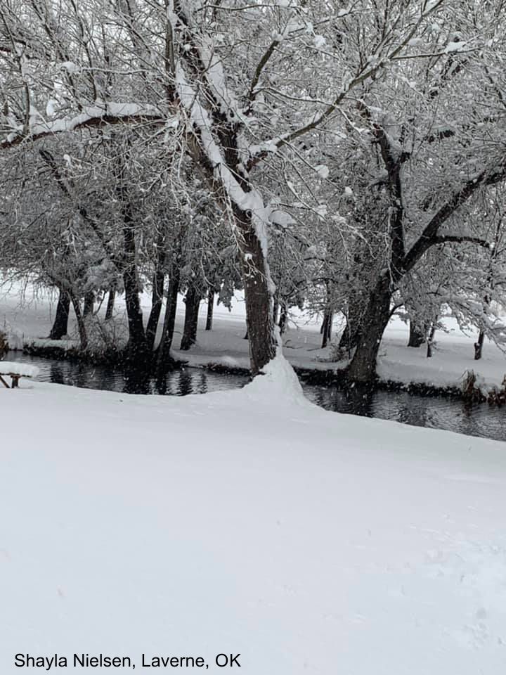
Snow City
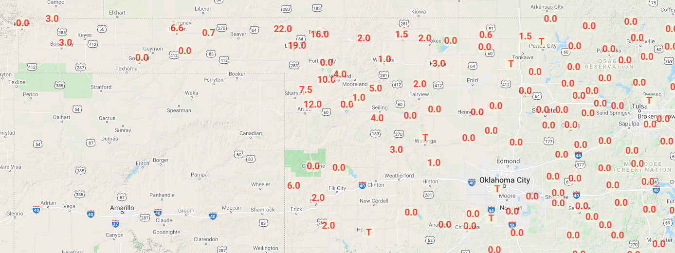
Dec. 2-3, 2020, Snow Totals
-***-
Location County Snow Total
Buffalo Harper 15.0
Gage Ellis 14.0
Laverne Harper 14.0
Gate Beaver 12.0
Tangier Woodward 11.0
Shattuck Ellis 7.0
Woodward Woodward 6.5
Slapout Beaver 6.0
Fort Supply Woodward 6.0
Forgan Beaver 5.0
Turpin Beaver 4.0
Vici Dewey 4.0
Mooreland Woodward 3.8
Alva Woods 3.0
Waynoka Woods 1.0
-****-
Note: These are from preliminary storm reports as shown by the local NWS offices.
The 15-inch total at Buffalo was from a trained spotter, while the official
NWS Cooperative Observer at Buffalo reported 14 inches. Snow could have melted
or continued accumulating after each of these totals were reported, so they
should be considered preliminary. That being said...
B-U-F-F-A-L-O, BUFFALO BUFFALO GO GO GO!!
(In the event a late report comes in topping this, I disavow any connection to
Buffalo, since they probably disavowed me first).
Yeah, I haven't forgotten. My hair has, and my bones, but not my brain. I can
remember way back when and...uh, what we're we talking about? Oh yeah, snow. This
event that dumped up to 15 inches on my hometown of Buffalo, OK, darned near
became the early snowstorm of record for the state for this early in the season.
We couldn't top the Thanksgiving week storm of 1992, which dumped from 18-22
inches across far NW OK on Nov. 24-25. I remember that storm pretty well because
I was trying to make it home for Thanksgiving and had to get pushed up a hill
south of Buffalo by an ODOT truck. Rest of the way was downhill, so I was okay.
Thanks for asking. Gate, OK, led the way with that 22 inches.
Then there was the 10-20 inches dumped across far SW OK on Nov. 24-25, 2013. Yes,
SW OK! Roosevelt had 20 inches that storm.
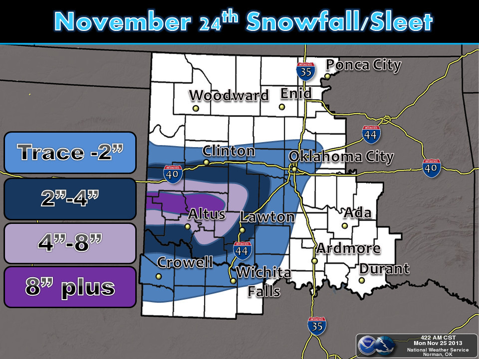
Odd that both are November 24-25, but Oklahoma's weather starts with odd and
goes from there to downright lunacy. The SW OK snowstorm is probably more
impressive, since it has the word "south" in it. I'll note that there was a
20-inch snow in Boise City on Dec. 3-4, 1946, but that was later than the Dec.
3 cutoff date, as well as pretty isolated. And I stuck to 2-day snow totals.
There usually aren't many snowstorms that last three straight days in Oklahoma,
although there can be some multiple rounds from different storm systems that
close together.
At any rate, we needed the moisture. And gosh darn it (keep it clean), we
needed the boost in seeing a good snowstorm. I know they can be a pain, and even
downright dangerous, but it generally perks the mood up to see a good snow
in December.
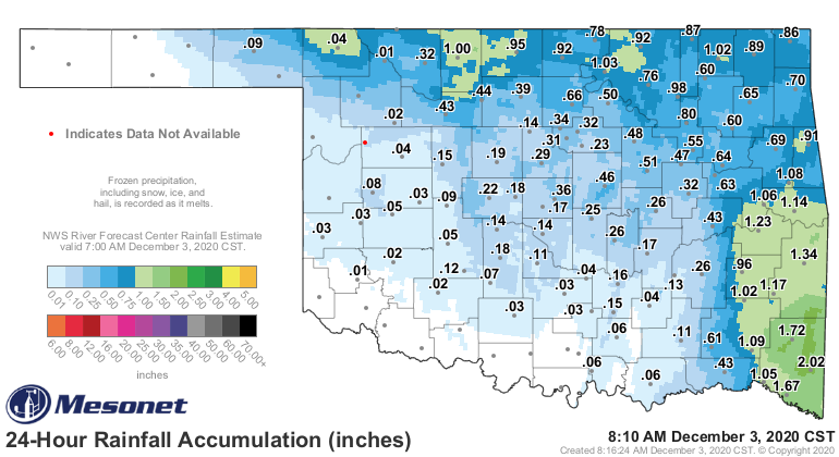
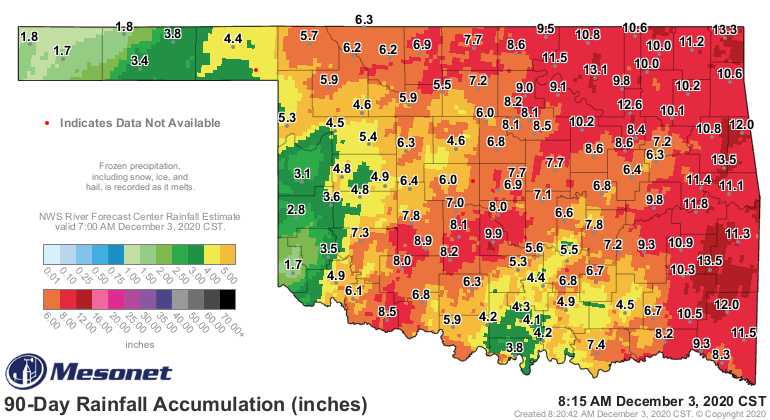
The amounts from the Mesonet gauges you see on the map differ in the areas
where snow fell since we use unheated rain gauges, so we're waiting for some
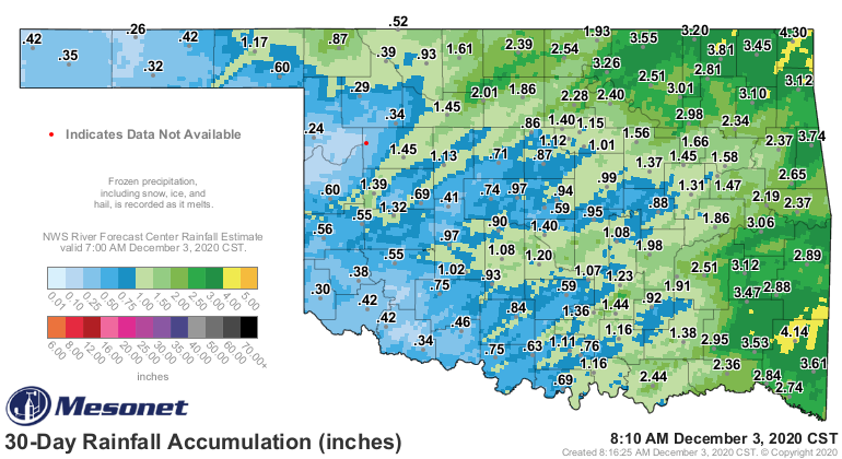
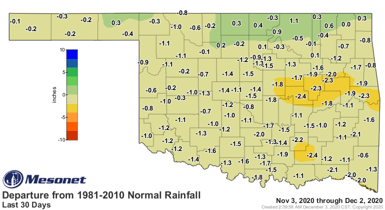
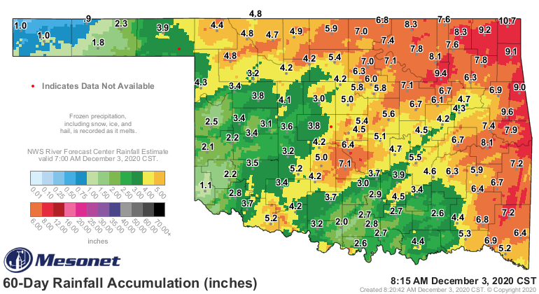
meltage for official totals. We still have big deficits from 30-90 days across
the state, however, and need some more. JUST NO ICE!
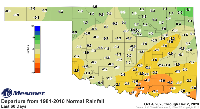
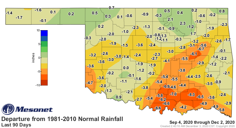
This has left us with an unsightly Drought Monitor pic, with newfound drought
burgeoning across south central OK.
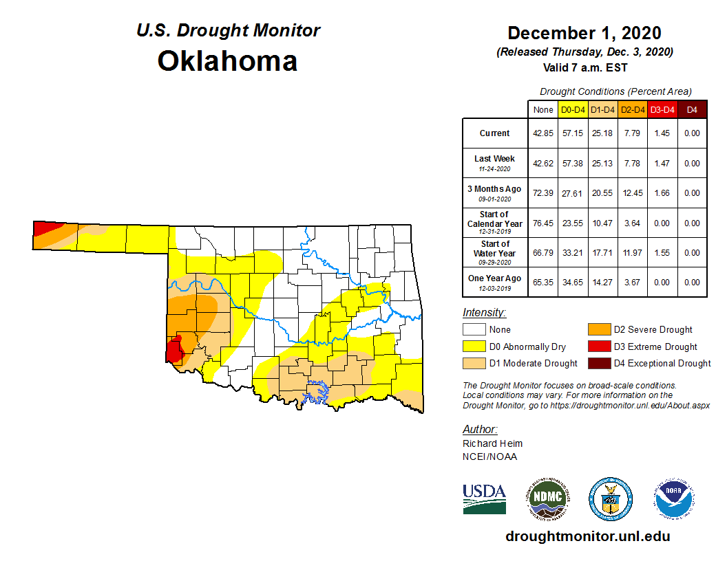
Not much help down that way, or in the hardest hit areas. We'll see temperatures
start to rebound over the next week, and no major storms showing up just yet
after this one.
I did manage to use "that being said" and "at any rate" in today's Ticker, so
I'm probably disavowed all over again. I'll also mention Buffalo still owns
the snowstorm record total of 36 inches from way back on Feb. 22, 1971. I was
alive for that one, too! Wasn't driving though, so no big stories there.
Spavinaw has the 24-hour snow total record of 27 inches from Feb. 9, 2011.
No 2011's again, please. 2020 was enough.
Gary McManus
State Climatologist
Oklahoma Mesonet
Oklahoma Climatological Survey
(405) 325-2253
December 3 in Mesonet History
| Record | Value | Station | Year |
|---|---|---|---|
| Maximum Temperature | 84°F | DURA | 2005 |
| Minimum Temperature | 0°F | NOWA | 2006 |
| Maximum Rainfall | 1.97 inches | KETC | 2002 |
Mesonet records begin in 1994.
Search by Date
If you're a bit off, don't worry, because just like horseshoes, “almost” counts on the Ticker website!