Ticker for October 3, 2022
MESONET TICKER ... MESONET TICKER ... MESONET TICKER ... MESONET TICKER ...
October 3, 2022 October 3, 2022 October 3, 2022 October 3, 2022
I am Cold
Sorry so late this morning. I'm trying to finish my nuclear fusion reactor and
I can't find a place to plug it in.
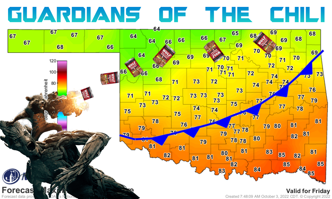
Some would say the weather is awesome, the way we have it now...warm afternoons,
and very cool mornings.
Now as for my taste, I'd add about 10 degrees onto those lows, but I'm willing
to compromise. If we're not careful, somebody's gonna drop down to 32 degrees
overnight and the whole shebang is over with.
But here's the deal...when you're in drought, there ain't no "lovely weather" if
it isn't (no double ain't-ing!) raining. And raining it is not. I have all
the gruesome details down below in the September summary, but suffice it to say
(English to Okie translator: I'm fixing to tell ya) that we are well into a
month-plus of yet another dry spell.


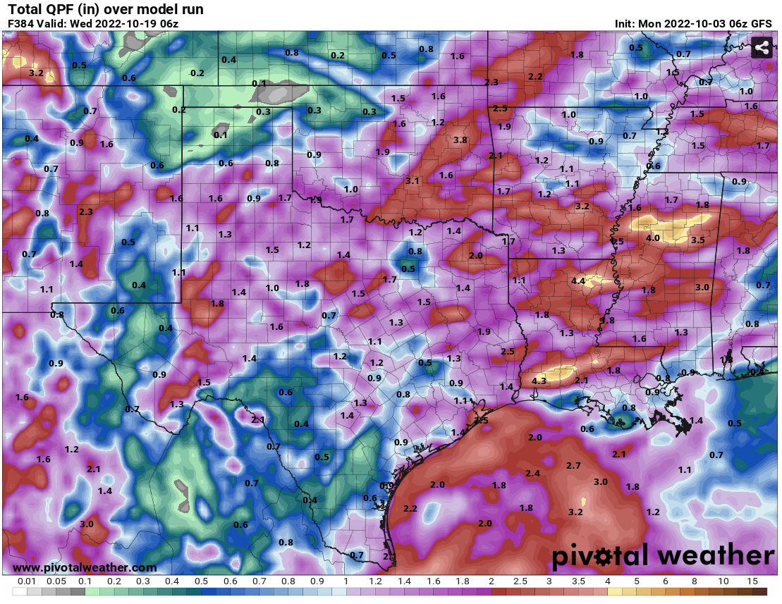
And I know that there is some rain out in fantasy-cast territory...early next
week, the end of next week, etc., but when in drought, it's always safer to go
with persistence. There really isn't much at all showing up for the state, save
maybe for far NW OK with a couple of fronts moving through mid-week and then
into the weekend.
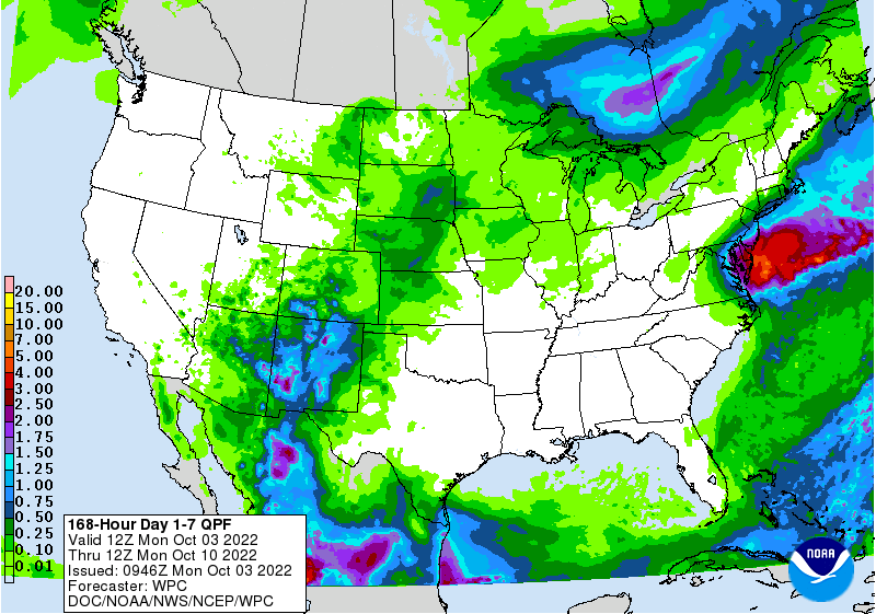
But October, as you can see below in the outlooks, still looks fairly dry
throughout.
Even those fantasy-cast amounts are looking pretty puny for most of us.
Now all of this can (and will eventually) change in an instant. It will start
to be reproduced in multiple model runs, then onto the 7-day forecast, and
before you know it...drought relief.
As many of you have told me though...I'll believe it when I see it. At least
we'll have that big front at the end of the week though.
Now onto (back) September!
----------------------------------------------------------------------------------
September Continues Dry, Dusty Weather
Oct. 3, 2022
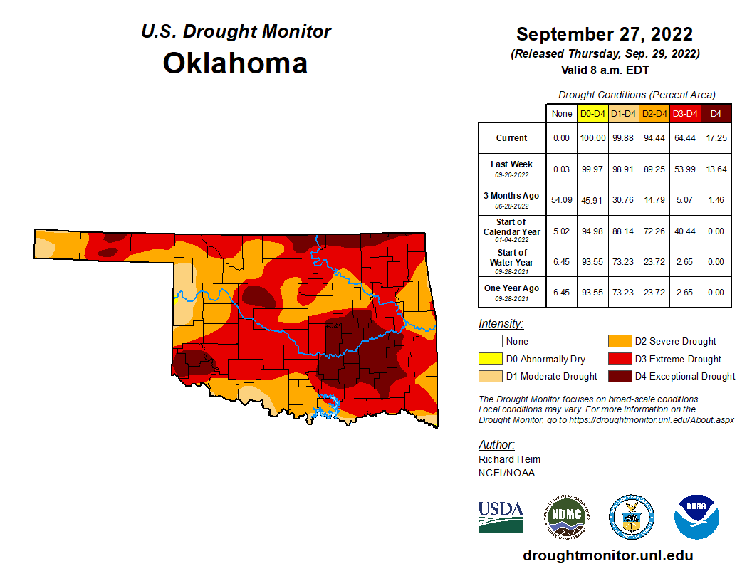
Drought surged across Oklahoma as the driest September since 1956 took its toll
on the state’s landscape. The amount of drought in the state remained largely
unchanged through September at approximately 99%, but the intensity of that
drought increased dramatically according to the U.S. Drought Monitor. Extreme
and exceptional drought, the Drought Monitor’s two worst categories, jumped
from 47% on Aug. 30 to 64% at the end of September, the highest such levels
seen in the state since Feb. 19, 2013. Exceptional drought alone rose to 17%,
its highest level since May 8, 2018. Soil moisture plummeted and fire danger
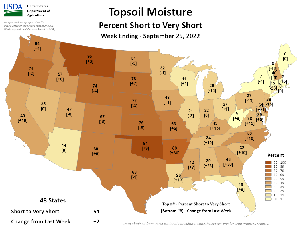
increased in the hot, dusty conditions. The USDA estimated that 91% of the
state’s topsoil moisture was considered “short to very short” by the end of the
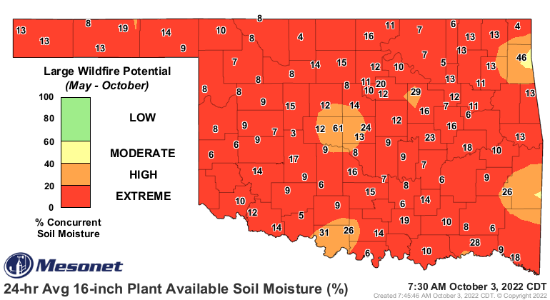
month. The Oklahoma Mesonet measured critically dry soils down to at least 32
inches, which helped boost large wildfire potential into the extreme category.
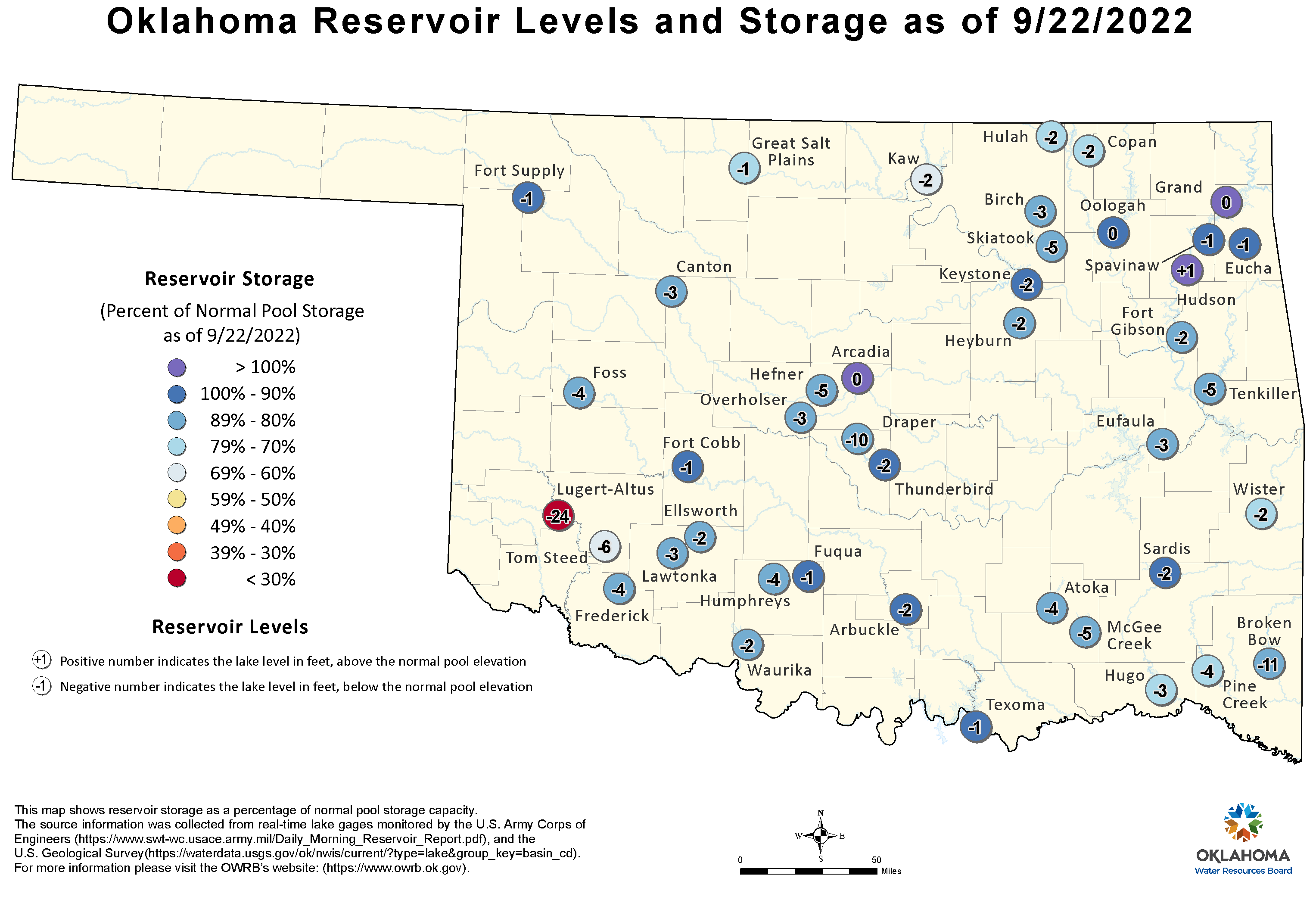
Farm ponds were reported low to completely dry across many parts of the state,
and the bulk of Oklahoma’s larger reservoirs sat 5-10 feet below normal through
the third week of September.


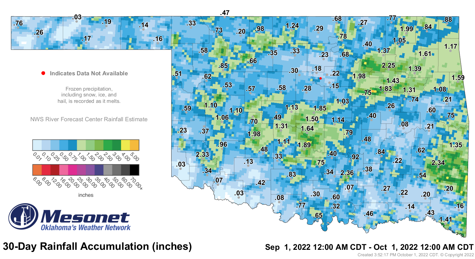
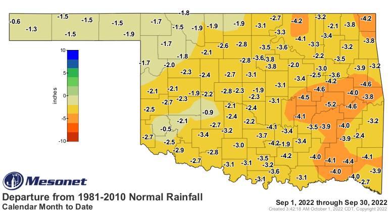
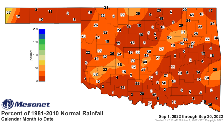
The statewide average rainfall total was 0.71 inches according to the Oklahoma
Mesonet, 2.61 inches below normal and ranked as the fifth driest September
since records began in 1895. None of the 120 Mesonet sites came even close to a
surplus for the month. Fittstown led the way with 2.36 inches. Three western
Oklahoma sites—Eva, Grandfield, and Hollis—shared the bottom spot with three-
hundredths. Eighty-seven sites recorded less than an inch for the month, and 54
of those sites actually had less than a half-inch. Much of the state had gone at
least a month without a quarter-inch of rainfall in a single day, with some
locations across northern Oklahoma missing out for more than 60 days. The first
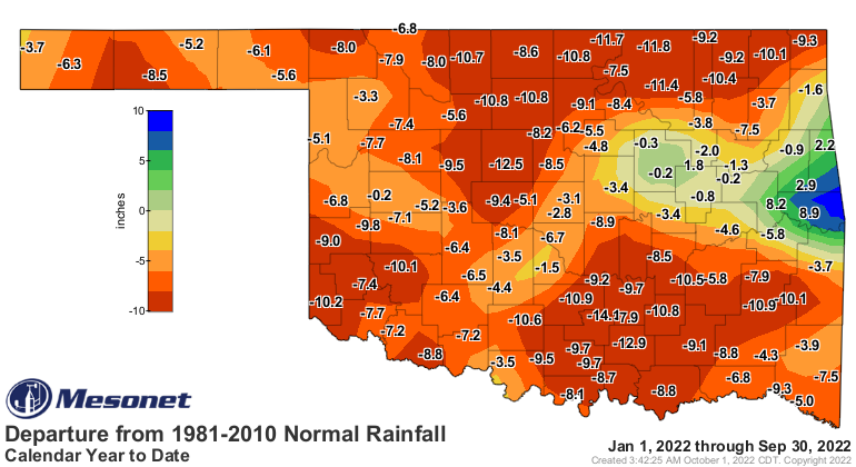
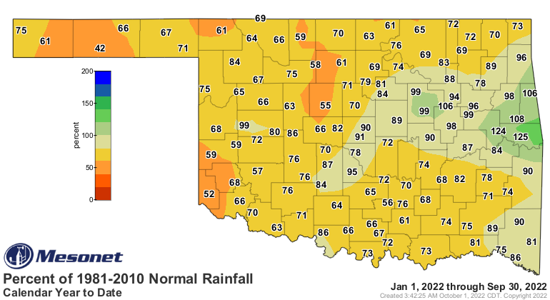
nine months of the year remained squarely on the dry side with a statewide
average of 22.01 inches, 6.56 inches below normal and ranked as the 21st
driest January through September on record. The Oklahoma Panhandle was
particularly dry at 11.63 for their ninth driest such period on record.

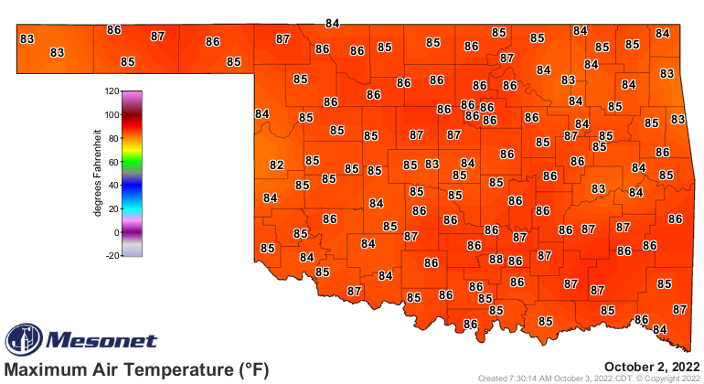
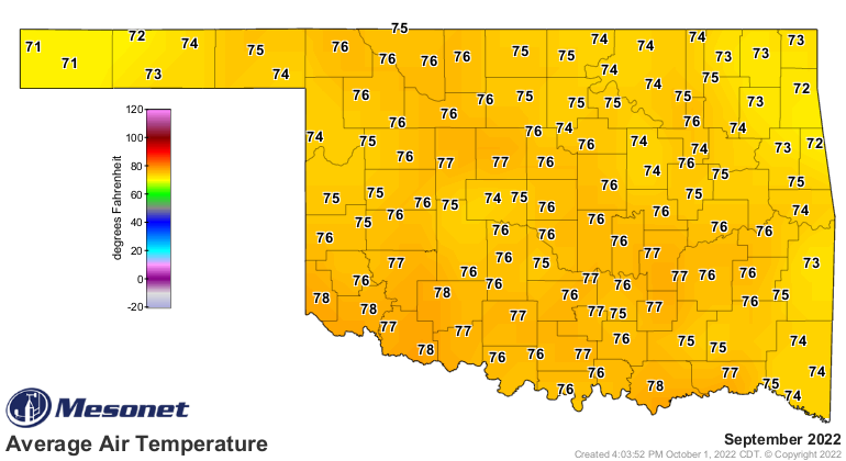
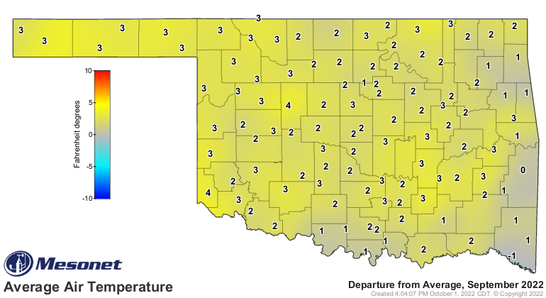
The statewide average temperature of 75.7 degrees ranked as the 24th warmest
September since records began in 1895, 2.8 degrees above normal. Temperatures
were solidly above normal for most of the month, at times 10 to 15 degrees
higher than the seasonal averages. The 120 Mesonet sites recorded triple-digit
temperatures 342 times on 10 separate days, with 102 degrees being the top mark
at many locations across several days. The month’s—and possibly the seasons’—
final 100s occurred on the 25th at the Burneyville, Hugo, and Valliant Mesonet
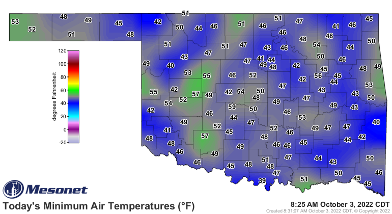
sites. September’s coldest reading of 36 degrees occurred on the 30th at
Wister. That reading and the 39 degrees at Talihina the same day were the first
30s recorded in the state since May 22. The year continued very warm with a
January through September statewide average of 64.8 degrees, a degree above
normal and ranked as the 22nd warmest such period on record.
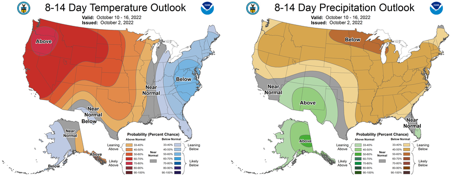
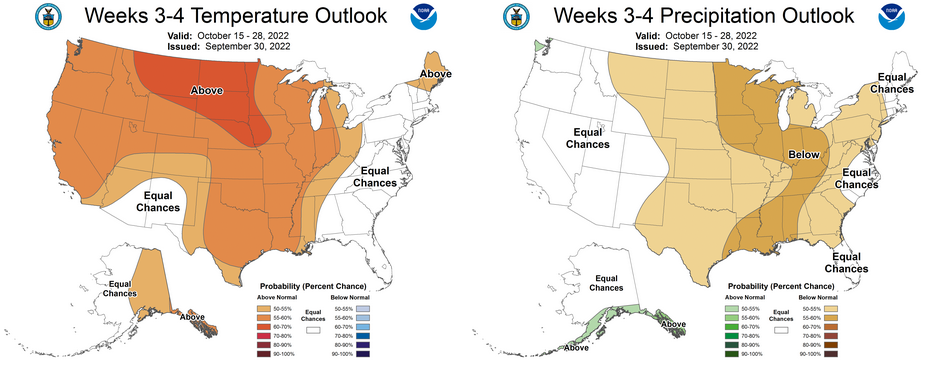
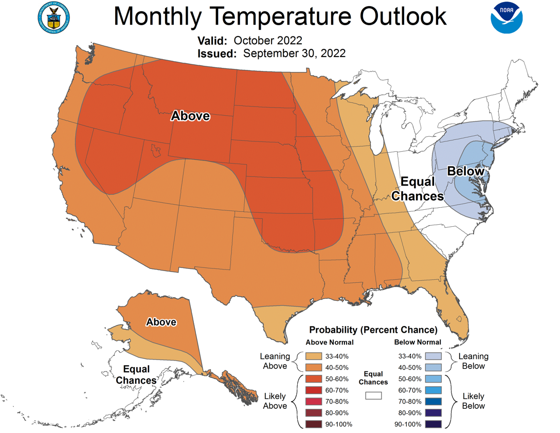
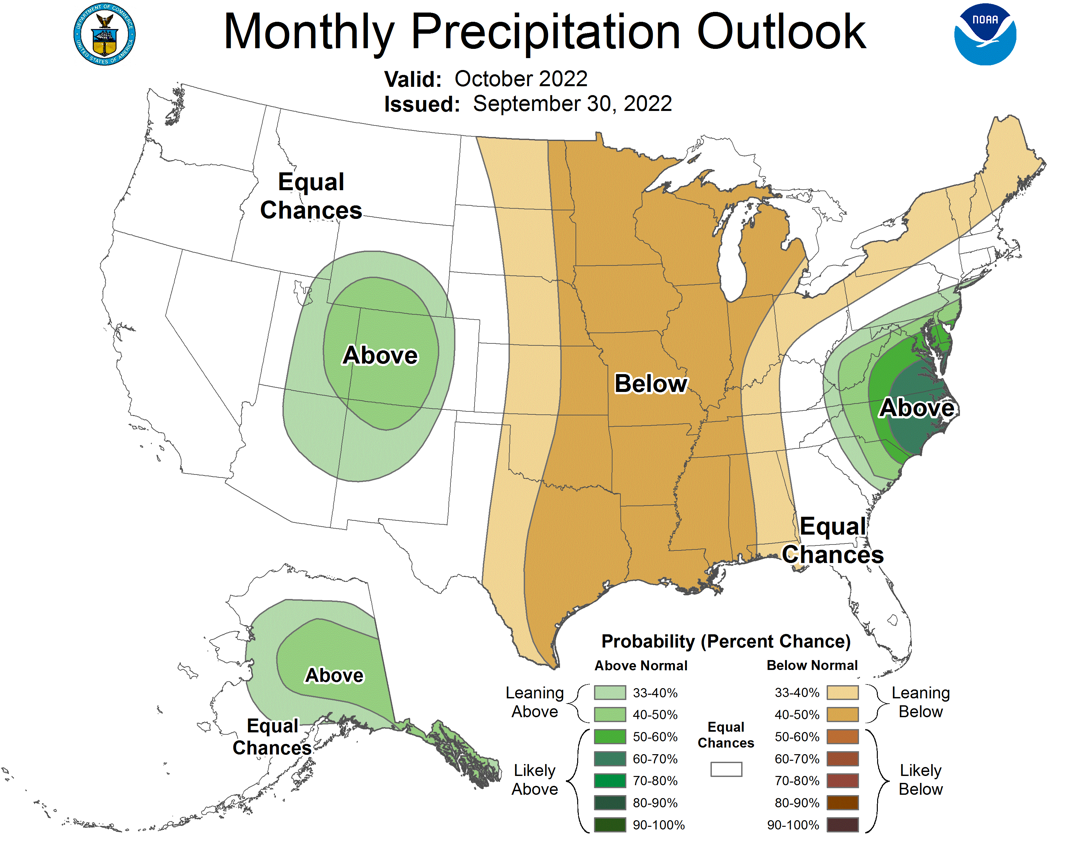
The Climate Prediction Center’s outlooks for October portray possible warm and
dry conditions continuing, with increased odds of above normal temperatures for
the entire state and below normal precipitation for all but the western
Panhandle. The western Panhandle has equal chances for above-, below-, and near-
normal precipitation for October. CPC’s October drought outlook indicates
drought persisting across the entire state through the end of the month, and
expanding to cover most of the Southern Plains through that same period.

###
Gary McManus
State Climatologist
Oklahoma Mesonet
Oklahoma Climatological Survey
gmcmanus@mesonet.org
October 3 in Mesonet History
| Record | Value | Station | Year |
|---|---|---|---|
| Maximum Temperature | 106°F | HOLL | 2000 |
| Minimum Temperature | 31°F | OILT | 2010 |
| Maximum Rainfall | 4.11 inches | WOOD | 2019 |
Mesonet records begin in 1994.
Search by Date
If you're a bit off, don't worry, because just like horseshoes, “almost” counts on the Ticker website!