Ticker for August 3, 2020
MESONET TICKER ... MESONET TICKER ... MESONET TICKER ... MESONET TICKER ...
August 3, 2020 August 3, 2020 August 3, 2020 August 3, 2020
Ju-Bye
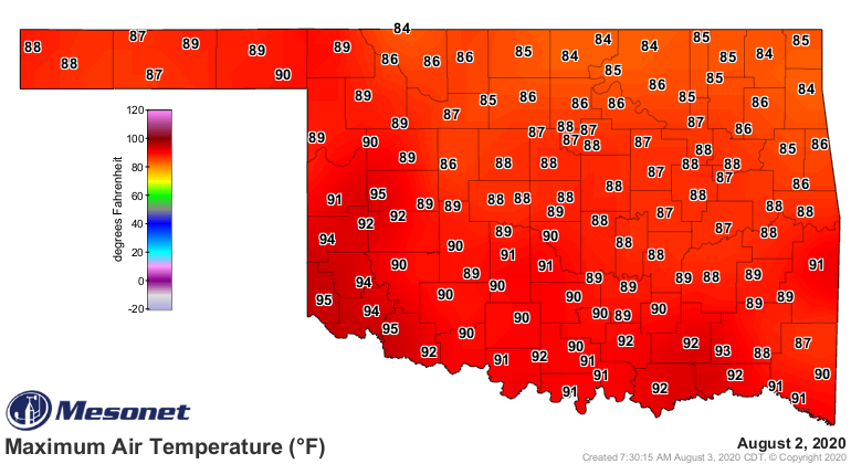
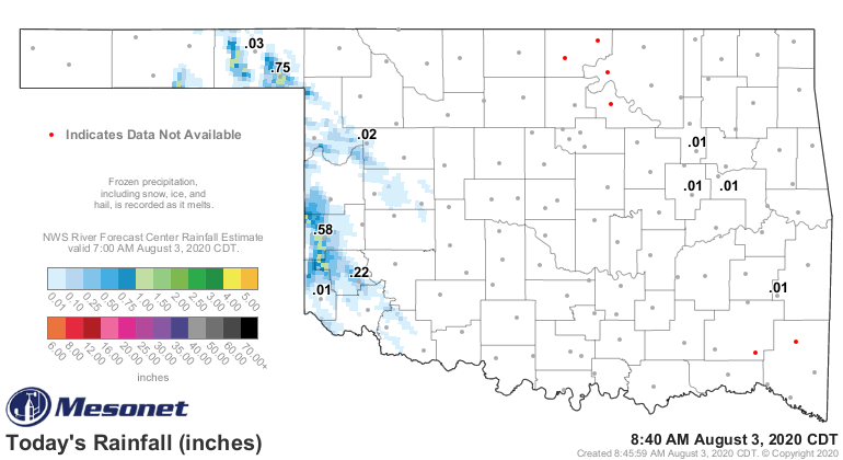
Exactly what kind of August are you folks running here? And it rained this
morning?
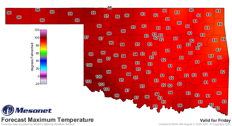
What you see is what you're gonna get, too. Expect more of the same for the
state through the week...maybe getting a bit more August (the month, not the
adjective, as in "Wow, that Ticker writer is really august, and his hair is
sublime!). Okay, I've gone too far with those. Oddly enough, I'd much rather
have the latter, but that's for a later therapy session.
Expect some rain across western Oklahoma here and there over the next couple
of nights, and then a return to summer by the end of the week.
That's a far cry from the last week of July, which I rhymed and I don't know
why. Let's talk about July, before I say bye.
Roll the videotape.
----------------------------------------------------------------------------------
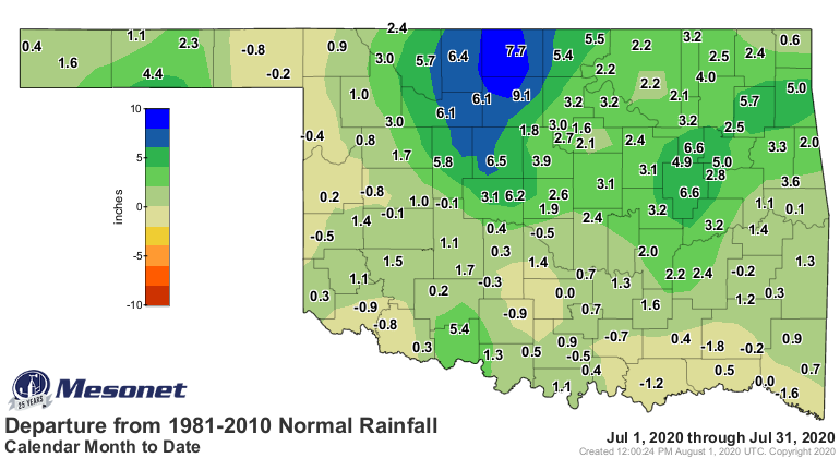
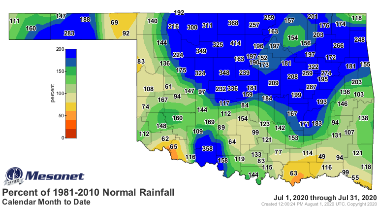
July Sees Drought Relief
Aug. 3, 2020
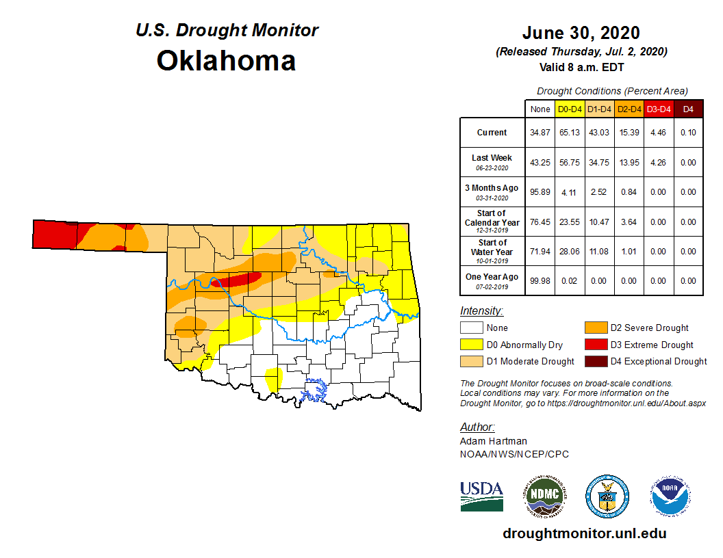
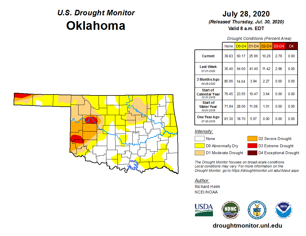
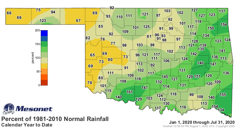
July brought a near miraculous recovery to much of Oklahoma, which was faced with
an intensifying drought headed into summer’s scorching middle stanza.
Uncharacteristically wet conditions succeeded in beating the drought back to a
more manageable level, however, especially across the hardest hit areas in
northern and central Oklahoma. Drought covered as much as 51 percent of the state
on July 7 according to the U.S. Drought Monitor. That coverage was reduced
nearly in half by the end of July, however, eventually encompassing a little
less than 26 percent of the state. The worst remaining conditions were across
southwestern and west central Oklahoma where severe-to-extreme drought
dominated the Drought Monitor map. The Drought Monitor’s intensity scale slides
from moderate-severe-extreme-exceptional, with exceptional being the worst
classification.
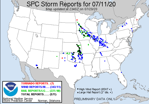
Some of the heaviest rains were accompanied by severe weather. Two large areas
of severe storms moved from north to south across the center and eastern
sections of the state on the 11th, along with damaging winds of up to 80 mph.
The storms left tens of thousands without power – for several days in some
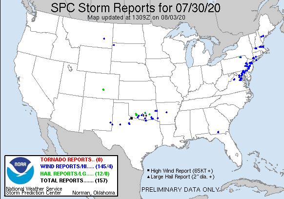
cases. Another round of storms on the 30th packed winds of over 90 mph and
caused extensive tree and power line damage across southern Oklahoma. The
Oklahoma Mesonet site at Fittstown recorded a wind gust of 90 mph that evening.
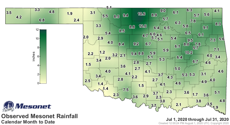
In a stunning reversal of fortune following its 12th driest June on record,
north central Oklahoma recorded its second wettest July with an average of 7.8
inches of rainfall, a surplus of 4.99 inches. Only 1950’s 8.59 inches ranked
higher. Overall, the statewide average of 4.84 inches was 1.96 inches above
normal to rank as the 16th wettest July on record. Several locations broke
rainfall records for July. Enid’s 13.06 inches became their highest July total
since its records began in 1894, topping 1960’s 12.97 inches. Ames and Jefferson
– both with data stretching back to the 1890s – also saw records fall with
10.61 and 9.55 inches, respectively. Enid’s value for the month was bested when
a volunteer observer near the small town of Hunter in Grant County reported the
state’s highest total with 16.17 inches. That ranks as the 13th highest July
rainfall total ever recorded in the state. Wewoka’s 18.83 in 1950 tops the list.
Three Oklahoma Mesonet sites surpassed 10 inches, led by Breckinridge’s 11.96
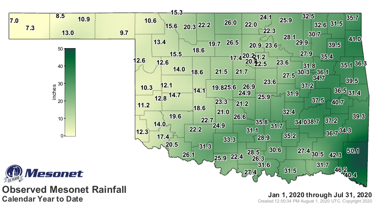
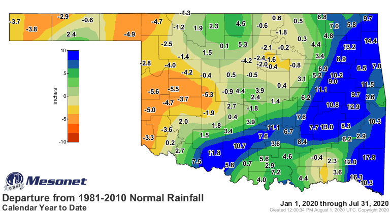
inches. Butler brought up the rear at 1.23 inches. The January-July statewide
average of 25.07 inches ranked as the 19th wettest such period on record with
an average surplus of 3.16 inches.
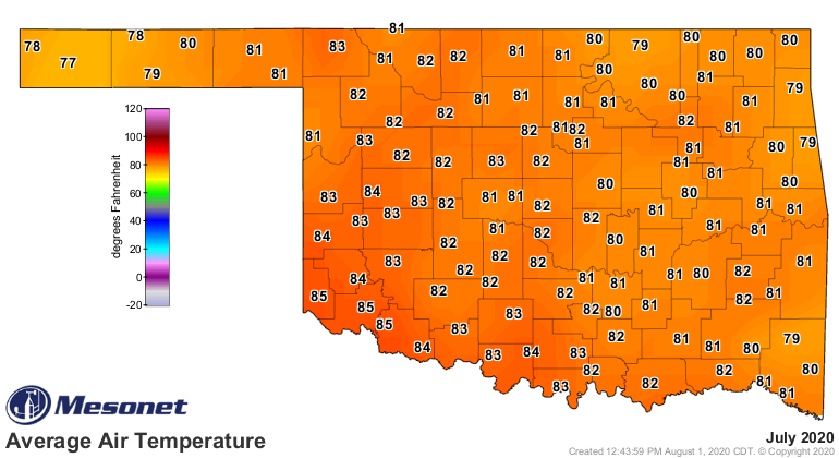
The month began with searing heat, peaking on the 14th with the Mesonet’s site
at Hollis hitting 113 degrees. The Mesonet’s 120 sites recorded triple-digit
readings 258 times during the month, and 286 heat index values of at least 110
degrees. Stillwater topped heat index reports during July at 121 degrees on
July 11. Rain and its associated cloudiness helped to cool the state down
during the second half of the month. The most enjoyable weather was reserved
for the month’s final week when highs dropped into the 80s and low 90s.
Northeastern Oklahoma failed to escape the 70s on July’s final day. Altogether,
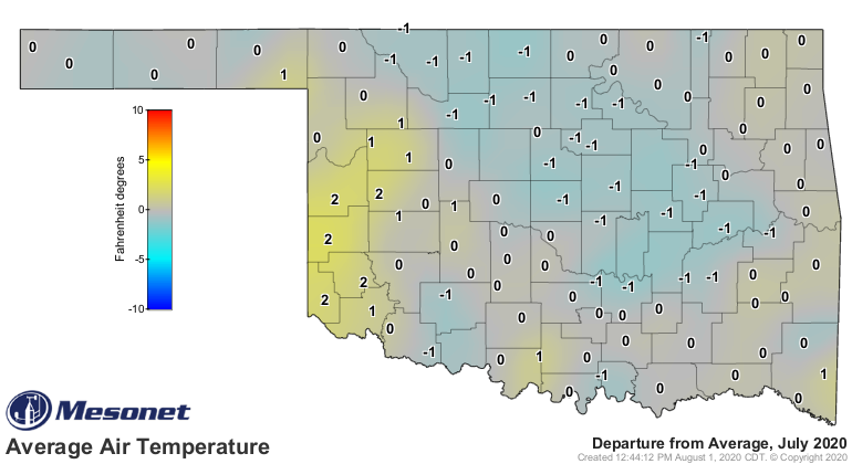
the statewide average temperature was 82 degrees to rank as the 54th warmest
July on record at half a degree above normal. The first seven months of the
year were 1.4 degrees above normal at 60.9 degrees to rank as the 17th warmest
January-July on record.
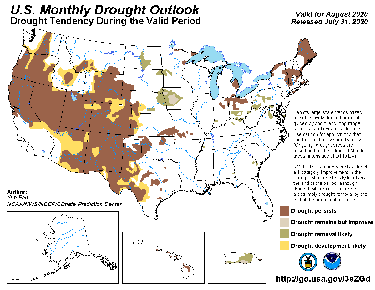
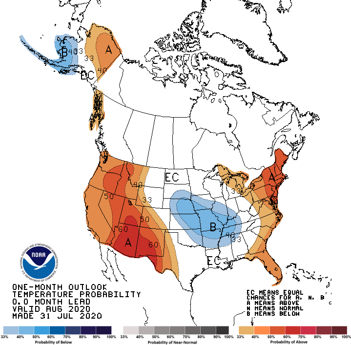
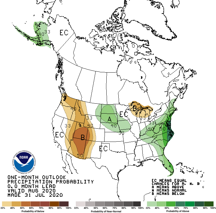
The Climate Prediction Center sees continued drought woes through August
for those areas of the state currently in drought, but no further drought
development is expected. Drought is expected to persist or intensify across
much of the western half of the country. The temperature outlook indicates
increased odds of below normal temperatures across the northeastern third of
the state, but the worst drought areas across western Oklahoma are shown with
“equal chances,” where odds are equal for above-, below- and near-normal
temperatures. The precipitation outlook also shows all of the Southern Plains,
including Oklahoma, with those same equal chances for each corresponding
rainfall category.
Gary McManus
State Climatologist
Oklahoma Mesonet
Oklahoma Climatological Survey
(405) 325-2253
gmcmanus@mesonet.org
August 3 in Mesonet History
| Record | Value | Station | Year |
|---|---|---|---|
| Maximum Temperature | 115°F | WILB | 2011 |
| Minimum Temperature | 53°F | CAMA | 2021 |
| Maximum Rainfall | 5.73″ | CHER | 1995 |
Mesonet records begin in 1994.
Search by Date
If you're a bit off, don't worry, because just like horseshoes, “almost” counts on the Ticker website!