Ticker for December 2, 2020
MESONET TICKER ... MESONET TICKER ... MESONET TICKER ... MESONET TICKER ...
December 2, 2020 December 2, 2020 December 2, 2020 December 2, 2020
DQ in the house!
Sorry Braum's, you had your chance! Should have given us that free ice cream. DQ,
you're now on the clock. Okay, there's probably room for the both of you. And
for the record, the Oreo Blizzard is the ONLY blizzard. Well, Heath or
Butterfinger blizzards aren't bad either. MMMMMMMM, Butterfinger.
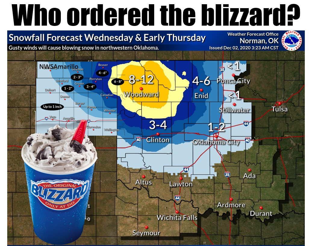
First, let's not deceive here...today's setup doesn't technically meet the
definition of "blizzard," at least not by NWS standards (thanks to our friends at
the NWS Amarillo and Norman offices for allowing us to stitch their images
together). The NWS defines a blizzard as:
Sustained wind or frequent gusts greater than or equal to 35 mph
will accompany falling and/or blowing snow to frequently reduce
visibility to less than 1/4 mile for three or more hours.
So technically, not a blizzard. But with winds forecast to gust to over 25 mph
and over a foot of snow possible, there will be lots of near white out conditions
and some pretty big drifts. Get my drift? Well, drive northwest and you'll end up
stuck in a drift. I see you, Highway 183 from Ft. Supply to Buffalo (long story).
This is one of those rare storms that invigorates instead of gratifies instead
of disappoints. I say gratify if you get to stay home and not go anywhere,
otherwise I guess one did disappoint. It started out looking like maybe some
minor accumulations, then we went to maybe 5-6 inches, now were up to 8-12
inches in localized areas with a nice big winter storm warning area centered
on NW OK.
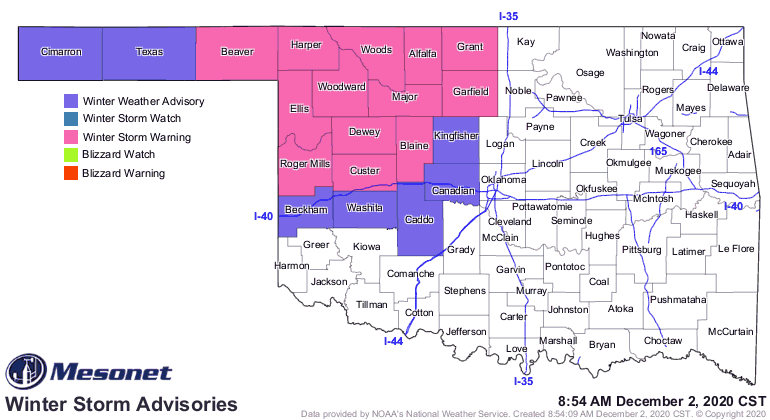
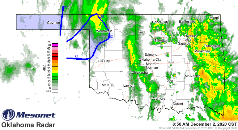
It's already a winter wonderland out that way, with up to 5 inches reported in
Ellis County near Shattuck north into Harper County near Buffalo already. All
the various maps point toward this "wonderland" (or horrorland) status already.
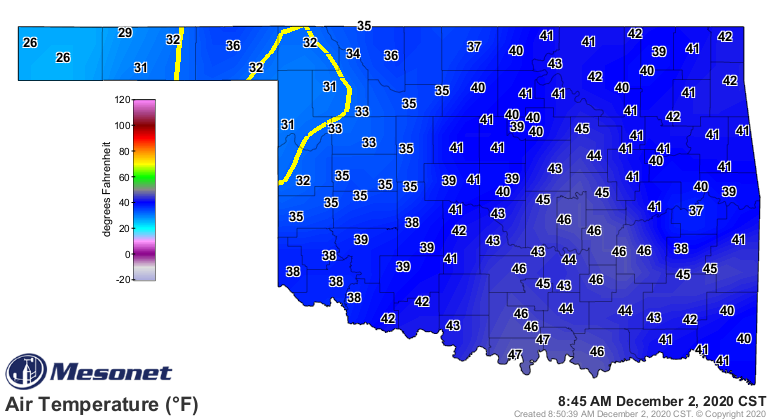
Everybody else outside of the winter storm warning and winter advisory areas?
Have a cold rain. Blah. Might as well go to McDonald's.
Gary McManus
State Climatologist
Oklahoma Mesonet
Oklahoma Climatological Survey
(405) 325-2253
gmcmanus@mesonet.org
December 2 in Mesonet History
| Record | Value | Station | Year |
|---|---|---|---|
| Maximum Temperature | 83°F | BURN | 2021 |
| Minimum Temperature | -1°F | MIAM | 2006 |
| Maximum Rainfall | 2.15 inches | BROK | 2020 |
Mesonet records begin in 1994.
Search by Date
If you're a bit off, don't worry, because just like horseshoes, “almost” counts on the Ticker website!