Ticker for November 2, 2020
MESONET TICKER ... MESONET TICKER ... MESONET TICKER ... MESONET TICKER ...
November 2, 2020 November 2, 2020 November 2, 2020 November 2, 2020
Boring is good
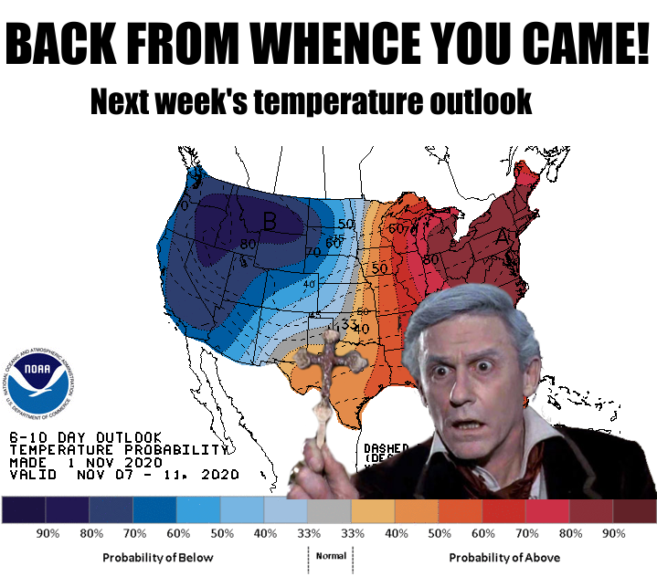
Uh oh!
Uh oh, pt. 2!
Haven't we had enough excitement this winter...errrr, fall, already? The worst
October winter storm in state history should be enough to last us until April,
I'd think, although I guess "worst April winter storm in state history" hasn't
been used yet. JINX!
Until we worry about another possible return to winter late this weekend, let's
just enjoy the monotony of a nice, pleasant fall week, shall we? Now, let's
talk about that idiotic October for a second...
----------------------------------------------------------------------------------
Historic Storm Haunts October
Nov. 2, 2020
A historic winter ice storm struck the state during the last week of October,
leaving nearly 400,000 residences and businesses without power. The extreme
nature of the event – arguably the most impactful early-season winter storm in
the history of Oklahoma – was punctuated by heavy snow in the Panhandle and
flooding rains in eastern sections of the state. Trees, still burdened with a
full head of leaves so early in the season, were easy prey for radial ice
accumulations of up to 3 inches across western and central Oklahoma.
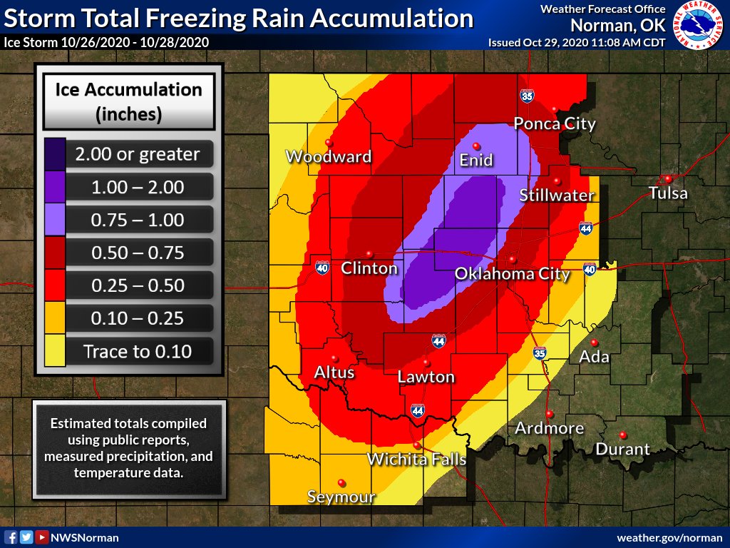
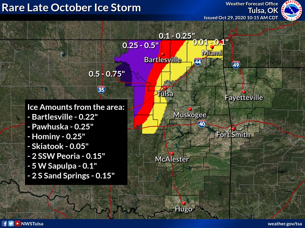
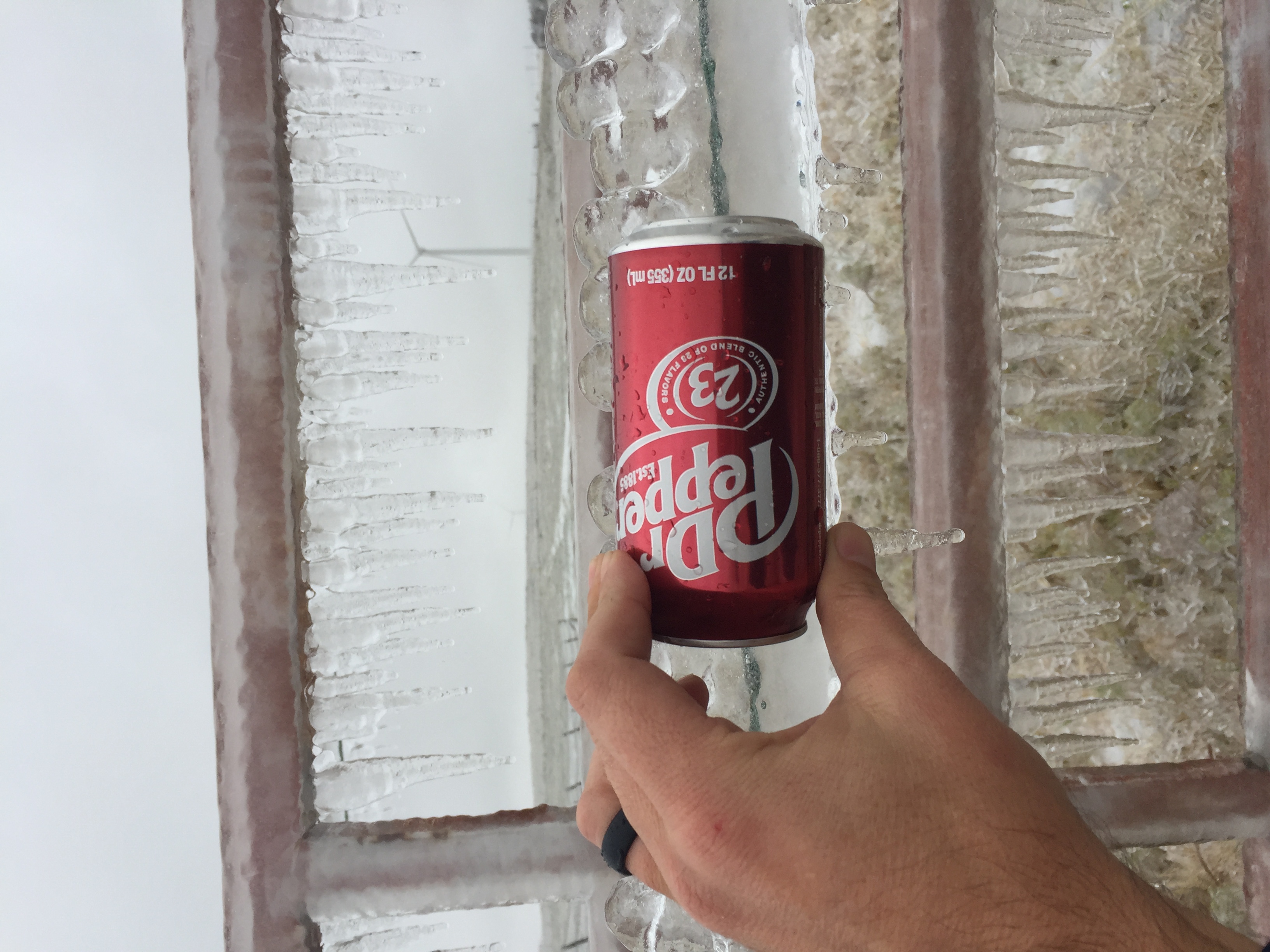
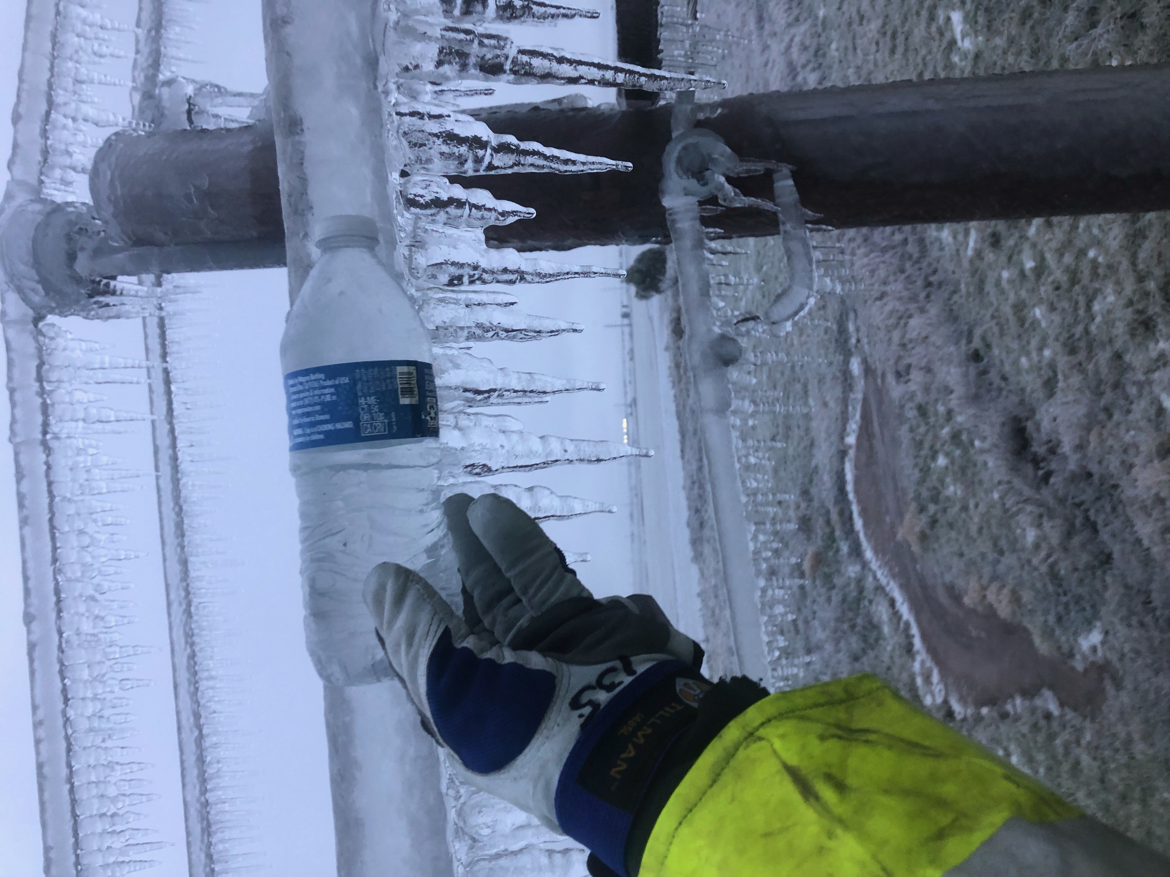
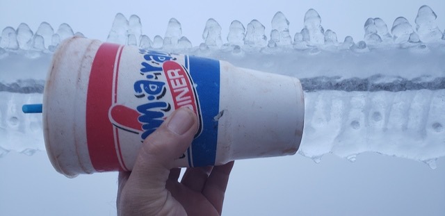
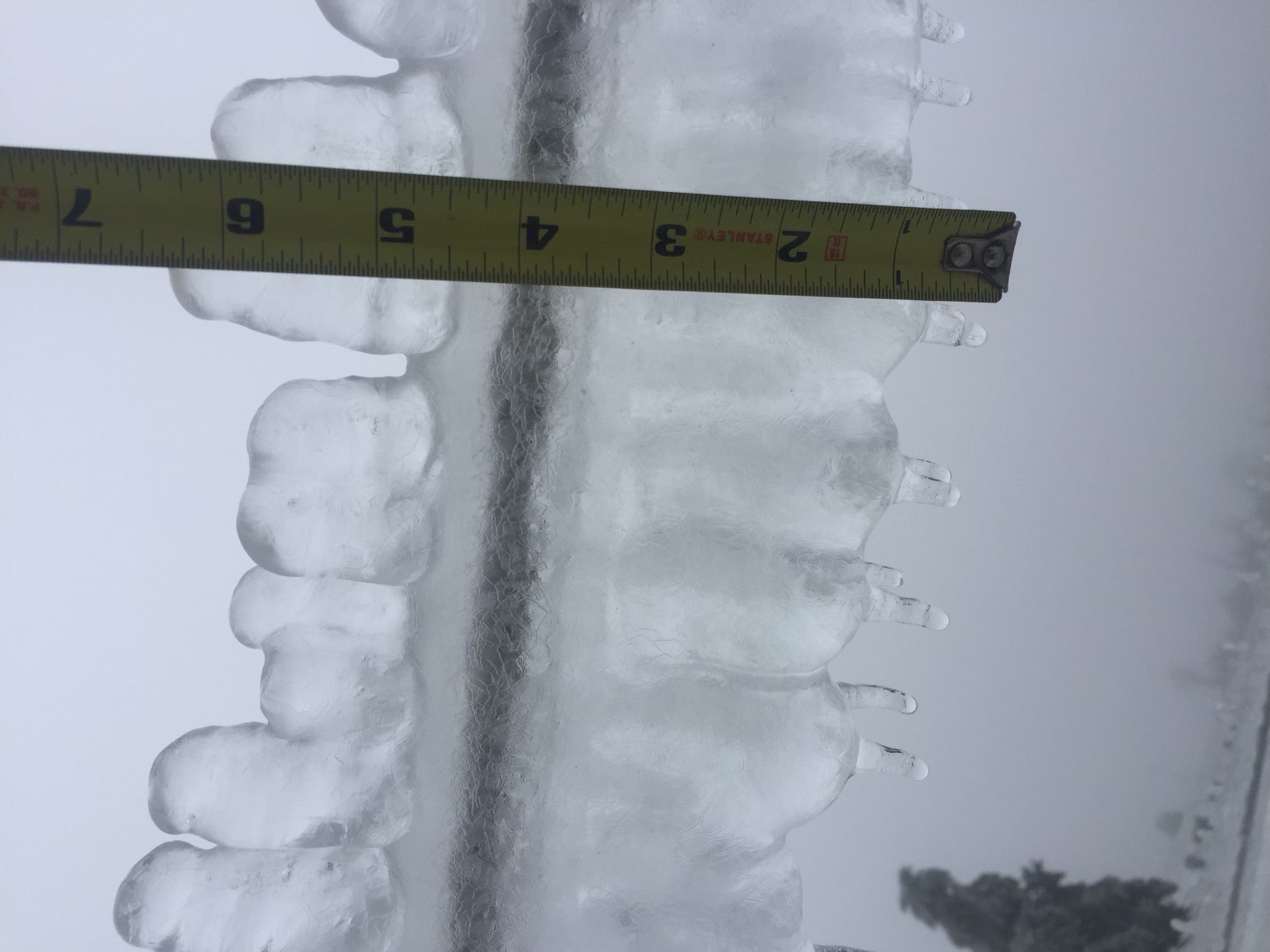
(Images courtesy of the Oklahoma Association of Electric Cooperatives.)
Downed branches felled power lines, clogged streets and snarled traffic. The
power lines themselves sagged and fell under the weight of the frozen
accumulation. Many school districts in the ice storm’s footprint closed for the
remainder of the week due to continued challenges with debris and lack of
power. Areas to the west received more sleet and snow than freezing rain, and
areas to the east were inundated with cold, flooding rains. Snow and sleet
totals across far western Oklahoma were generally between 2-4 inches, although
as much as 9 inches was reported in localized areas. The frigid weather that
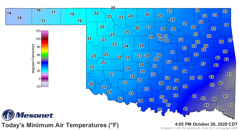
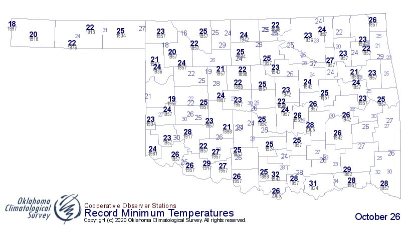
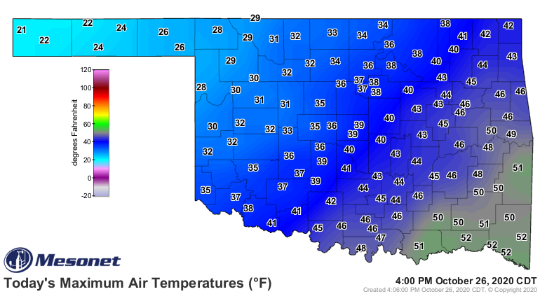
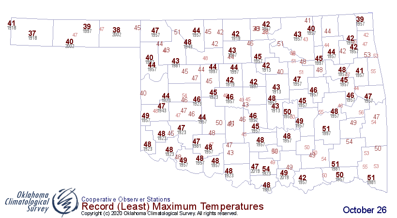
came with the storm was as historic as the ice. Record low minimum and maximum
temperatures were shattered across western Oklahoma October 26-27. Highs in the
Panhandle on the 26th only rose into the low to mid-20s, breaking their
previous record low maximum temperatures by 15-20 degrees.
The Oklahoma Department of Emergency Management and Homeland Security reported
132 injuries as a result of the storm, with 58 of those from falls and another
28 due to motor vehicle accidents.
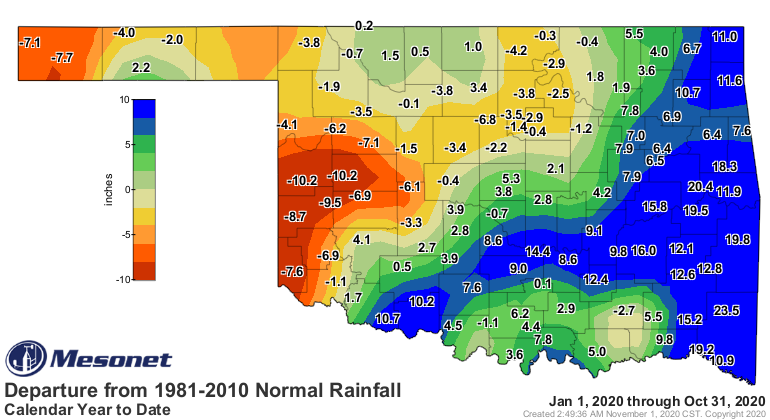
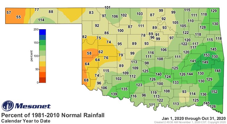
The late winter storm provided the first significant moisture since early
September for much of western Oklahoma. According to preliminary data from the
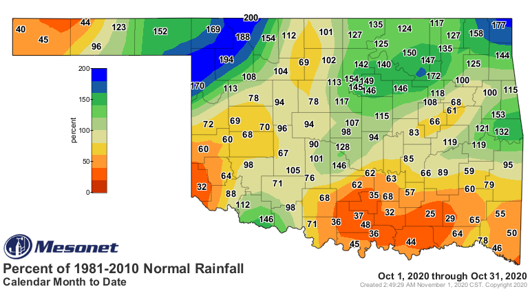
Oklahoma Mesonet, the statewide average total for the month ended at 3.37
inches, 0.17 inches above normal, to rank as the 45th wettest October since
records began in 1895.
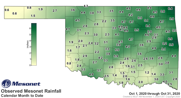
Individual amounts from Mesonet sites ranged from 6.9 inches in Cookson to
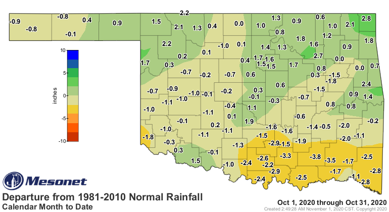
0.57 inches in Kenton. Despite the deluge, parts of southern Oklahoma were
still 2-3 inches below normal for the month. The late burst of moisture helped
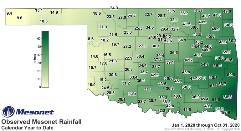
propel the January-October statewide average to 35.75 inches, 3.82 inches above
normal, to rank as the 21st wettest January-October on record. That surplus was
mostly built on gaudy totals 10-20 inches above normal across the southeastern
half of the state, however. The western Panhandle and parts of west central
Oklahoma had deficits of 7-10 inches over the first 10 months of the year.
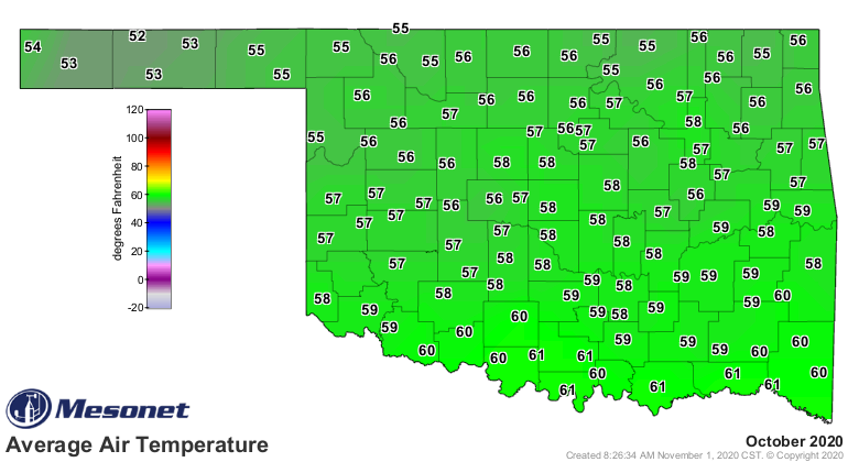
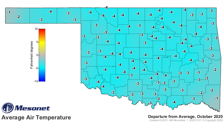
The month began on the cool side and finished on the frigid side, resulting in
a statewide average temperature of 57.8 degrees, 3.1 degrees below normal, to
rank as the 13th coolest October on record.
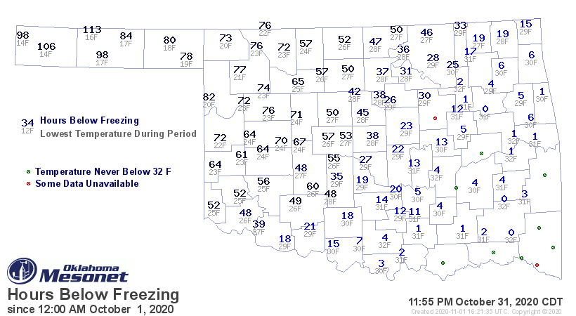
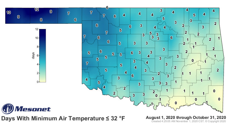
The state’s first freeze of the season came at Eva and Hooker on the 12th – just
a few days earlier than average – when each bottomed out at 32 degrees. Almost
the entire state spent some time below freezing, save for parts of the
southeastern one-quarter. Most of the northwestern half of the state was from
40-80 hours below freezing, with areas in the Panhandle up to 113 hours at or
below 32 degrees.
On the other side of the thermometer, 2020’s presumable final triple-digit
readings came on the 14th when Altus, Hollis and Mangum each reached 100
degrees.
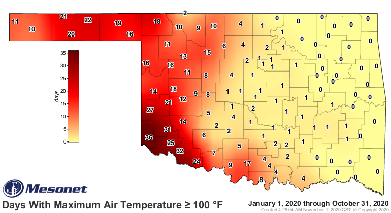
Grandfield and Hollis each recorded 102 degrees on the 11th for the month’s
highest reading. Boise City and Kenton reported the lowest temperature of the
month at 14 degrees on the 26th. The statewide average year-to-date temperature
of 63.4 degrees was 0.4 degrees above normal to rank as the 47th warmest
January-October on record.
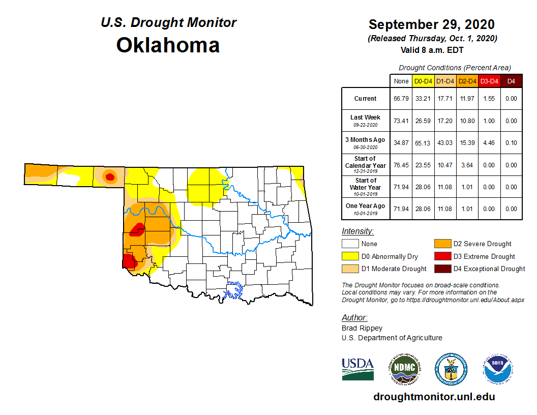
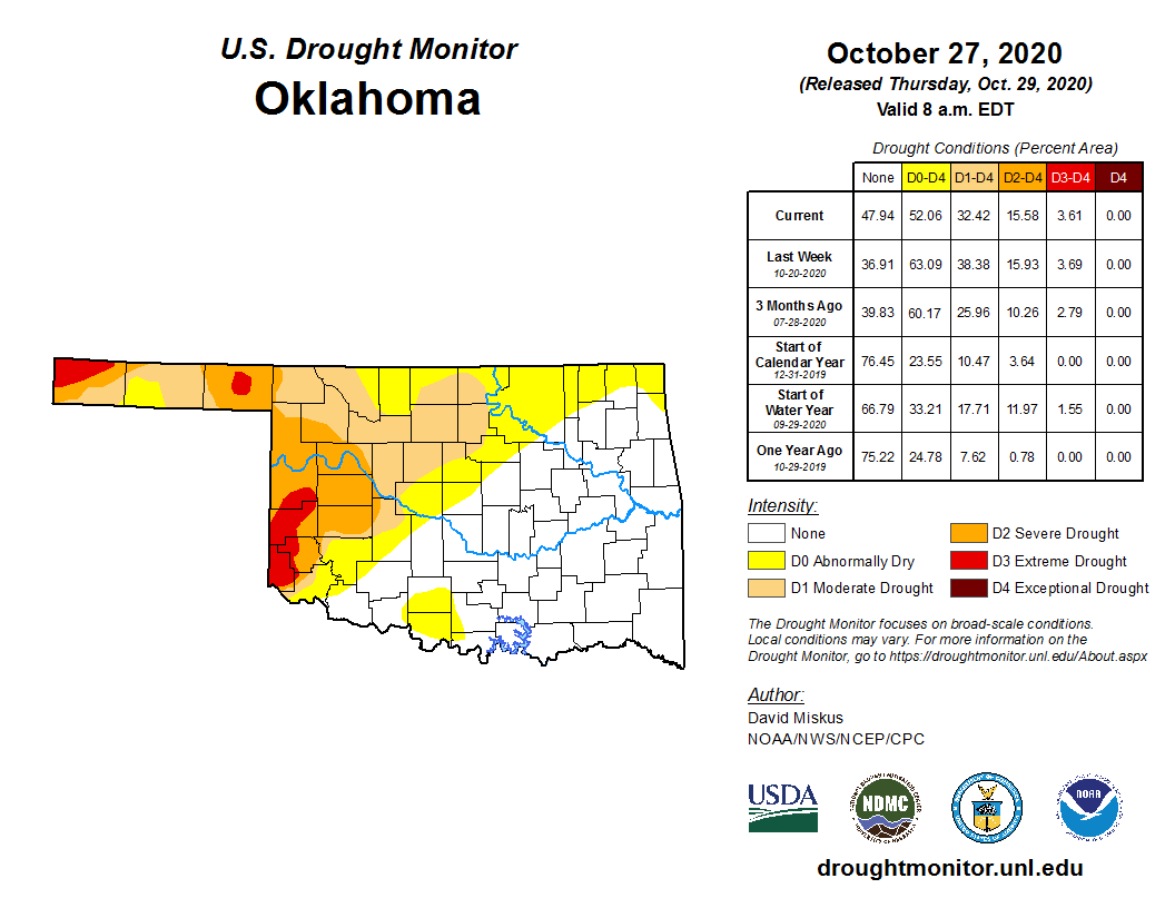
Drought surged during October before abating somewhat due to the late-month
moisture. Drought coverage reached a high of 38% of the state on October 20
according to the U.S. Drought Monitor, up from 18% at the end of September.
The month’s final map on October 27 reflected improvements with drought
coverage down to 32% of the state.
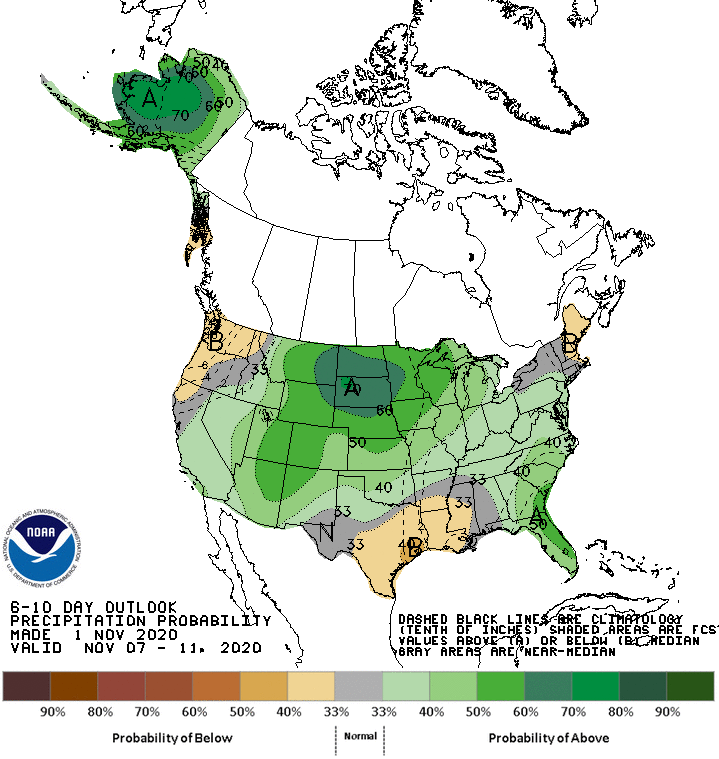
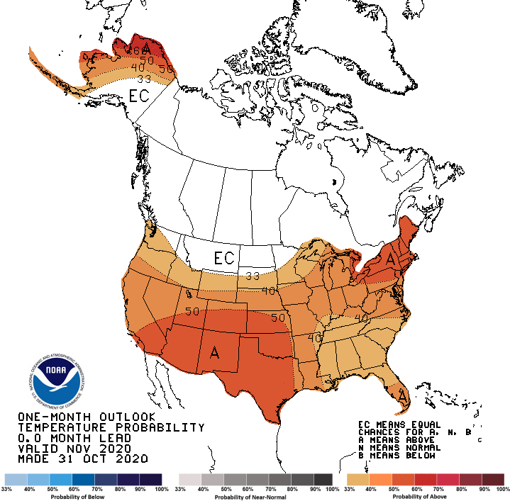
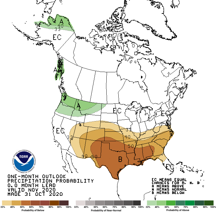
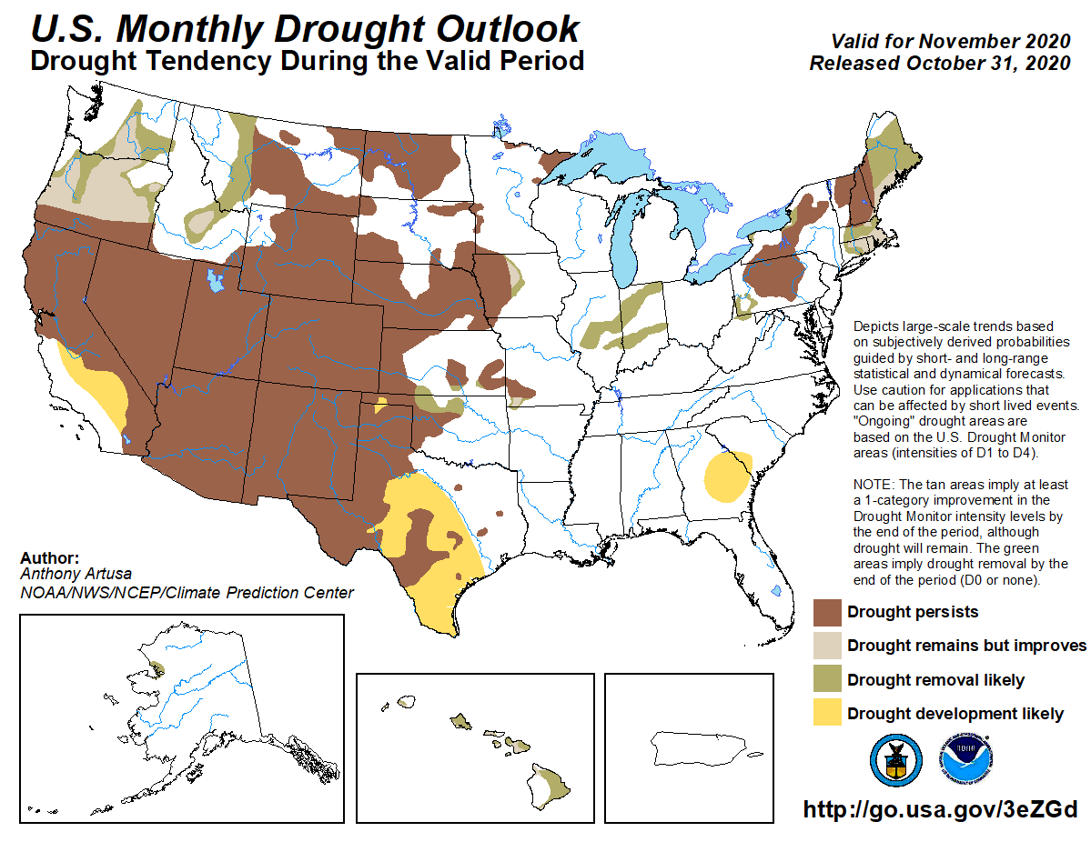
The outlook for further drought improvement is slim through November for much
of the remaining drought area, according to the Climate Prediction Center (CPC).
CPC’s November outlooks indicate increased odds of above normal temperature and
below normal precipitation for Oklahoma. Their November drought outlook does
see some drought improvement across the northwest, but that is for moisture
from late October not yet accounted for in the latest Drought Monitor map. The
remaining area of drought is expected to persist through November.
Gary McManus
State Climatologist
Oklahoma Mesonet
Oklahoma Climatological Survey
(405) 325-2253
gmcmanus@mesonet.org
November 2 in Mesonet History
| Record | Value | Station | Year |
|---|---|---|---|
| Maximum Temperature | 93°F | BURN | 2017 |
| Minimum Temperature | 15°F | KENT | 2004 |
| Maximum Rainfall | 4.12 inches | HOLL | 2024 |
Mesonet records begin in 1994.
Search by Date
If you're a bit off, don't worry, because just like horseshoes, “almost” counts on the Ticker website!