Ticker for October 2, 2023
MESONET TICKER ... MESONET TICKER ... MESONET TICKER ... MESONET TICKER ...
October 2, 2023 October 2, 2023 October 2, 2023 October 2, 2023
Yak hair and goat tongue
Yeah yeah, I know, Eeyore. You'll believe it when you see it, right? Sort of
like how I feel with that Latvian hair growth formula I ordered on the internet.
Hey, if a poultice of yak hair and goat tongue can grow hair, I'll give it a
shot. Interestingly, I'm also now on the list of several Kings in Nigeria wanting
to give me money, so I have that going for me as well!
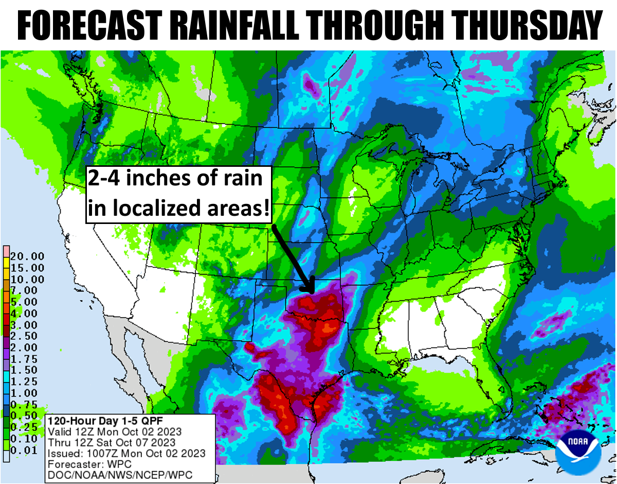
Yak hair and goat tongue (hey, that was my band's name in reform school!) aside,
here's a closer look at the possible rain totals with our storminess coming
later this week.

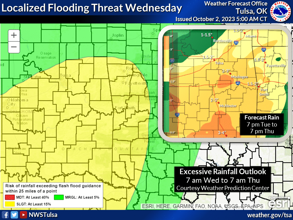
Now keep in mind that these bouts with rain will come with daily chances for
severe weather as well as we've warned you about for a week now, but you have
been focused on Taylor and Travis!
Who? Taylor Swift and Travis Kelce? Never heard of 'em. I'm talking Travis and
Taylor McGillicutty, creators of Carvax, a frozen honey candy found in fine
stores throughout the world (don't bother googling...they're boutique only).
At any rate, Tuesday looks to be the most danger-filled day.
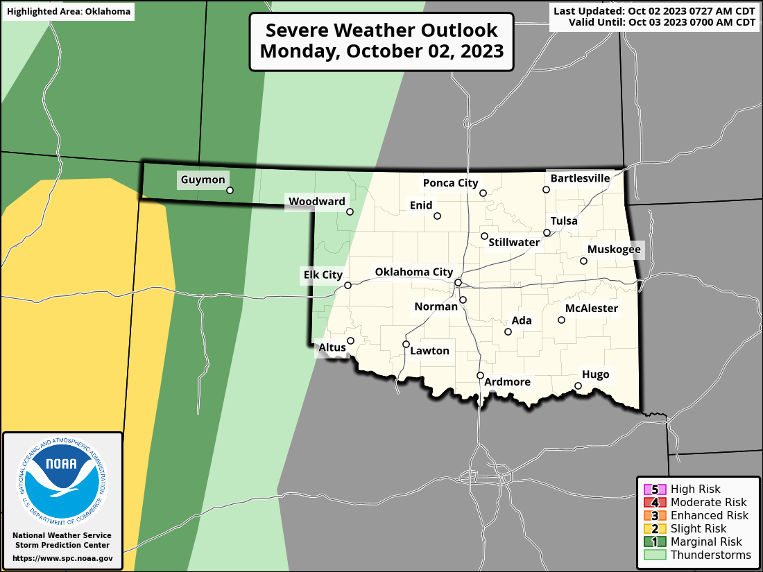

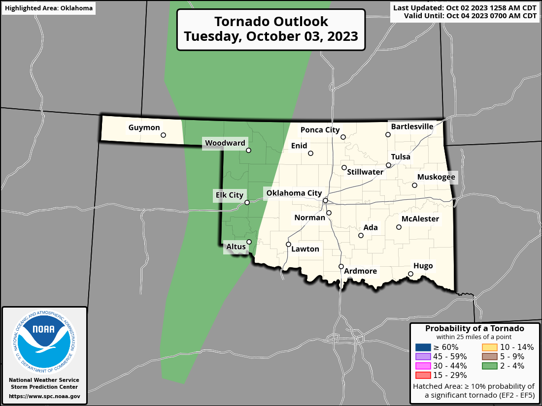
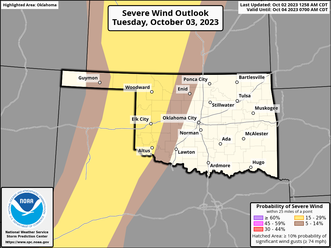
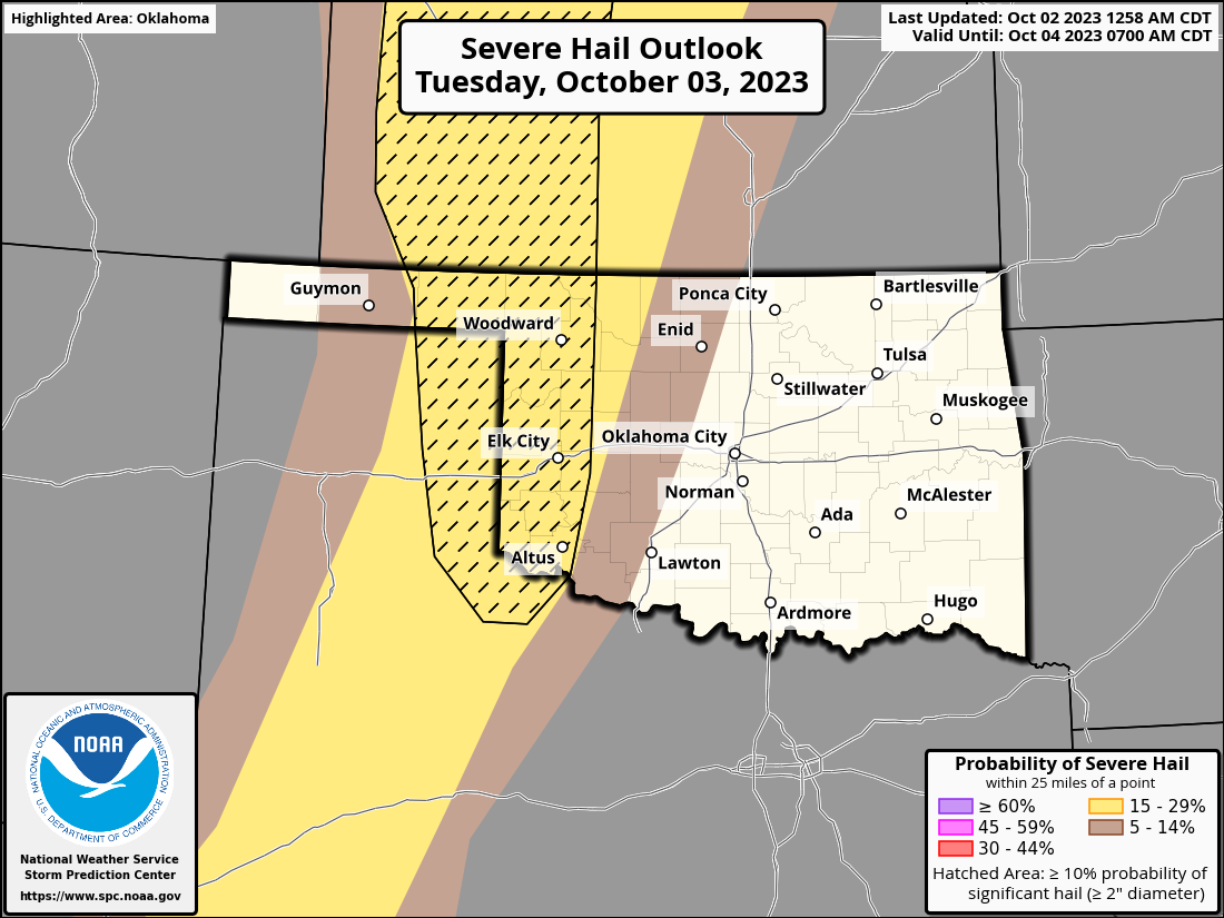

Yeah, that's a low-but-not-zero tornado threat for tomorrow, but it appears
the large wind threat is the biggie.
And don't forget the cool down that's coming along with the storms! Why, it'll
feel downright fall-like for another week or so before we go back to "it's a bit
warm, isn't it?"
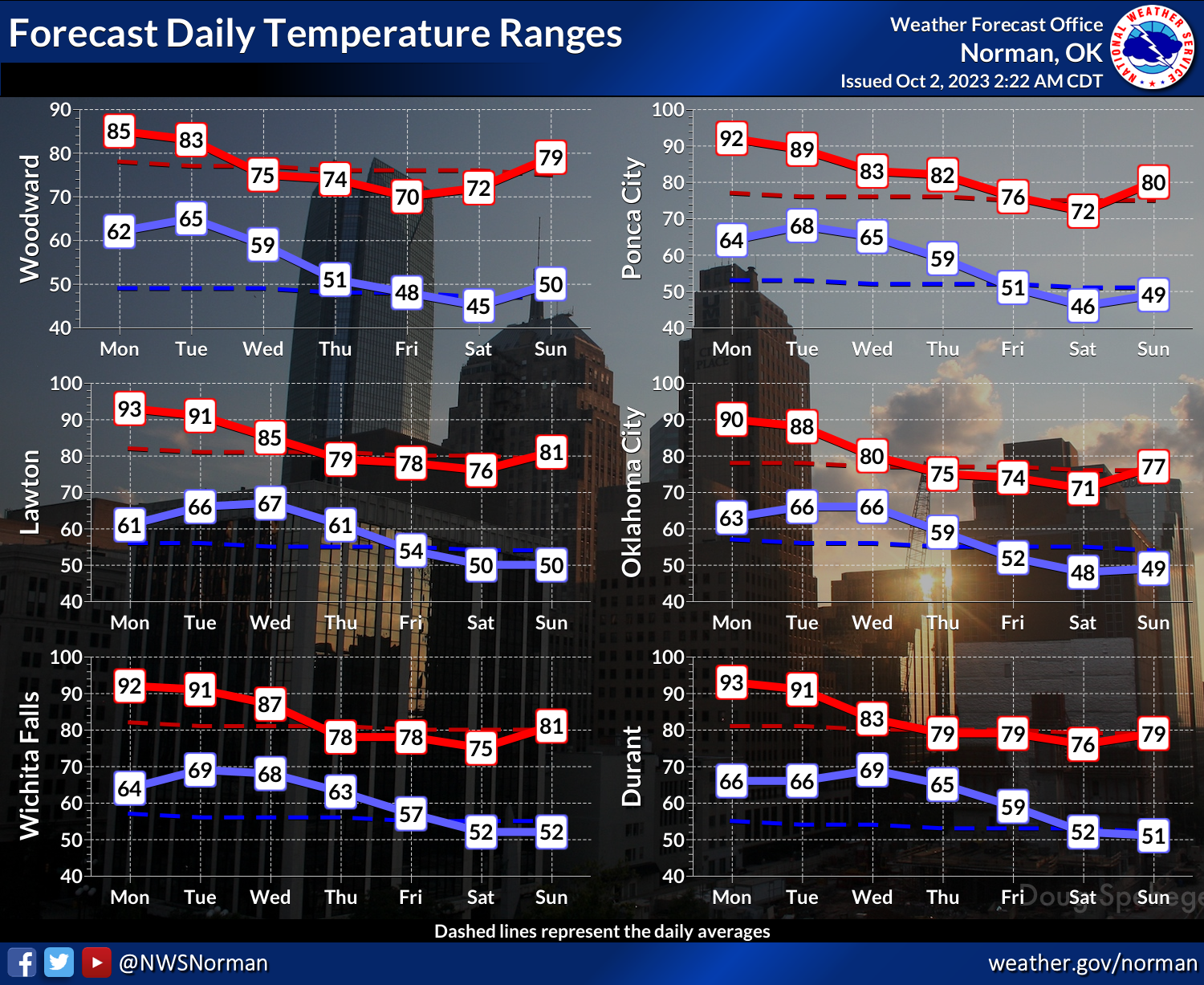
Hey, I know some folks around the state feel slighted by constantly seeing the
Norman NWS temperature 7-day forecasts, but the reason isn't my being
geographically insensitive, it's merely that they produce that graphic almost
daily and it's the easiest way for me to convey temperature trends for the state
was a whole. If other NWS offices produce them, I'll throw them up there as well!
Okay, so there's your week in a nutshell (which is an ingredient in the
Bulgarian hair growth formula, but I'm a yak hair and goat tongue man). Stick
around below (and we all know just how painful that can be) and catch up on
all the September stats you can handle!
---------------------------------------------------------------------------------
Flash Drought Surges During September
Oct. 2, 2023
Flash drought continued to advance and intensify across the southwestern half of
Oklahoma during September, aided by scorching hot weather and a prolonged dry
spell that had stretched to more than 60 days in some areas. While there was
some relief during September from the dry and hot conditions—the weather cooled
considerably during the month’s second week to go along with heavy rains—summer
weather returned soon thereafter for the remainder of the month. Despite the
welcome moisture, the most significant rainfall continued to miss the worst of
the drought plagued areas across southwestern and north central Oklahoma.
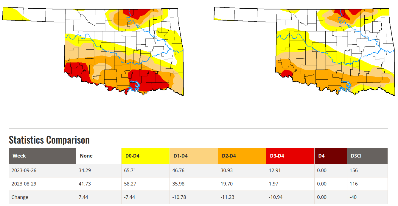
Drought coverage increased from about 36% of the state at the end of August to
nearly 47% at the end of September according to the U.S. Drought Monitor. Most
of that 11% increase came in the “extreme” drought category, however, from 2%
to nearly 13%. The Drought Monitor’s intensity scale slides from moderate-
severe-extreme-exceptional, with exceptional being the worst category. In
total, over 1.2 million Oklahomans were in at least moderate drought at the end
of September, with over 200,000 of those in extreme drought.
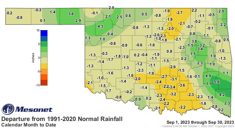
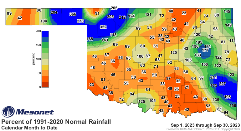
The statewide average precipitation total for the month was 2.95 inches
according to preliminary data from the Oklahoma Mesonet, 0.37 inches below
normal and ranked as the 64th driest September since records began in 1895.
Pockets of very heavy rainfall occurred from the eastern Panhandle into
northwestern Oklahoma, and again across the eastern one-third of the state.
Totals ranged from 9.96 inches at Talihina to 0.59 inches at Boise City.
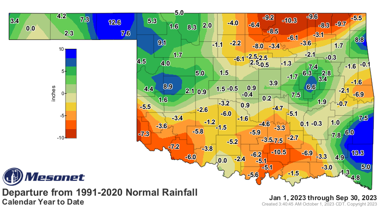
Monthly deficits ranged from 1-2 inches in general across much of the main body
of the state in addition to the western Panhandle, while surpluses of 2-4 inches
occurred across northwestern and eastern Oklahoma. Nineteen of the Mesonet’s
120 sites received at least 5 inches of rain during the month, and another 10
recorded at least 4 inches. Fifty-eight sites finished with totals of less than
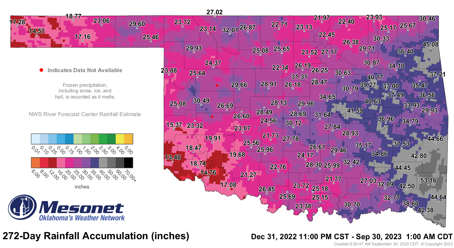
2 inches, however. The first nine months of the year were 0.14 inches above
normal statewide at 28.71 inches, the 46th wettest January through September on
record. Totals during that period ranged from 13.48 inches at Hollis to 53.16
inches at Mt. Herman.


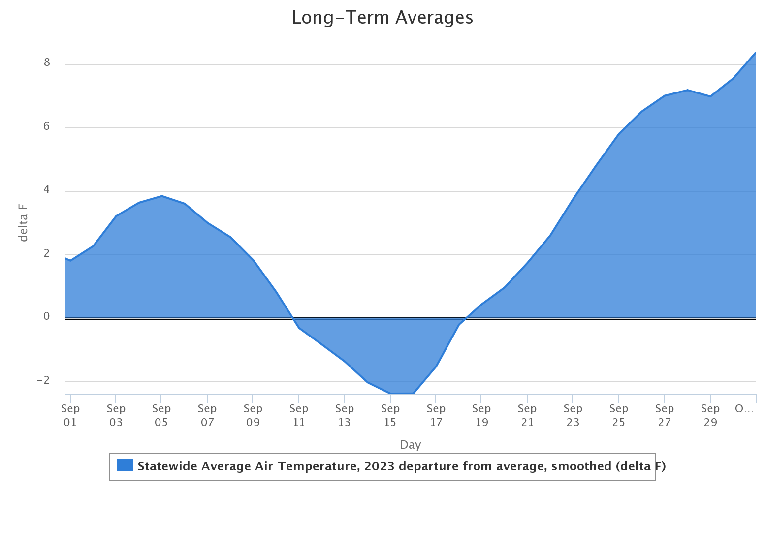
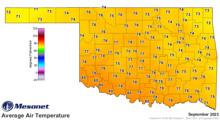
The statewide average temperature was 76.6 degrees according to preliminary
data from the Oklahoma Mesonet, 3.7 degrees above normal and ranked as the 16th
warmest September since records began in 1895. As was the case through summer,
the southwestern corner’s heat was a step above the rest of the state with an
average of 79.3 degrees, 4.5 degrees above normal and ranked as the ninth
warmest September for that region. Temperatures ranged from 111 degrees at
Grandfield, Tipton, and Waurika on Sept. 8, to 44 degrees at Kenton on Sept.
25. The month’s—and possibly 2023’s—final spate of triple-digit temperatures
occurred on Sept. 23. Heat index values of at least 105
degrees were recorded 225 times by the Mesonet during September, reaching a
maximum value of 115 degrees at Idabel on Sept. 6. The first nine months of the
year were the 20th warmest on record at 65 degrees, 1.2 degrees above normal.

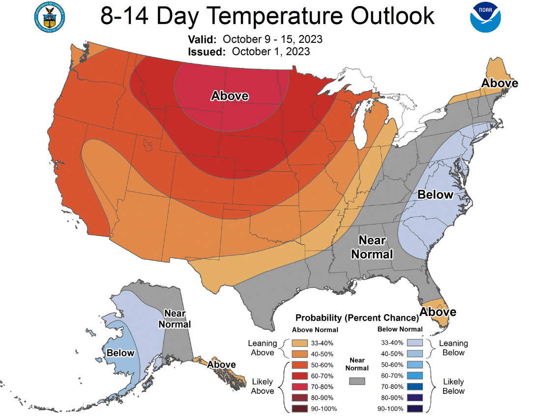
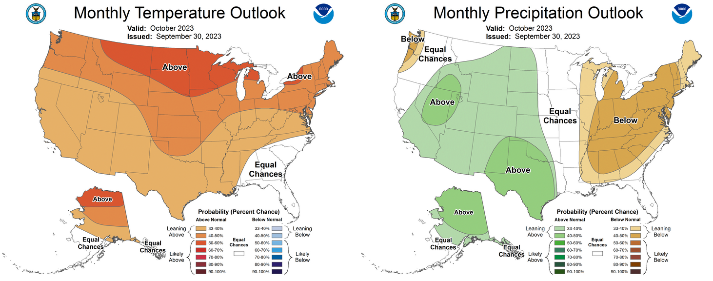
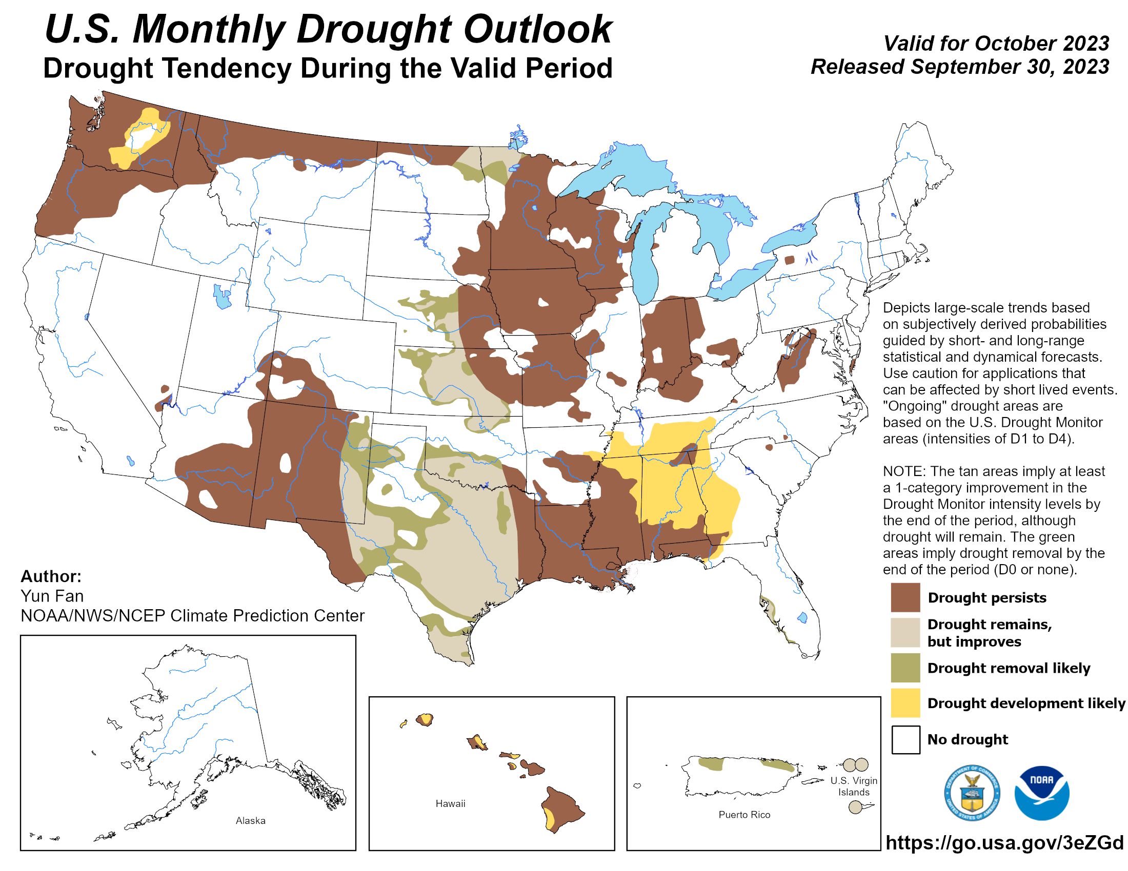
The October outlooks from the Climate Prediction Center hold some hope for the
dry areas of Oklahoma, including the long-term drought regions of north central
and southwestern Oklahoma. The precipitation outlook shows increased odds of
above normal precipitation for the western three-fourths of the state,
especially across the southwestern corner and western Panhandle. The temperature
outlook indicates warm weather should win out, especially across the northern
two-thirds of the state. CPC’s October drought outlook predicts drought
improvement for all but far southeastern Oklahoma through the month, with some
complete drought removal likely.
###
Gary McManus
State Climatologist
Oklahoma Mesonet
Oklahoma Climatological Survey
gmcmanus@mesonet.org
October 2 in Mesonet History
| Record | Value | Station | Year |
|---|---|---|---|
| Maximum Temperature | 103°F | TIPT | 2000 |
| Minimum Temperature | 28°F | BOIS | 2009 |
| Maximum Rainfall | 4.76″ | CHER | 2002 |
Mesonet records begin in 1994.
Search by Date
If you're a bit off, don't worry, because just like horseshoes, “almost” counts on the Ticker website!