Ticker for November 1, 2023
MESONET TICKER ... MESONET TICKER ... MESONET TICKER ... MESONET TICKER ...
November 1, 2023 November 1, 2023 November 1, 2023 November 1, 2023
A freeze smorgasbord
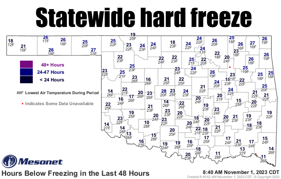
Stick a fork in summer...everybody has now had a hard freeze, signalling our
descent into madness. I mean "winter." Oh, we'll have some nice warm weather...
maybe even hot a time or two, which I guess can be called by the old
colloquial term (hey, Colloquial Term was my band's name when I was racing on
the Gran Prix circuit!) "Indian Summer." Maybe even coming up this weekend?
Nah, that's just fall. Maybe later?
We can't really look forward to that until we get past this burst of winter we're
having lately. This morning was the coldest of the bunch statewide, even
record-breaking up in NE OK.
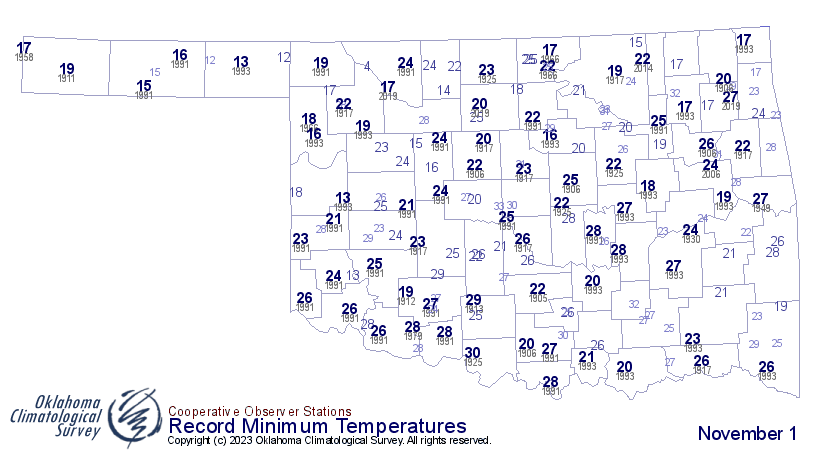
And those 16s at Nowata and Vinita are the lowest temperatures ever recorded on
a Nov. 1 on the Mesonet since its temperature records began in 1997, besting
Hooker's 17 degrees in 2019.
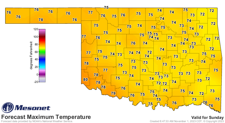
That's really all the excitement I see for the next week or so. A warm up
through the weekend then a minor cold front.
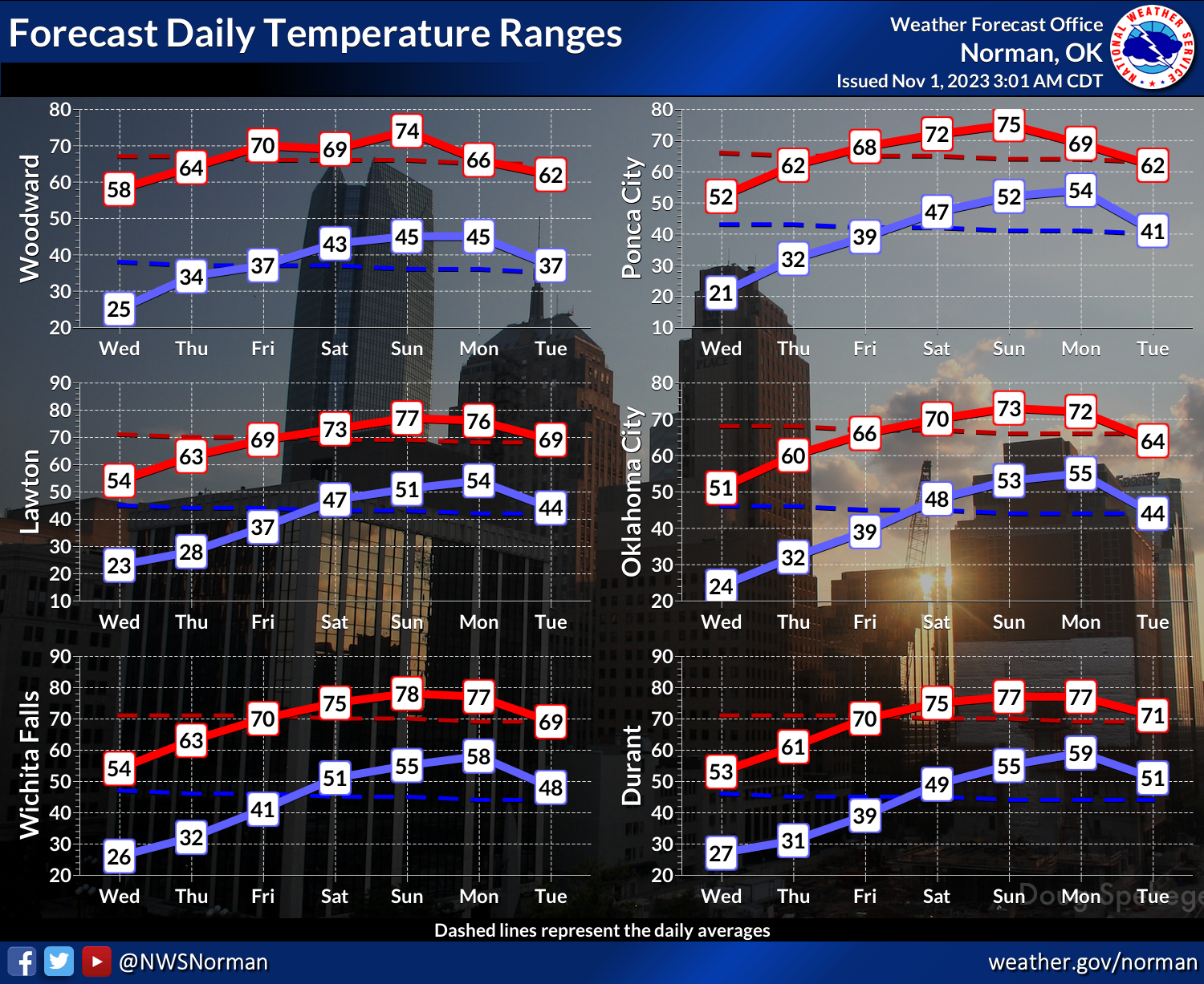
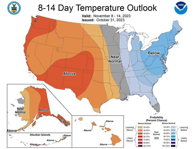
The models try and bring a bigtime storm system through in 10-14 days, but that's
solidly in fantasy-cast territory, I'm afraid. Hey, you think that's boring, take
a look at last month's weather story!
No no no, I mean October's weather was pretty exciting, if you like lots of
rain and cold weather. The WRITING is boring. See for yourself.
----------------------------------------------------------------------------------
October’s Drought to Deluge
Nov. 1, 2023
The flash drought that had plagued the southwestern half of Oklahoma since
mid-July appeared poised to explode across the entire state during October. As
it began its northward advance, however, assistance arrived in the form of
three distinct storm systems that not only halted the drought's advance but
reversed its course. The first storm originated from the Tropical Pacific off
the West Coast of Mexico. The remnants of Hurricane Norma journeyed over Mexico
and into the Southern Plains on October 24, depositing 1-2 inches of tropical-
style rain across parts of southern and central Oklahoma. This was swiftly
followed by a more conventional storm system from the west that brought another
round of rainfall to the state and ushered in significantly cooler weather. The
last system arrived during the month's final weekend, accompanied by a blast of
Arctic air, offering Oklahoma an early taste of winter. Freezing rain, mixed
with sleet and snow, created hazardous driving conditions across the Panhandle
and far northwestern Oklahoma on the 28th and 29th, while the rest of the state
experienced a cold rain in blustery conditions. Another surge of cold air
greeted Oklahoma's trick-or-treaters, leading to a frigid Halloween night with
wind chills in the 20s and 30s on the evening of the 31st.
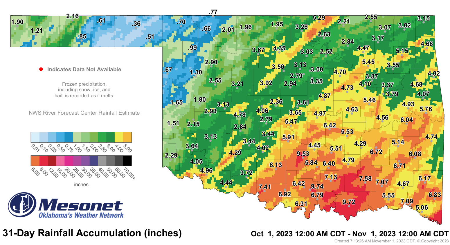
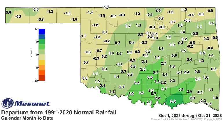
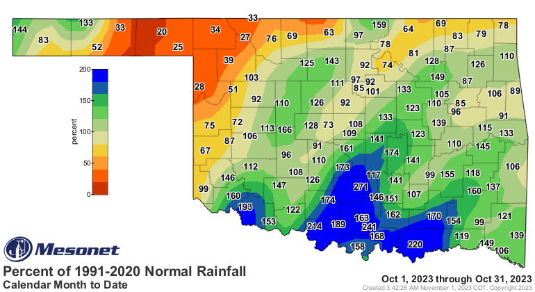
The statewide average precipitation total for the month stood at 3.88 inches,
based on preliminary data from the Oklahoma Mesonet, surpassing the normal by
0.52 inches and ranking as the 37th wettest October since records began in 1895.
The late-month storms contributed to surpluses of 3-6 inches across south
central Oklahoma, making it the 15th wettest October on record for that region
of the state, exceeding the normal by 2.92 inches. However, far northwestern
Oklahoma and the eastern Panhandle received limited rainfall, resulting in
deficits of 1 to 2 inches. Ardmore led the month with 9.74 inches of rainfall,
while Beaver had the lowest total at 0.36 inches. An additional 31 sites of the
Mesonet's 119 active locations recorded at least 5 inches of rainfall, while
nine sites in the far northwest and Panhandle ended the month with less than an
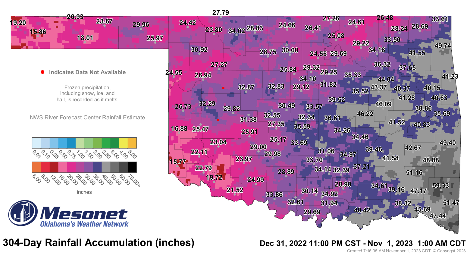
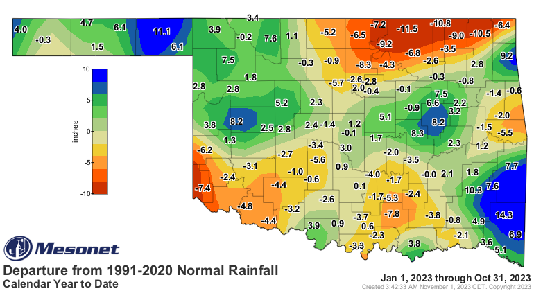
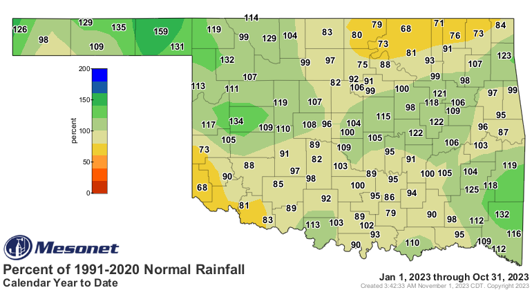
inch. The first ten months of the year concluded with a statewide average of
32.42 inches, surpassing the normal by 0.49 inches and ranking as the 42nd
wettest January through October since records began in 1895.
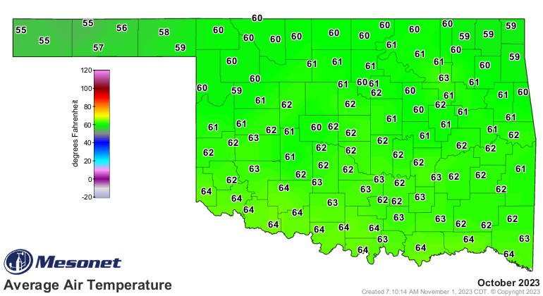
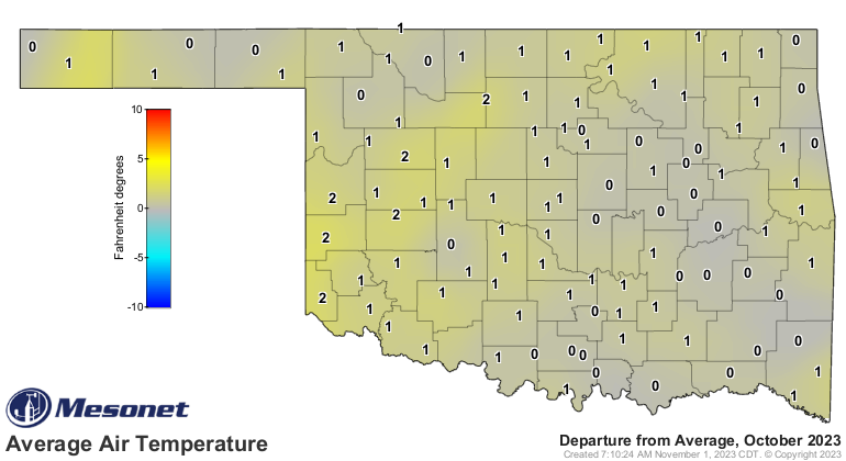
The statewide average temperature for the month was 61.9 degrees, exceeding the
normal by 0.6 degrees and ranking as the 60th warmest October on record.
Temperatures ranged from 94 degrees at four separate sites during the month to
11 degrees at Kenton on October 30. This marked the lowest temperature recorded
in the state since Eva dropped to 5 degrees on March 19 of this year. Wind
chill values also reached their lowest levels since March during the late-month
cold snap. Boise City recorded a wind chill of zero degrees on October 30, the
lowest reading for the month. The statewide average for the first ten months of
the year was 64.7 degrees, exceeding the normal by 1.1 degrees and ranking as
the 19th warmest such period since records began in 1895.
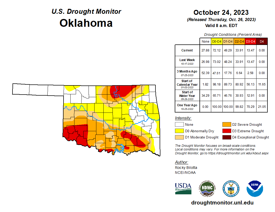
Drought coverage had surged to nearly 50% of the state in early October,
according to the U.S. Drought Monitor. Timely rains alleviated conditions in
the middle of the month, but drought had started to advance northward once again
before the end-of-month moisture arrived. The Drought Monitor's final report
for October, on October 24, showed that 49% of the state was in at least
moderate drought, with another 23% of the state experiencing abnormally dry
conditions indicating areas at risk of further drought development. The
precipitation that fell during the final week will be reflected in the
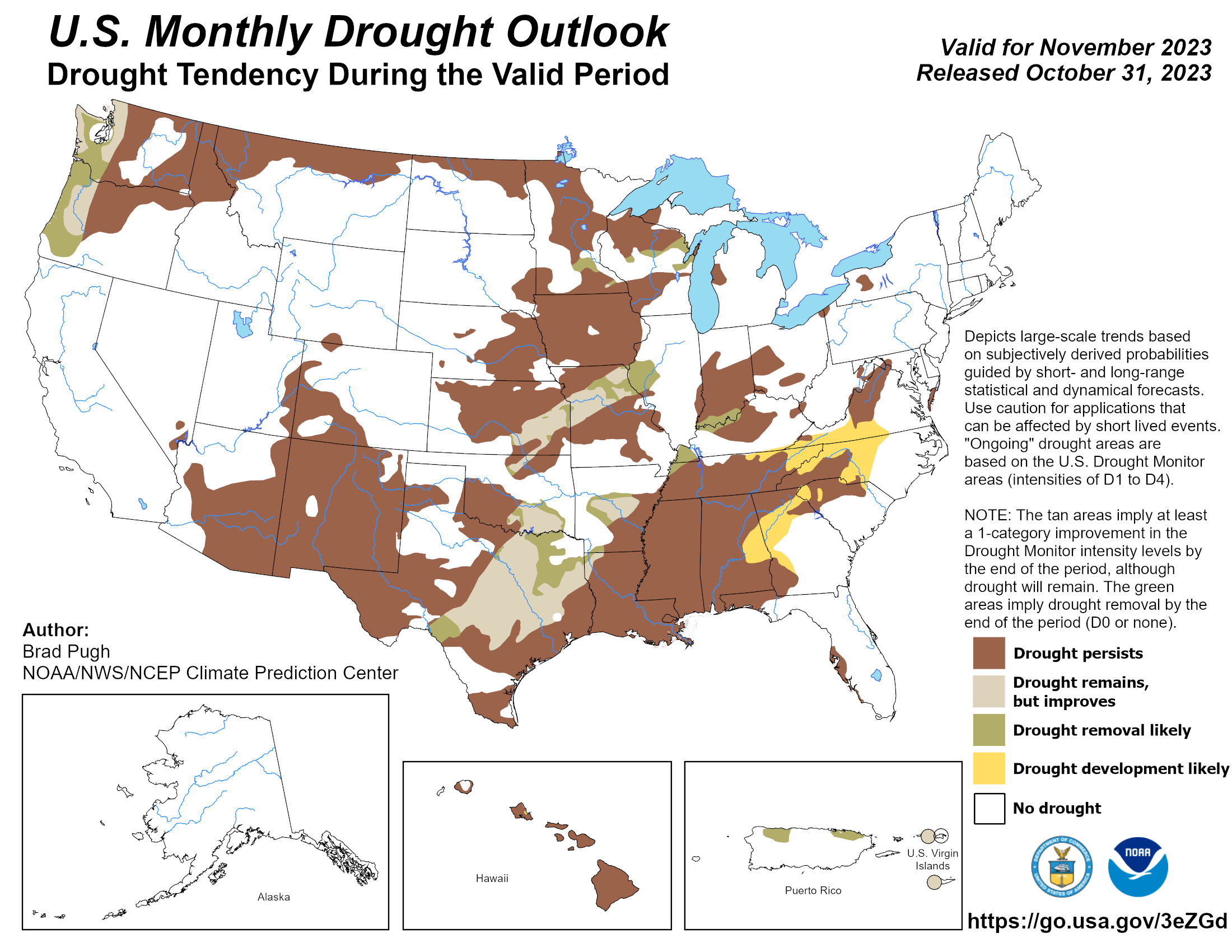
following week's U.S. Drought Monitor report. The Climate Prediction Center's
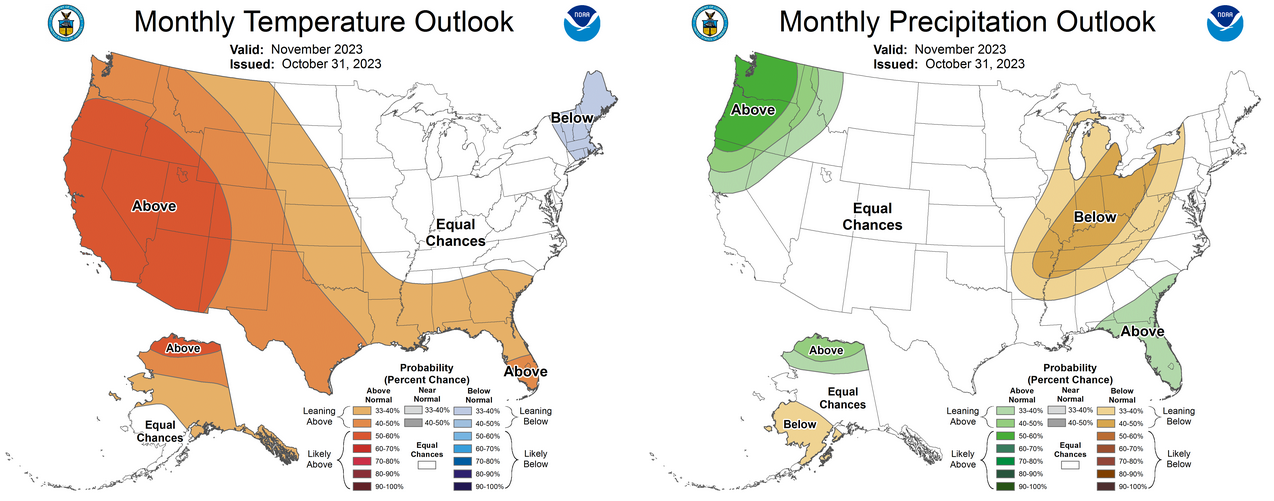
November drought outlook reflects these changes, with expected improvements in
parts of south central and north central Oklahoma. Drought is anticipated to
persist through November in other parts of the state. The temperature and
precipitation outlooks predict above-normal temperatures with an equal
probability of above-normal, below-normal, or near-normal moisture.
###
Gary McManus
State Climatologist
Oklahoma Mesonet
Oklahoma Climatological Survey
gmcmanus@mesonet.org
November 1 in Mesonet History
| Record | Value | Station | Year |
|---|---|---|---|
| Maximum Temperature | 90°F | ALTU | 2001 |
| Minimum Temperature | 16°F | VINI | 2023 |
| Maximum Rainfall | 3.65″ | NEWK | 1998 |
Mesonet records begin in 1994.
Search by Date
If you're a bit off, don't worry, because just like horseshoes, “almost” counts on the Ticker website!