Ticker for December 5, 2013
MESONET TICKER ... MESONET TICKER ... MESONET TICKER ... MESONET TICKER ...
December 5, 2013 December 5, 2013 December 5, 2013 December 5, 2013
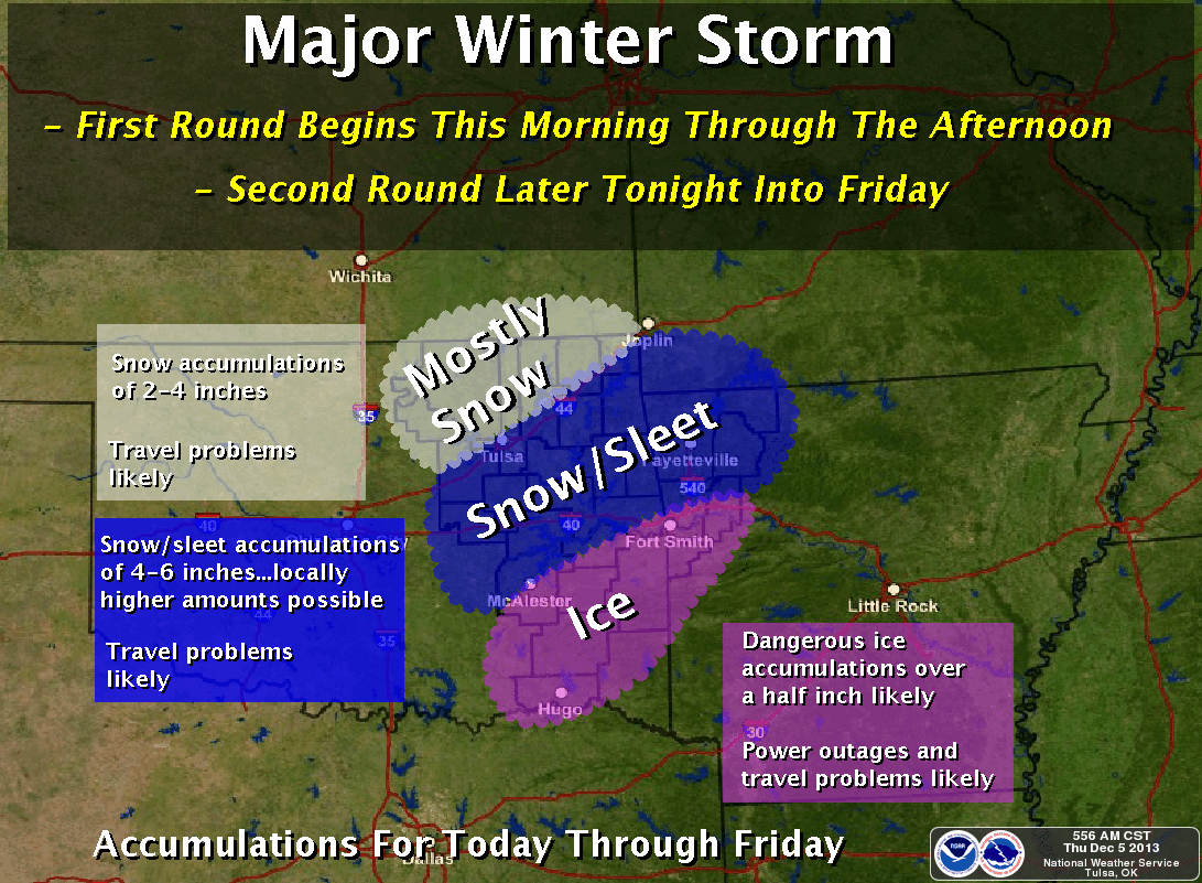
Ice Storm 2013!
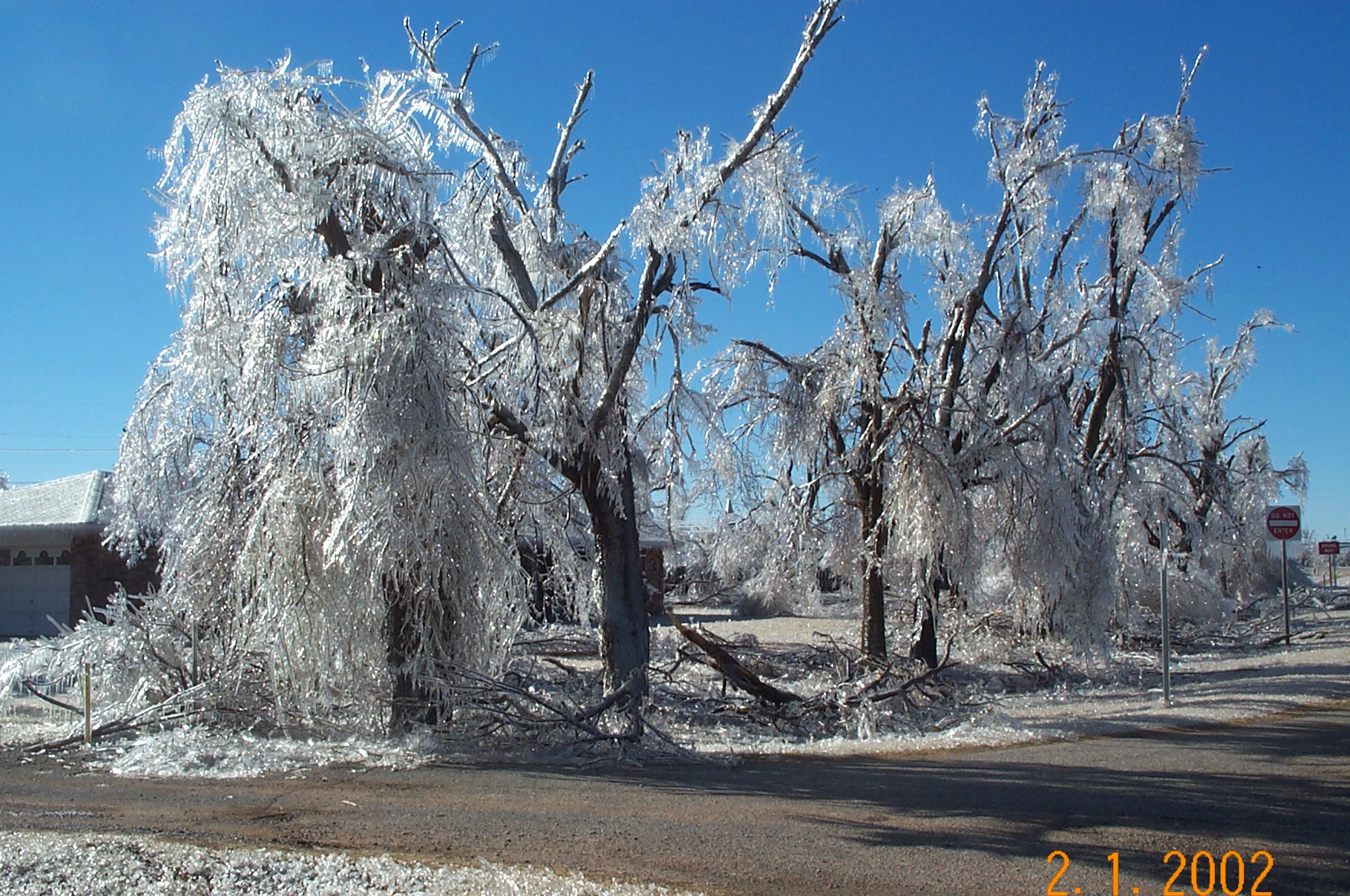
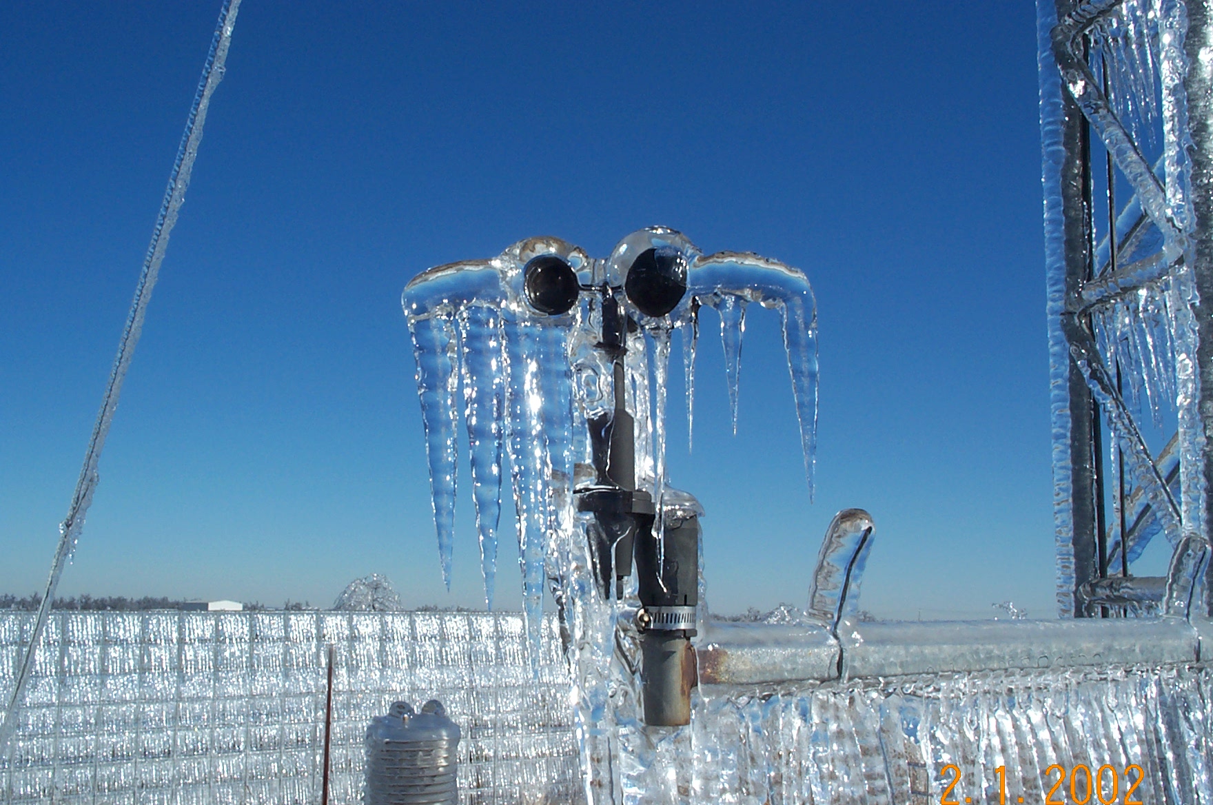
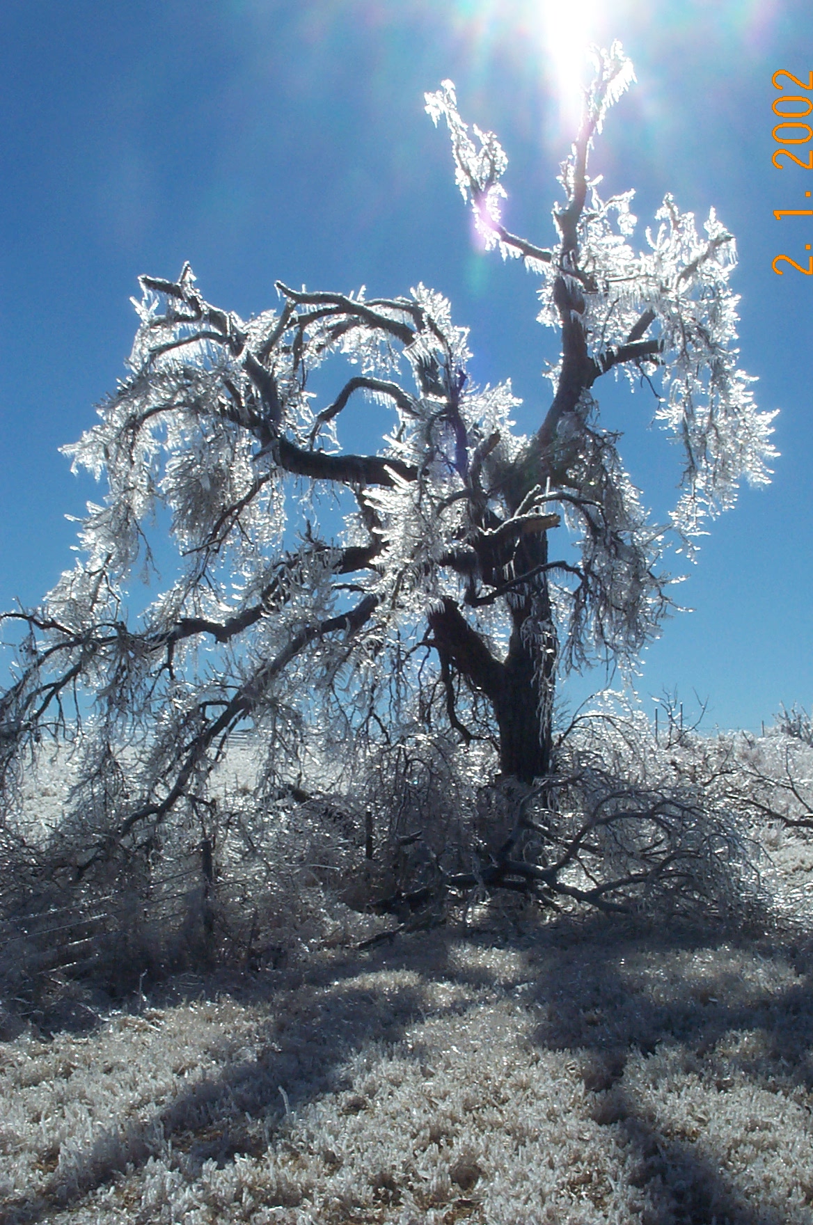
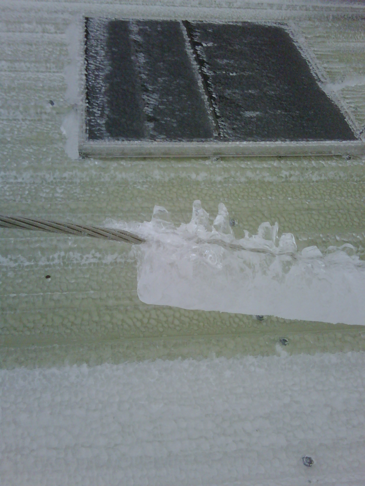
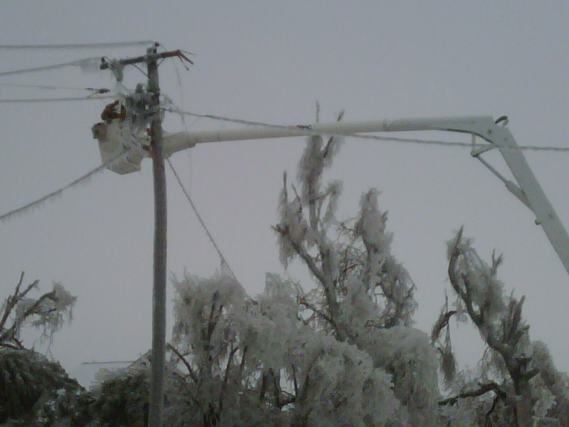
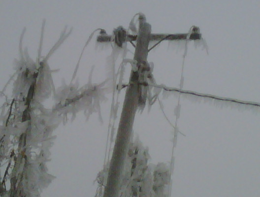
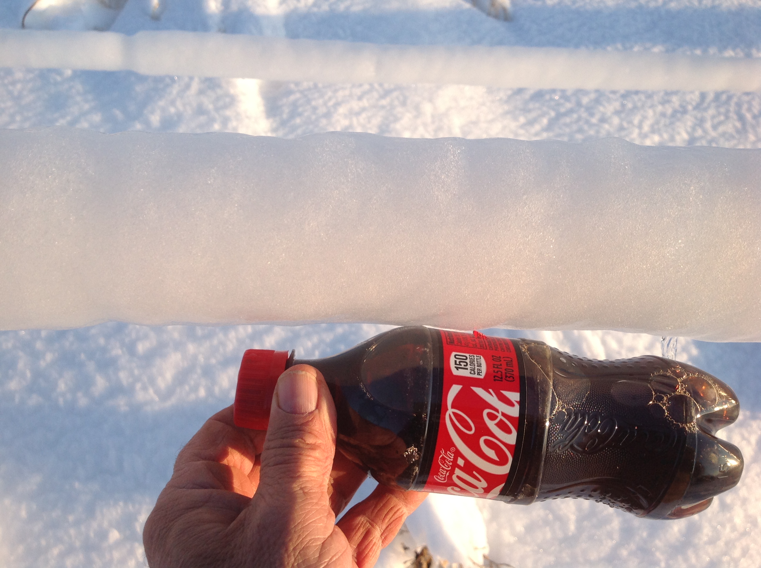
That series of ice storm photos taken on Feb. 1, 2002, in Kingfisher by Oklahoma
Mesonet Manager Dr. Chris Fiebrich provides a vivid example of the destructive
power of ice. Unfortunately, parts of Oklahoma are facing that type of
destruction in the next couple of days.
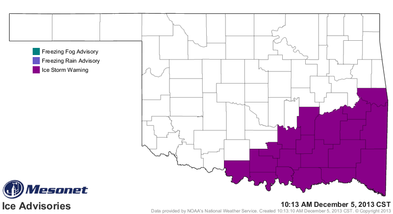
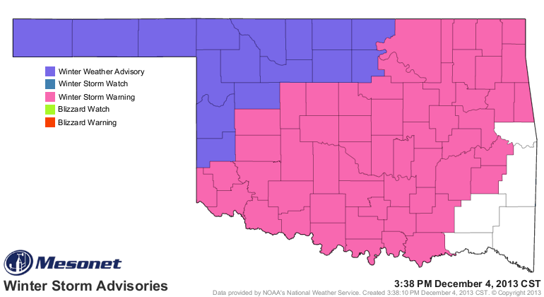
No joking around here ... this is an extremely serious situation that's possibly
going to occur down in southeastern Oklahoma. An "Ice Storm Warning" is now
in effect for much of the southeastern one-third of the state. As much as an inch
of ice is expected across that area.
I was but a fledgling climatologist, barely a year into the job, when Oklahoma
started getting all these catastrophic ice storms ... storms that used to come
once a decade or longer were now showing up within 1-2 years of each other.
Some really nasty ones too, which cumulatively left more than 1.5 million
power utility CUSTOMERS (so that is multiplied by several when thinking of
family members of those "customers") and more than $2 billion in damages to
power industry infrastructure (power lines, power poles, etc.).
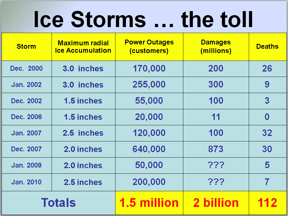
Those deaths are mostly associated with traffic accidents, but some are also due
to things like slips and falls, and carbon monoxide poisoning (people get pretty
desperate for heat when they've been without power for a few days and it's 20
degrees outside ... they do unfortunate things like bring gas heaters indoors
and run them unventilated).
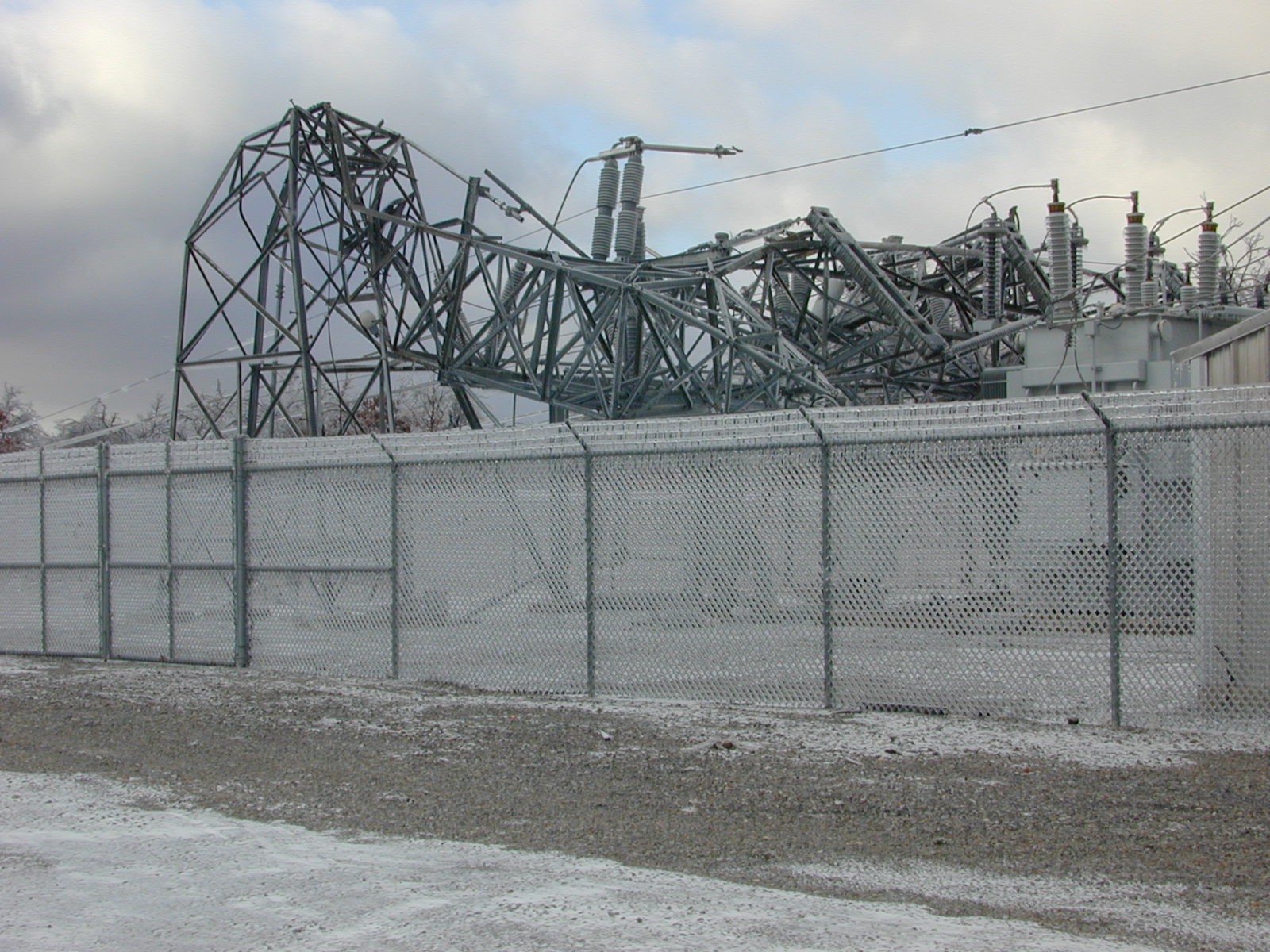
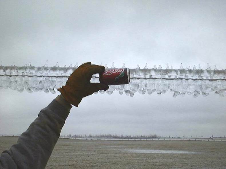
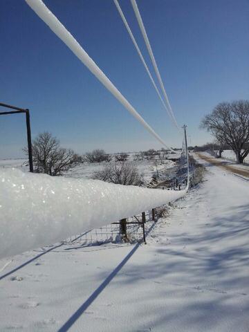
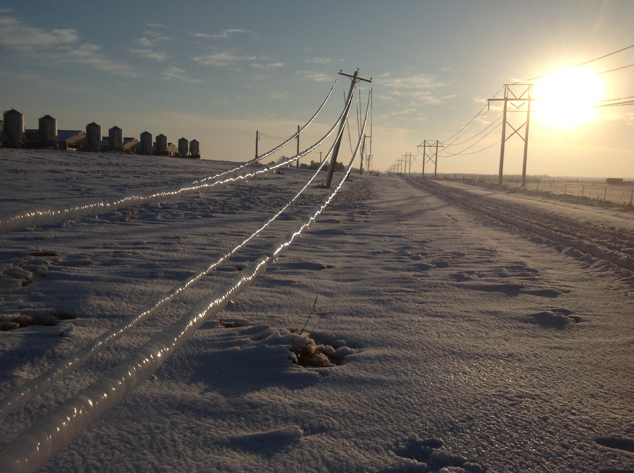
Here are a few pics courtesy of Sid Sperry, Director - PR, Communications &
Research at the Oklahoma Association of Electric Cooperatives, that give you
an idea of the power of ice.
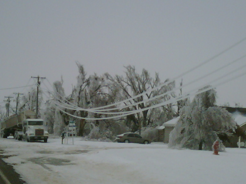
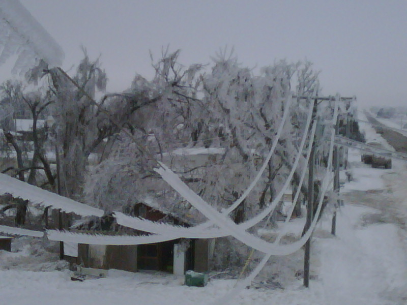
So those folks down in that area are under the gun. This is the type of ice
accumulation, coupled with the wind, than can cripple the power utility's
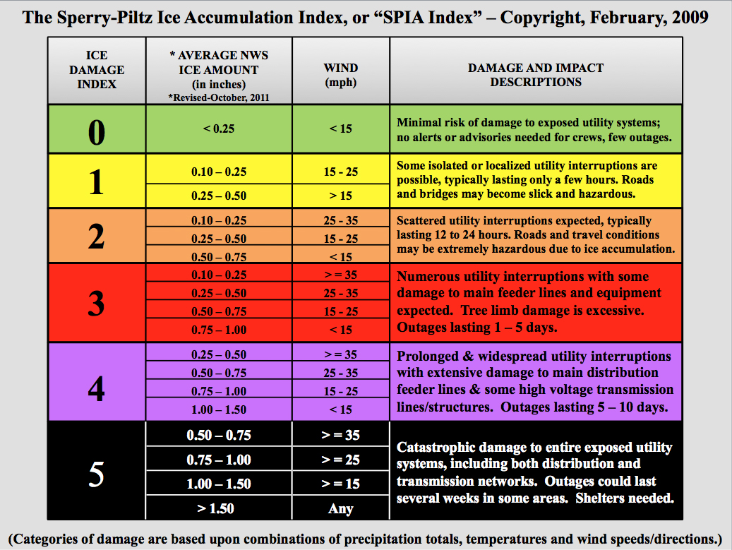
ability to deliver electricity for an extended period of time. Sid Sperry and
Tulsa NWS chief Steve Piltz developed an ice index that combines ice
accumulation and winds to categorize the damage potential of freezing rain. You
can see here that with ice accumulations of an inch, coupled with winds
expected to be gusting to as much as 25 mph on Friday, that they are in the
Ice Damage Index 4-5 category. The damage and impact descriptions indicate
prolonged and widespread utility disruptions, with outages lasting up to
several weeks in some areas.
With temperatures expected to drop into the single digits across the state by
as early as Saturday morning, and wind chills even lower than that, this is a
life threatening situation. You can learn more about the Sperry-Piltz Ice
Accumulation Index here:
http://www.spia-index.com/
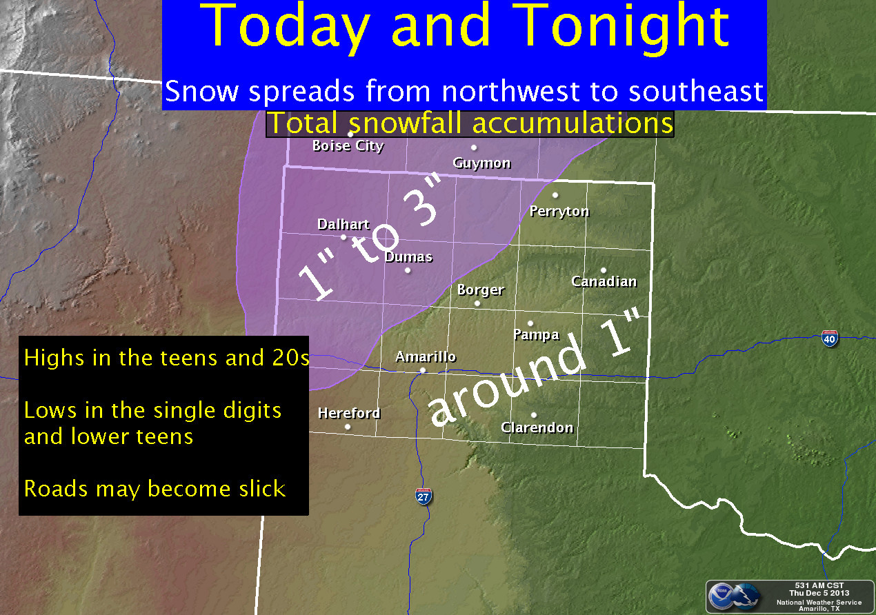
And remember the rest of the state is under a winter storm watch and a winter
weather advisory.
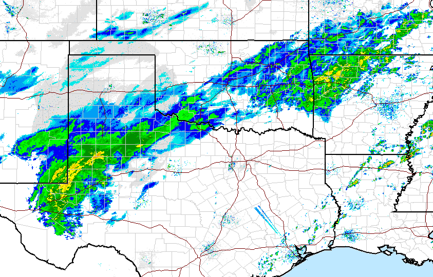
The precipitation has already started, as has the power-freeze Mother Nature is
providing. South central Oklahoma over into east central Oklahoma has already
started to see freezing rain, and there is a lot of green stuff (falling as white
stuff) off to out southwest headed this way.
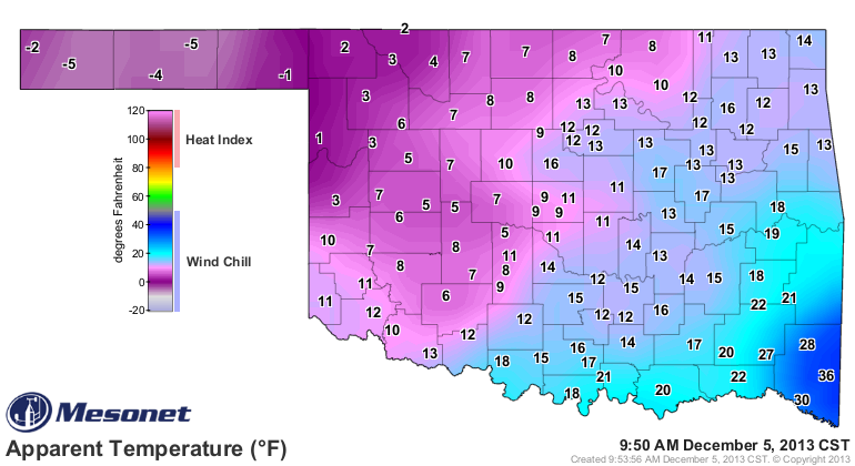
Temperatures are already down into the "your kidding, right" category, and wind
chills are even worse ... below zero already in the Panhandle.
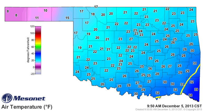
The freezing line is still showing up in the state, at least, on the current
air temperature map, but it won't be for long.
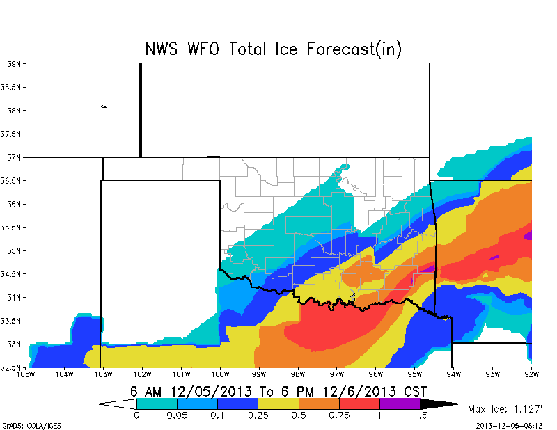
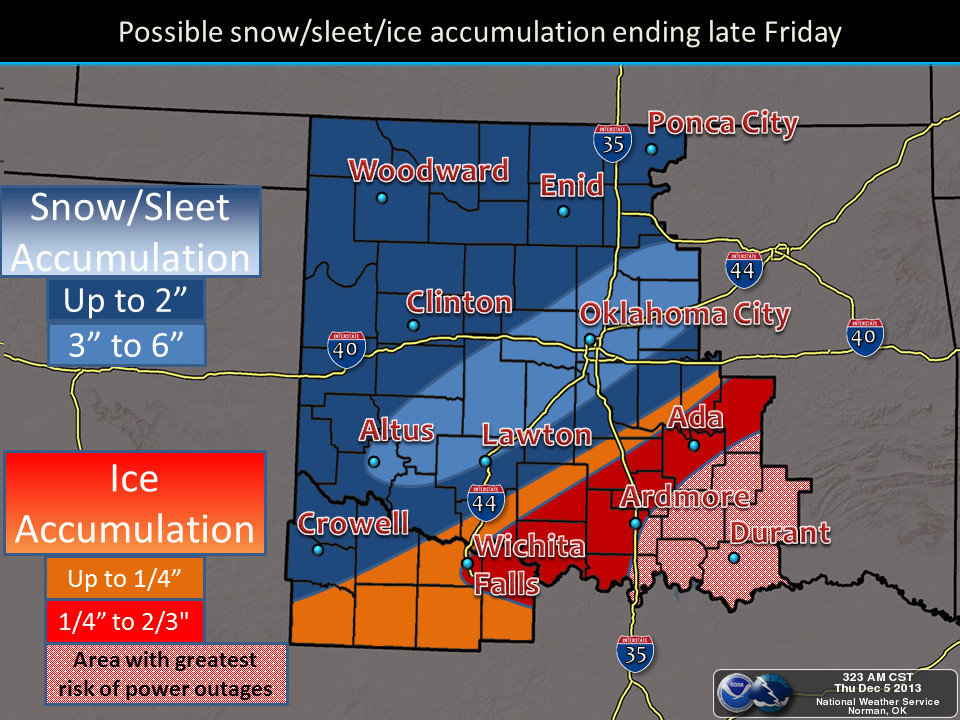
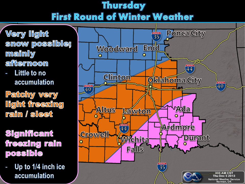
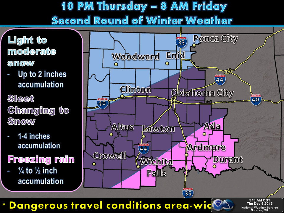
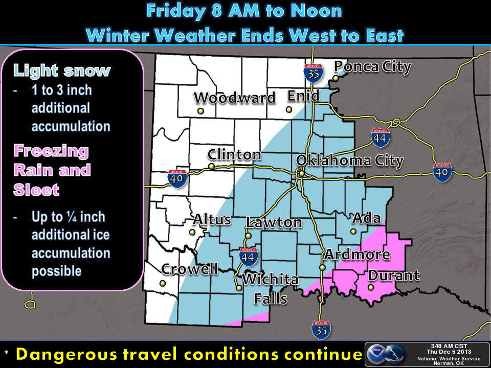
Here are the local NWS office graphical depictions of the wintry wonderland
(i.e., nightmare) to come.
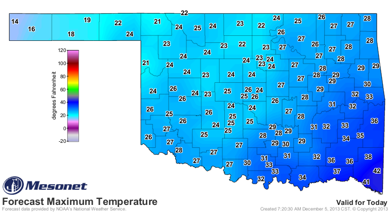
On top of all of that, we're definitely headed for some record low maximum
temperatures today (and probably Friday, and Saturday, etc.)
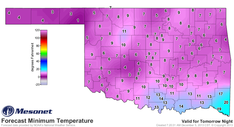
Here are the forecast Saturday morning lows, just for another punch to the gut.
Some are saying the coldest December weather we've seen since the December
deep freeze of 1983, but it might match up more closely with the December 1989
cold air outbreak. Whatever the case, this is an extremely serious situation,
particularly for those folks down in southeastern Oklahoma. At this point, we
have to pray for sleet and snow instead of freezing rain, although as Sid Sperry
pointed out back last February, even just sleet and snow can wreak havoc on
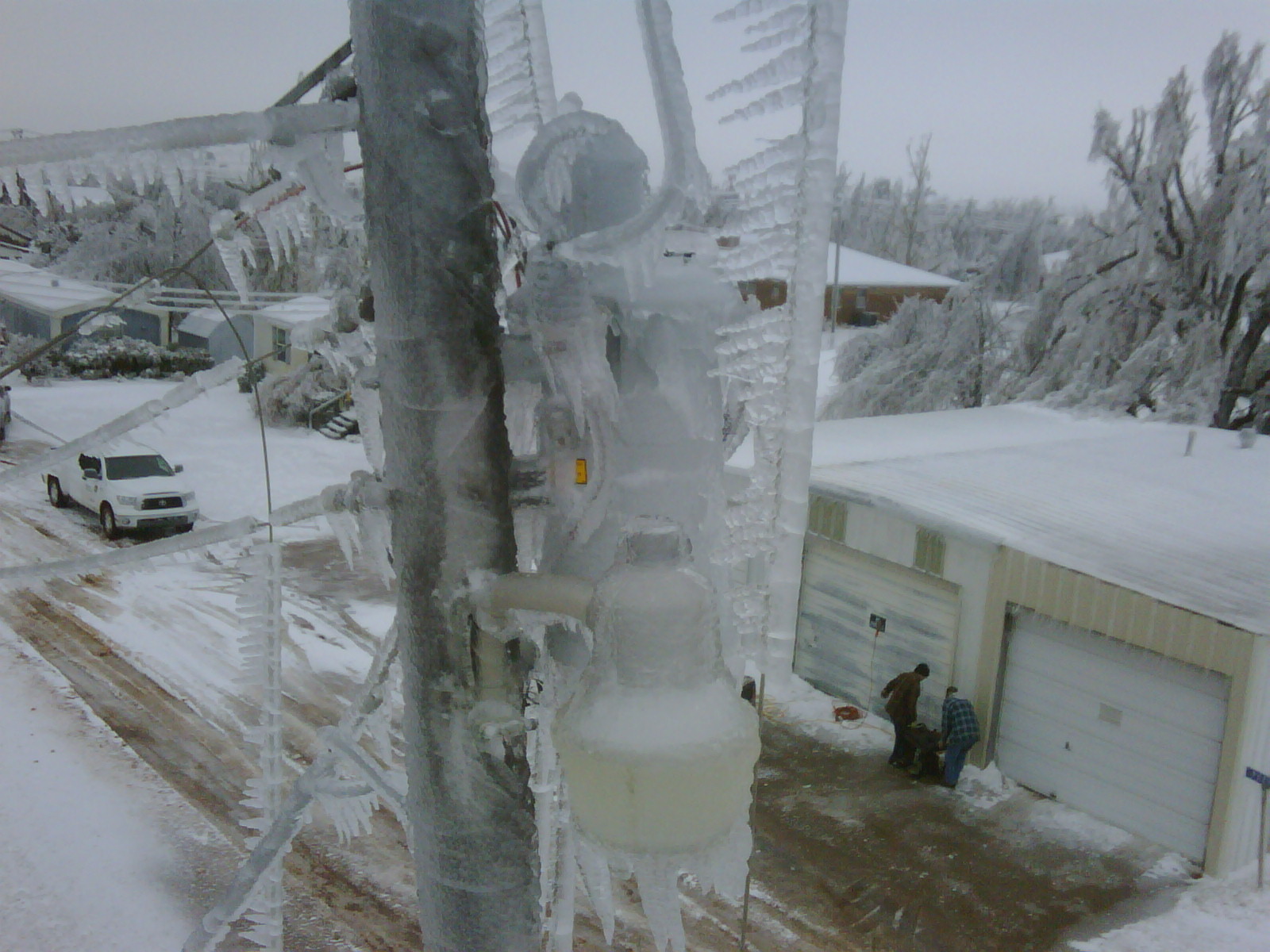
power lines. I'll leave you with some pictures from Cimarron Electric Cooperative
where that exact thing occurred, with very unfortunate results.
Gary McManus
Associate State Climatologist
Oklahoma Climatological Survey
(405) 325-2253
gmcmanus@mesonet.org
December 5 in Mesonet History
| Record | Value | Station | Year |
|---|---|---|---|
| Maximum Temperature | 84°F | MANG | 2021 |
| Minimum Temperature | 0°F | KENT | 2013 |
| Maximum Rainfall | 1.55″ | BIXB | 2021 |
Mesonet records begin in 1994.
Search by Date
If you're a bit off, don't worry, because just like horseshoes, “almost” counts on the Ticker website!