Ticker for September 3, 2015
MESONET TICKER ... MESONET TICKER ... MESONET TICKER ... MESONET TICKER ...
September 3, 2015 September 3, 2015 September 3, 2015 September 3, 2015
Flash drought expanding in Oklahoma

Just when we thought our Mondays and Tuesdays would be freed up to work on other
exciting and fabulous climate stuff, this stupid flash drought decided to ramp up
once again. Just look at the U.S. Drought Monitor map released this morning.
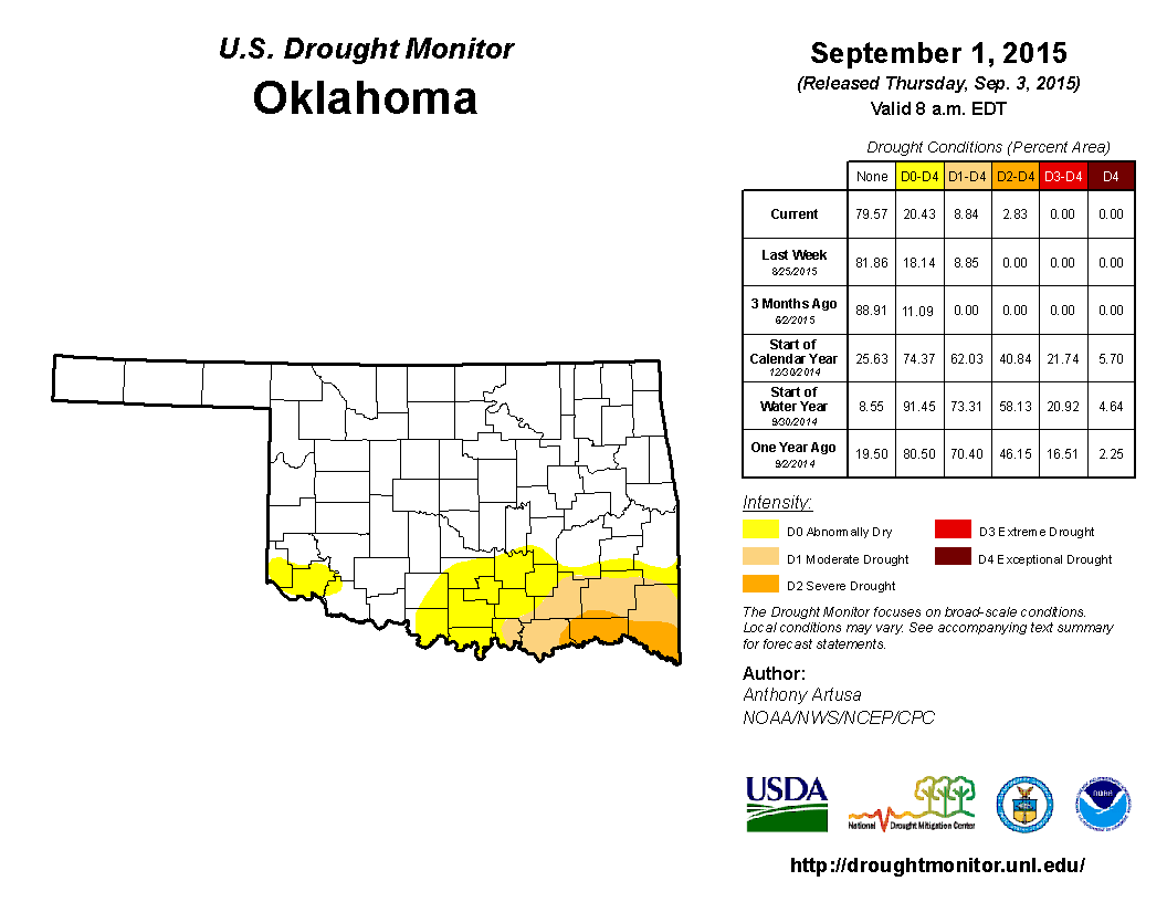
Severe drought is now up to 3% of the state, all across far SE OK, and moderate-
severe is up to 9%. Areas in at least abnormally dry (D0) conditions now
cover 20.43 percent of the state.
This dry spell really got going about 10 days into July, after "THE WETTING OF
SPRING AND SUMMER 2015!!!!" (that's copyrighted, BTW). Check out the rainfall
maps for July 10-today. Yikes! That's looks a lot worse than I thought.
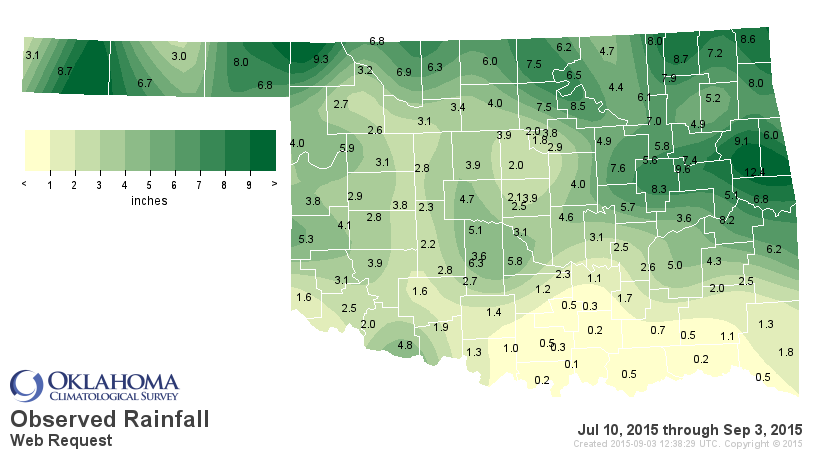
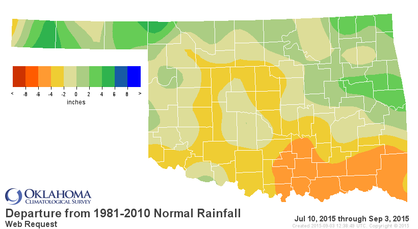
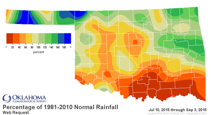
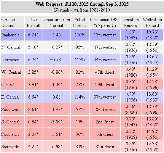
The 2nd driest such period for south central Oklahoma since at least 1921, 4
inches below normal. And the southeast ain't much better. Combine that with that
heat dome that sat over the state for so long (and made a comeback this week)
and you have the perfect ingredients for flash drought. All those heat indexes
of 110-115 meant all that previous 3 months worth of rainfall was evaporating
from the soils and the lakes/ponds/reservoirs. Again, check out the soil maps.
These are ugly.
http://www.mesonet.org/index.php/weather/category/soil_moisture
I feel sorry for folks preparing their fields to plant wheat with those types
of conditions. And that deep, dark brown color from far SW OK prompted us to
go ahead and ask for D0 over Harmon and Jackson counties. They have irrigation
water for their cotton thanks to the previous rains, but that's some dry soil
down that way otherwise. The reservoirs are hanging in there, although still
some low levels out west.
http://www.owrb.ok.gov/supply/drought/reservoirstorage.php
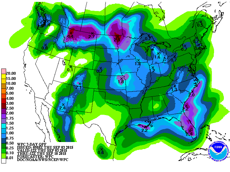
Hopes for the near-term are a bit bleak, although there is a chance for a bit
of moisture next week. That moisture is just starting to show up on the 7-day
forecast map. Let's hope this turns a bit more blue across S OK.
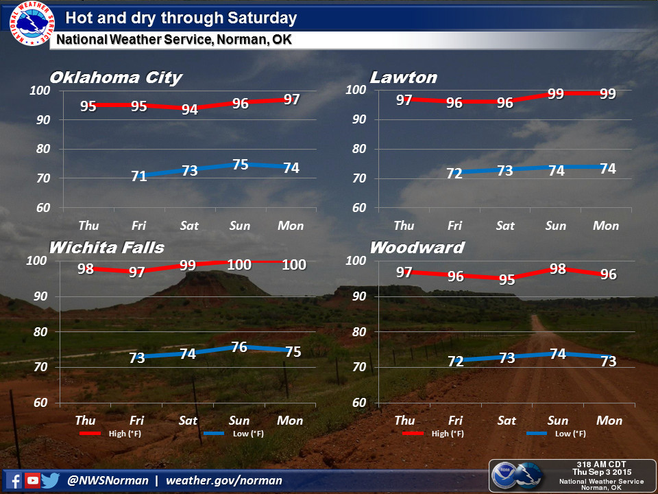
Other than that, it's going to be HOT through Labor Day weekend.
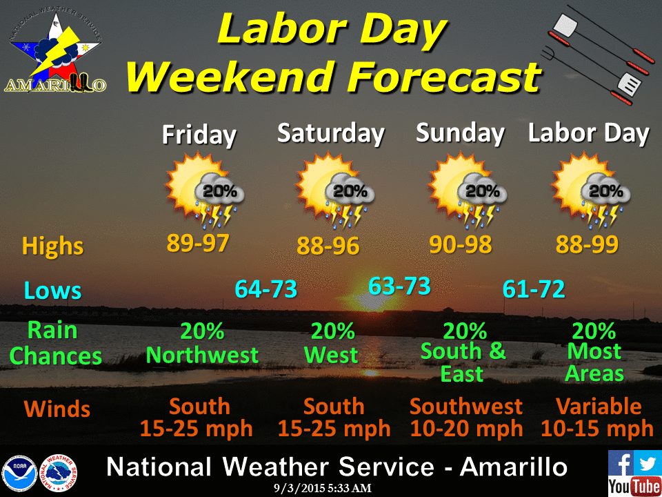
It's early September, fall is right around the corner, but we have to escape
summer's last gasp first.
Gary McManus
State Climatologist
Oklahoma Mesonet
Oklahoma Climatological Survey
(405) 325-2253
gmcmanus@mesonet.org
September 3 in Mesonet History
| Record | Value | Station | Year |
|---|---|---|---|
| Maximum Temperature | 111°F | ARDM | 2000 |
| Minimum Temperature | 44°F | KENT | 2010 |
| Maximum Rainfall | 3.51″ | COOK | 2008 |
Mesonet records begin in 1994.
Search by Date
If you're a bit off, don't worry, because just like horseshoes, “almost” counts on the Ticker website!