Ticker for August 8, 2005
MESONET TICKER ... MESONET TICKER ... MESONET TICKER ... MESONET TICKER ...
August 8, 2005 August 8, 2005 August 8, 2005 August 8, 2005
We're at a Loss to Explain This One
OCS's software engineers do more than engineer great software. They
are also weather fans like the rest of us (most of them are, in fact,
meteorologists). This morning, they noticed some bizarre goings-on
using OCS's WeatherScope software.
Here are some WeatherScope screen captures from the, uh, event?
At 5:00 am, The Tulsa and Ft. Smith radars showed junky-looking
clear-air returns near the radar sites (certainly not uncommon for
a humid August morning):
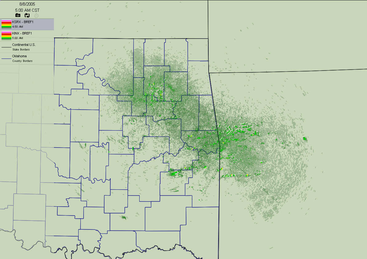
Notice, however, the subtle enhanced returns in eastern Oklahoma and
western Arkansas. These are actually hilltops of the east-west mountain
ranges bracketing the Arkansas River valley. These features typically
don't show up so far from the radar site, which is important to later
discussion.
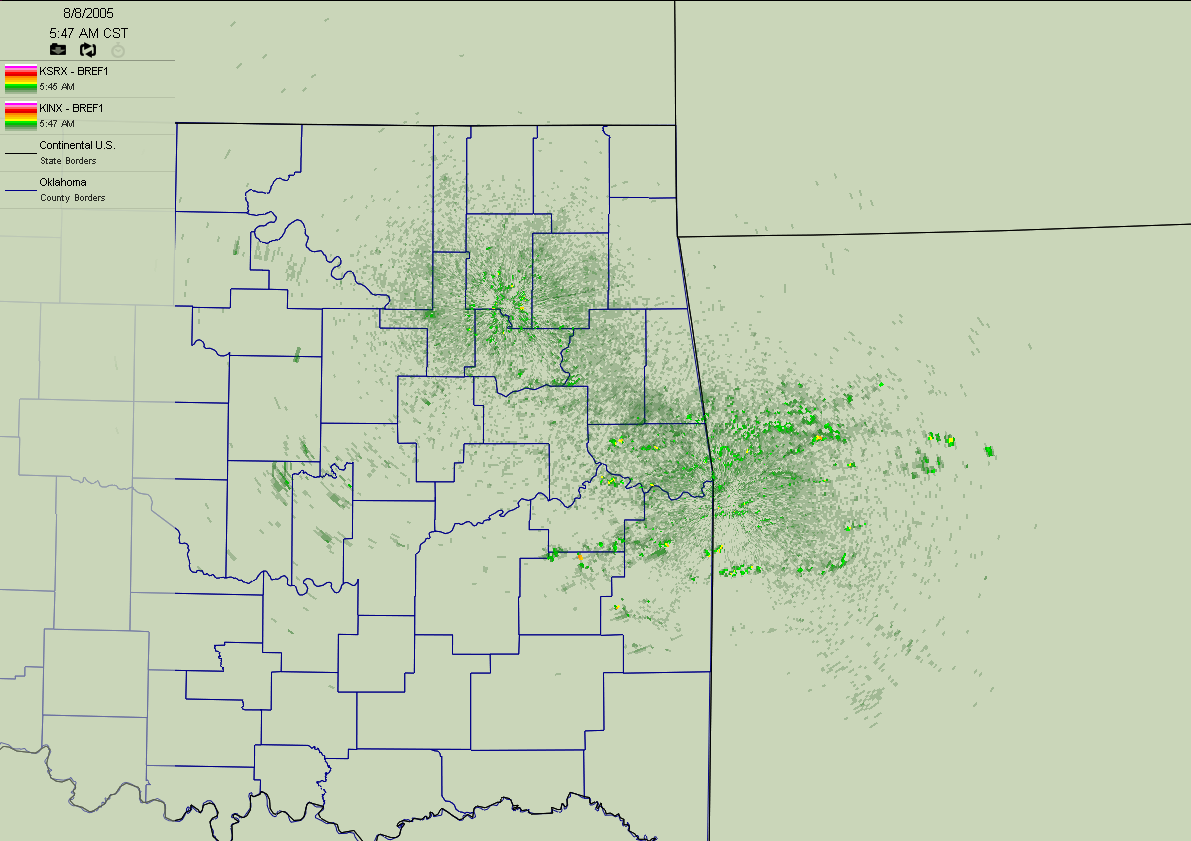
By 5:47 am, the mountains hadn't moved (thankfully!), and the clear-air
returns had started to clear up:
By 5:56 am, both the Tulsa and Ft. Smith radars switched to clear-air
mode. In clear-air mode, the radar is given much more time to rotate.
Consequently, it is much more sensitive. To put it clumsily, the radar
can "pick up subtle stuff" easier in clear air mode (this makes it
valuable in a pre-storm environment, when subtle boundaries may be
focal points for convection).
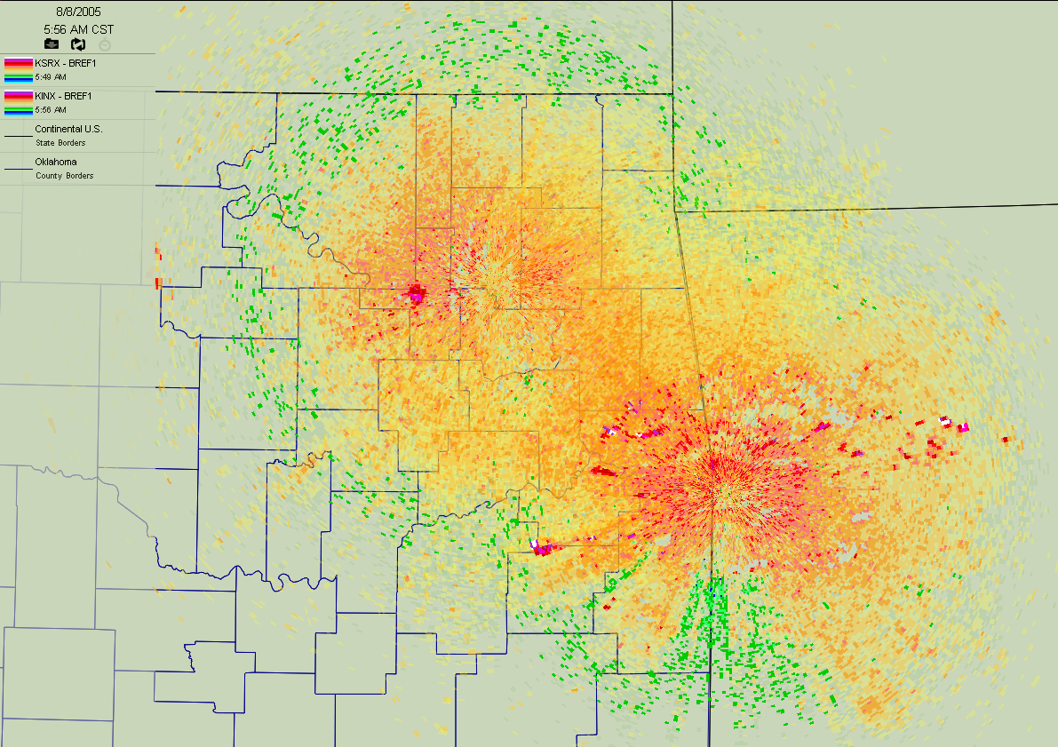
The very "hot" whites and purples are the aforementioned hilltops.
There is also a very curious feature over downtown Tulsa.
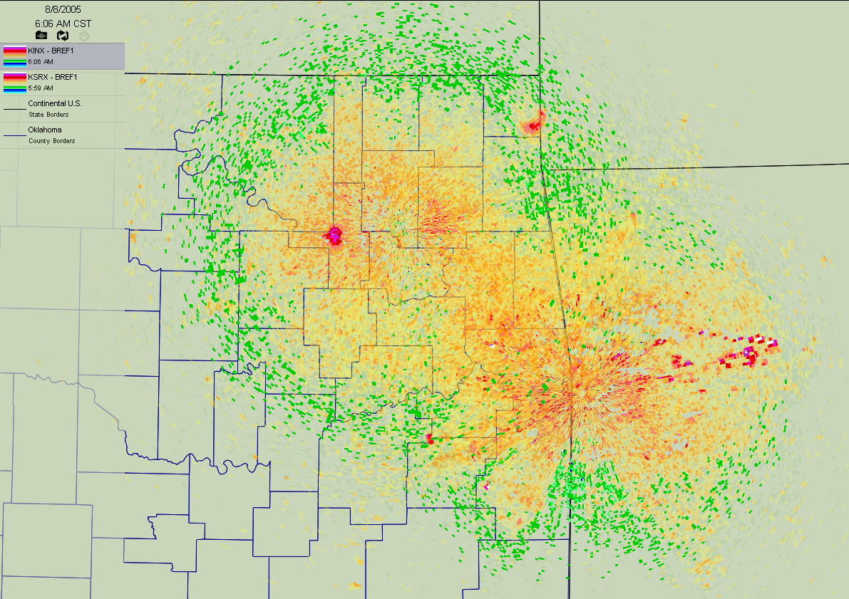
By 6:06 am, the downtown Tulsa feature was larger and showed stronger
reflectivity:
At 6:15, some bizarre circular features began to pop up all over
northeastern Oklahoma and western Arkansas:
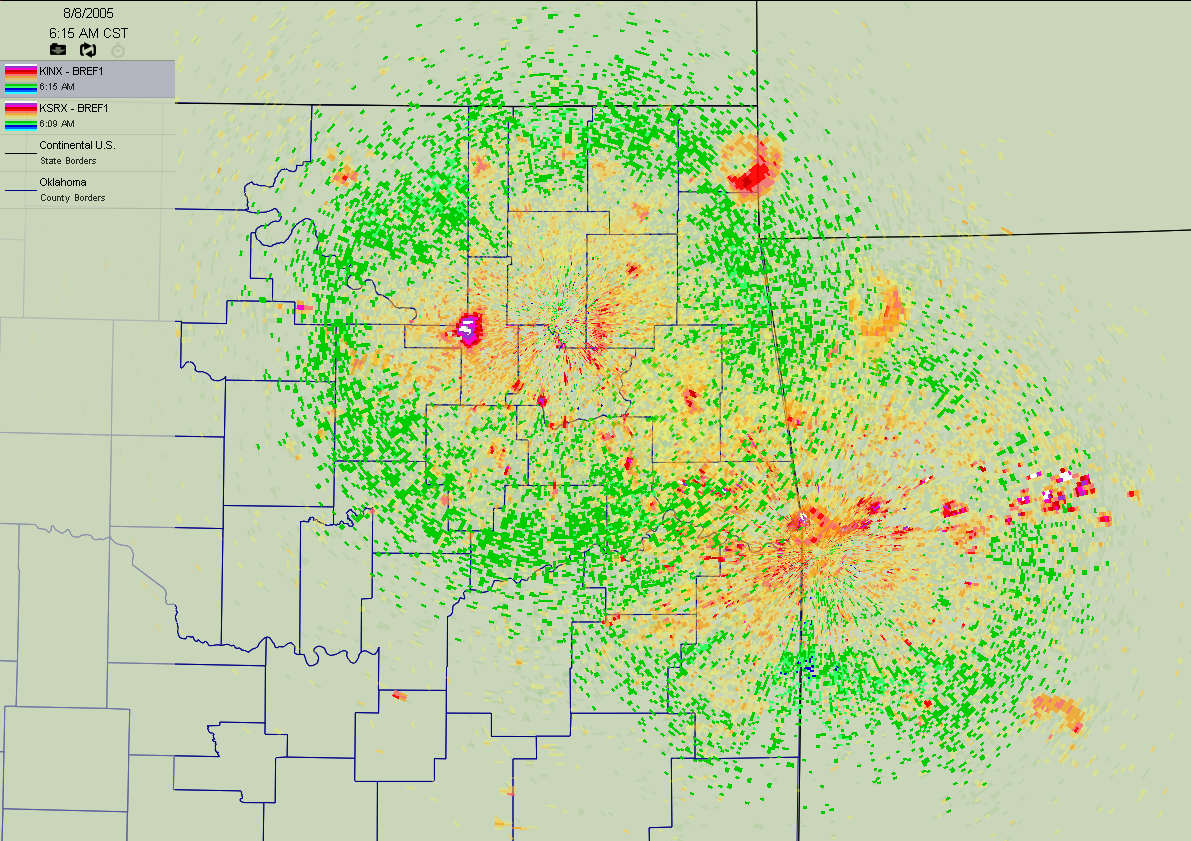
Notice the circle over southeast Ottawa County, another in far
northwestern Arkansas (near Bentonville), one just northwest of Hot
Springs. and one directly over the Ft. Smith radar site (look closely!).
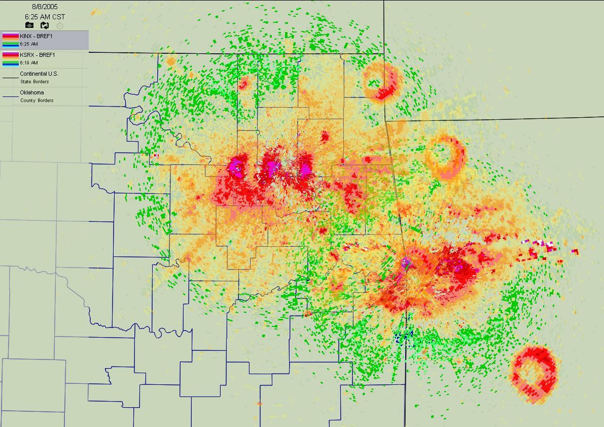
By 6:25 am, these features were obvious (the Hot Springs feature
showed up particularly strongly):
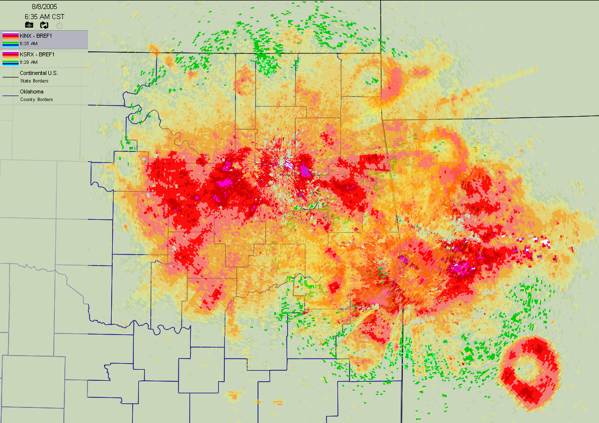
By 6:35 am, they were huge (and new ones started over Bartlesville and
a few other places):
For the 6:45 and 6:55 am snapshots, we turned off the Tulsa radar to
reduce clutter:
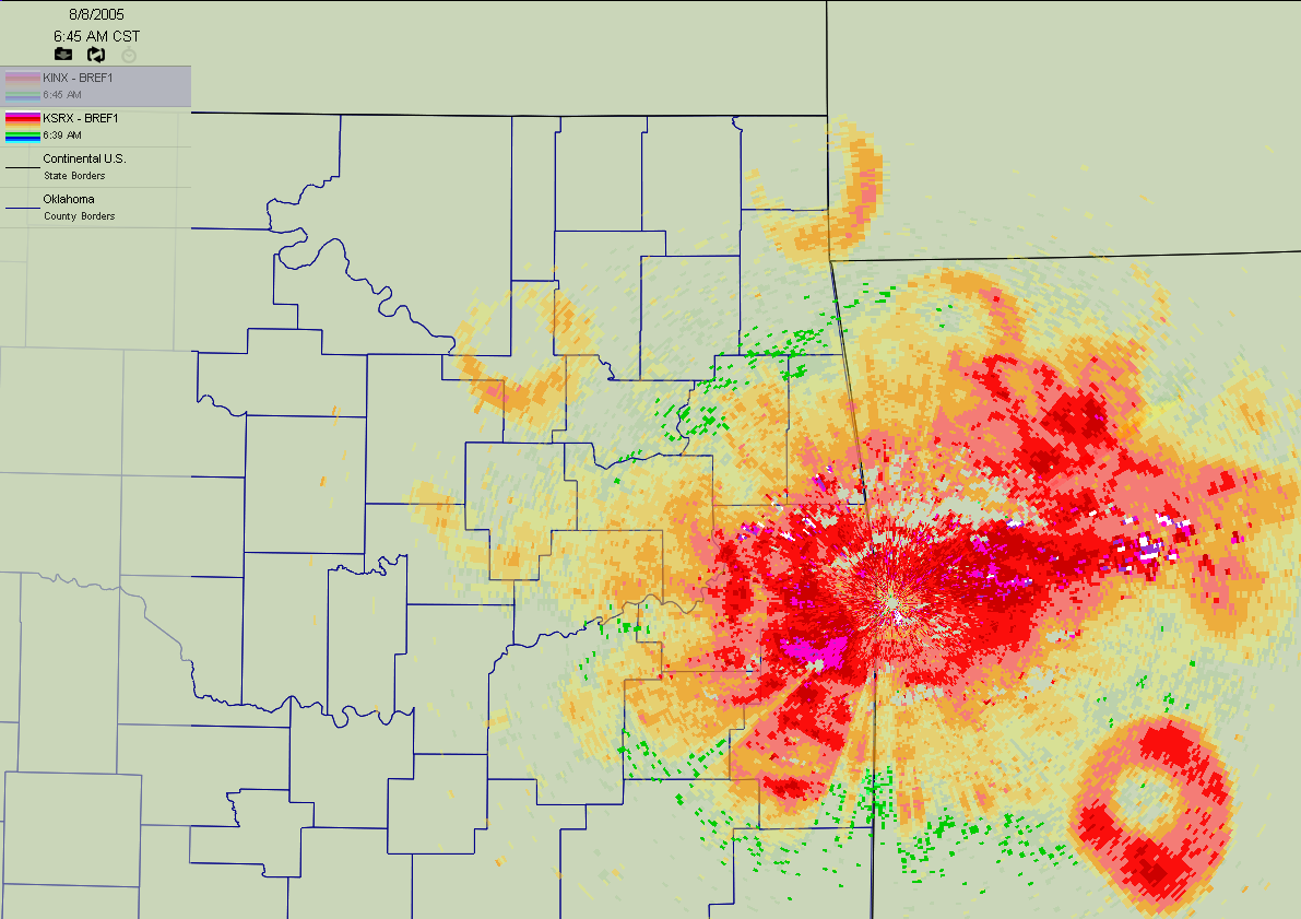
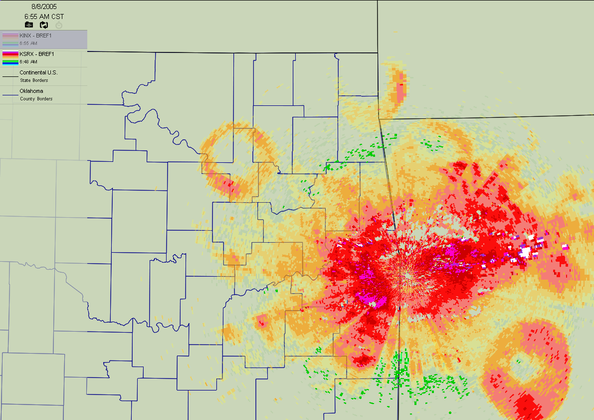
However, the four main features described earlier were quite visible
on the Ft. Smith image.
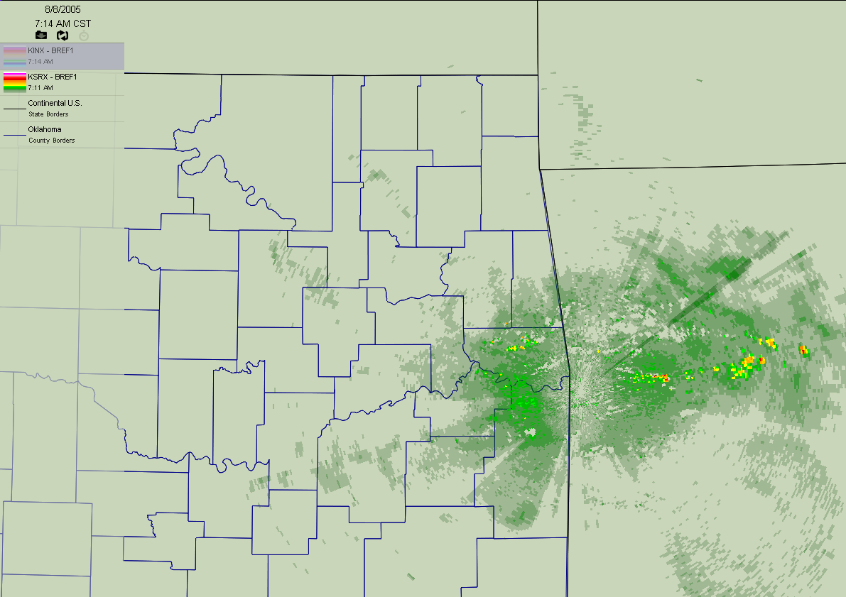
By 7:14 am, the radars had switched back to precip mode, and the
features dissipated (partly because of the switch, but mostly because
they actually dissipated):
So, here's the question: what were they?
And, here's the answer: we have no idea.
Some contributing factors that we ran through in our discussions:
1. The features showed up on at least two radars in the region. This
eliminates the "one radar was acting screwy" explanation. These were
actual atmospheric phenomona.
2. The radar beams were being refracted (bent back toward earth by the
atmosphere) more strongly than usual. This is evidenced by the
appearance of the hilltops of the Sans Bois and Lower Boston
Mountains. So, these were near-surface features.
3. We toyed around with the idea of waves from collapsing convective
clouds (aborted showers). However, the features were so synchronous
that we ruled it out. Besides, no reflectivities were visible in
preceding scans.
4. We toyed around with the idea of a sunrise burst of birds or bugs
from each of the locales, but the features were so large and so
symmetric that we leaned away from this.
5. A few of us nervously offered up extra-terrestrial explanations,
but then we pretended we were just joking when folks looked at us
strangely.
So, what's your take?
August 8 in Mesonet History
| Record | Value | Station | Year |
|---|---|---|---|
| Maximum Temperature | 111°F | KIN2 | 2011 |
| Minimum Temperature | 53°F | EVAX | 2017 |
| Maximum Rainfall | 4.48″ | WIST | 2023 |
Mesonet records begin in 1994.
Search by Date
If you're a bit off, don't worry, because just like horseshoes, “almost” counts on the Ticker website!