Ticker for July 8, 2020
MESONET TICKER ... MESONET TICKER ... MESONET TICKER ... MESONET TICKER ...
July 8, 2020 July 8, 2020 July 8, 2020 July 8, 2020
500 days of summer
ZOINKS! I prefer "ZOUNDS!" but went with the more common "ZOINKS" since most
people have at least heard of Scooby Doo. Some uncertainty there, but much more
certainty that we're about to get a good (or bad, depending on your point of view)
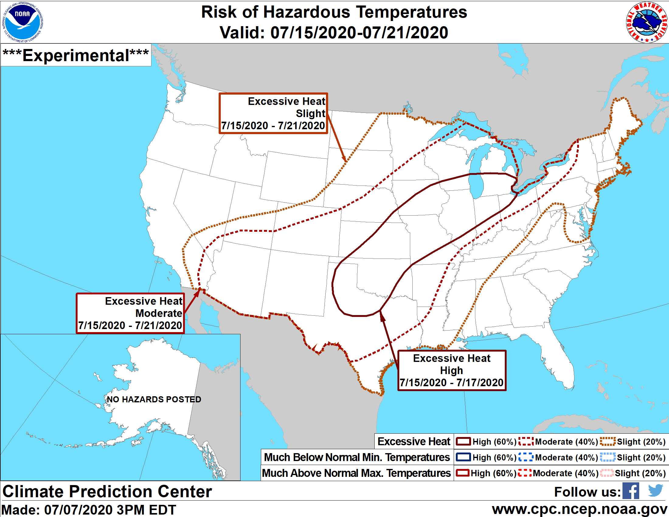
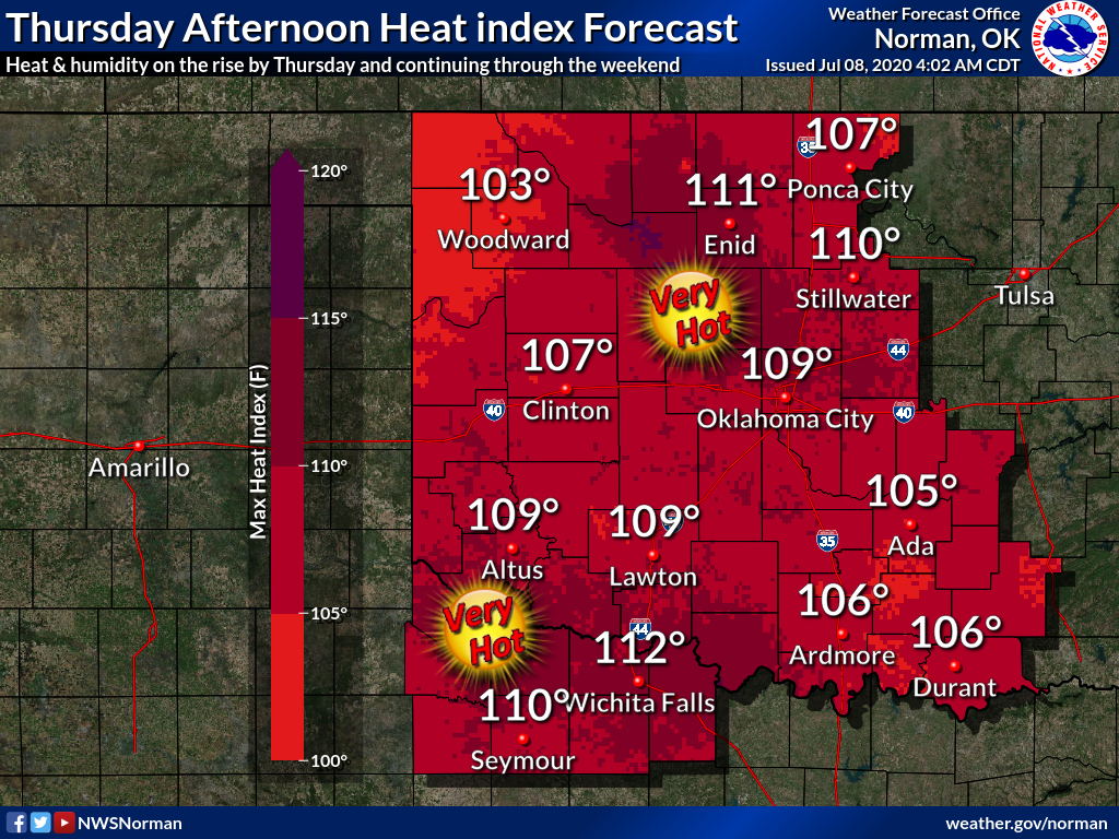
dose of summer. As you can tell from the graphic above, the risk of dangerous
temperatures will extend from tomorrow through the next 10 days. Hard to say
after that, but it wouldn't shock me, at least from the model output I've seen,
to have triple-digits across the state for the next 10 consecutive days. The
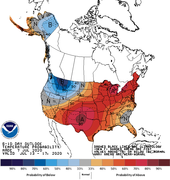
extended outlooks from CPC that go along with the above graph are indicative of
that, as well as a lack of moisture as the summer death ridge builds over the
Southern Plains.
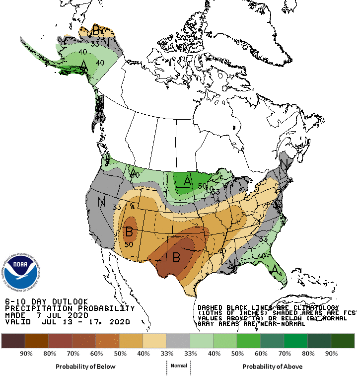
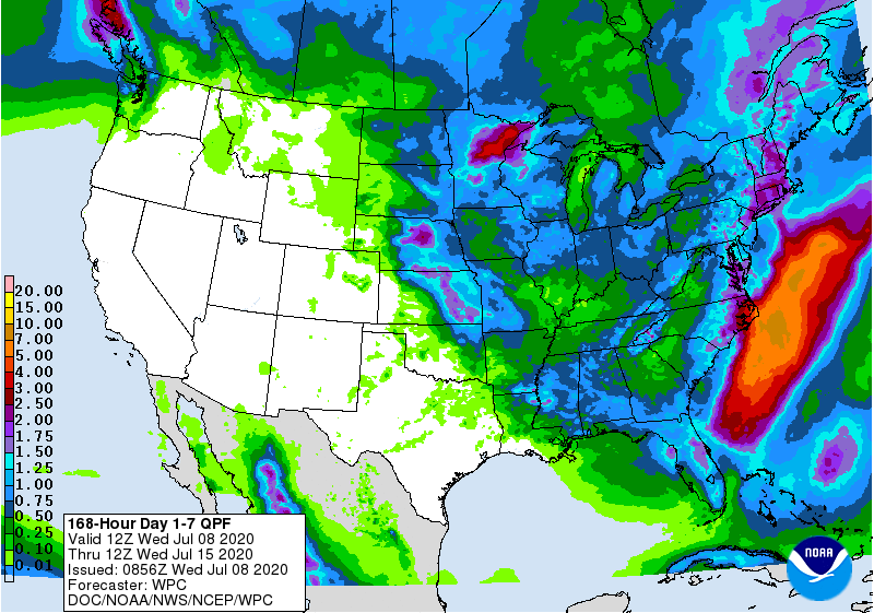
The 7-day rain forecast is looking pretty bleak. A chance for rain (and severe
weather) tomorrow night across NC and NE OK, but not much after that!
Now this heat will be accompanied by even higher heat index values, especially
across eastern Oklahoma. Expect heat advisories during the period, starting
tomorrow.
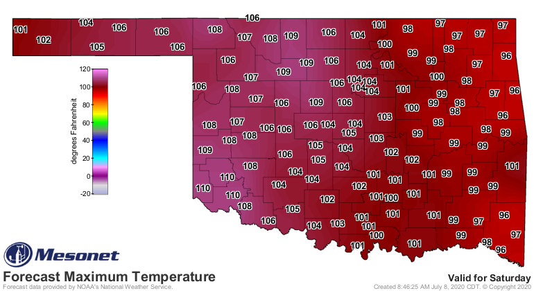
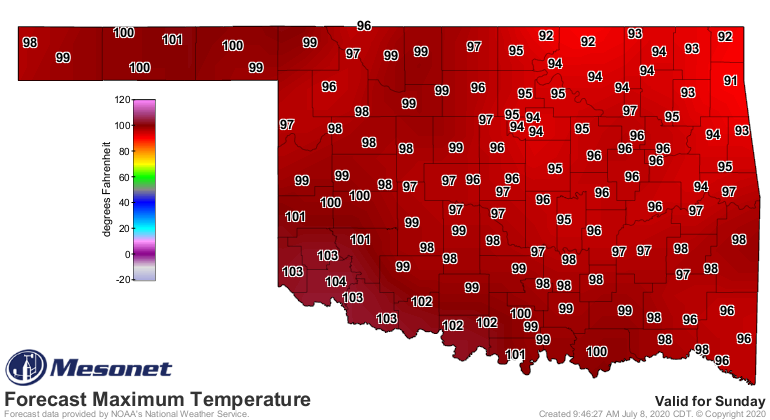
Saturday will be a scorcher! Maybe a bit of relief across the north for Sunday,
but there will still be 100s in Oklahoma.
After that, back to the frying pan. The other thing to worry about, after the
hazardous heat, is how will this impact the drought? And where are we starting
from after last weekend's moisture? We'll have more about that tomorrow.
Gary McManus
State Climatologist
Oklahoma Mesonet
Oklahoma Climatological Survey
(405) 325-2253
gmcmanus@mesonet.org
July 8 in Mesonet History
| Record | Value | Station | Year |
|---|---|---|---|
| Maximum Temperature | 109°F | WAL2 | 2022 |
| Minimum Temperature | 50°F | WIST | 2006 |
| Maximum Rainfall | 4.99″ | STUA | 2015 |
Mesonet records begin in 1994.
Search by Date
If you're a bit off, don't worry, because just like horseshoes, “almost” counts on the Ticker website!