Ticker for June 28, 2012
MESONET TICKER ... MESONET TICKER ... MESONET TICKER ... MESONET TICKER ...
June 28, 2012 June 28, 2012 June 28, 2012 June 28, 2012
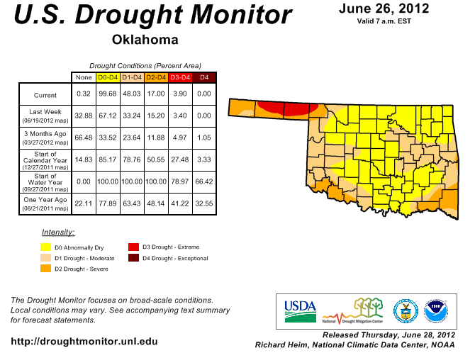
Flash drought continues to strengthen in Oklahoma
Fueled by oppressive heat, intense sunshine, dwindling soil moisture and a lack of
rainfall, drought continues to rapidly develop across the state. Over 48% of the
state is now considered to be in drought according to the latest U.S. Drought
Monitor, and for the first time since November 15, 2011, the entire state is now
considered at least "abnormally dry."
The dryness that has continued to intensify across Oklahoma is hardly confined
to our state, with 72% of the country now labeled with conditions at least in the
abnormally dry category. That is the largest such extent covering the country
since the Drought Monitor effort began in 1999. More than 51% of the country is
considered to be in drought, the largest such extent since September 2003.
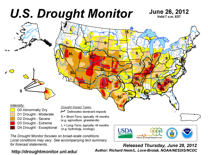
The horrific fires plaguing Colorado are occurring amidst one of their worst
droughts in recent memory. Their entire state is now covered by at least moderate
drought for the first time in the history of the U.S. Drought Monitor. Wildfire
danger will become a more prominent hazard for Oklahoma as well if rain does not
appear on the horizon soon. Abundant rains over parts of the state throughout the
cool season and into spring fueled rapid vegetation growth. With drought on the
rise, that vegetation has begun to dry out and will become a particularly
potent fuel source for fires.
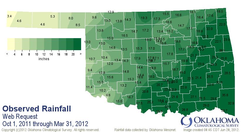
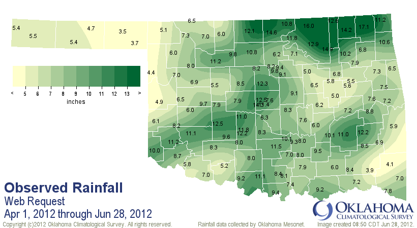
The first six months of the current water year provided miraculous drought
relief for a majority of the state. The water year runs from October 1-September
30. The October-March statewide average rainfall was the 13th highest for
Oklahoma since records began in 1895 at 17.96 inches. That counts as a surplus
from normal of 5.45 inches.
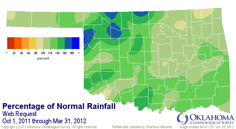
The rains have dwindled since for a good part of the state, unable to keep up
with the demands of easily the warmest first six months of the year for
Oklahoma. The southeast and east central sections of the state are both at
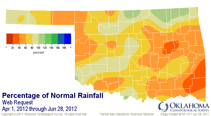
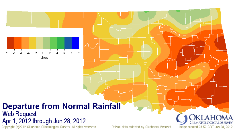
or below 50% of normal for April 1-June 28, which encompasses the entirety
of Oklahoma's primary rainy season. Statewide, the average total of 8.19 inches
is 4.22 inches below (or 66% of) normal, the ninth driest such period since
1921.
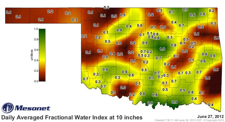
The heat and dwindling moisture from the sky has led to a rapid depletion of
soil moisture. The soil moisture network of the Oklahoma Mesonet continues to
record that quick decline at the 10-inch soil depth.
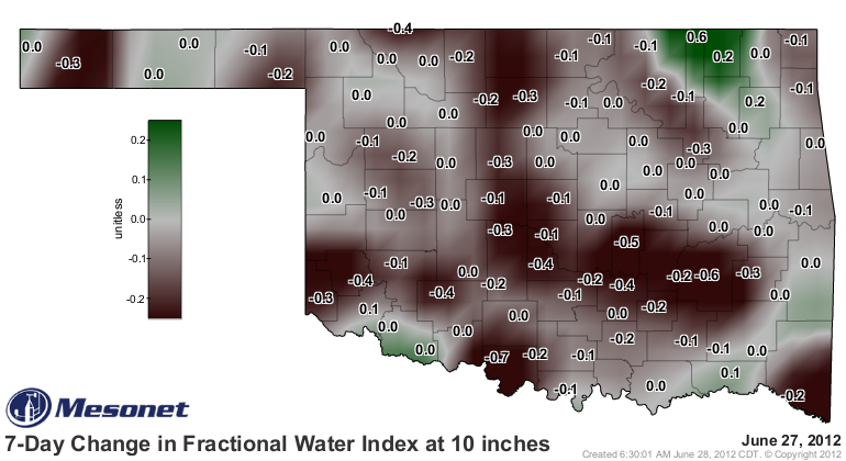
Keep in mind that the decline does not look as bad in some places since there
is little left to leech from the soil in those spots, such as northwestern
Oklahoma and the Panhandle.
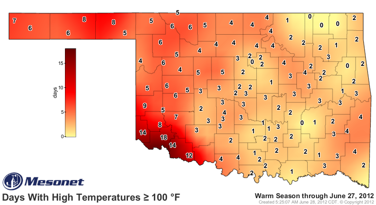
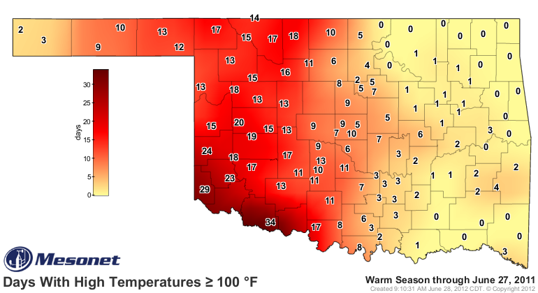
Much of the state has seen high temperatures above 100 degrees for the last
several days.
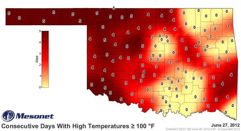
And while those triple-digit days have begun to mount, the counts still pale in
comparison to this time last year.
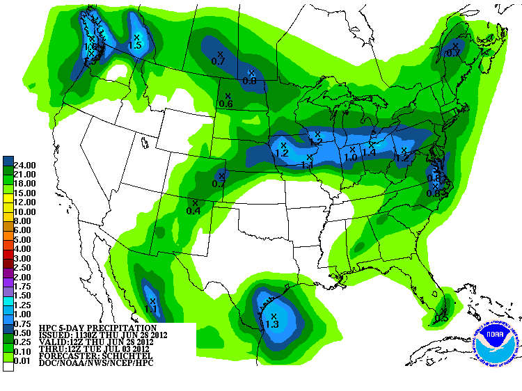
The solution is simple ... more rain. Unfortunately, July and August is not
the ideal time to expect relief.
And nothing is appearing just yet through early next week.
July and August is a time of depletion, with evapotranspiration rates normally
outpacing rainfall. By the time August rolls around, the state is often has a
bit of a brown-yellowish tint. The current dryness would not be quite so
unusual to see in late August. The fact that it is occurring a month or two
early is a reason for concern. Odds favor more drought development as summer
continues and a dry Oklahoma looks with anticipation towards the fall rainy
season.
Gary McManus
Associate State Climatologist
Oklahoma Climatological Survey
(405) 325-2253
gmcmanus@mesonet.org
June 28 in Mesonet History
| Record | Value | Station | Year |
|---|---|---|---|
| Maximum Temperature | 113°F | ALTU | 2023 |
| Minimum Temperature | 48°F | EVAX | 2022 |
| Maximum Rainfall | 3.95″ | WEST | 2000 |
Mesonet records begin in 1994.
Search by Date
If you're a bit off, don't worry, because just like horseshoes, “almost” counts on the Ticker website!