Ticker for April 23, 2013
MESONET TICKER ... MESONET TICKER ... MESONET TICKER ... MESONET TICKER ...
April 23, 2013 April 23, 2013 April 23, 2013 April 23, 2013
Apruary
Don't worry, I make up words all the time. But with this April that seems like
February, why not combine the two? Another cold front has blasted through the
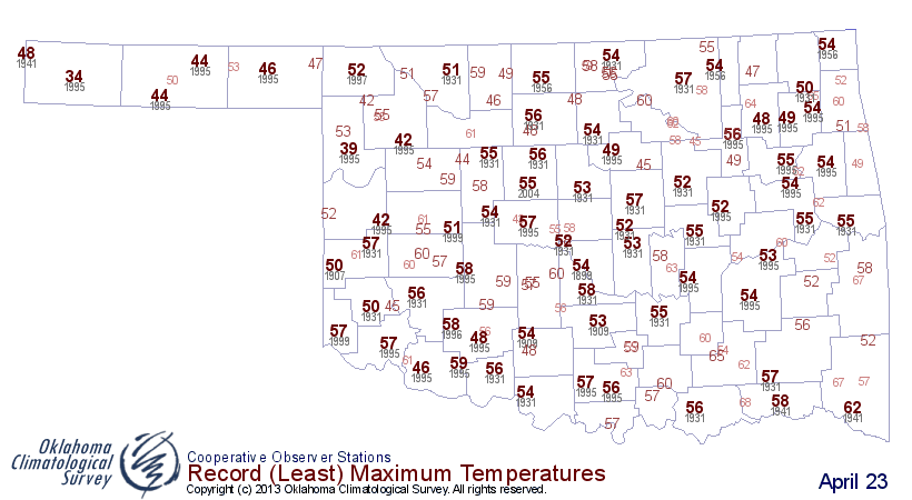
state, dropping temperatures back down into record territory. Keep an eye on the
highs today out in the northwest. They will surely challenge the records for
lowest maximum temperatures for this date, April 23. Here are the record low
maximum temperatures dating back to the late 19th century.
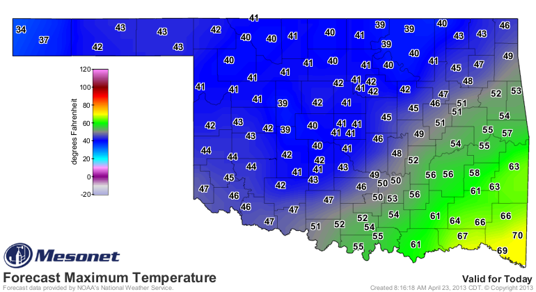
And here are today's highs thus far. Farther to the southeast, the record attempt
has been ruined by the timing of the front. I'll throw the current temperatures
in there to show the progression of the front.


So TECHNICALLY today's highs across most of Oklahoma won't be breaking their
respective records, but if you just look at afternoon highs, they most assuredly
will. Here's another little tidbit ... the lowest maximum temperature ever
recorded on April 23 is 34 degrees at Boise City in 1995. That area is only
forecast to get up to about 34 degrees, so the race is on!
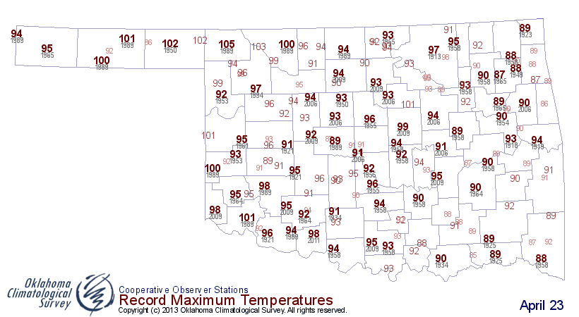
Just for kicks, here are the record highs for the day ... April 23, 1989, must
have been a scorcher!
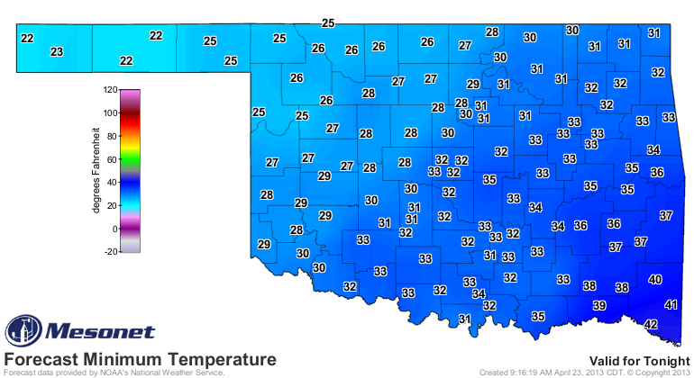
All eyes will then turn to tomorrow's record lows, which could fall by the
wayside if these forecast temperatures validate. Holy cow!
-------------------------------------------------------------------------------
Buckshot
Mother Nature also loaded up the rain gun last night with buckshot and peppered
the northern half of the state. A decent general rain of a quarter- to half-inch
with some higher localized amounts.
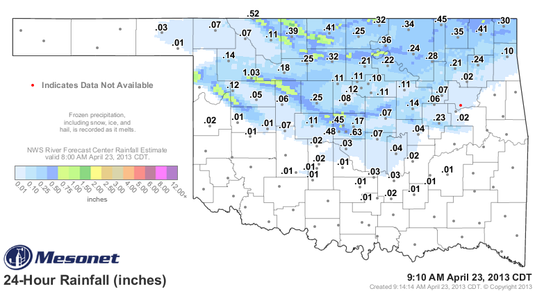
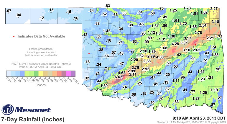
We'll just add that to last week's totals so it looks a bit nicer.
Gary McManus
Associate State Climatologist
Oklahoma Climatological Survey
(405) 325-2253
gmcmanus@mesonet.org
April 23 in Mesonet History
| Record | Value | Station | Year |
|---|---|---|---|
| Maximum Temperature | 97°F | HOOK | 2006 |
| Minimum Temperature | 17°F | BOIS | 2013 |
| Maximum Rainfall | 3.68″ | HOBA | 2019 |
Mesonet records begin in 1994.
Search by Date
If you're a bit off, don't worry, because just like horseshoes, “almost” counts on the Ticker website!