Ticker for January 15, 2014
MESONET TICKER ... MESONET TICKER ... MESONET TICKER ... MESONET TICKER ...
January 15, 2014 January 15, 2014 January 15, 2014 January 15, 2014
The little farm pond that still can't
Veteran Ticker know three things about me:
1. I'm devilishly handsome
2. Cold weather doesn't suit me
3. I'm not really devilishly handsome
4. I have an unhealthy obsession with a small little spring-fed farm pond south
of Buffalo.
E. I'm not good at counting
As the drought trudges on now well into its fourth year across western Oklahoma,
many areas that were impacted way back in early 2011 still have not seen anything
close to a full recovery. That's where the little farm pond comes in. Yes, it is
my favorite place in the universe, dry or not. I grew up fishing there and
running the canyons it sits in south of Buffalo. It had never been dry prior to
this current drought. The drought of 1995-96 took it way down, but it just made
it easier to fish. The 2005-06 drought was no picnic either. But it, and the
state, had not seen the type of drought we're currently experiencing in decades.
The ferocity of the drought from October 2010-September 2011 was reminiscent of
some of our big baddies from the 1930s and 1950s. But it was still just a year.
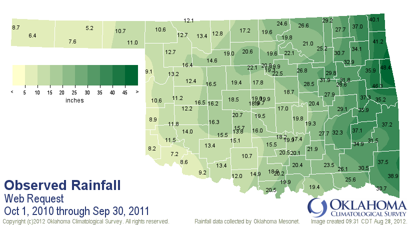
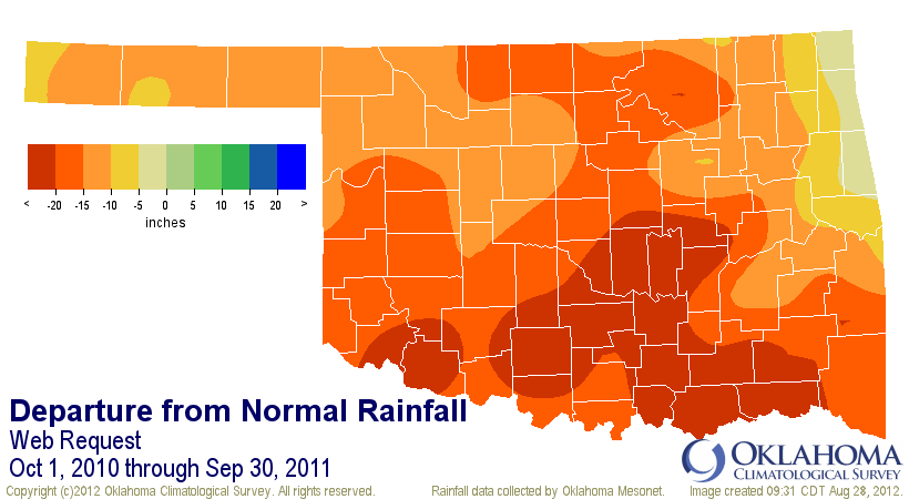
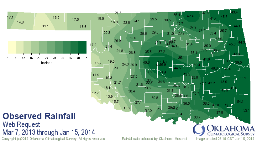
That period is actually known as a "water year." The statewide average during
that 2010-11 water year was 20.05 inches, 16 inches below normal and the
second driest on record (1956 still #1). Deficits across the state ranged
from 8 inches to more than 20 inches. Notice Buffalo up there in the far
northwest corner received a meager 10.6 inches, about 15 inches below normal.
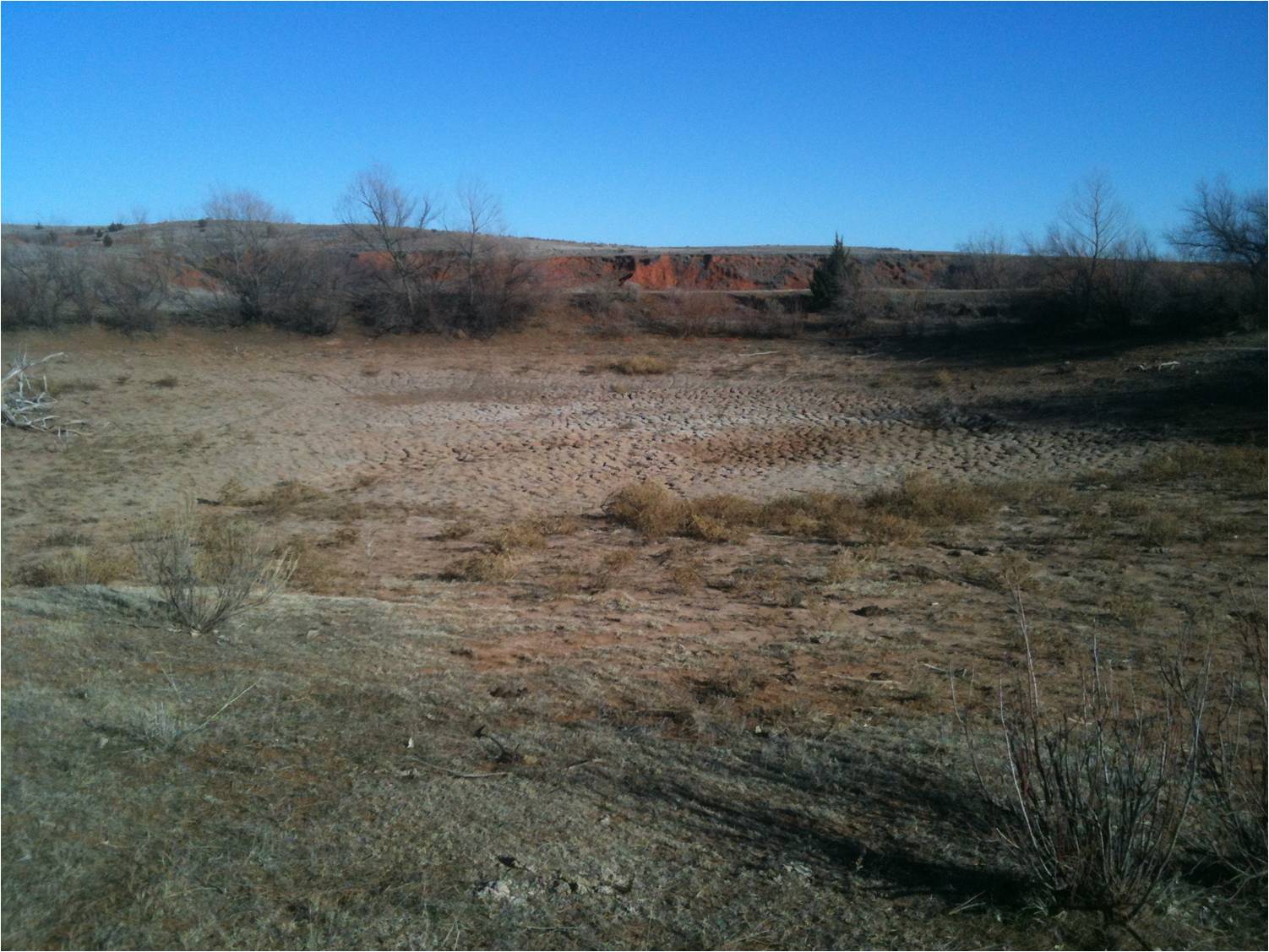
The little pond actually suffered throughout much of 2010 after a glorious
2009, until finally drying up completely during the 2011 spring.
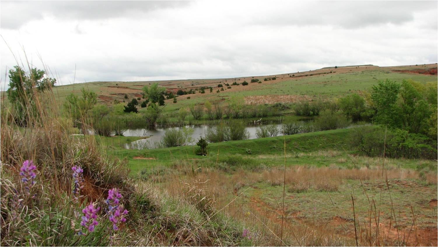
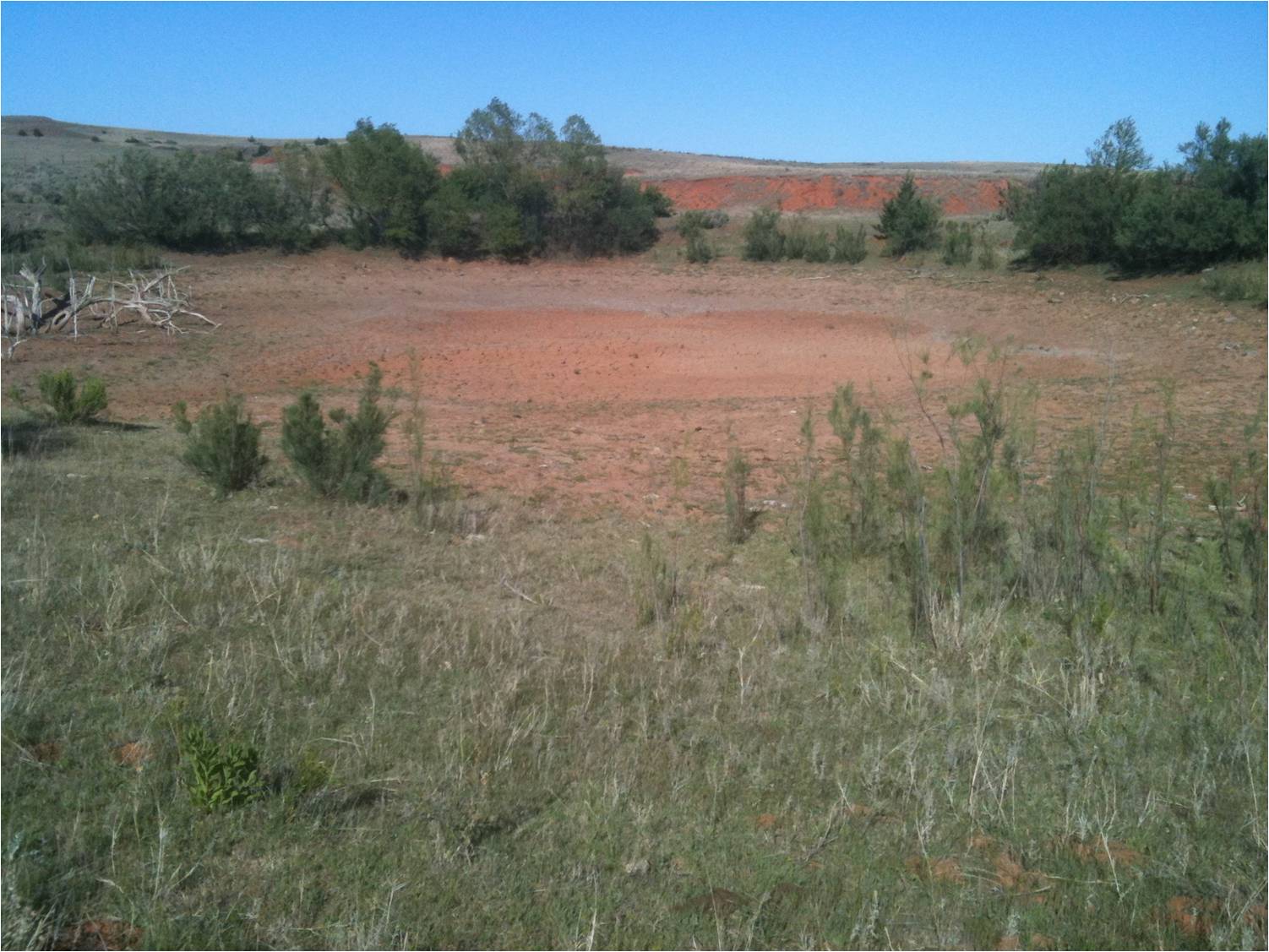
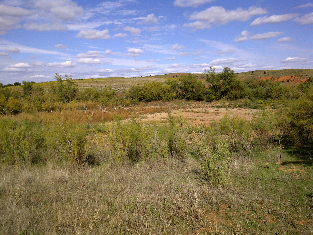
Here's a jaunt back over the last four years, starting with May 2009, about a
month after a blizzard buried northwestern Oklahoma with as much as 26 inches of
snow. Never had it looked this green when the picture was snapped.
Following that, you can track the drought's progress by the declining levels
of the pond. You can see the impacts of the summer 2010 flash drought in the
first picture below, BEFORE the drought really got going in late fall.
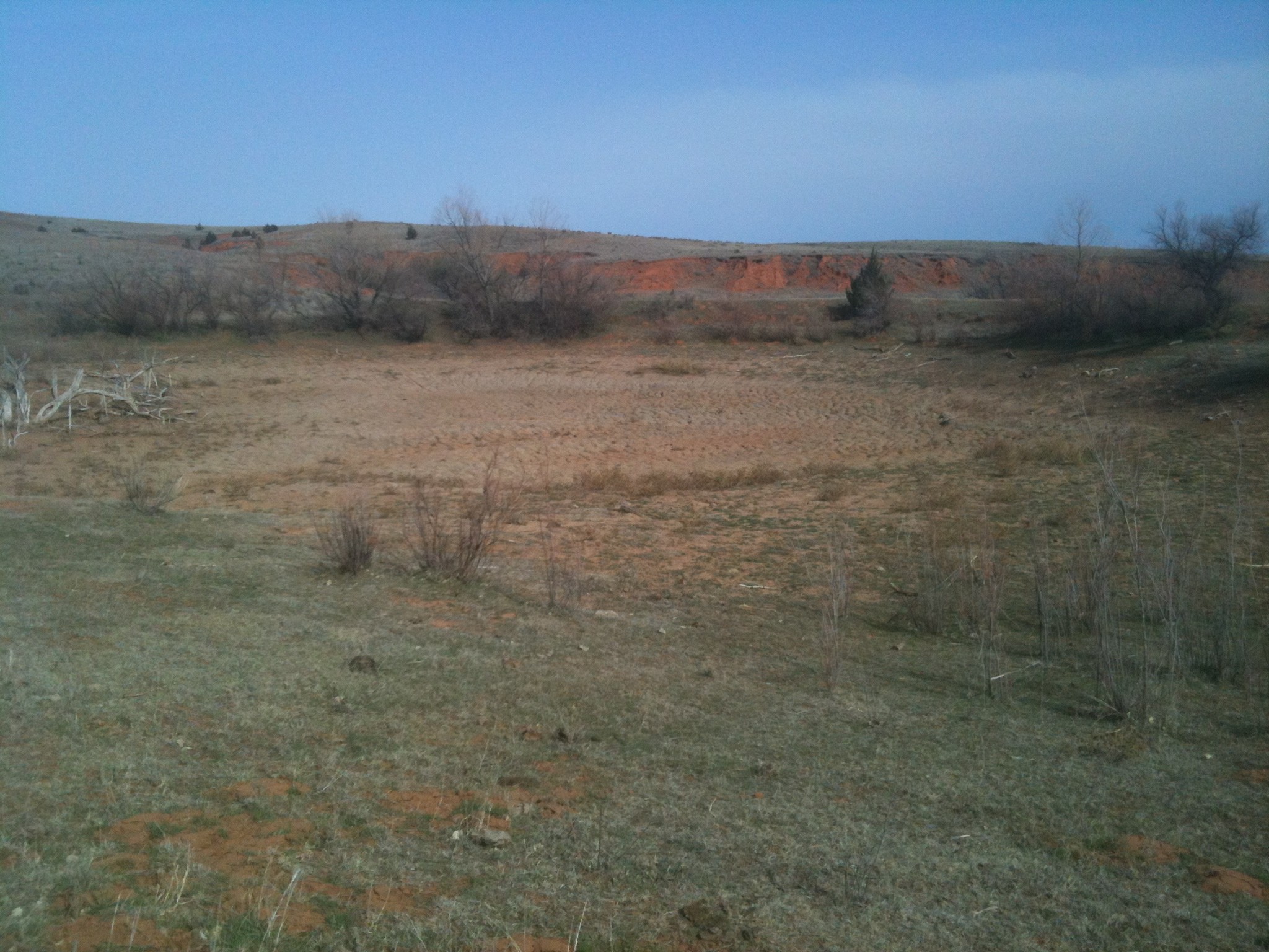
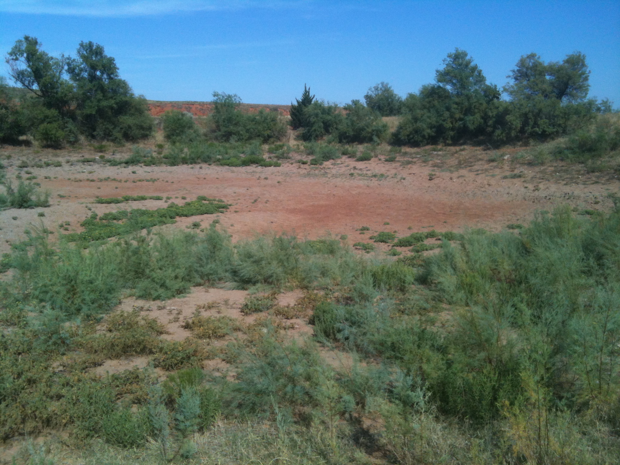
I hadn't actually visited the pond in awhile. It's tough for me to see, after
all. But on a trip to speak about, what else ... drought, in Garden City, I
thought it was finally time to go back and check on the levels. Buffalo
has had some "decent" moisture since March, after all. So maybe it had gone
from mudhole to actual pond again? Here are the rainfall totals since that
March 6 visit, and my reason for cautious optimism (I visited the pond on
January 8, but I'll include the next week as well anyway since nothing fell).
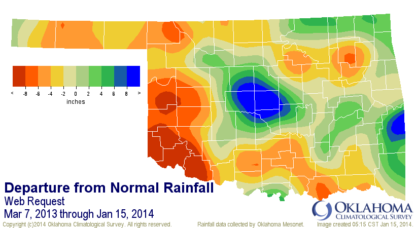
Well, 18 inches! That looks promising. It's still around 6 inches below normal,
but surely enough to give a pond a boost, right? Let's take a look at the pond
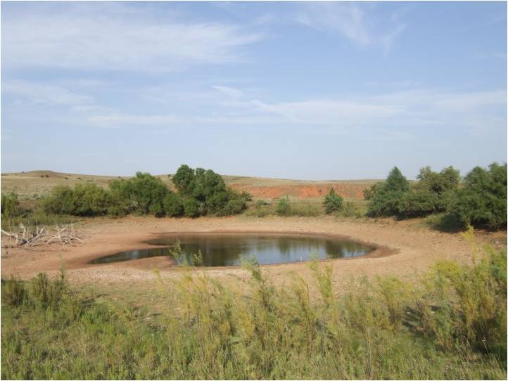
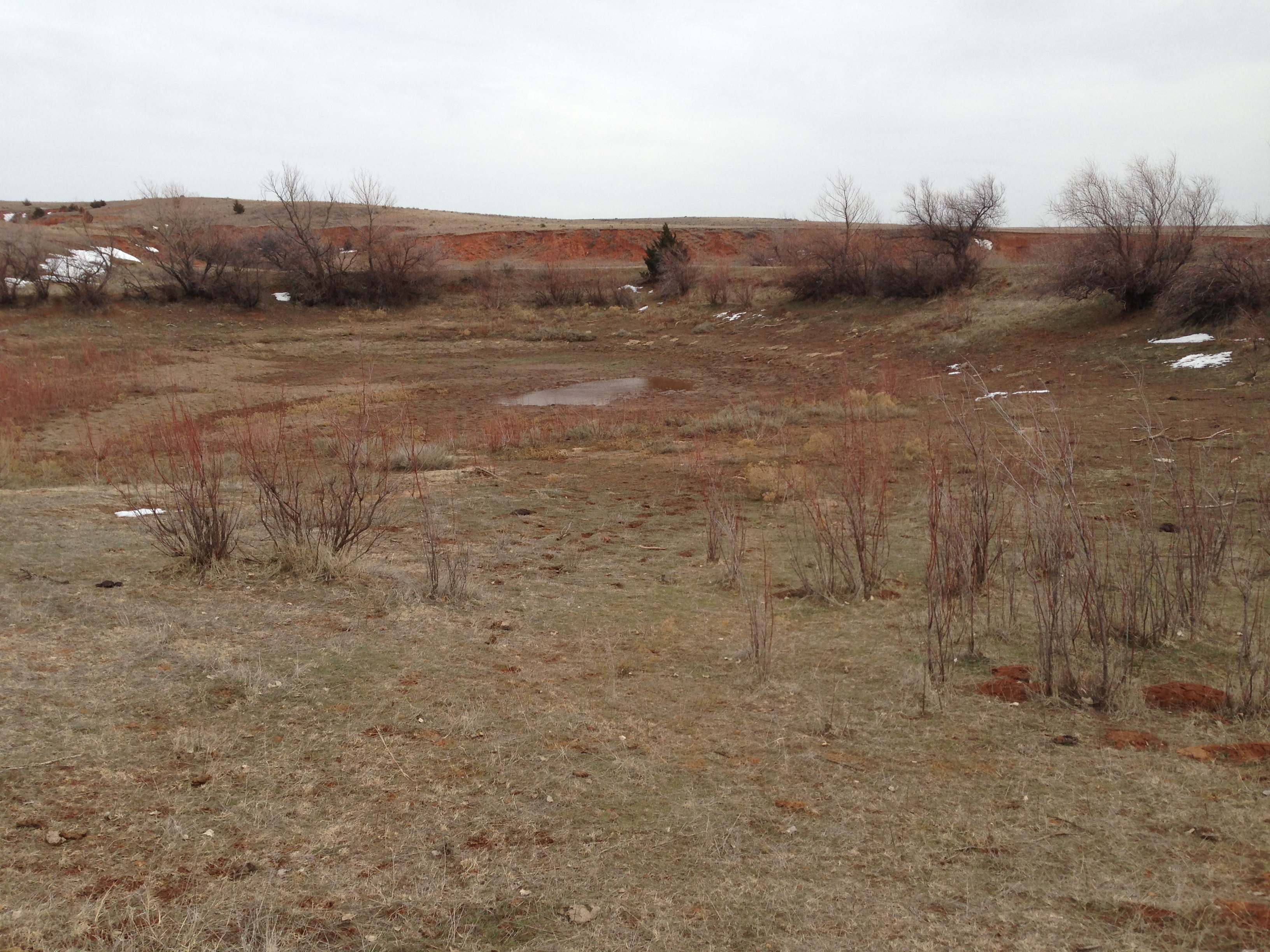
from January 8, 2014.
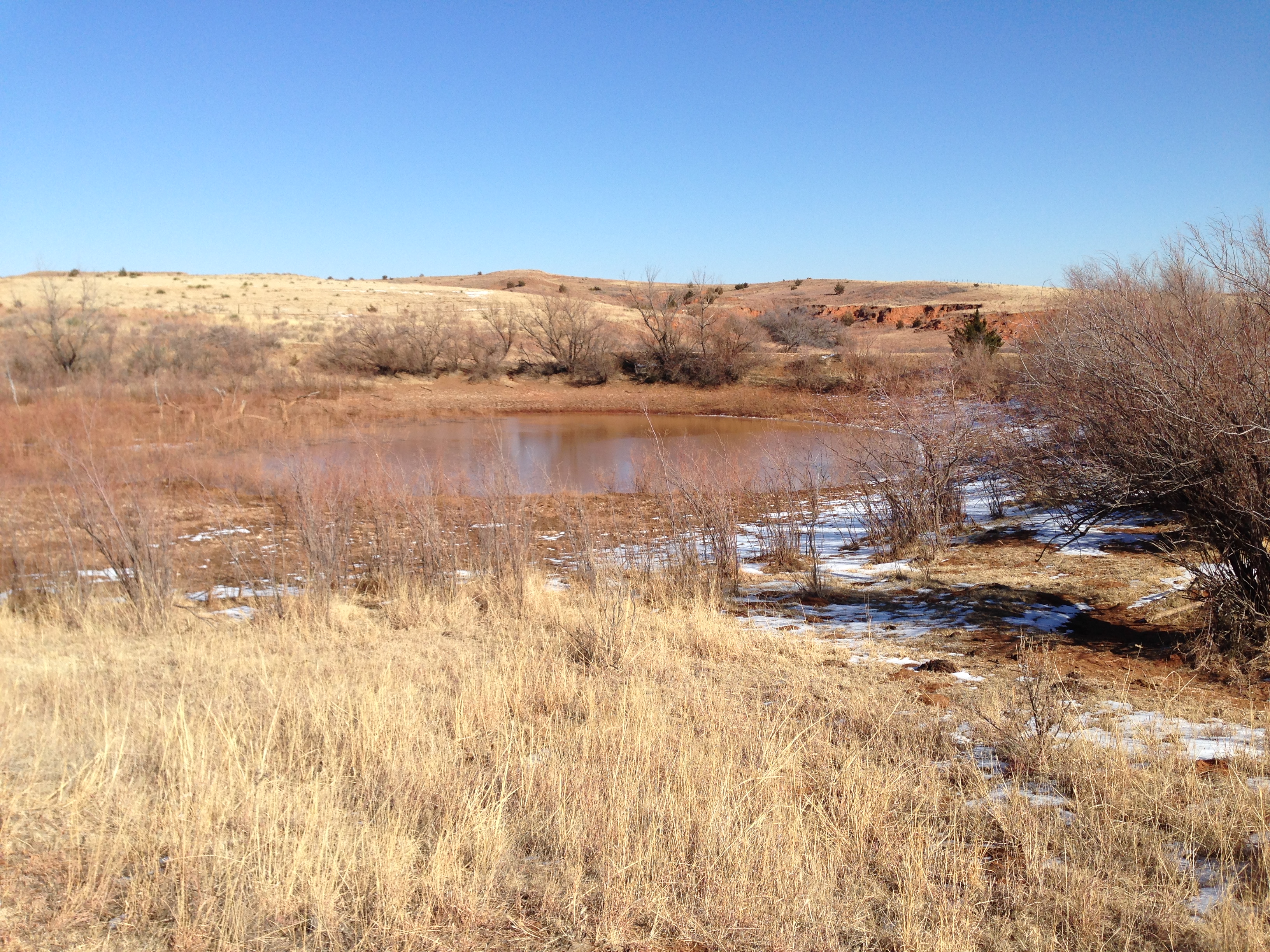
A bit underwhelming, unfortunately. It has gone from a small mudhole in March
to a bit of a bigger mudhole 10 months later. If it was summer, it would not
be suitable for the cattle to drink from, and definitely not enough water to
begin re-stocking any fish! It might have been at a higher level earlier in the
year when the rains were coming a bit more steadily, but the problem is the
moisture has largely gone away from western Oklahoma, especially in the
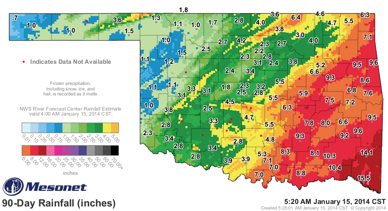
northwest. Here is the 90-day rainfall map from the Mesonet with radar-estimated
overlay. A scant 1.3 inches around Buffalo since early October (and it looks
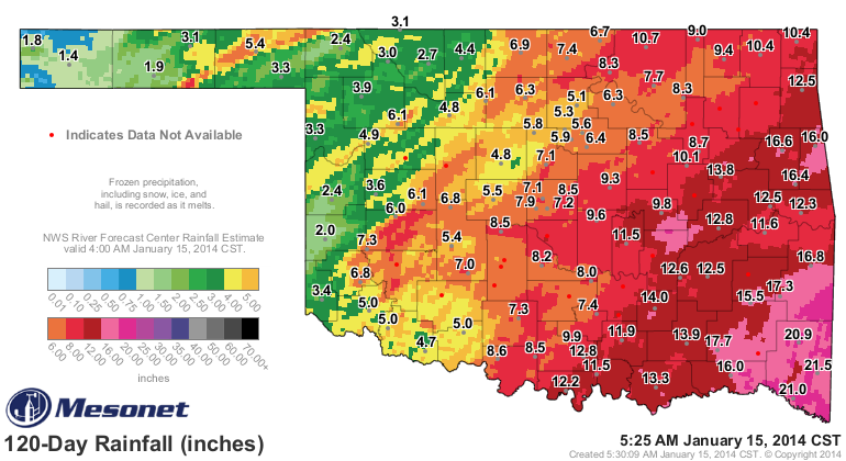
that way across much of the northwestern half of the state). The 120-day is no
beauty either.
It has now been 87 days since Buffalo has seen at least a quarter-inch of
moisture in a single day. Caveat: there might have been a period where more than
a quarter-inch stretched through midnight, but the point of the map remains the
same.
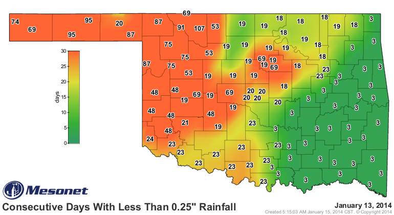
Alva is even worse at 107 days, but things are tough all over across much of
western Oklahoma extending northeast up into Payne County.
It's drought on the rise again. We are extremely lucky on two counts.
1. It's the cool season.
2. This cool season has been REALLY cool.
If this were August, we'd see a large part of western Oklahoma covered by
Exceptional (D4) drought. Now it has started to get warm again, however. The
winds have been ferocious. Fire danger is getting a head start by about a month.
No relief in sight just yet either ... all making a bad situation worse.
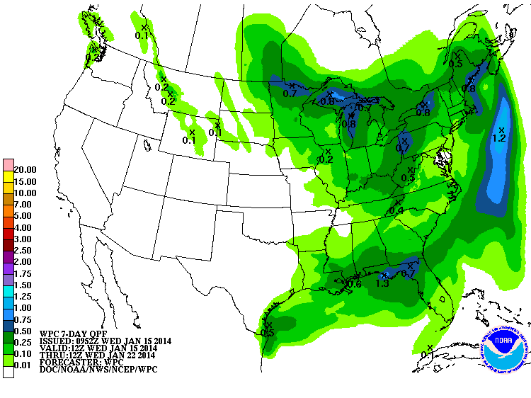
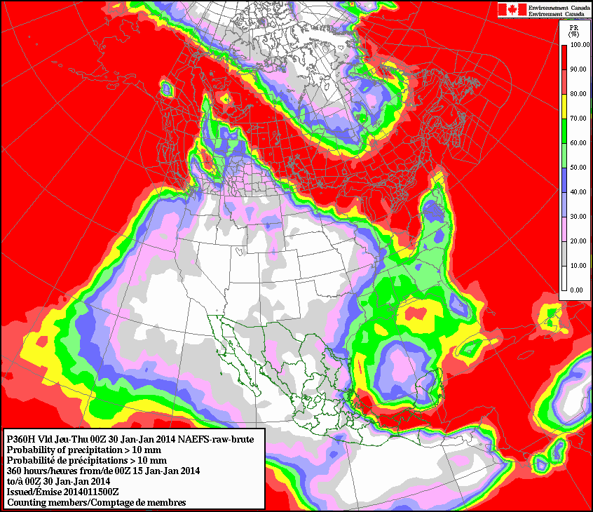
The Canadian forecast model we sometimes look at for precipitation probabilities
sees a ZERO chance of at least a half-inch of rain or so through the end of
January for much of Oklahoma.
Things can change around in a hurry and we can return to our more active pattern
of the last couple of months. At least it was active for the southeastern half
of the state. The problem is getting the northwestern half more active.
Until then, the fishing hole is closed.
Gary McManus
State Climatologist
Oklahoma Climatological Survey
(405) 325-2253
gmcmanus@mesonet.org
January 15 in Mesonet History
| Record | Value | Station | Year |
|---|---|---|---|
| Maximum Temperature | 78°F | CAMA | 2006 |
| Minimum Temperature | -11°F | NOWA | 2024 |
| Maximum Rainfall | 2.95″ | FAIR | 2017 |
Mesonet records begin in 1994.
Search by Date
If you're a bit off, don't worry, because just like horseshoes, “almost” counts on the Ticker website!