Ticker for January 14, 2014
MESONET TICKER ... MESONET TICKER ... MESONET TICKER ... MESONET TICKER ...
January 14, 2014 January 14, 2014 January 14, 2014 January 14, 2014
Where's Ken Burns when you need him?
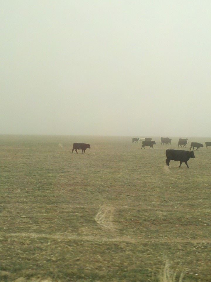
Tales of woe from drought-plagued western Oklahoma, but where to start? Might as
go with the more scenic story. As the cold front swept our 70s out from under
our feet on Sunday, the northerly winds that came with it swept something else
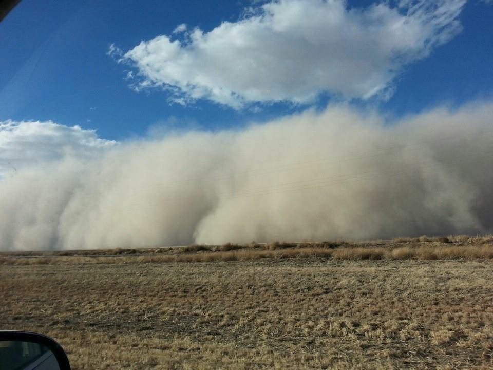
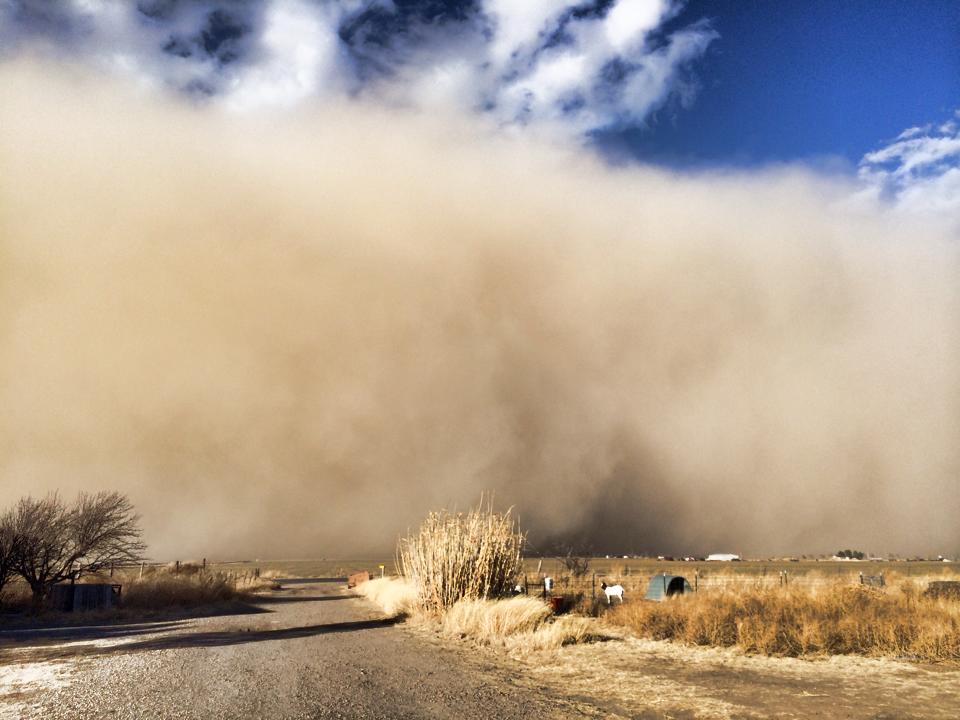
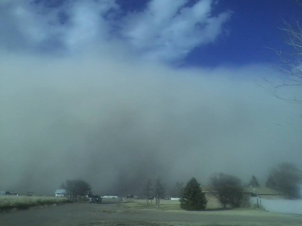
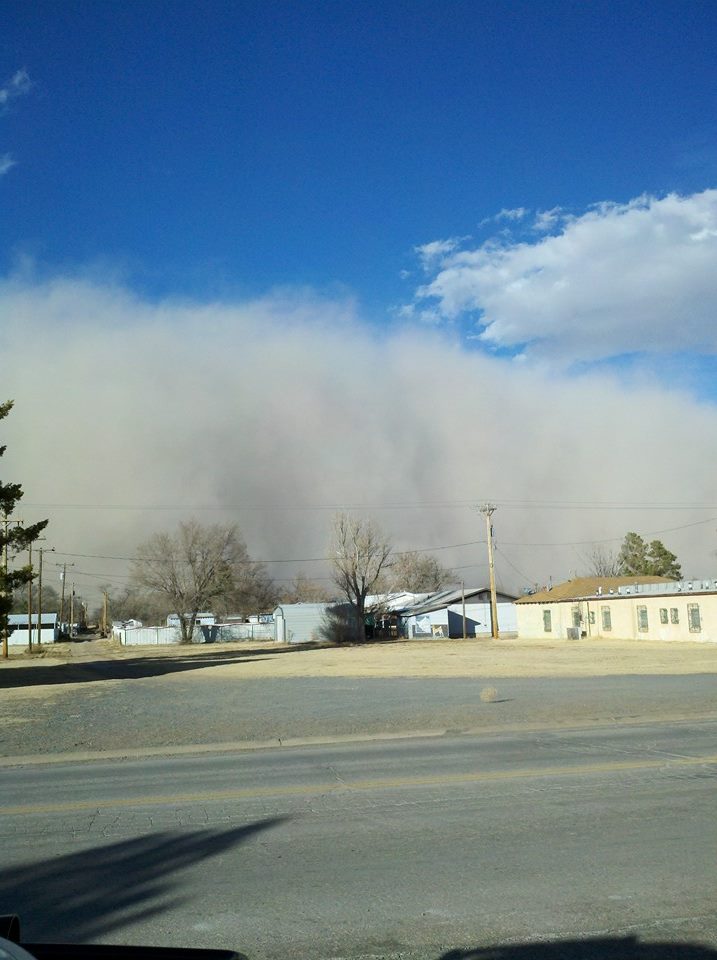
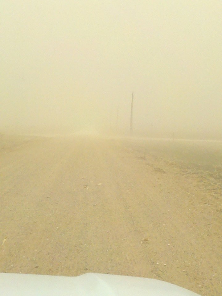
along with it our in the High Plains ... a good old fashioned 1930s style dust
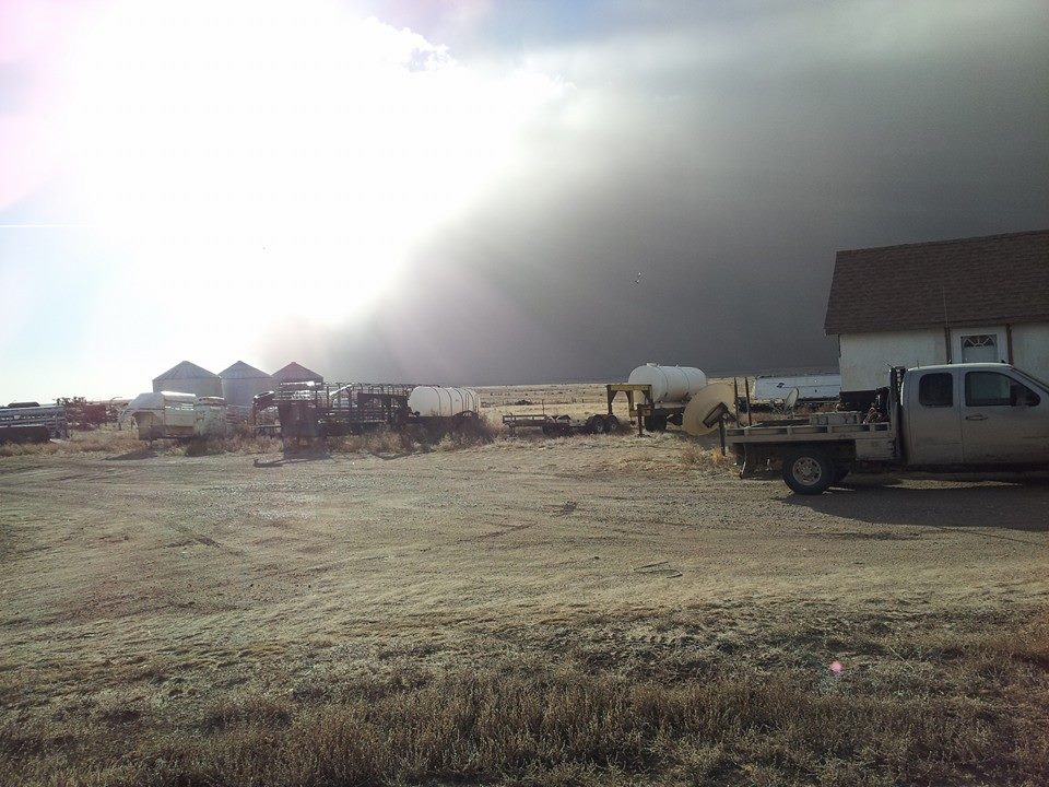
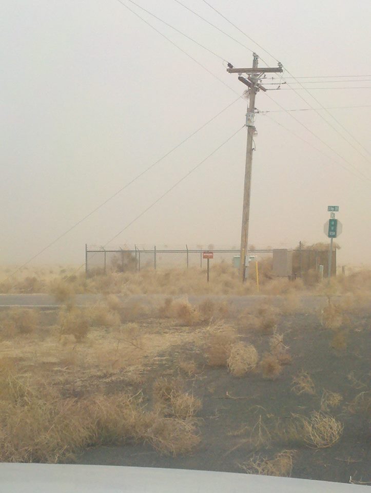
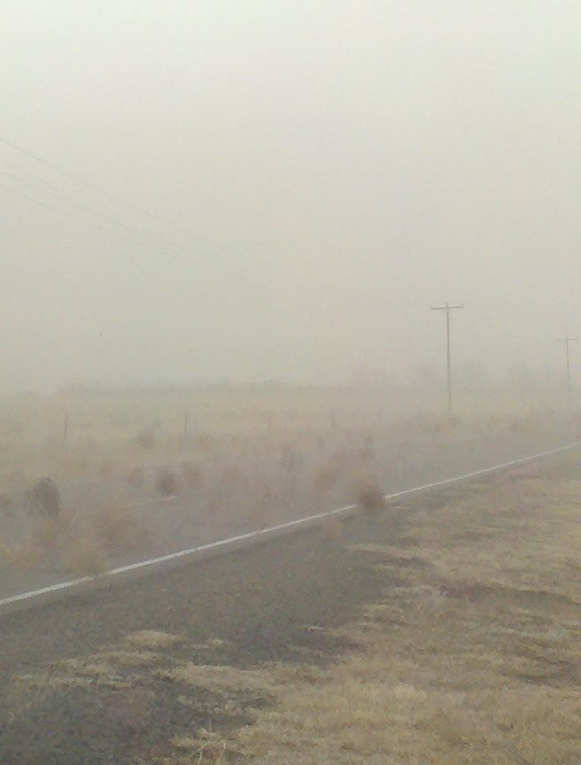
storm. The folks at the Cimarron County Conservation District were kind enough
to send us some pics of the towering wall of dirt as it bore down on Cimarron
County from SE Colorado. Check out the pictures here and tell me those don't
belong in a Ken Burns documentary!
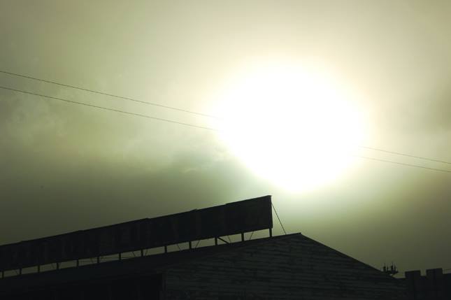
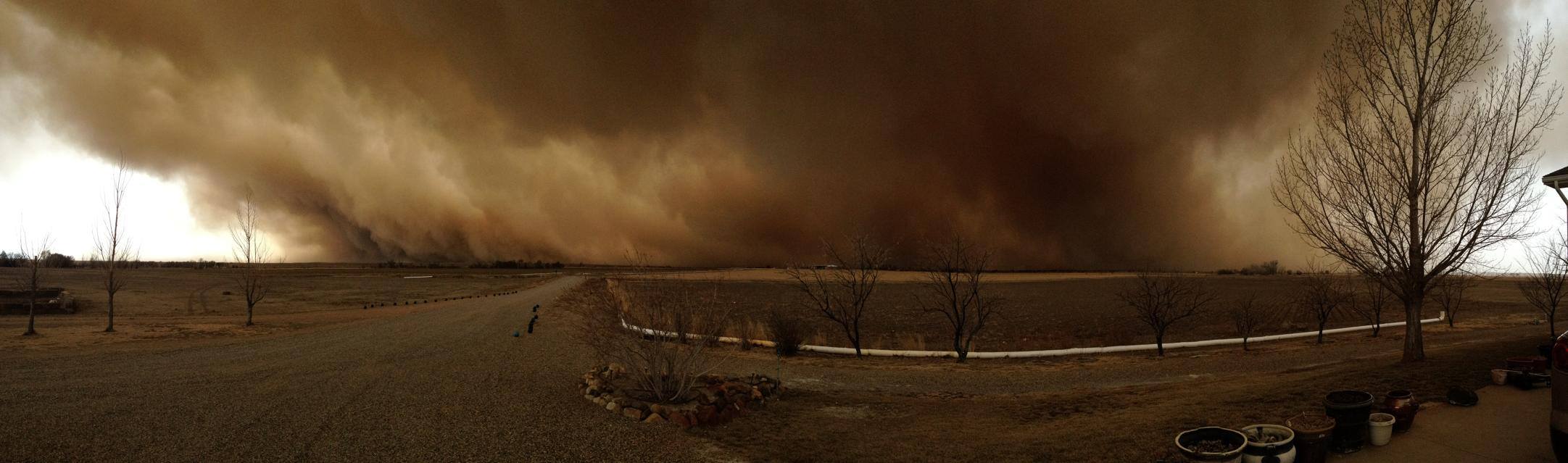
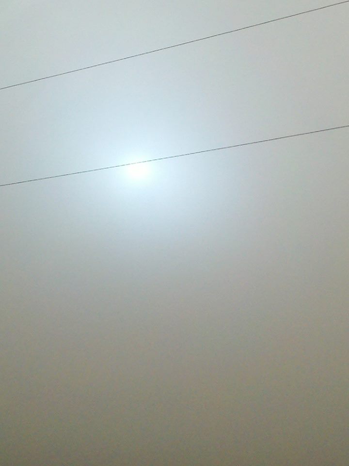
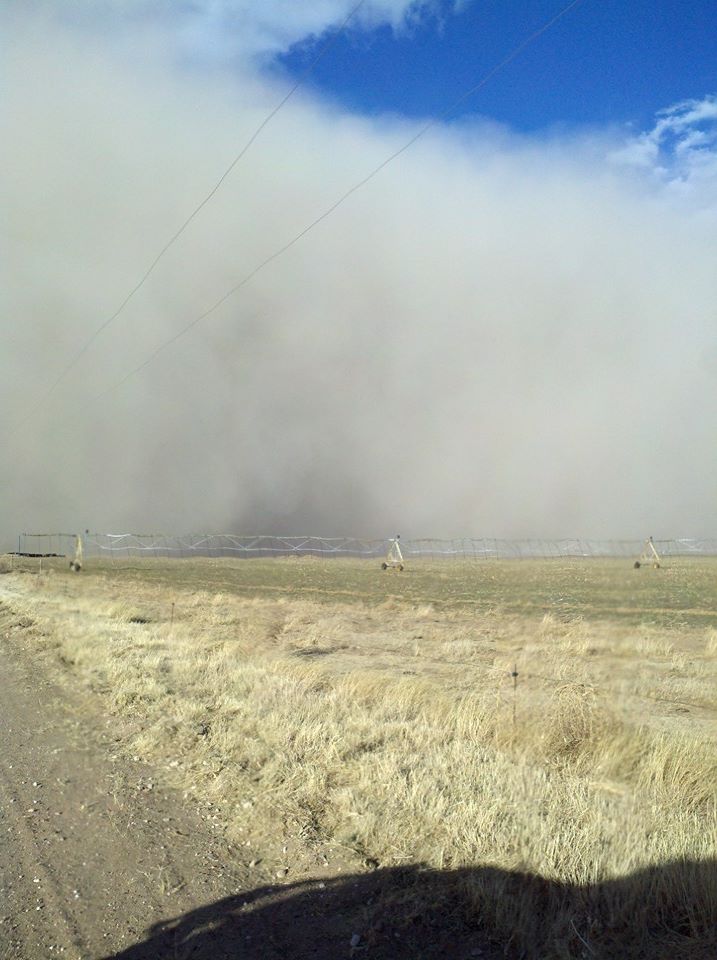
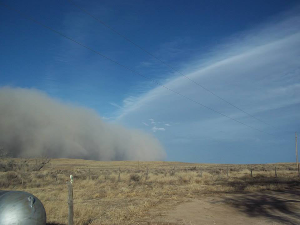
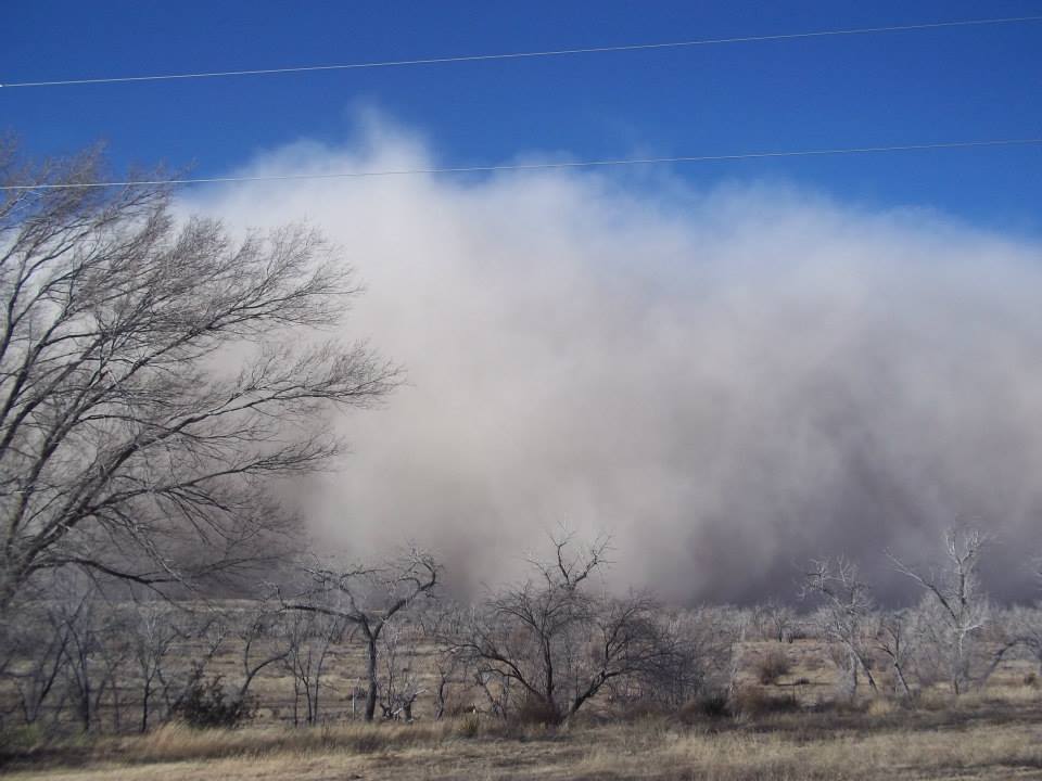
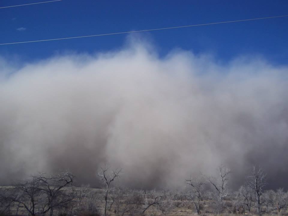
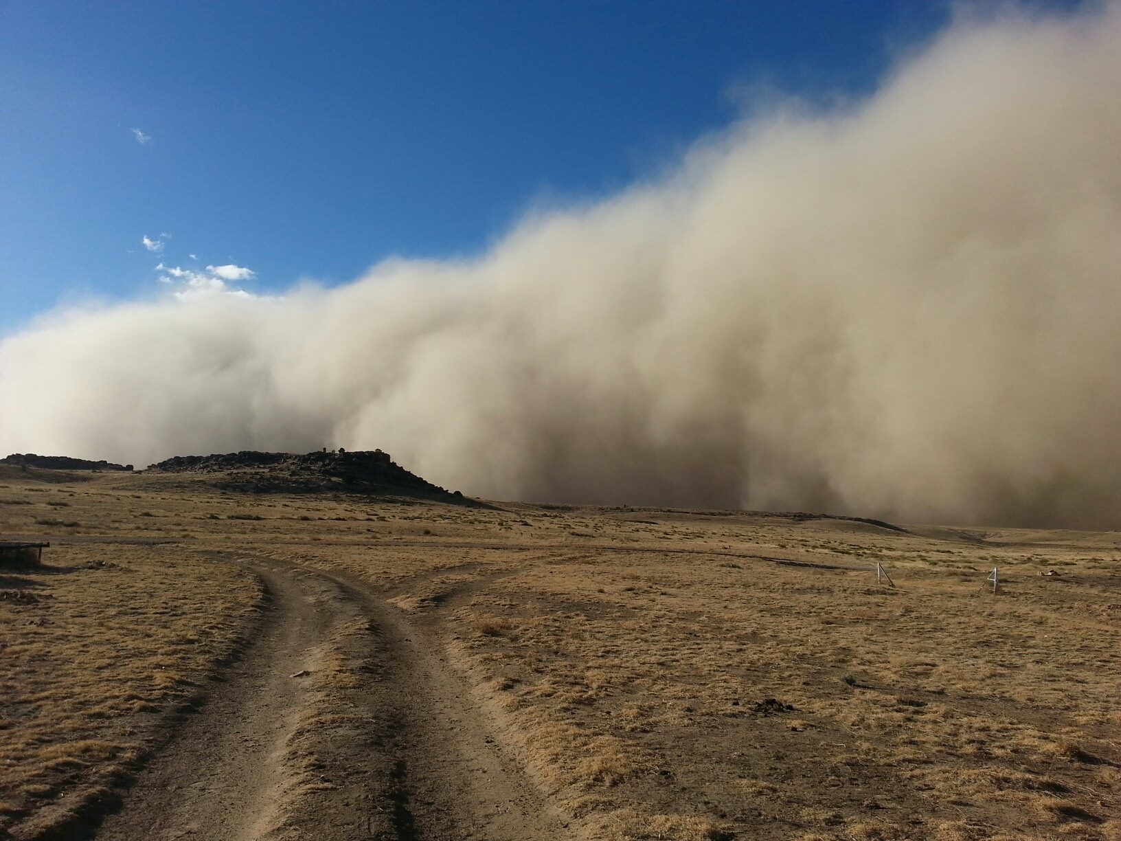
From what I can tell searching around various websites, the picture from near
La Junta, Colorado, (#6) appears to show the genesis of the event. The Cimarron
County folks tell me that the storm swept into the Boise City area around 4
p.m. That fits pretty well from what we can see from the meteogram at Boise City
on the 12th. Temperatures drop from the 60s into the 50s in about an hour as
winds switch from the west-southwest to northerly and gust to over 50 mph ...
right around 4 p.m.

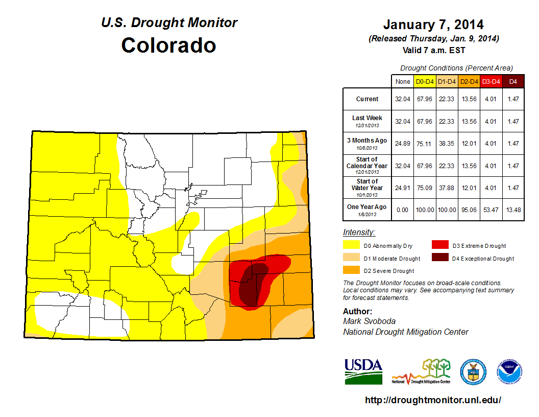
La Junta, Colorado, would be located right around that area of Exceptional
Drought (D4) there in SE portions of the state, so not a shock you could get
a nice duster started around there.
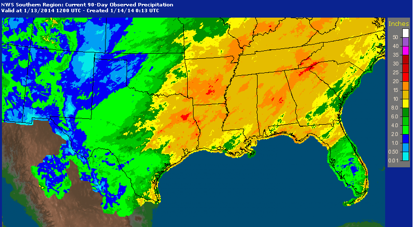
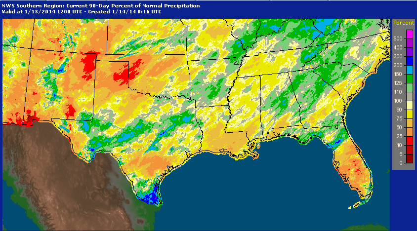
As you can see, the last 90 days have actually turned out pretty darned horrible.
The only saving grace, and this is a toughie, is that it has been cool for the
most part as the moisture deficits have once again started to accumulate. And
remember for out west, these are moisture deficits that have been going on for
more than three years now.
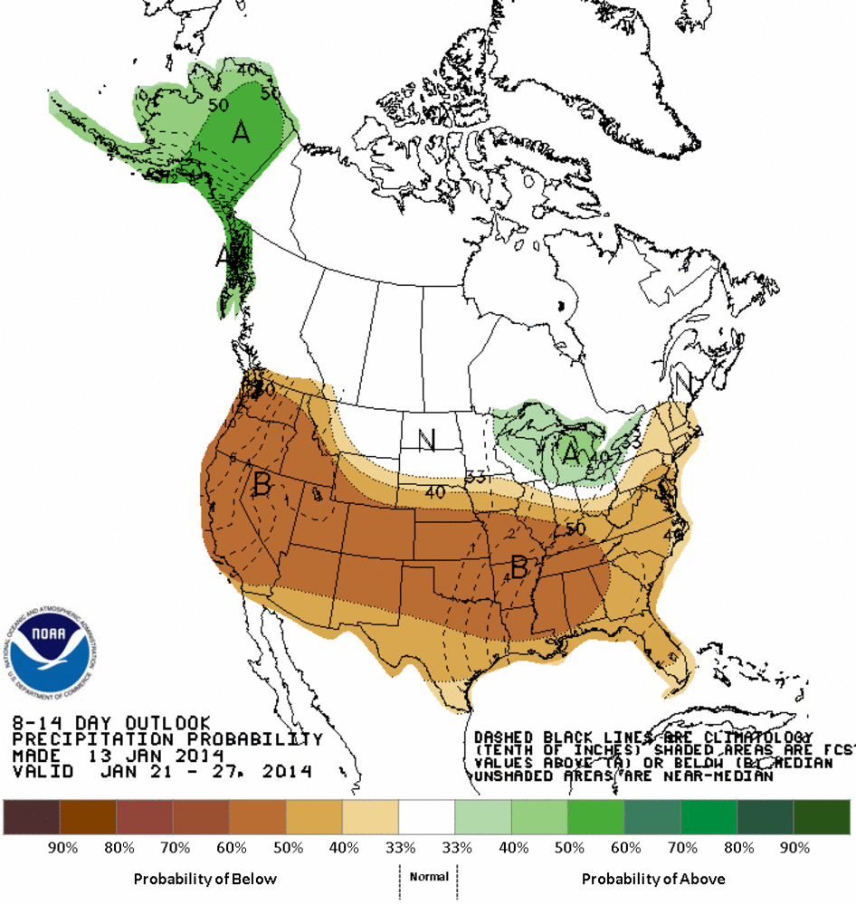
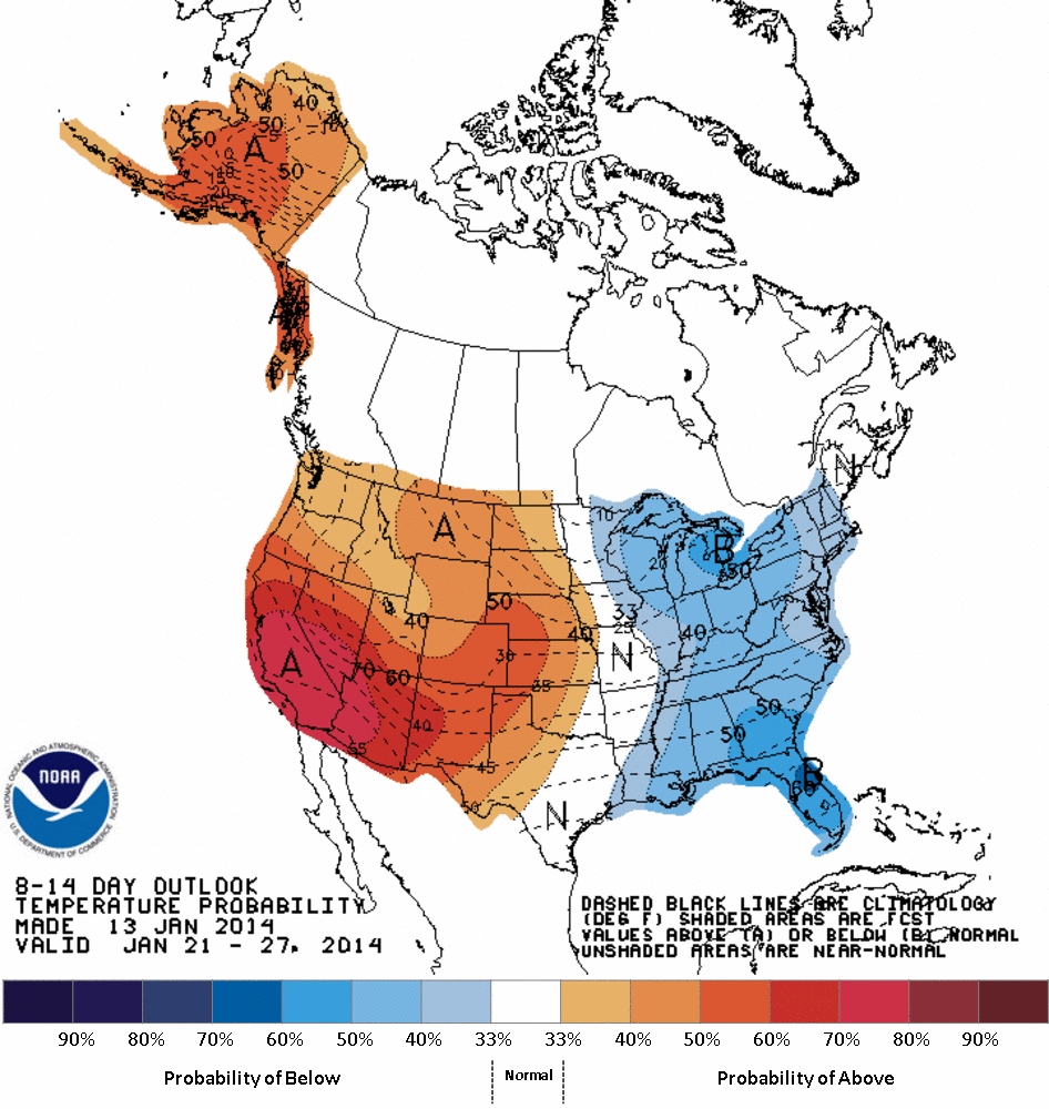
Relief? Well, we might be waiting awhile. The 7-day moisture forecast from WPC,
as well as the 8-14 day CPC outlooks tell us we're going to get a great big
heaping bowl of warm, dry January. Just what the doctor DID NOT order.
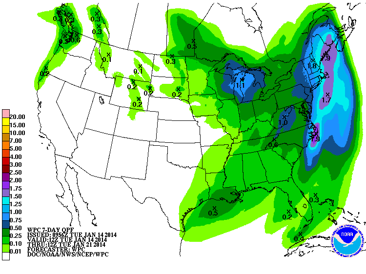
Remember, these are maps of probabilities, not amounts, so what you see here
indicate increased odds of above normal temps and below normal precipitation
across most of the western U.S., including Oklahoma. The dry slant to the
moisture extends across most of the U.S., actually.
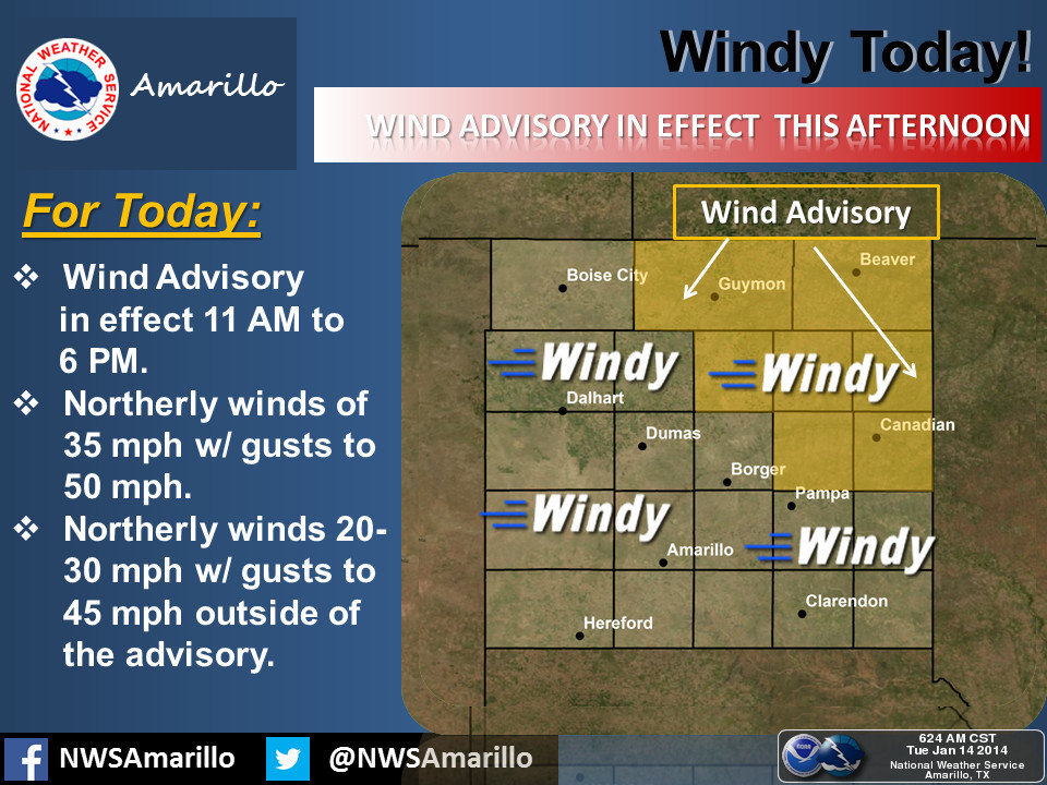
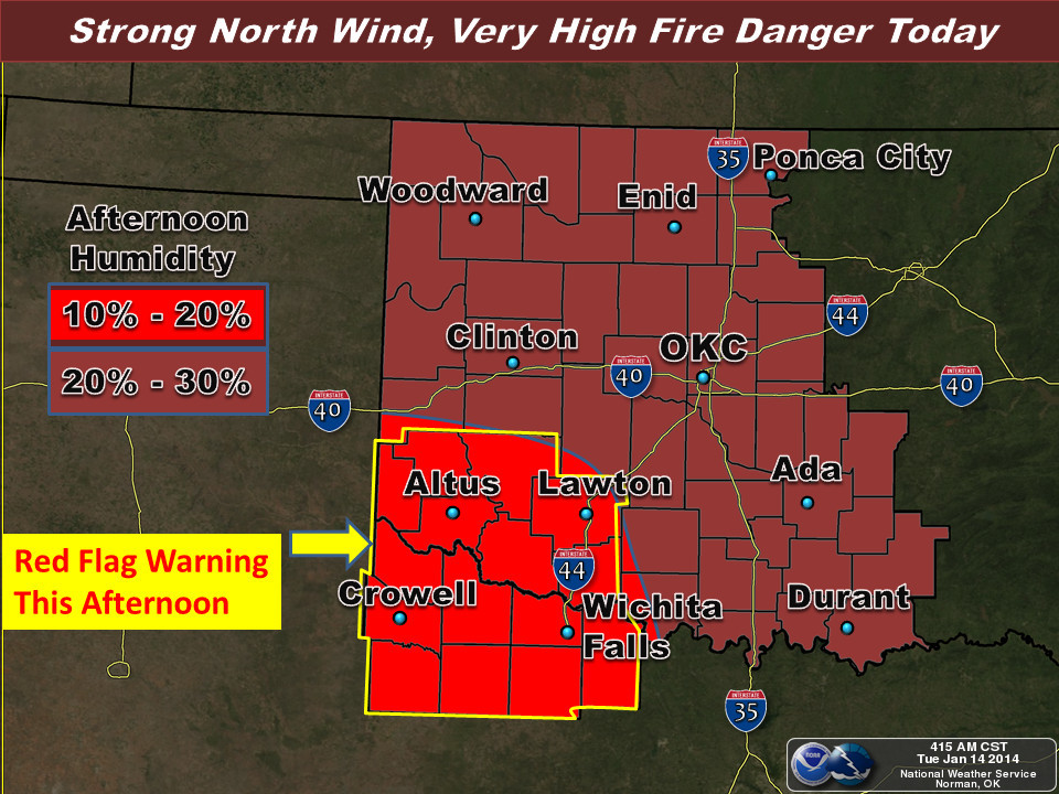
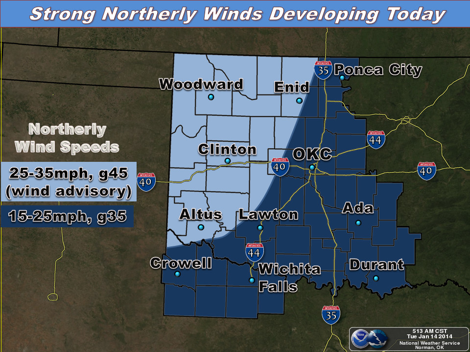
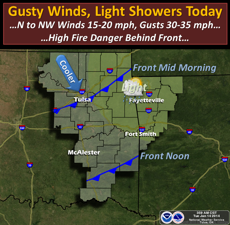
As for today, much the same scenario that we saw on Sunday with strong winds and
low humidity creating high fire danger across the state. Things in SW OK are
looking particularly dangerous and thus a Red Flag Fire warning is in effect
for that area. Basically, fires may start easily and spread rapidly. No outdoor
burning should be occurring. Regardless of the absence of the Red Flag warning
over the rest of the state, and despite the slight chance for light rain, the
entire state will see enhanced fire danger today.
Here's the view from our local NWS offices.
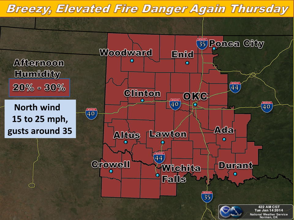
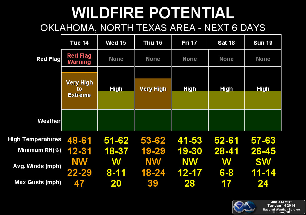
We haven't even reached our primary fire season just yet, usually as we get
into February, so this is not a good start. Maybe we can douse the fires with
dust? Just trying to make lemonade from dirt.
Gary McManus
State Climatologist
Oklahoma Climatological Survey
(405) 325-2253
gmcmanus@mesonet.org
January 14 in Mesonet History
| Record | Value | Station | Year |
|---|---|---|---|
| Maximum Temperature | 74°F | ERIC | 2020 |
| Minimum Temperature | -11°F | VINI | 2024 |
| Maximum Rainfall | 2.39″ | BROK | 2007 |
Mesonet records begin in 1994.
Search by Date
If you're a bit off, don't worry, because just like horseshoes, “almost” counts on the Ticker website!