Ticker for June 27, 2024
MESONET TICKER ... MESONET TICKER ... MESONET TICKER ... MESONET TICKER ...
June 27, 2024 June 27, 2024 June 27, 2024 June 27, 2024
Uncommon
Now listen here (and there, wherever "there" is, which is not "here" because I'm
"here" and you're not)...any Oklahoman worth their salt is more discerning about
the weather than to see one of the highest heat indexes in the Mesonet era
during June and simply say "it's summer."
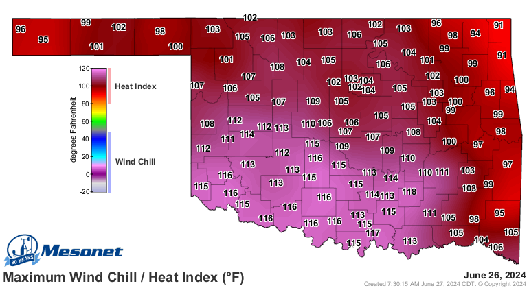
That 117 at Madill was only the 11th time in Mesonet history that we've seen
such a high heat index during June, so that's 30 years X 30 days in June X 120
Mesonet sites, or 108,000 possible readings. And that's the 11th. Interestingly,
5 of those 11 occurred last year, including the overall highest of 120.2 degrees
on June 19, 2023. Two occurred in 1998, and the other three in 2016. In
other words...uncommon heat. And it matters that it's this early, even though
yes, "it's summer." There's a natural order of things in weather and climate that
even Mother Nature tends to follow here in Oklahoma. Not always, of course. That's
where we get extremes. Extremes, like yesterday, upend the normal order of things
and cause problems. We usually get a ramp up of the heat over June into July that
allows some acclimation. Not that there's really too much acclimation to 117
degrees, but when it's suddenly hitting the heat index maps after just a few
days of oppressive heat, it's all the more dangerous.
The point is, we can't just chalk it up to "it's summer." Who here (didn't we
cover that already?) actually believes June is like July, and July is like
August, or August is like June, when it comes to Oklahoma's weather? It's all
summer, right? Who believes early June is like late June? Or late August is
like early July? No, we Oklahomans are more nuanced and knowledgable about the
weather than that, even if we (meaning, me) are not nuanced enough to know how
to spell knowledgeable.
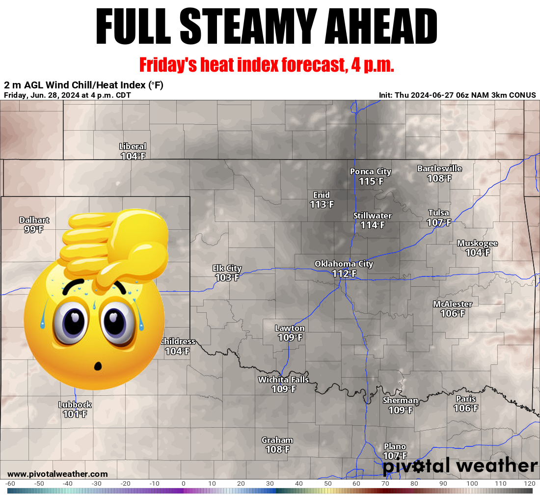
So no, not just "summer." It's very much an extreme for June, and it's dangerous
to the health and safety of Oklahomans, especially those most vulnerable, like
the elderly who might not have proper cooling capabilities where they live. And
for those working or living outside as well. While some of the state gets a
break today, SW OK will still be sweltering in dangerous territory, before
tomorrow's pressure cooker for the rest of us.
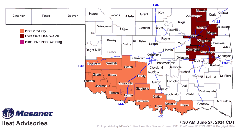
NWS Tulsa already has part of its region in an Excessive Heat Watch for tomorrow,
and expect much of the state to follow suit for Friday.
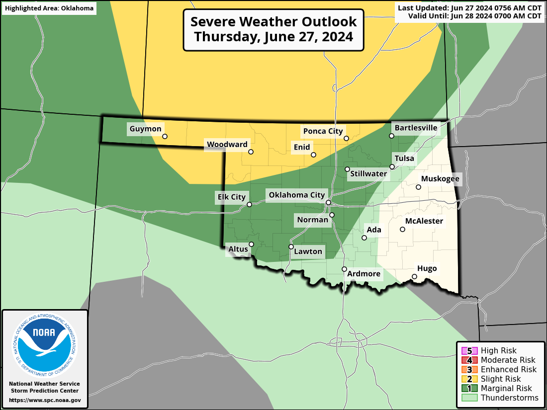
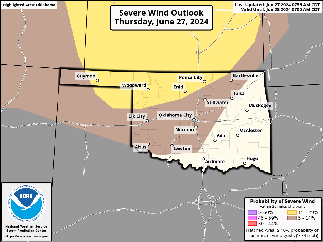
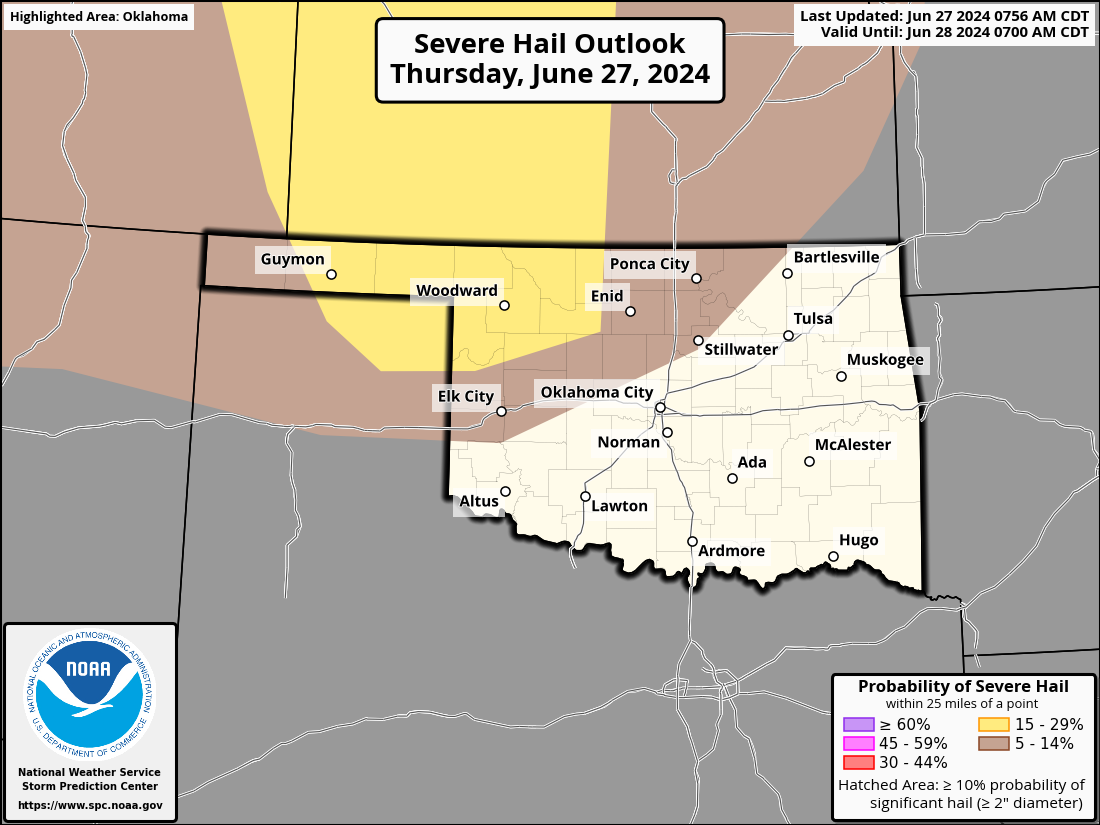
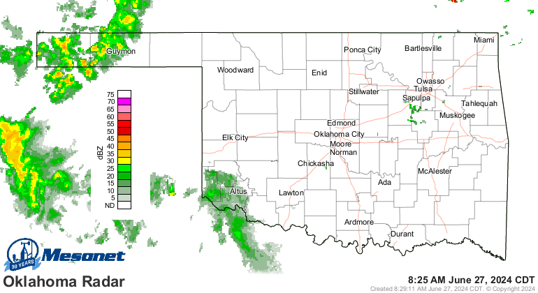
All this heat and humidity should continue generating some storms over the next
few days, with severe weather a possibility later this afternoon into tonight.
Chances for severe weather are highest across northern Oklahoma, but anywhere in
the shaded regions have the possibility for that to occur. So stay weather aware
today.
The rain that has occurred over the last few days might actually help stave off
some areas of the state falling into flash drought. I hope so, because that wind
and hail was worthless! You'll notice by today's new U.S. Drought Monitor that
we have greatly increased Abnormally Dry Conditions (D0) in the state from
16% of the state last week to 32% this week. While not an actual drought category,
Abnormally Dry Conditions designate areas either coming out of drought, or in
this case areas in danger of going INTO drought. Notice that D1 stayed about
the same with around 20% of the state in moderate drought (D1). And in good news,
the heavy rains in the Panhandle relieved much of the drought pressure in that
area.
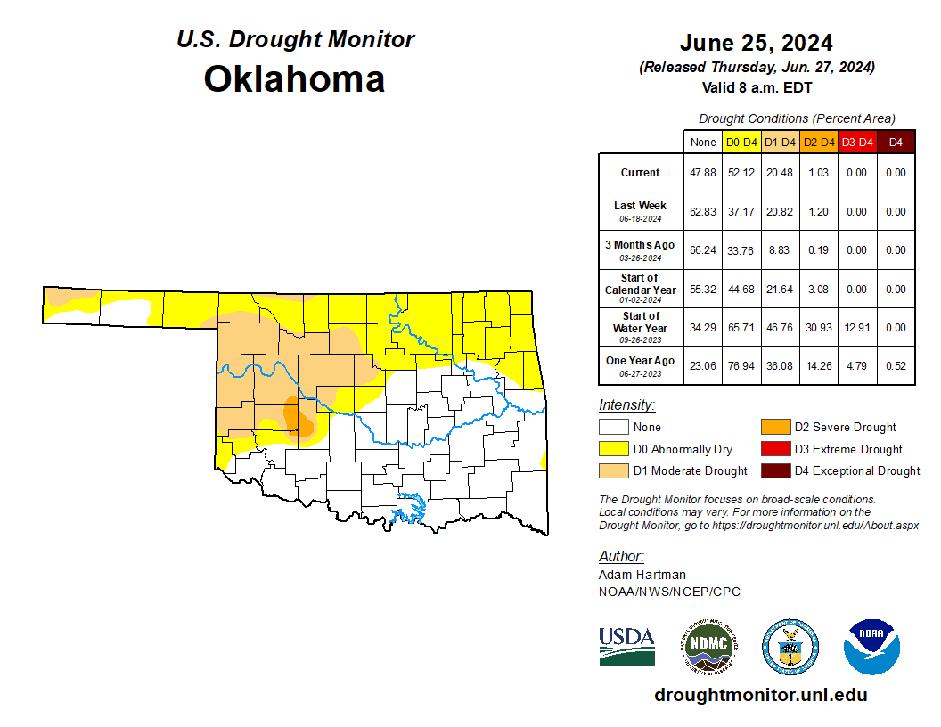
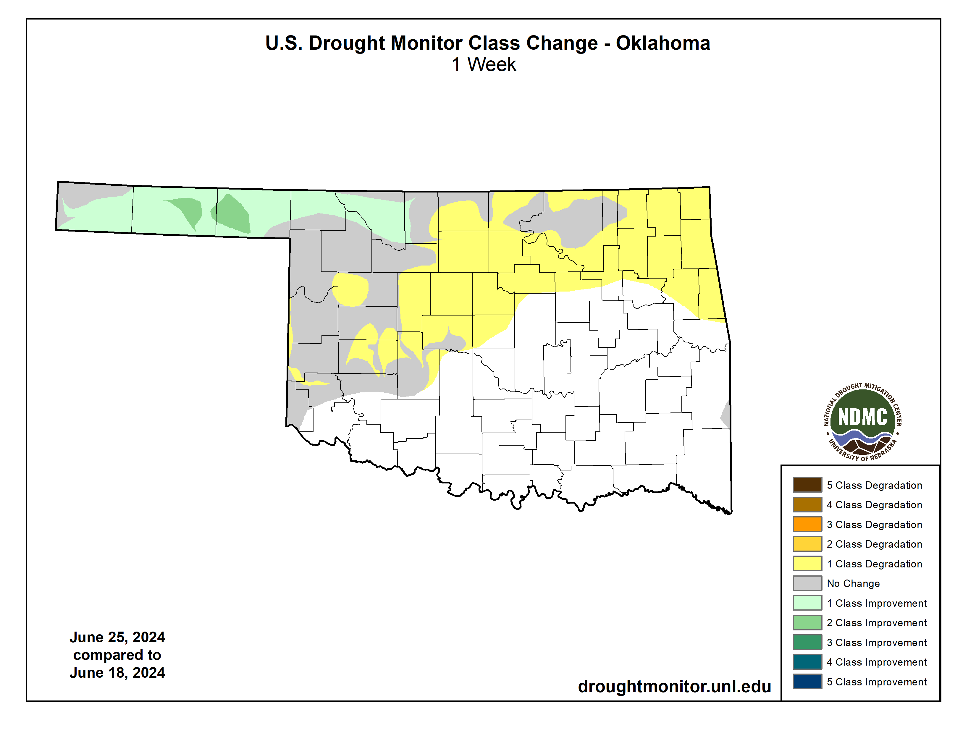
Most of the D1 area missed out on the rains over the last few days, but some of
that new D0 area threatened by flash drought did receive decent moisture (sorry,
no indecent moisture...this is a family Ticker).
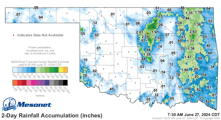
Hopefully the storms aren't too bad tonight, but maybe that area in NW OK can
get some good rains. Heck, it's raining right now for crying out loud!
As for the heat, we get a bit of a break this weekend, and then maybe around
July 4th. But for the most part, it's full steamy ahead.
Our statewide average high temps are about 5 degrees above normal over the
last week or so (dark color), but adding in the humidity is nearly doubling
that anomaly (orange color).
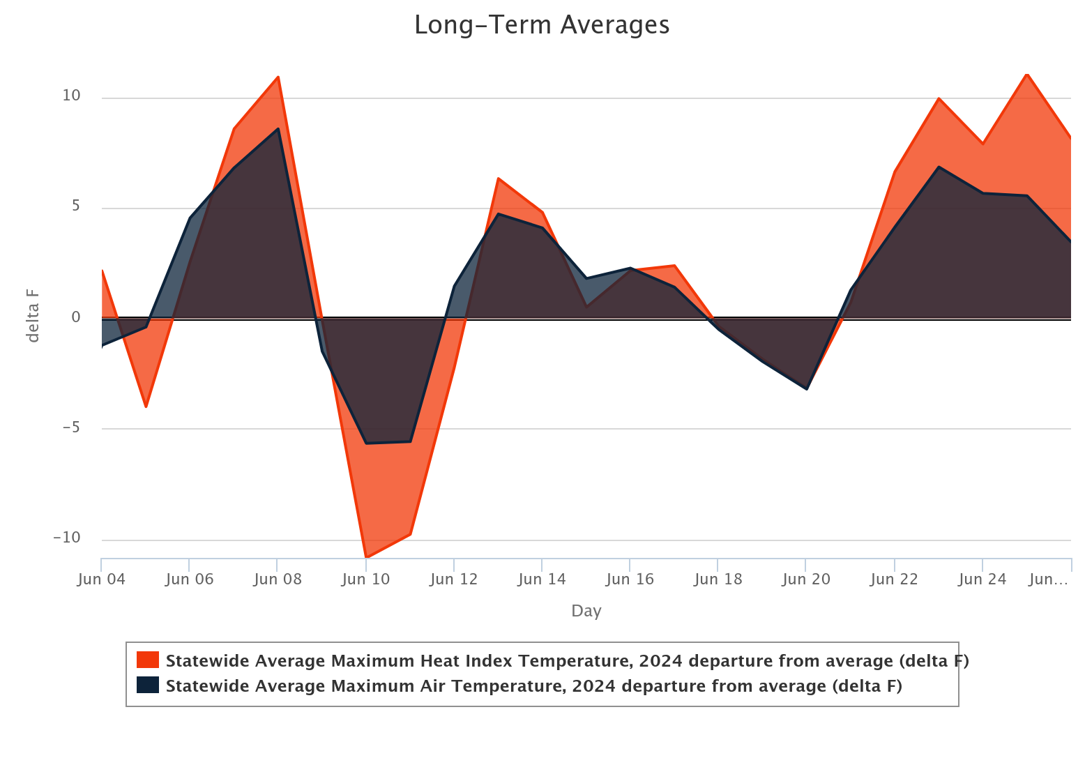
It was also pretty high in early June, but the "normal" early June maximum
heat index isn't the same as the late June maximum heat index. A light bulb
should have just gone off in your head (unlike mine, which is just a mix of
Cherry Pop-Tart and drought images) from our discussion in the 2nd and 3rd
paragraphs above.
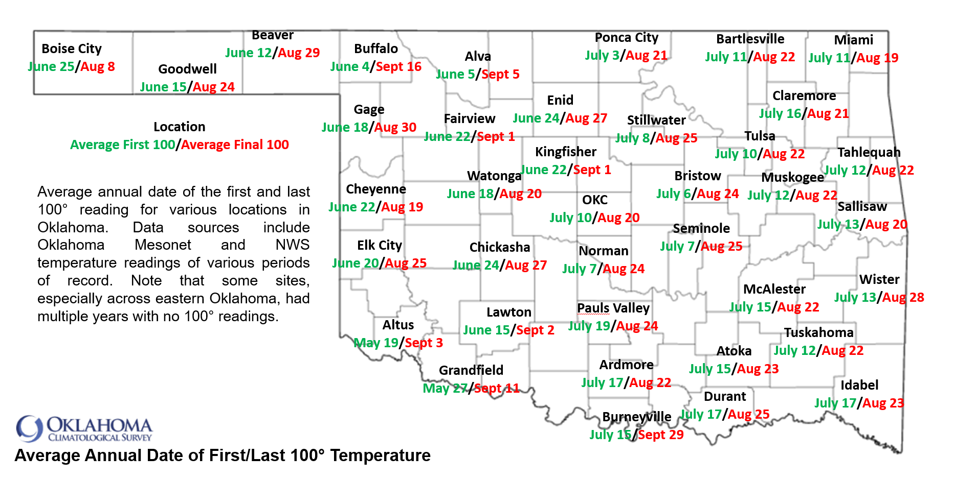
Has your region hit 100 degrees yet, actual air temps? Is that early or late?
This map might help you decide if you're ahead of schedule, or behind, for your
region.
Stay tuned for my next missive, which is titled "What's the deal with Fairview?"
Gary McManus
State Climatologist
Oklahoma Mesonet
Oklahoma Climatological Survey
gmcmanus@ou.edu
June 27 in Mesonet History
| Record | Value | Station | Year |
|---|---|---|---|
| Maximum Temperature | 112°F | BUFF | 2012 |
| Minimum Temperature | 50°F | COOK | 2003 |
| Maximum Rainfall | 4.21 inches | KING | 2007 |
Mesonet records begin in 1994.
Search by Date
If you're a bit off, don't worry, because just like horseshoes, “almost” counts on the Ticker website!