Ticker for November 17, 2015
MESONET TICKER ... MESONET TICKER ... MESONET TICKER ... MESONET TICKER ...
November 17, 2015 November 17, 2015 November 17, 2015 November 17, 2015
The aftermath

Well, last night ended up being as bad as advertised and then some. Things were
probably a tad worse in the High Plains of Texas and Kansas, judging by the media
reports, but our Panhandle and northwestern corner also had a few bouts with
twisters. Including the mecca of all Oklahoma towns, Buffalo! In fact, I think
a tornado (or at least a large mesocyclone) possibly went right over my favorite
little pond 8 miles S of Buffalo. If not, it was darned close.
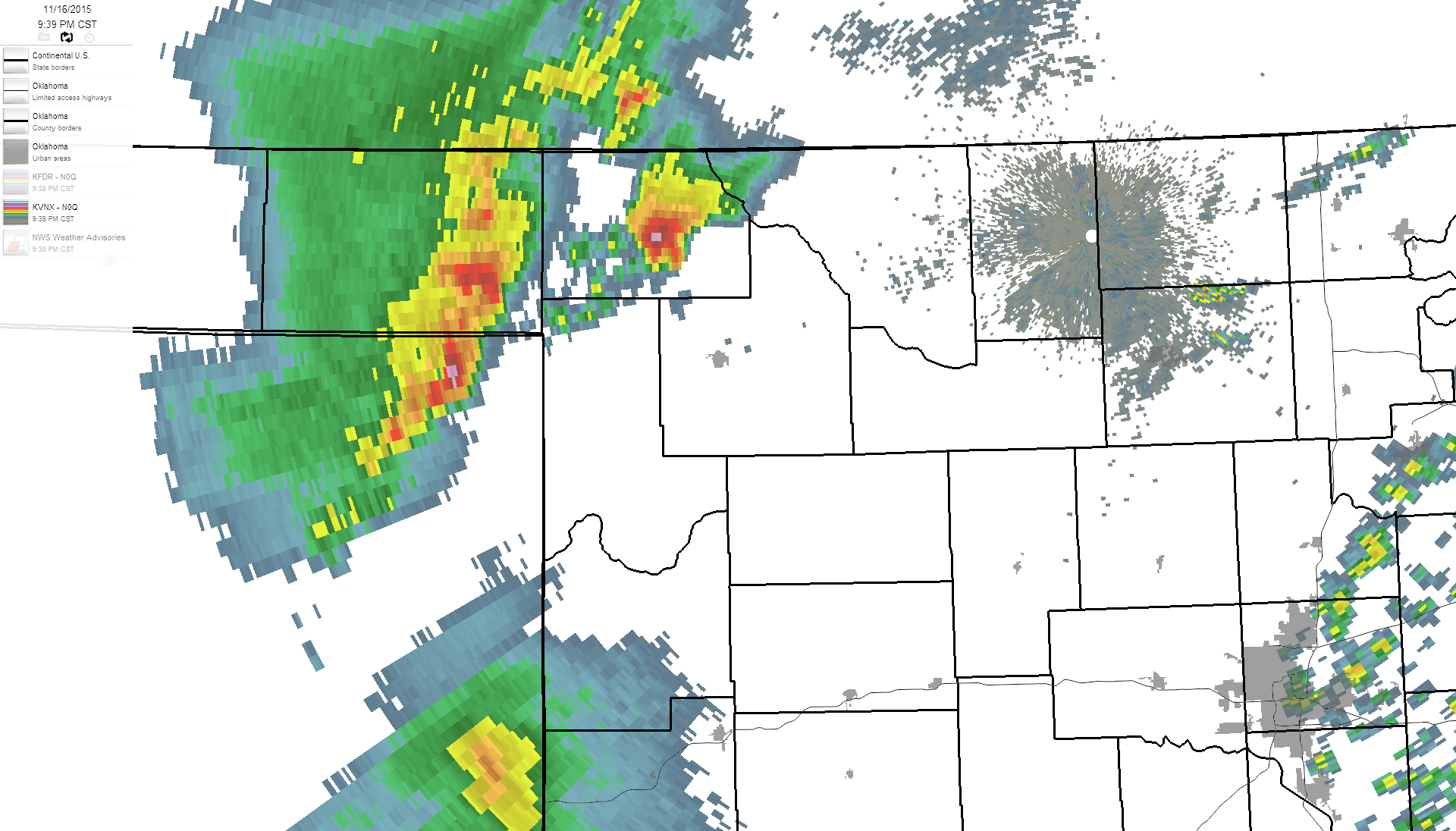
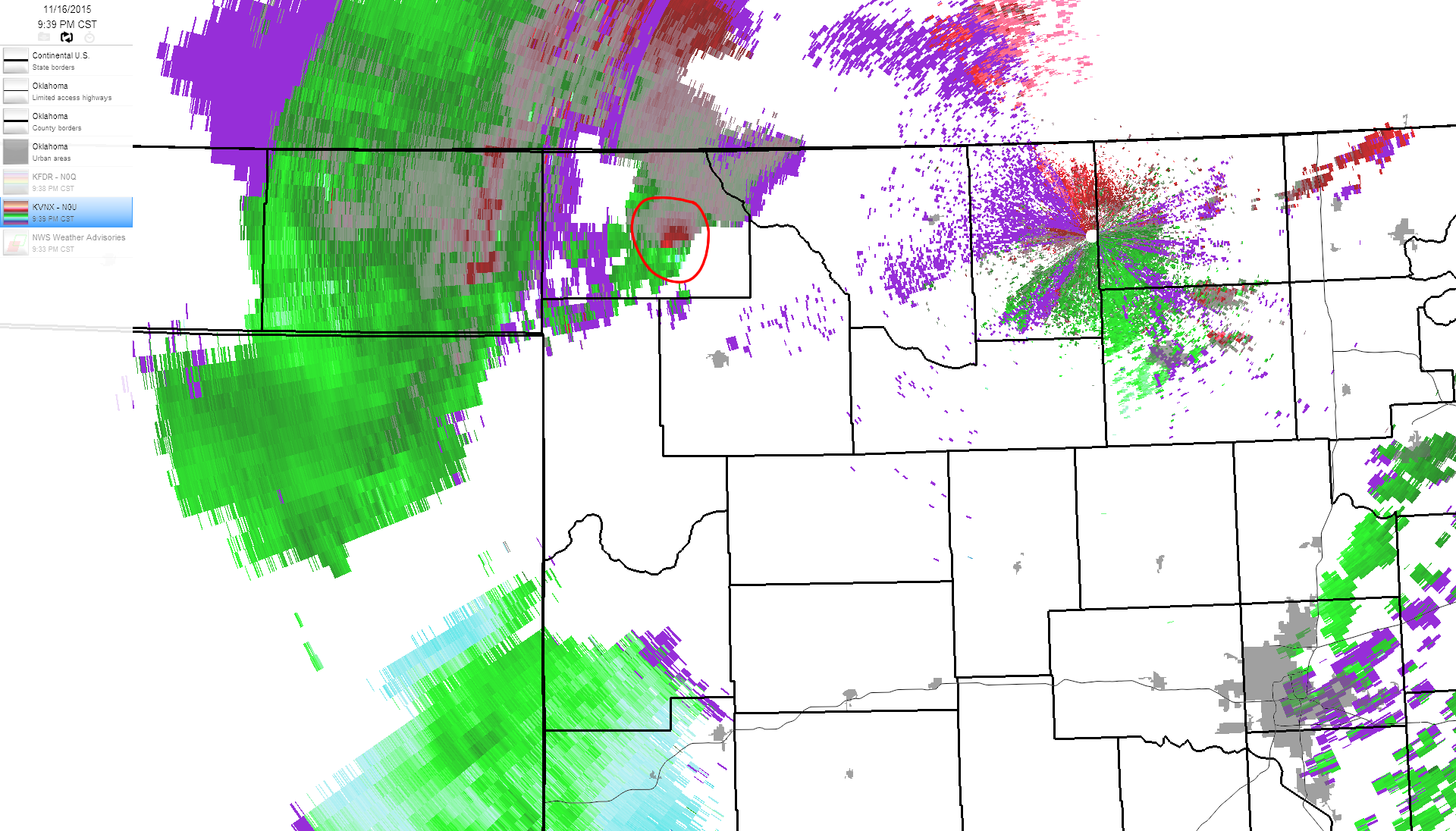
You can clearly see the velocity couplet on that last doppler radar pic I posted
(especially since I circled it in red). But, that area was not the only spot
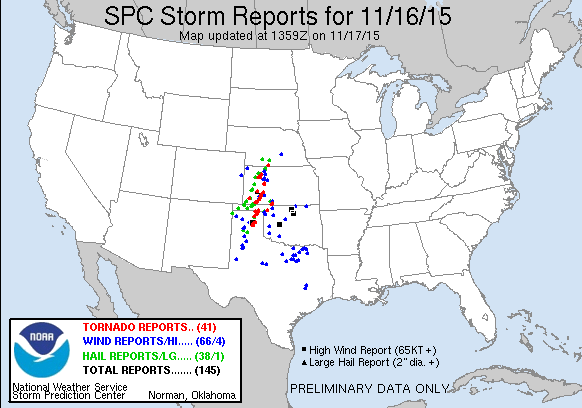
targeted by severe weather last night. The SPC storm reports page shows all the
severe weather events THAT WERE REPORTED. There were undoubtedly countless more
episodes of hail and winds, and judging again from the media coverage, a few more
tornadoes as well.
And who needs tornadoes when you see the severe wind gust maps from yesterday
and today (thus far). 99 mph at the Red Rock Mesonet site up in Noble County.
Holy frijole!! That makes the 60+ mph gusts scattered about seem like kids
play.
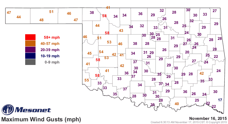
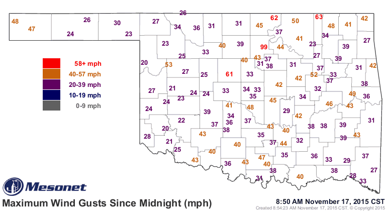
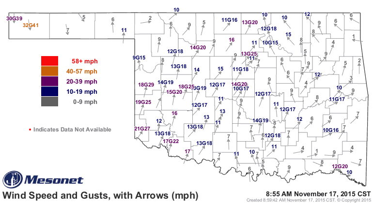
By the way, those near-50 mph gusts up in the far western Panhandle are not
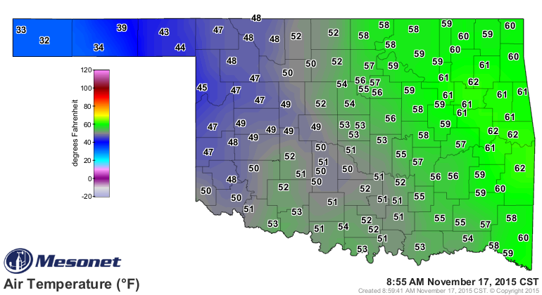
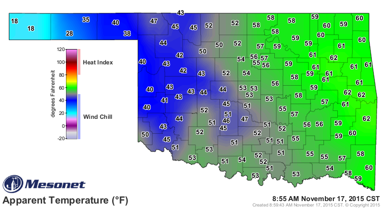
associated with thunderstorms. It's just really really windy now, and it's cold
as all get out up that way. Winter has entered the state for sure now. WIND
CHILLS OF 18 DEGREES??? No thanks, man!!
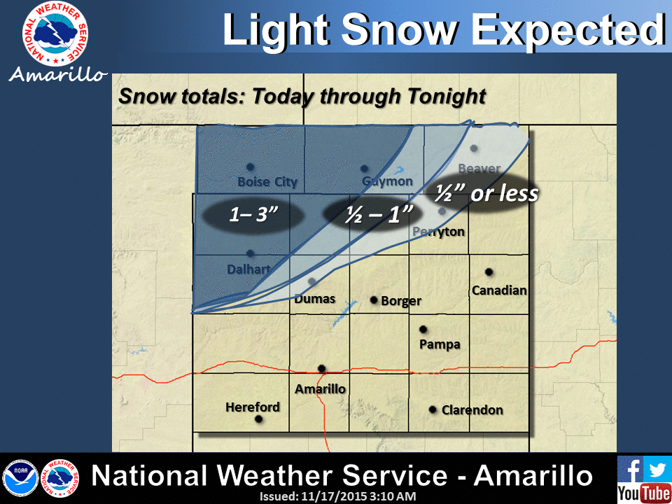
And while it's still raining like crazy to the east of I-35, there might be a
few flakes out in the Panhandle. And some snow too. The Amarillo NWS office says
maybe 1-3 inches across the western half of the Panhandle.
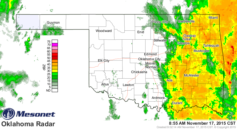
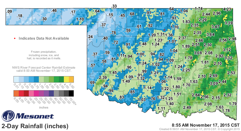
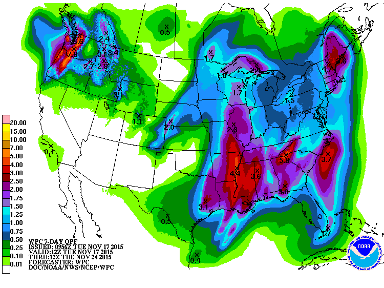
Let's talk about that rain, even though the totals will be exploding for awhile
to our east. Over the last couple of days, we've seen the eastern half of the
state get from 2-4 inches, and even parts of western Oklahoma have reached an
inch or more.
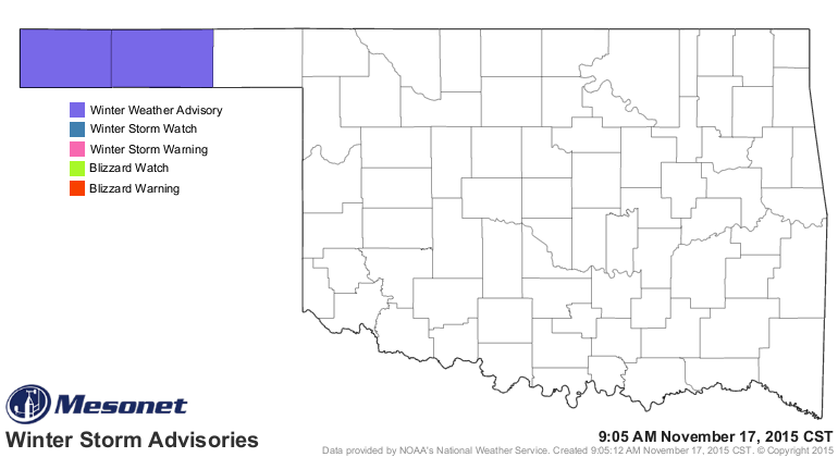
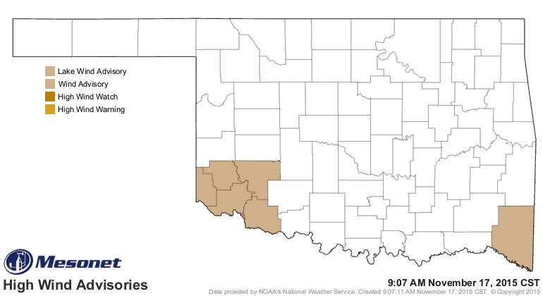
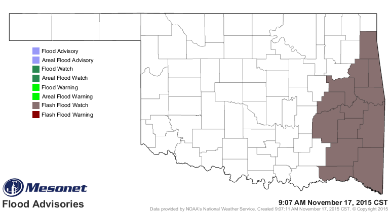
So much action left, it's tough to get it all out! Just looking at the advisories,
we have a winter weather advisory for the Panhandle, wind advisories for the
SW and SE, and a flash flood watch for the eastern quarter.
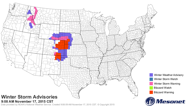
In some ways, the Panhandle got darned lucky, because blizzard warnings are
just a county away.
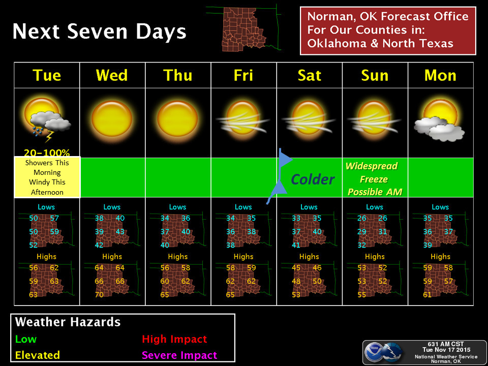
Eventually one of these storms is going to have some cold air to work with, and
then we'll be cooking with gas as far as winter is concerned. Maybe not this
week, but sometime!
Gary McManus
State Climatologist
Oklahoma Mesonet
Oklahoma Climatological Survey
(405) 325-2253
gmcmanus@mesonet.org
November 17 in Mesonet History
| Record | Value | Station | Year |
|---|---|---|---|
| Maximum Temperature | 94°F | MANG | 2017 |
| Minimum Temperature | 3°F | KENT | 2014 |
| Maximum Rainfall | 3.71″ | MIAM | 2015 |
Mesonet records begin in 1994.
Search by Date
If you're a bit off, don't worry, because just like horseshoes, “almost” counts on the Ticker website!