Ticker for June 17, 2020
MESONET TICKER ... MESONET TICKER ... MESONET TICKER ... MESONET TICKER ...
June 17, 2020 June 17, 2020 June 17, 2020 June 17, 2020
Fill 'er up!

Ooh! Ooh ooh! No, I'm not trying out my Arnold Horshack impersonation (youngsters,
look it up...and while you're at it, up your nose with a rubber hose). I'm just
liking these 7-day rainfall forecast maps more and more. With each release, the
amount they're painting in for moisture-starved western Oklahoma goes up and
up. Yes, I know we've seen this before, and they've fizzled, but it's a darned
sight (Okie translation: "a lot") better than having it painted white! The
festivities should kick off later tonight as a storm system approaches from the
northwest, then we see a front slide through tomorrow evening into northwestern
Oklahoma. That front and the lift from the storm system should set off a decent
round of thunderstorms, which would then track through southern Oklahoma, but
concentrated across the western half of the state through early Friday. But the
rain chances don't end there; they then continue over the weekend, and we will
see other rain chances into next week.
With cloud cover and rain chances, expect Friday to be somewhat more seasonable
with highs mostly in the 80s.
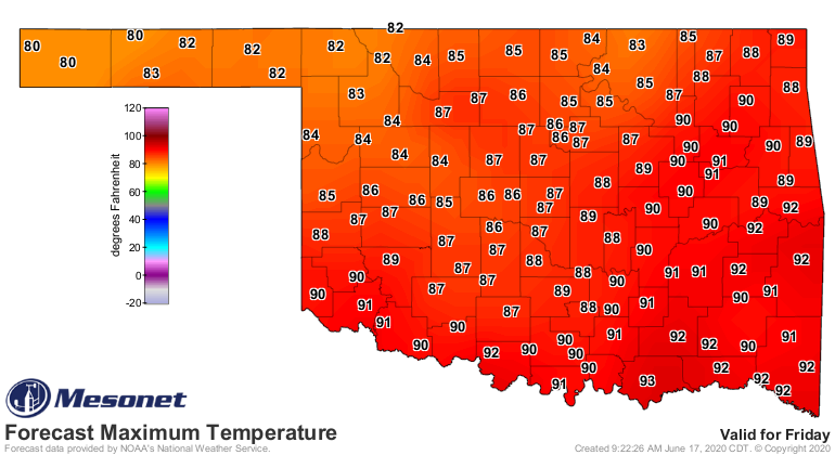
Today will be hot again, however, and the approaching surface low from the west
means lots of wind, which will once again raise fire concerns across western
and northern Oklahoma, but extending down into the I44 corridor.
Now, will this rainfall erase the drought? Probably not, but it will put a dent
in it, and prevent further spread. The deficits have grown pretty serious
over the last 90 days growing to 5-8 inches from the Texas border in the west
through central and north central Oklahoma.
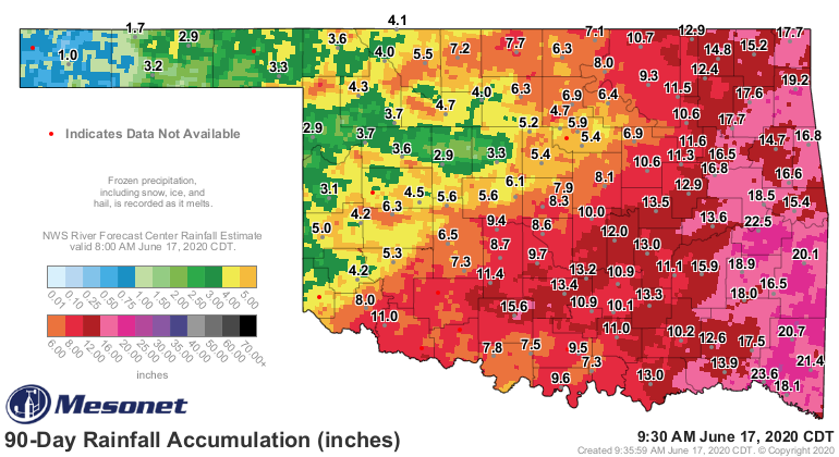
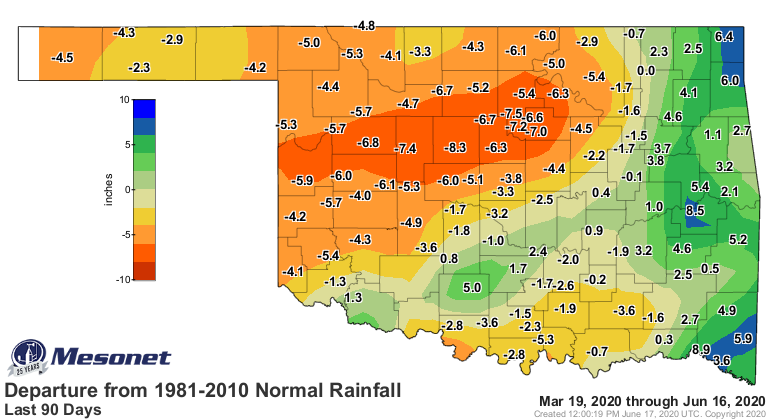
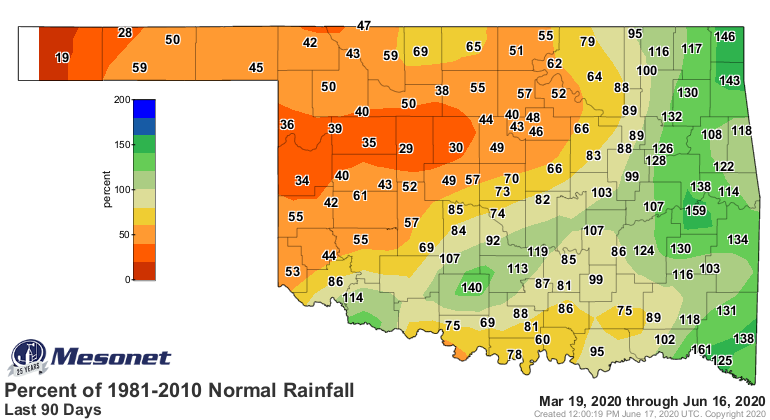
The drought threatens to spread even farther into eastern Oklahoma if they miss
out on the coming storms. There will be a chance of severe weather over the
next two days, but more of the garden variety severe storm types you'd see
later into June...wind and hail, mostly. For today, however, the danger is of
the wildfire variety, and six counties now have burn bans, including the entire
OK Panhandle.
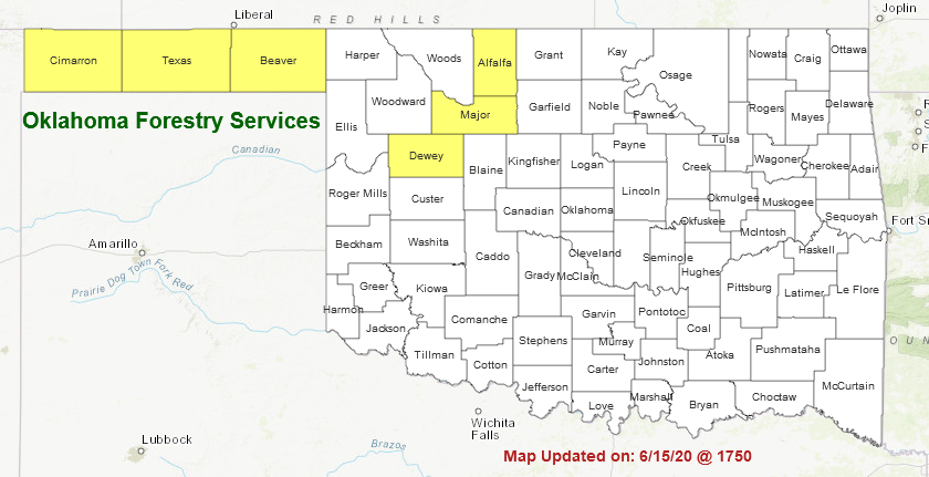
Tomorrow's drought map won't be pretty, but maybe it's just a prelude to a bit
of reversal.
Oh yeah, almost forgot...TWICE AS FAR WITH A CHOCOLATE BAR!
Gary McManus
State Climatologist
Oklahoma Mesonet
Oklahoma Climatological Survey
(405) 325-2253
gmcmanus@mesonet.org
June 17 in Mesonet History
| Record | Value | Station | Year |
|---|---|---|---|
| Maximum Temperature | 114°F | GRA2 | 2011 |
| Minimum Temperature | 45°F | BEAV | 1999 |
| Maximum Rainfall | 10.49″ | NEWP | 2015 |
Mesonet records begin in 1994.
Search by Date
If you're a bit off, don't worry, because just like horseshoes, “almost” counts on the Ticker website!