Ticker for September 16, 2020
MESONET TICKER ... MESONET TICKER ... MESONET TICKER ... MESONET TICKER ...
September 16, 2020 September 16, 2020 September 16, 2020 September 16, 2020
It's a girl!
So you open up your climatological Christmas present -- you know, the big box
in the back of the tree -- expecting something lovely for winter. Maybe a big
snow season coming your way, which for Oklahoma would mean maybe 3 inches. Or how
about a nice long cold spell to kill all the bugs that are hiding hither to and
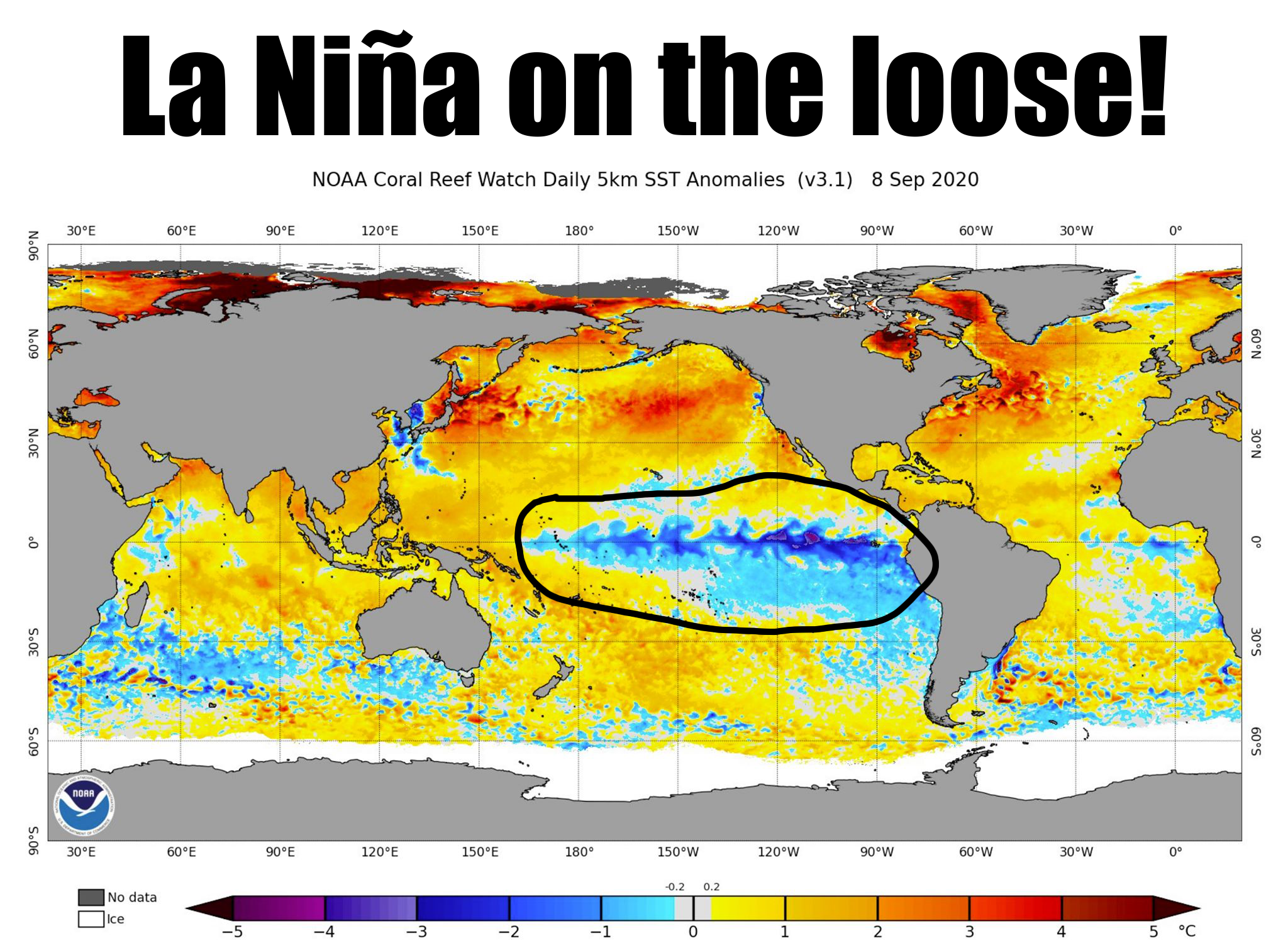
yonder? BZZZTTT! How about a lump of La Nina instead. What is La Nina? Well, from
the image above, you might have ascertained it's a cooling of the equatorial
pacific waters off the western coast of South America.
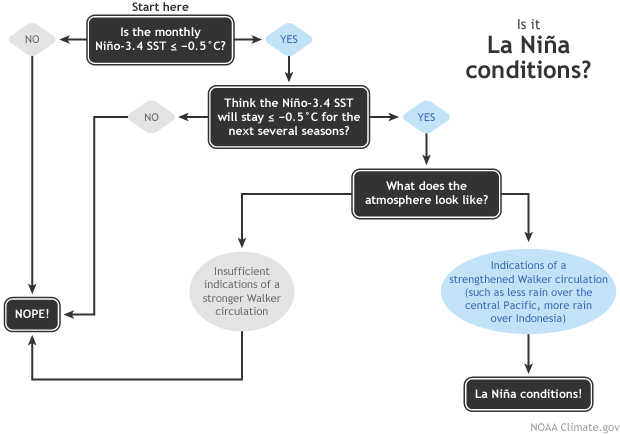
The CPC has issued a La Nina Advisory, which indicates La Nina conditions are
now present. CPC considers those conditions to be present when we
see those SST changes ALONG with the expected changes in the wind patterns.
Here is a handy little decision tree you can look at to see what the forecasters
use to determine if La Nina has officially arrived. It's sort of like one of
those things you see on the internet to determine if you're dying of some
horrible disease or not (Does your finger hurt? If yes, then you're doomed).
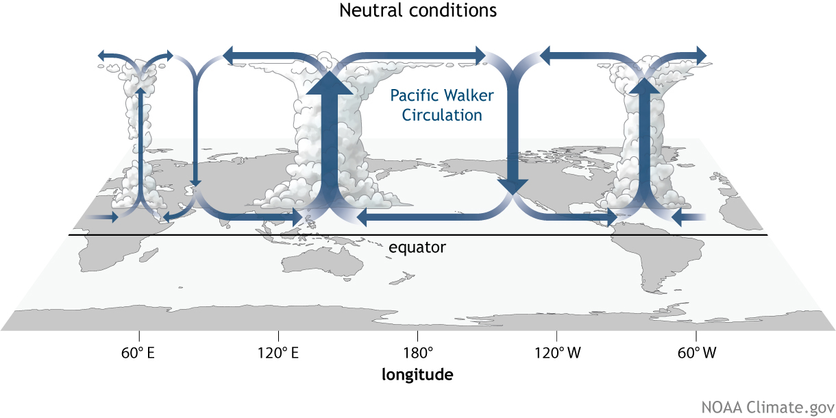
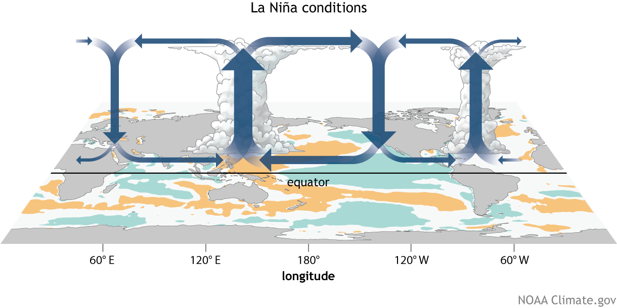
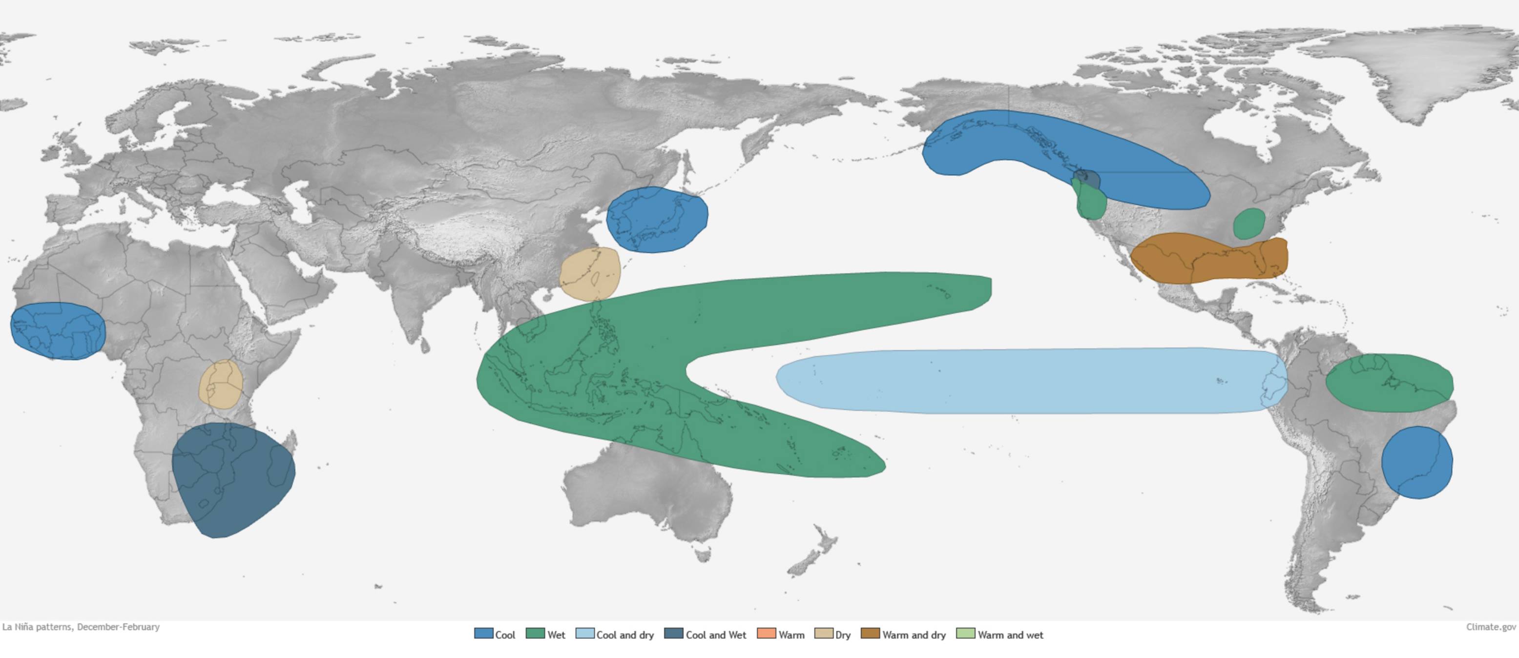
Those atmospheric changes are important because they therefore cause changes
across the globe, what with the atmosphere acting as one large fluid. In La
Nina's case, it strengthens the Walker circulation. I know I'm getting deep
into the weeds here, but these changes in the trade winds cause the perturbations
that travel through the global atmosphere. Here you can see those rising and
sinking columns of air over the equatorial Pacific, and the trade winds along
the surface created by those motions...for both neutral conditions and La Nina.
Okay, let's move on before I bore you to death. Oh, does your finger hurt?
Let's look at what it can sometimes do to the overall climate pattern over our
little part of the globe. The tendency is for drier and warmer than normal
weather during the cool season (let's say November-ish through March-ish), with
more emphasis on the drier part.
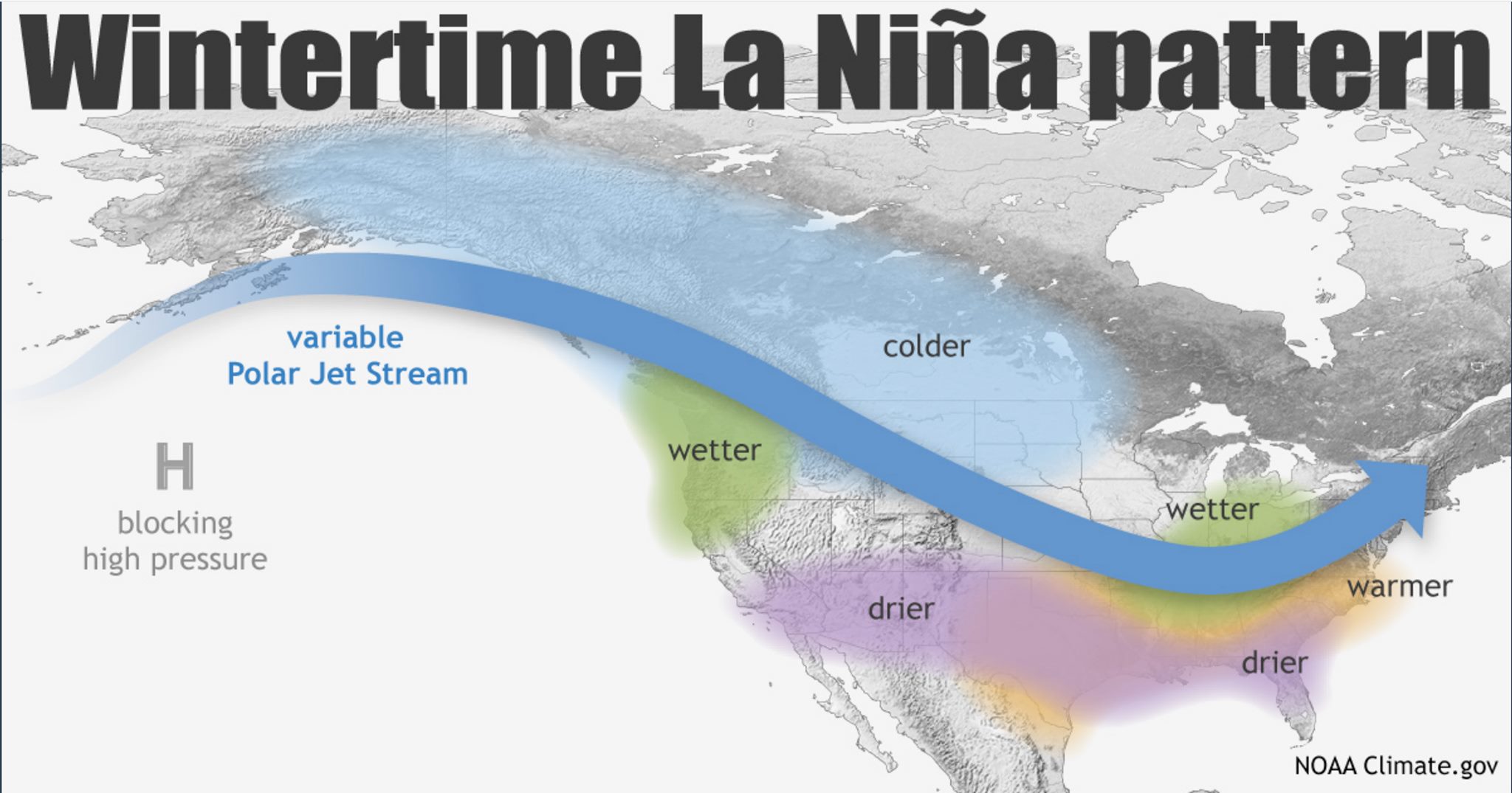
So you can see the associated climatic (but not always climactic) changes in
our weather patterns, but that's just a general picture. When we're talking
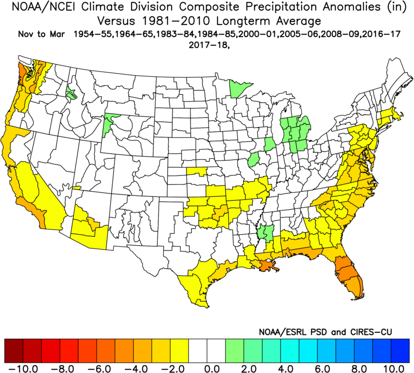
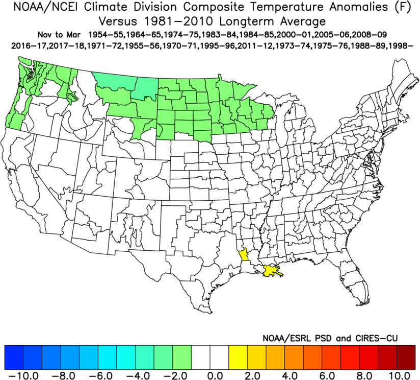
about precipitation changes, considering all La Nina episodes, this is what
we get (and you can see the associated event years on the graphic).
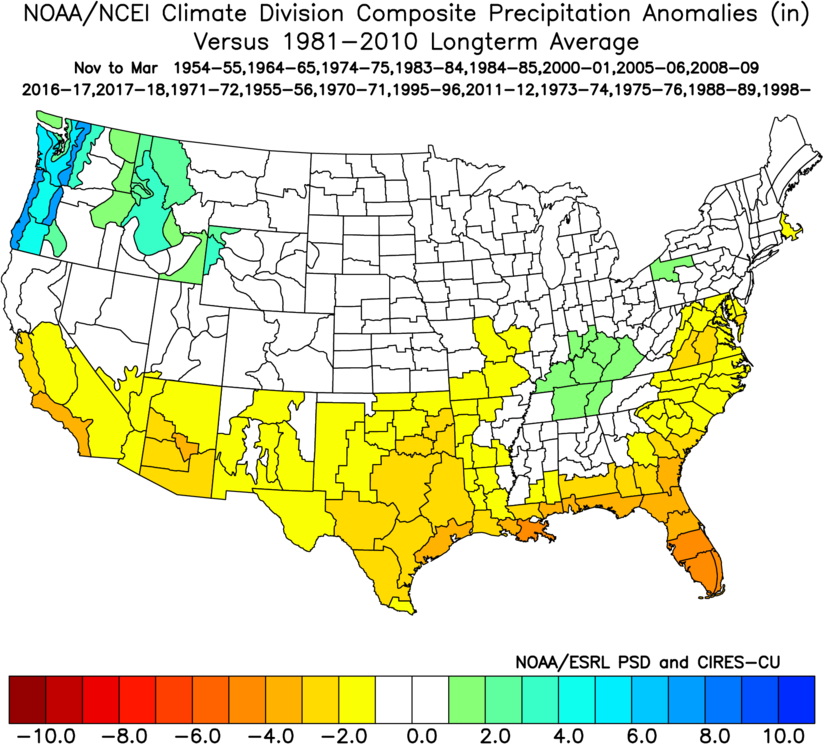
But the strength of the La Nina episode matters as well. If you divide up the
events into strong, moderate and weak, then we get a slightly different take.
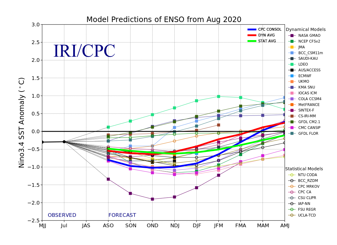
The current forecasts seem to indicate that we are headed for a borderline
moderate La Nina this go around. Here is the prediction plume for the different
forecast models as they look at the SST changes through the upcoming winter into
spring. With the CPC consolidation approaching -1C, that puts it into moderate
strength territory.
So with the differentiation between the strength of the events, here is how
those differences shake out with the different strengths (strong, moderate and
weak).
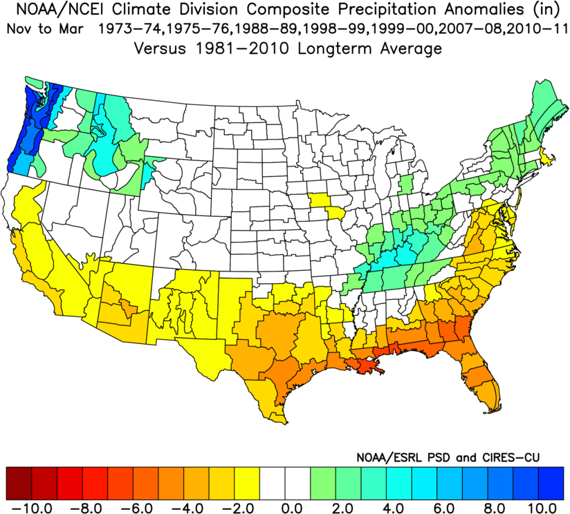
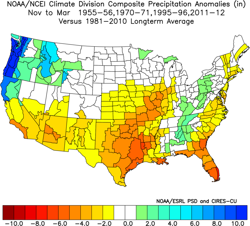
So from that view of the scenarios, it would appear the moderate La Nina's give
us the worst outcomes, and there are some years on there that you definitely
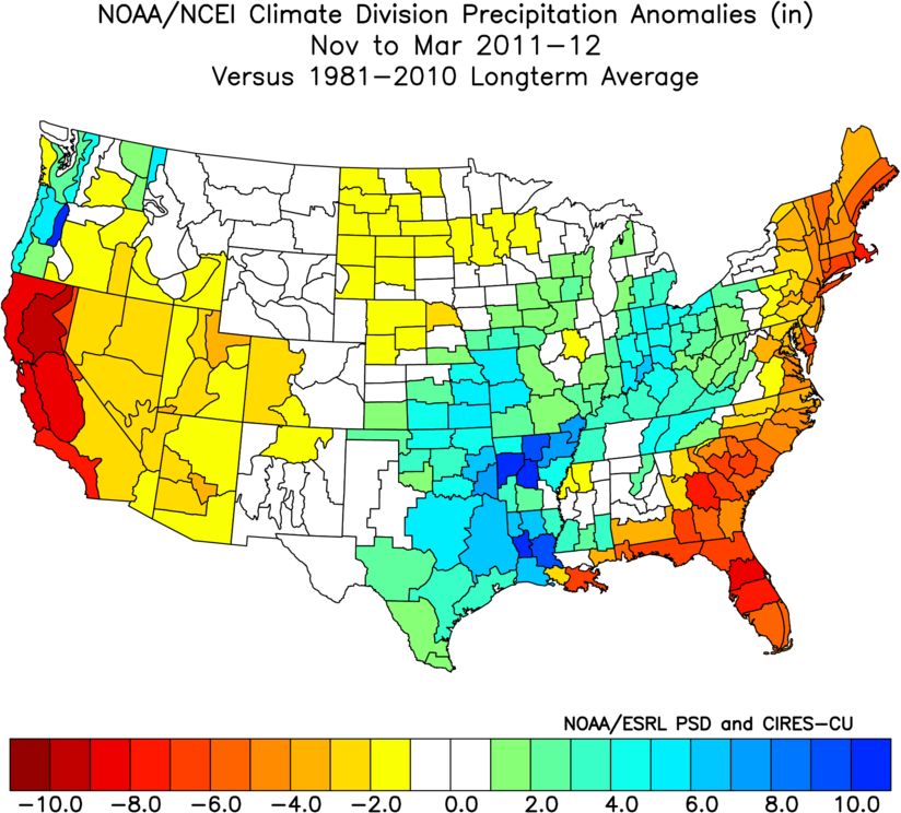
DON'T want to hang out with. 1955-56? 1995-96? Those are two of the worst drought
times in state history. Oddly enough, so is 2011-12, but that cool season
actually ended up wet, before the drought of 2010-11 came back stronger than
ever that spring until its demise in 2015.
But that's the deal we make with climatological averages...not every La Nina
gives us the same outcome, or every El Nino for that matter. They just tilt the
odds in a certain favor, and in this case, it's not generally a good direction.
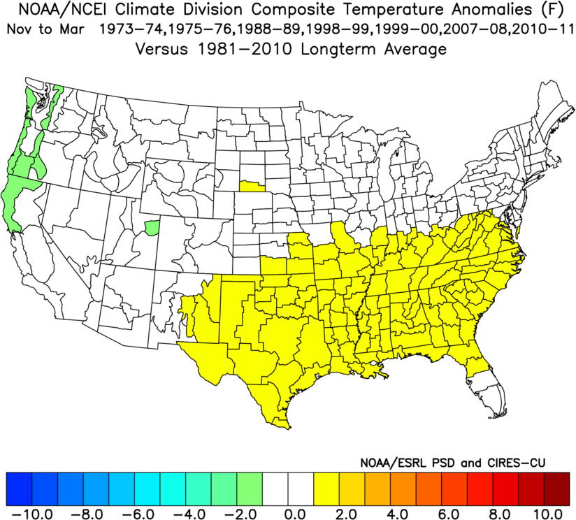
How about for temperatures? Well, it would appear only the strong La Ninas give
us any sort of significant temperature modifications. Again, on average. Here
are the figures for the overall average of La Ninas, but also the strong La
Ninas.
Since we're talking about the cool season, let's talk about something cool: snow.
What does La Nina mean for snow in Oklahoma? Well, in a place with so little
snow already, it's not good. At least for the area of the state that actually
sees a lot of snow. There is a reduction in snowfall, on average, during La
Nina years across northwestern OK. Getting the atmosphere to generate snow is
so delicate, however, that any sort of perturbation between temperatures across
the vertical profile of the atmosphere can cause havoc. So again, this is just
a general picture. The difference between a cold rain and a snowstorm can be
as little as 1 degree.
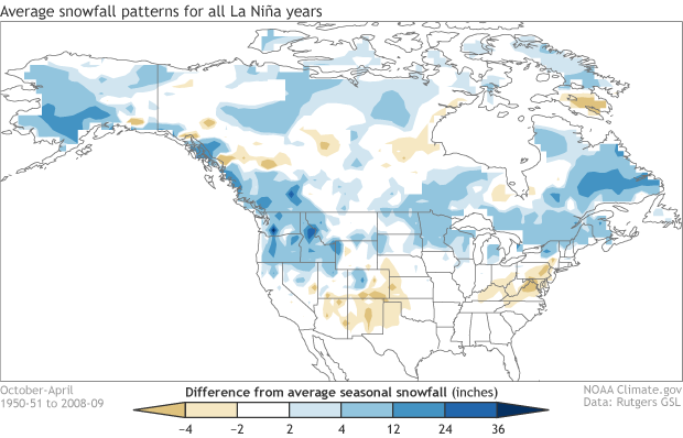
There's not really a difference for our state across the varying strengths of
a La Nina. But here's the deal...significant individual weather events can still
occur despite the overriding climate pattern. Think back to February 2011, for
instance. During that strong La Nina (one of the strongest on record) that
began in the fall of 2010, in the midst of the beginning months of the worst
drought the state has seen since the 1950s...we set records for the lowest
temperature ever recorded in the state (Nowata Mesonet, -31 degrees), and the
highest 24-hour snowfall event in state history (27 inches at Spavinaw).
There are other possible impacts we see with La Nina events. for instance, a
possible increase in severe weather events (hail and tornadoes) across the
SE US, including central and eastern Oklahoma during the March-May period.
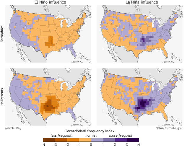
That one's a bit tricky, and the data are so highly variable that I get a bit
queasy in throwing this one out there. Yeah, I'm probably dying since my finger
also hurts, but this is a relationship worth mentioning. As with every severe
weather season, you should prepare like it's going to be the worst on record.
But here is a bit of evidence that we might see some enhanced activity next
spring.
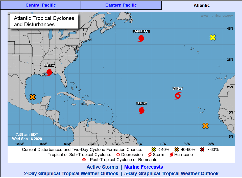
Another impact is enhanced tropical storm activity in the Atlantic (and
diminished in the Pacific). I think we have that one covered.
A lot to unpack in this Ticker. Maybe I should sum up so we're not ALL lost in
the weeds.
-- La Nina conditions are present, and expected to continue through the winter
of 2020-21 into early spring.
-- Current forecasts point to a MODERATE La Nina event.
-- Odds will be tilted towards a DRIER climate for the November-March period
across Oklahoma.
-- Snowfall could be diminished across northwestern Oklahoma.
-- Severe weather events could be more frequent across central and eastern
Oklahoma.
-- The remainder of the hurricane season (June 1-November 30) could see enhanced
activity across the Atlantic and reduced activity in the Pacific.
Now back to that "climate vs. weather" theme, please keep in mind that ENSO (El
Nino or La Nina...or even Neutral Conditions) is only one factor, but as climate
factors go, it's one of the more easily predictable. Other factors that can
impact our winter climate and weather include the Arctic Oscillation and the
North Atlantic Oscillation, which can influence the number of arctic air masses
that penetrate deep into the U.S. and are very difficult to forecast more than
a week or two in advance.
Okay, now ALL my fingers hurt. Plus, I just guaranteed a frigid, snowy winter
with my magical jinx powers.
DOOMED!
Gary McManus
State Climatologist
Oklahoma Mesonet
Oklahoma Climatological Survey
(405) 325-2253
gmcmanus@mesonet.org
September 16 in Mesonet History
| Record | Value | Station | Year |
|---|---|---|---|
| Maximum Temperature | 102°F | WALT | 1997 |
| Minimum Temperature | 37°F | KENT | 2012 |
| Maximum Rainfall | 3.52 inches | BURB | 2013 |
Mesonet records begin in 1994.
Search by Date
If you're a bit off, don't worry, because just like horseshoes, “almost” counts on the Ticker website!