Ticker for June 15, 2016
MESONET TICKER ... MESONET TICKER ... MESONET TICKER ... MESONET TICKER ...
June 15, 2016 June 15, 2016 June 15, 2016 June 15, 2016
Raiders of the Lost June
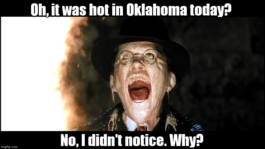
Listen, I'm not saying it's going to be face-meltingly hot out there today (and
the rest of the week), but if I were you I'd invest in some SPF 1,000,000
sunblock. Okay, a bit extreme, and the sun's rays aren't going to be extra strong,
it's the humidity that's gonna get us. You all know by now I'm a warmster at heart,
dreading the cold and loving the heat. But I'm from the Panhandle...I prefer that
blast furnace style warmth...you know, like you're standing in the middle of a
kiln. I don't cotton to this crock pot stuff. I'm not sure cotton cottons to it
either.
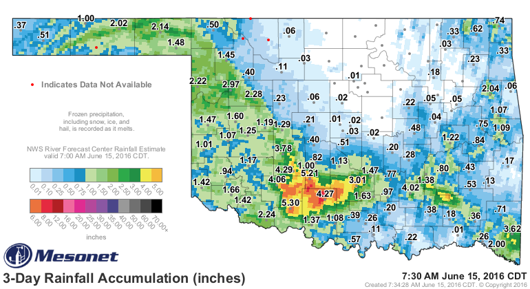
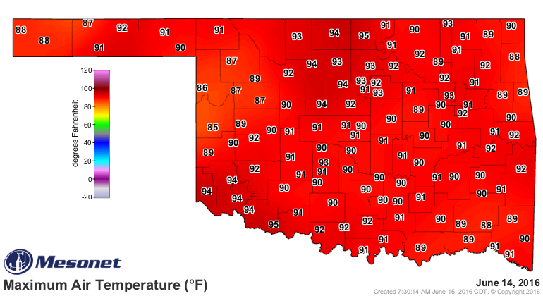
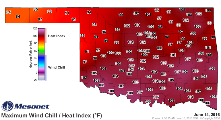
The heat has been kept in check somewhat by the rain and clouds of the last few
days, but you can see that rainfall hole from central up through northern OK did
allow for some higher temps to break through yesterday and the heat index values
soared into triple digits as a result.
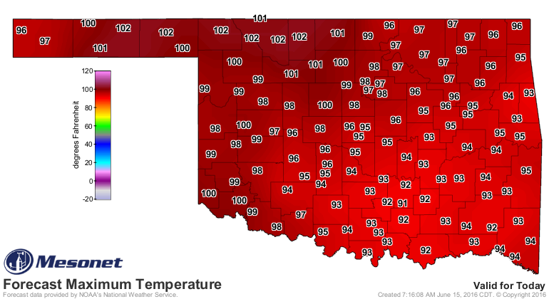
I'm betting that today we see our actual air temperatures finally reach 100
degrees for the first time this year on the Mesonet across the drier air in
western Oklahoma, and Friday could be a real scorcher.

But the real danger we're facing the rest of the week will be those high
humidity values with dewpoints reaching close to 80 degrees like yesterday. That
pops that heat index up like a firecracker and creates very dangerous heat
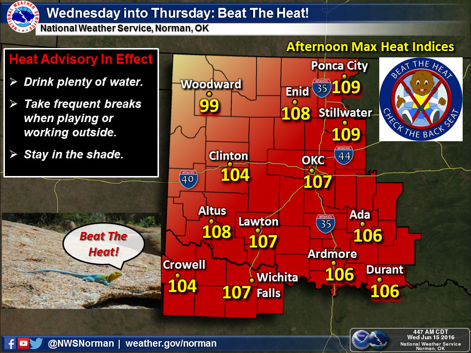
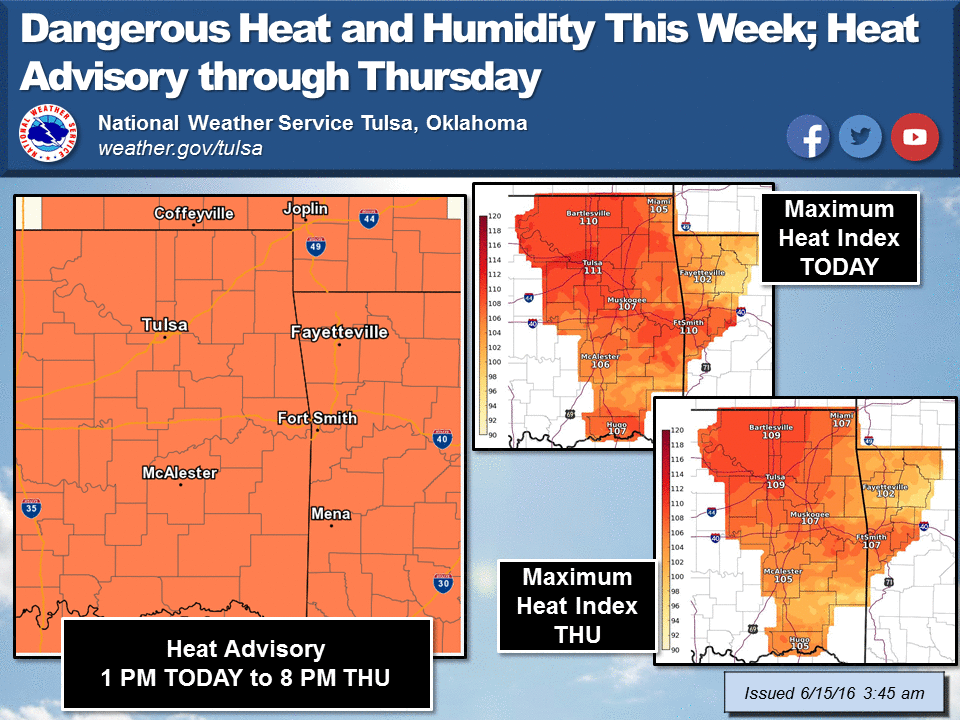
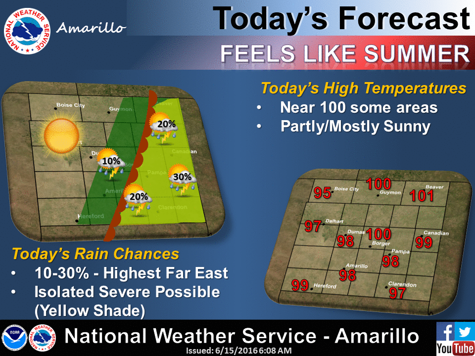
conditions. I'll let the local NWS offices clue us in on that:
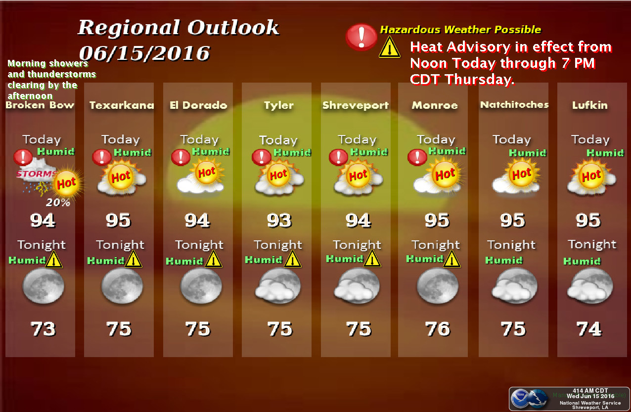
The heat index and actual air temperature can impact you in the shade...but what
if you are standing out in the sun in the wind? Well, that has an added impact
and that's where the "Wet Bulb Globe Temperature Risk" map comes in.
"The Wet Bulb Globe Temperature Risk map plots the current wet bulb
globe temperature (degrees F) at the standard height of 5 feet along
with its associated risk category. The wet bulb globe temperature is
an estimation of the impact of temperature, humidity, wind speed, and
solar radiation on humans. Its values are similar to a heat index;
however, the wet bulb globe temperature additionally accounts for
sunlight exposure and wind speed. The risk categories are based on
guidelines from the NWS Tulsa WFO."
Based on those risk categories, much of southern and eastern Oklahoma had a
really bad day yesterday, and there will be more of the same today. Check out
yesterday's max wet bulb globe risk map.
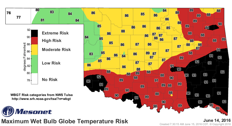
The wet bulb globe risk map is updated every 5 minutes and can be found here:
http://www.mesonet.org/index.php/weather/map/wet_bulb_globe_temperature_risk
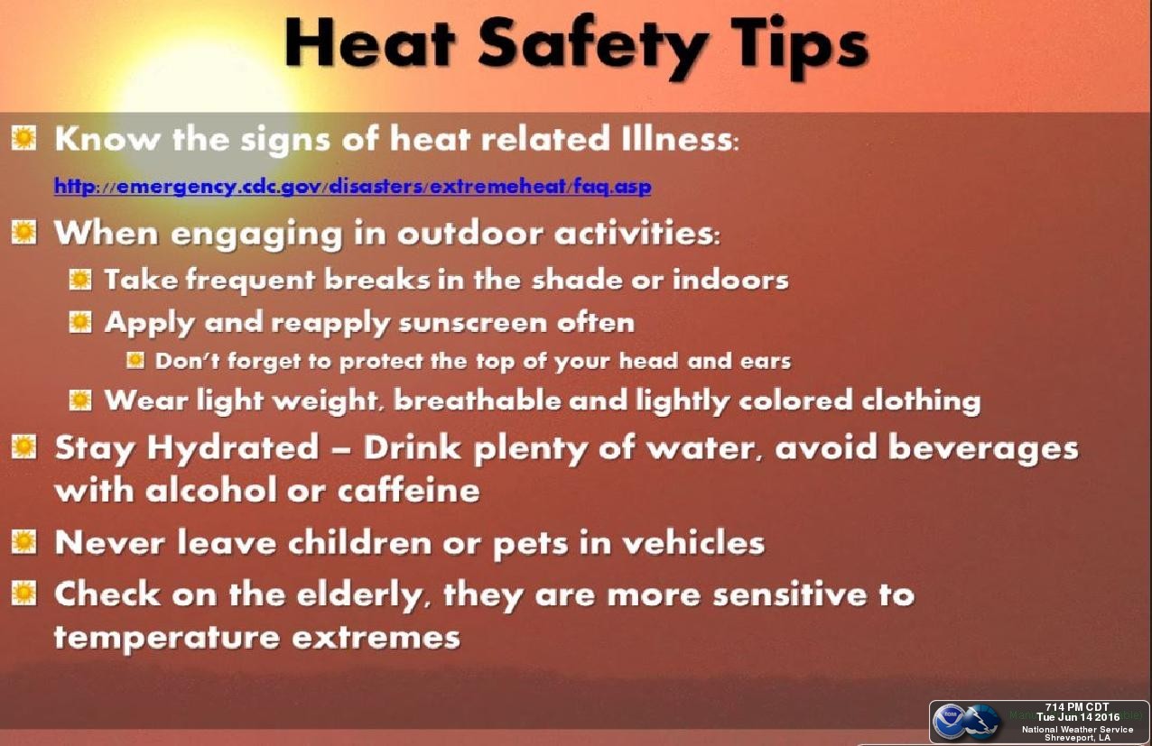
So check back there often and remember these heat safety tips from the NWS
Shreveport office:
Cool May, hot June...can't wait for July. Ugh!
Gary McManus
State Climatologist
Oklahoma Mesonet
Oklahoma Climatological Survey
(405) 325-2253
gmcmanus@mesonet.org
June 15 in Mesonet History
| Record | Value | Station | Year |
|---|---|---|---|
| Maximum Temperature | 104°F | ALTU | 2022 |
| Minimum Temperature | 42°F | KENT | 2001 |
| Maximum Rainfall | 5.22 inches | BYAR | 2007 |
Mesonet records begin in 1994.
Search by Date
If you're a bit off, don't worry, because just like horseshoes, “almost” counts on the Ticker website!