Ticker for October 10, 2018
MESONET TICKER ... MESONET TICKER ... MESONET TICKER ... MESONET TICKER ...
October 10, 2018 October 10, 2018 October 10, 2018 October 10, 2018
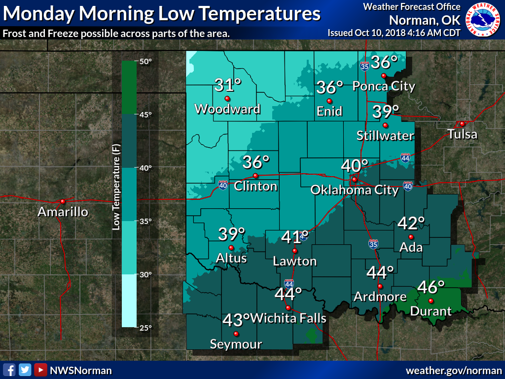
Et tu, winter?
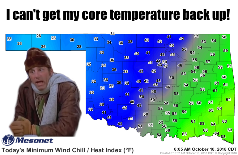
Okay, that's just nasty. Fresh off one of the wettest 3-4 day periods in western
Oklahoma history, with flood waters still rising in many of the rivers out that
way, they have to deal with this? Not nice. It does look like we'll miss out on
seeing an actual freezing air temperature though, with Eva coming close at 33
degrees. I would imagine lots of low spots out that way (there are some...it's
not as flat as you think!) hit the 32 mark, and surely some places got a good
frost.
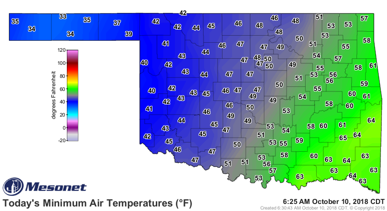
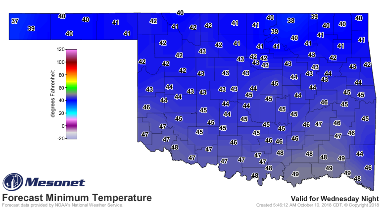
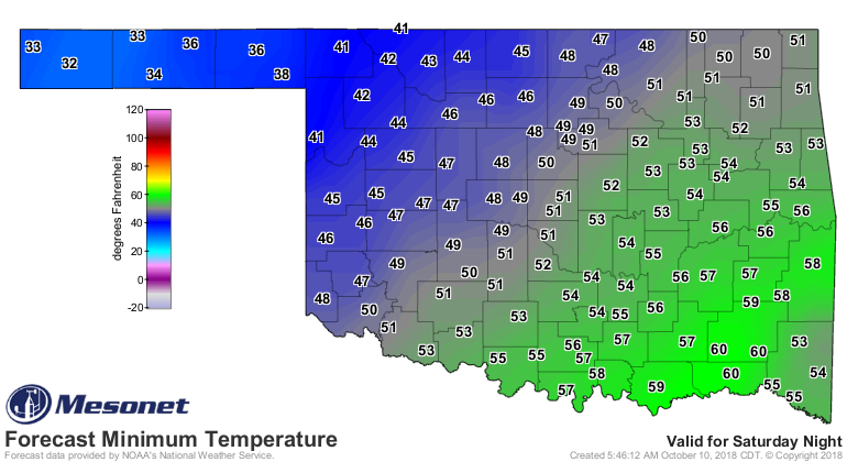
The wintry fun doesn't end there. Watch for another chiller tonight, then our
first freeze across the far NW over the weekend and early next week. Maybe some
snow as well?

Uhhhh, brrr! I'll have to get the old stocking cap out. Those with hair can
tough it out, probably.
We have bigger problems than hair...COLD WEATHER, I mean. As stated previously,
one of the wettest 3-4 day periods across far western Oklahoma on record has
left most of the rivers across that region swollen and out of their banks.
Captured here in the 5-day rain totals from the Mesonet (to ensure getting any
spare drops), our Mesonet site at May Ranch led the way with 9.78 inches between
Oct. 6-9, with 9.7 inches of that falling between Oct. 7-9. Both the 3-day AND
4-day rain total records were broken for the May Ranch Mesonet site. Here's a
more complete list of those Mesonet sites that broke their all-time 3-day
rainfall record (dating back to Jan. 1, 1994, for most).
-***-
Mesonet Site 3-day total (inches)
May Ranch 9.70
Seiling 8.95
Mangum 8.13
Weatherford 7.98
Woodward 7.76
Elk City 5.62
-****-
Impressive, helpful, but in some cases WAY too much water.
Unfortunately, it doesn't end there. We still have the remnants of Hurricane
Sergio headed out way from the Pacific, due to arrive just in time for the
weekend. Another strong cold front should be in the vicinity as well. All that
will set up a few rounds of showers, hopefully not too many storms after all
the excitement of the lasts couple of days.

Another 3-5 inches is simply not needed at this time.
When you go back and combine the 22nd wettest August and the 19th wettest
September with an already soggy October 1-10, you end up with the 3rd wettest
such period on record since at least 1921 with a statewide average of 13.08
inches, more than 5 inches above normal.
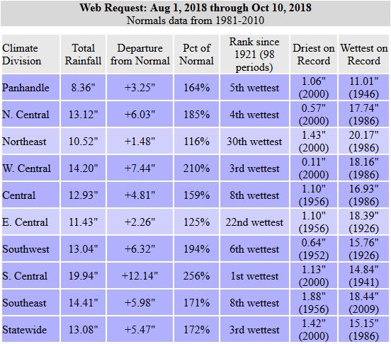
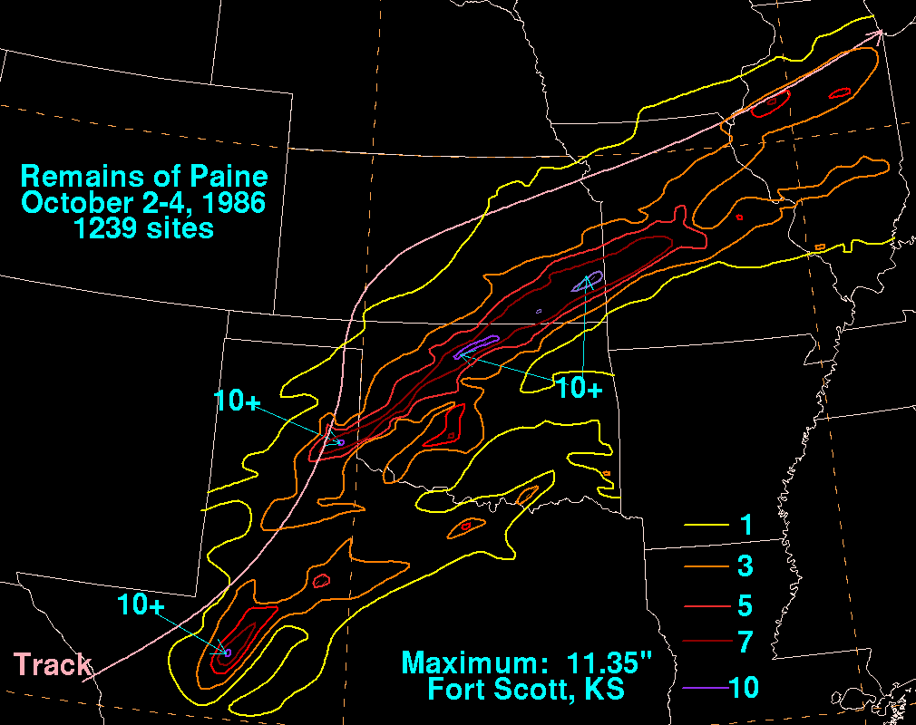
1986 stands atop that particular ranking at 15.15 inches, thanks mainly to a
visit from...you guessed it (well, you probably didn't), the remnants of
Hurricane Paine in early October of that year.
And even with Sergio's help, the August-October 1941 total of 18.41 inches is
probably unreachable. That monstrous total was spurred by October's statewide
average of 11.32 inches, Oklahoma's second wettest month on record next to
May 2015's 14.44 inches.
But, we are getting off point! That point, it's wet, it's cold, and more is
on the way. I can't wait until winter when we're complaining about how much
warmer than normal it is.
Gary McManus
State Climatologist
Oklahoma Mesonet
Oklahoma Climatological Survey
(405) 325-2253
gmcmanus@mesonet.org
October 10 in Mesonet History
| Record | Value | Station | Year |
|---|---|---|---|
| Maximum Temperature | 97°F | GRA2 | 2024 |
| Minimum Temperature | 21°F | BRIS | 2000 |
| Maximum Rainfall | 4.52″ | ANTL | 2004 |
Mesonet records begin in 1994.
Search by Date
If you're a bit off, don't worry, because just like horseshoes, “almost” counts on the Ticker website!