Ticker for July 7, 2016
MESONET TICKER ... MESONET TICKER ... MESONET TICKER ... MESONET TICKER ...
July 7, 2016 July 7, 2016 July 7, 2016 July 7, 2016
GODZILLA!!
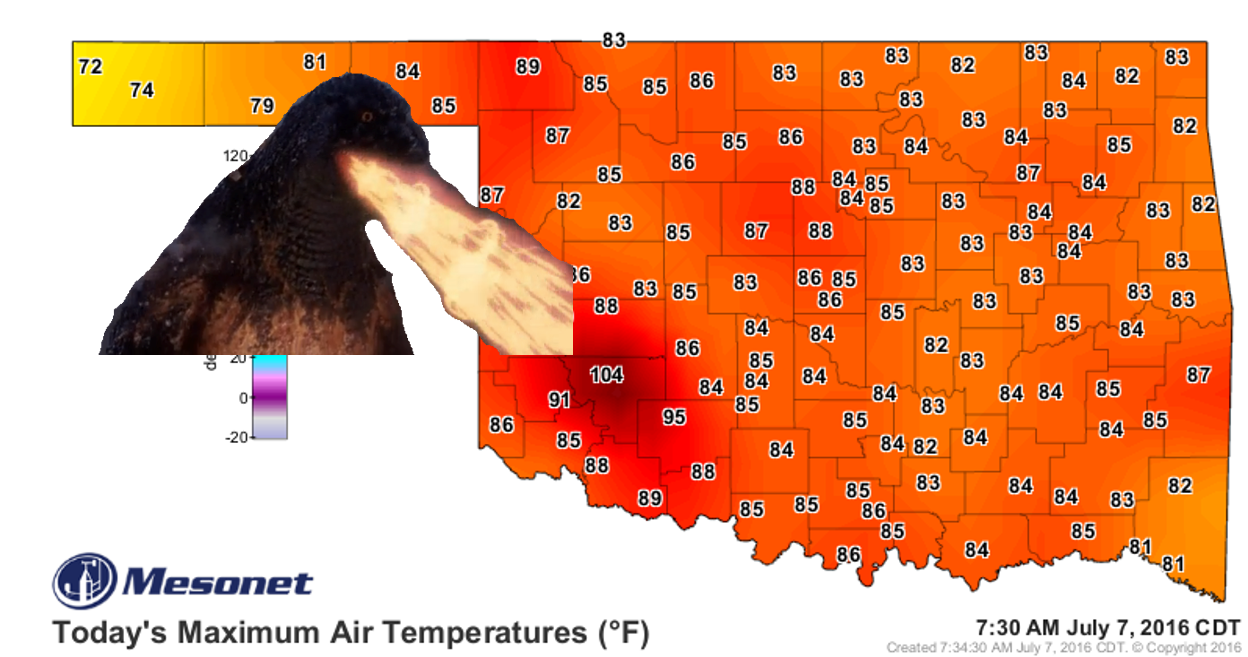
No, that burst of heat (otherwise known as a...wait for it..."heat burst") down
in SW OK last night that skyrocketed temperatures and winds for a brief period
was not due to any giant lizard. Heat bursts used to be considered somewhat rare
before the Mesonet was commissioned way back in 1994, but when you put that many
instruments in the field in that quantity, the rare will become the not-so-rare.
For a very rudimentary explanation, a dying storm dumps its
evaporation-cooled air to the surface where it compresses and warms (i.e.,
the hair drier effect ... or in my case, a scalp drier). For a more detailed
explanation, here's one from our friends at the NWS Norman office:
http://www.crh.noaa.gov/oun/?n=heatburst_info
The heat burst was ongoing throughout late last night into right after midnight,
but check out the meteogram for Hobart from last night for the most dramatic
image.
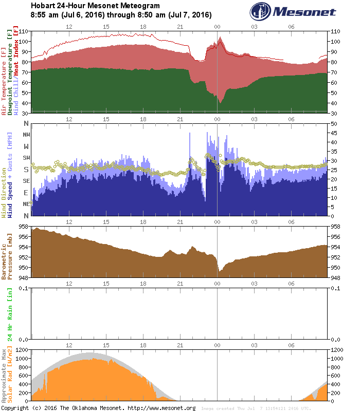
The temperature at Hobart was a respectable 81 degrees about 11pm, then a nearby
storm collapsed with all that air rushing to the ground rapidly, the winds gusted
to about 45 mph, the dewpoint and relative humidity crashed, as well as the
pressure, and the fun times were on! Some of the heat burst activity shows
up in yesterday's maximum wind gust map as well. Now some of these are from
actual thunderstorms, and some are from the heat burstage (new word, don't bother
looking it up).

Check out the meteograms from SW OK last night for yourself and see if you can
spot the heat burst events. No, there won't be a quiz later.
http://www.mesonet.org/index.php/weather/meteogram/
------------------------------------------------------------------------------
Some drought gone, some drought remains, some new areas of drought on the rise.
That about sums up what has occurred over the last week or so. The new drought
map still looks rather innocuous, but my warning to you is that it is July
and this has better odds of spreading than it does abating. Here's this week's
map and the changes from last week as well.
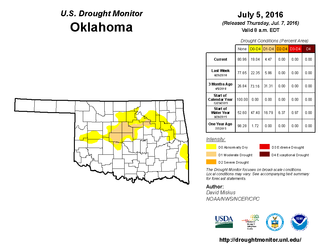
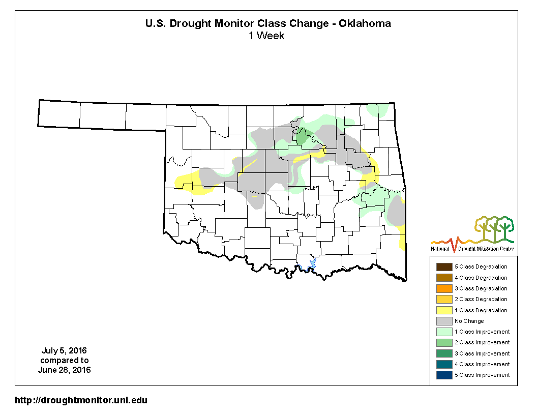
So we saw a very rare 2-class improvement in Pawnee County where all that rain
fell over the weekend, as well as some improvements surrounding that area and
down to the SE. But we also saw part of the drought holding strong AND a 1 class
degradation to the west and in various other places.
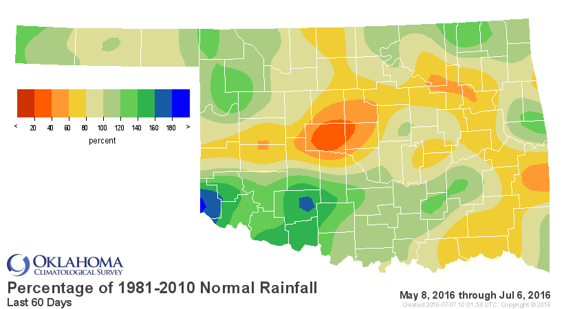
The rainfall maps tell the story. This 7-day total map tells the story. Bits and
pieces of relief here and there, with a great big blob of relief of 8-10+ inches
in Pawnee County to the NE.
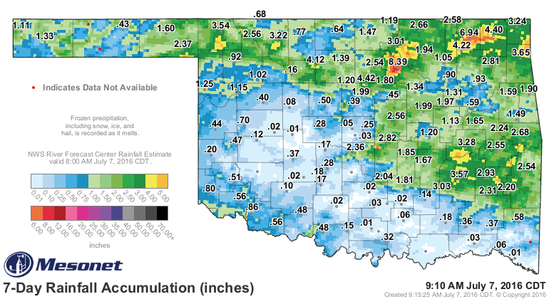
The lack of relief to the west and now down south is starting to get a bit stark
in the 30-60 day time frames, despite those "blobby" areas.
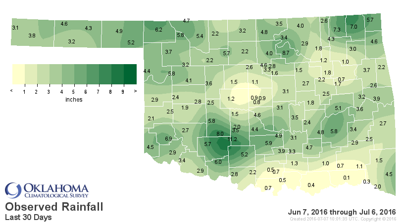
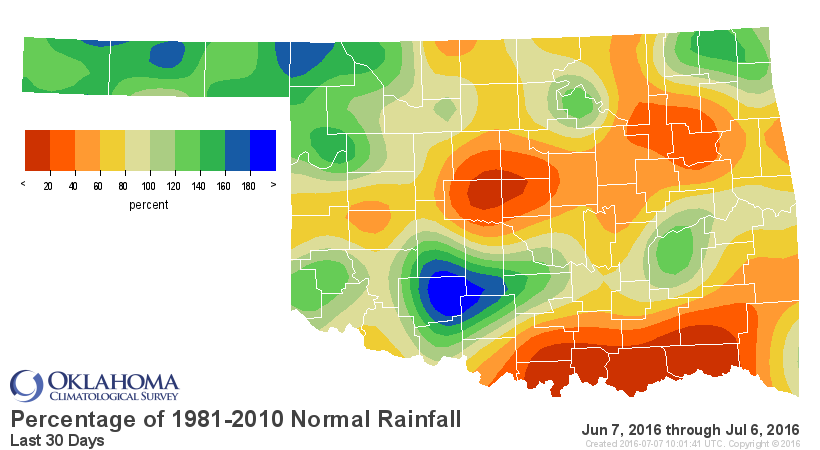
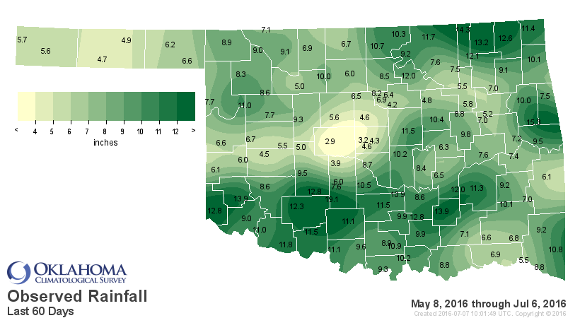
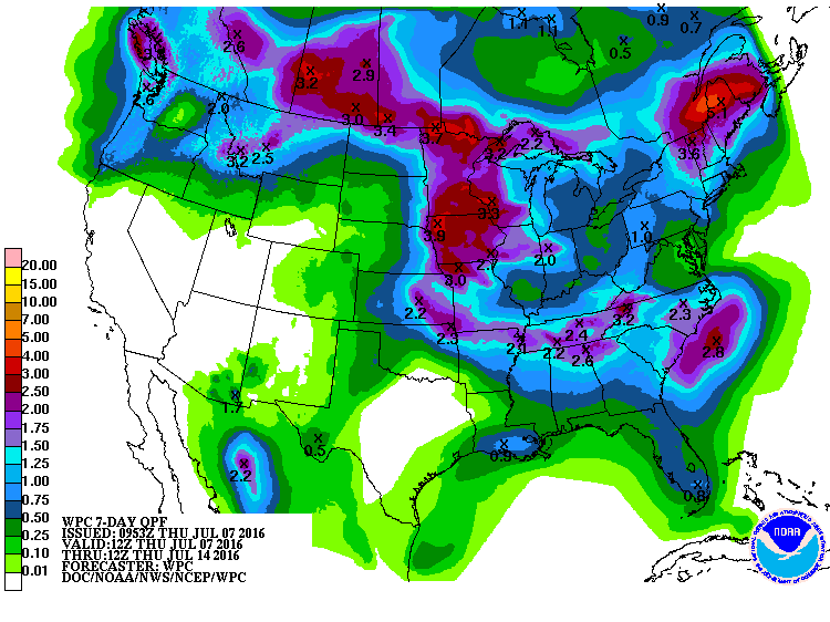
Prospects for future relief in the droughty areas are okay, I guess, but the
places that received the big rains and no longer need much of that relief look
like the prime areas for future moisture over the next week.
Other than that, it's going to be hot. Heat indices will rise into the 105-115
range today, just like yesterday.
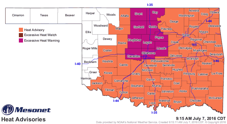
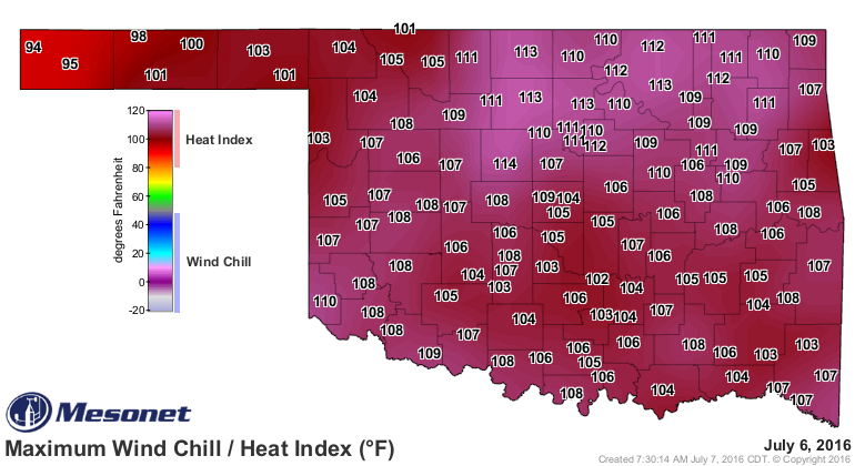
In other words, summer is here. Get used to it.
Gary McManus
State Climatologist
Oklahoma Mesonet
Oklahoma Climatological Survey
(405) 325-2253
gmcmanus@mesonet.org
July 7 in Mesonet History
| Record | Value | Station | Year |
|---|---|---|---|
| Maximum Temperature | 111°F | ALTU | 2011 |
| Minimum Temperature | 52°F | ANTL | 2006 |
| Maximum Rainfall | 5.20″ | KIN2 | 2024 |
Mesonet records begin in 1994.
Search by Date
If you're a bit off, don't worry, because just like horseshoes, “almost” counts on the Ticker website!