Ticker for January 4, 2021
MESONET TICKER ... MESONET TICKER ... MESONET TICKER ... MESONET TICKER ...
January 4, 2021 January 4, 2021 January 4, 2021 January 4, 2021
Snowly Cow!
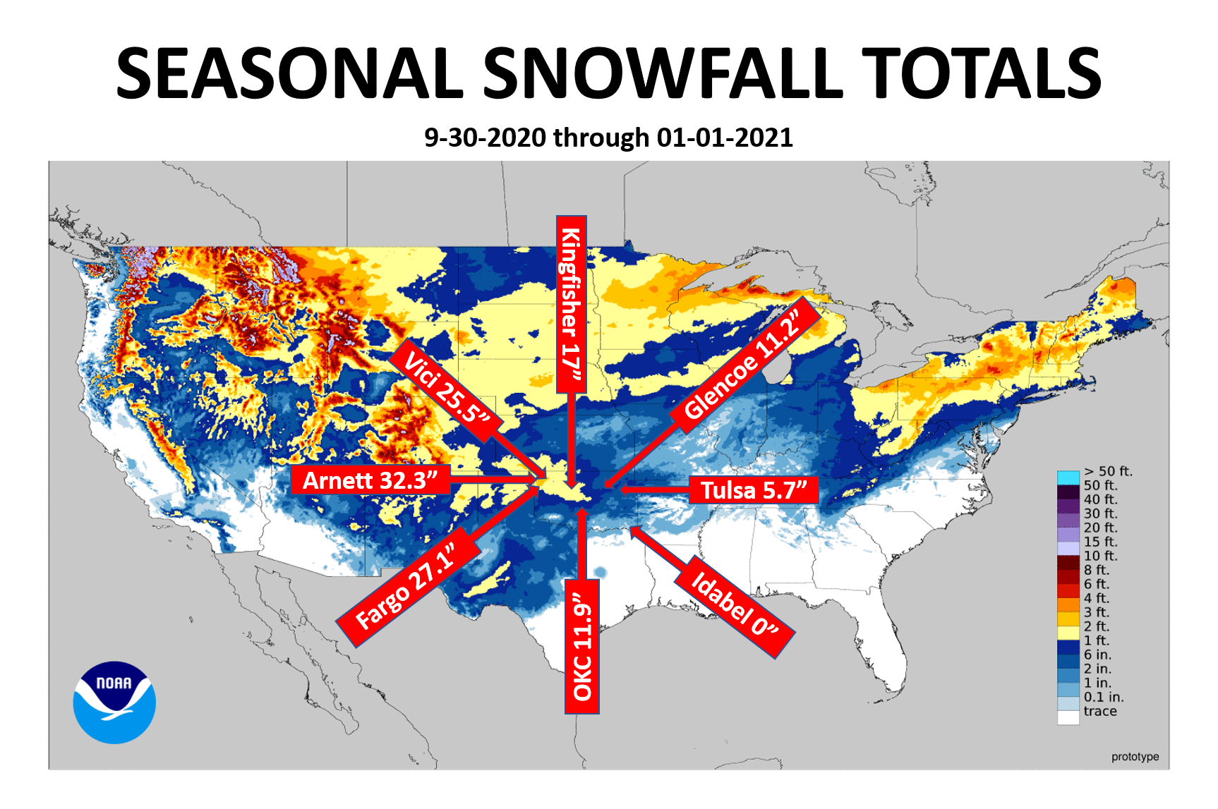
Snow snow snow snow snow SNOW, "snow snow snow!"
SNOWWWWWWWWWWWWWW!!
Had enough you-know-what yet? I'm not afraid to say the word, obviously, but
for some of us it has become a 4-letter word. Wait! I guess it was always a
4-letter word, but you know what I mean (and if you do, please wash your mouth
out with soap). Our next chance of 4-letter word will come later next weekend,
apparently, but still a long ways to go there. Otherwise, we will continue to
see seasonal-type temperatures this week and maybe a drop of rain or two
Wednesday into Thursday morning. We've been working on the December/2020
summary, and you can read it below.
Hey, speaking of 2020 (You started it! No I did. Guess I'll finish it.), did
you catch our Ticker over the break introducing the 2020 Mesonet extremes? No,
there weren't 2020 of them, they were for the year 2020. Here's the link to that
Ticker, just in case, and the 2020 Mesonet extremes graphic once again.
http://ticker.mesonet.org/select.php?mo=01&da=04&yr=2021
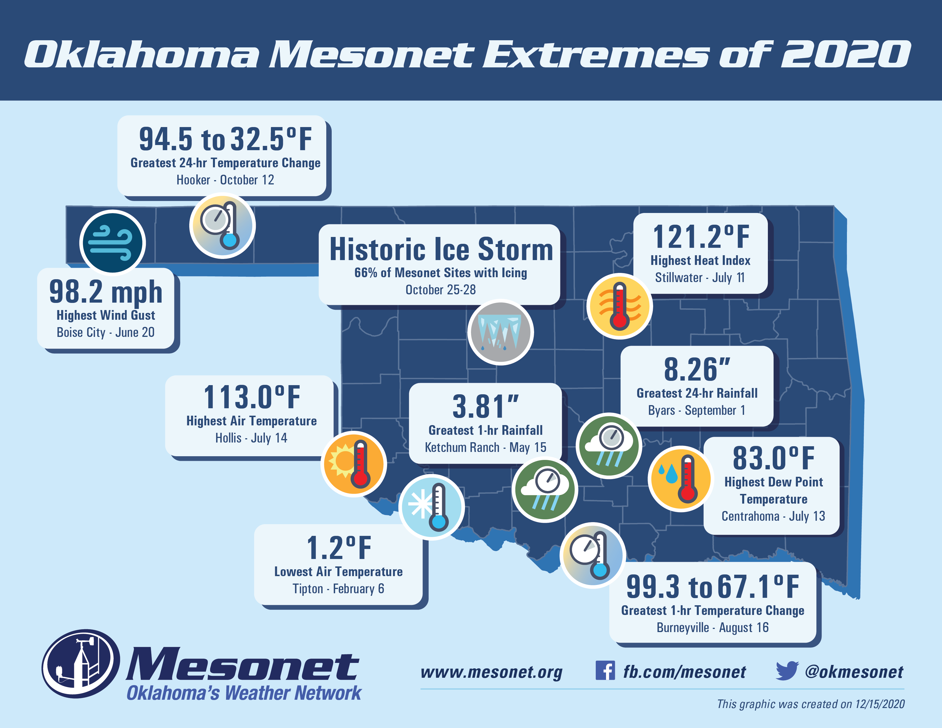
Now, onto 2020 (or back, whichever you prefer)!
----------------------------------------------------------------------------------
Winter Flexes Muscles During December
Jan. 4, 2020
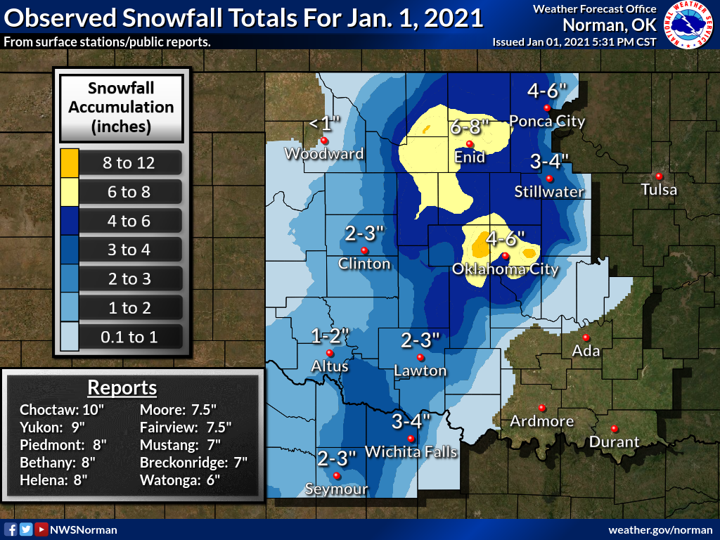
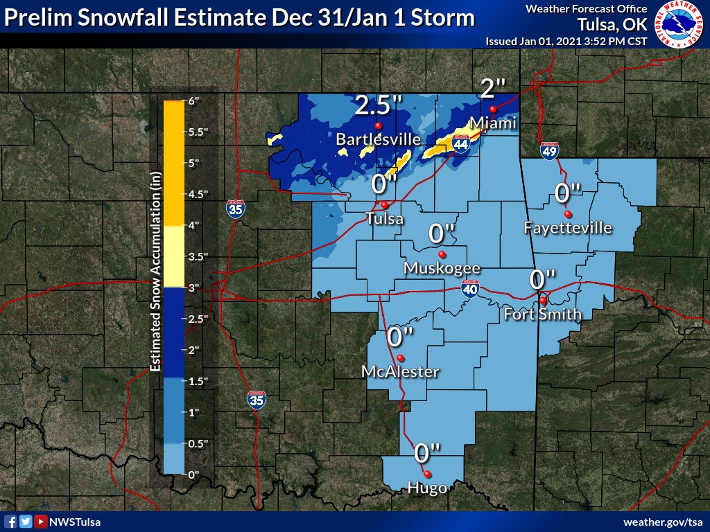
A powerful winter storm pounded the state on 2020’s final day, a fitting epitaph
to a tumultuous year—and a wintry December. The storm lasted into the first
morning of 2021 and brought widespread totals of 2-6 inches of snow from
southwestern into northeastern Oklahoma. Localized areas in central Oklahoma
reported up to 10 inches of snow.
The storm was the last in a series of four impactful winter systems that struck
the state during December, and the fifth of the season. The month’s first storm
dumped 10-15 inches of snow in far northwestern Oklahoma between Dec. 2-3. Two
more storms traversed the state in quick succession on Dec. 13 and Dec. 15. The
northwest was again the big winner between the two storms with over a foot of
snow reported in Woodward and Ellis counties. Fargo and Arnett led official
December totals at 27.1 inches and 26 inches, respectively, with Vici close
behind at 25.5 inches. Fargo’s tally is the third highest December total in
state history, behind Beaver’s 35 inches in 1911 and Goodwell’s 28 inches in
1918. Arnett’s total ranks fifth all-time. The highest Oklahoma snow total for
any month remains Kenton’s 46 inches from February 1903. Arnett’s 32.3
inches—including 6.3 inches from a late October winter storm—led this season’s
totals through December. Beaver holds the all-time mark for seasonal snowfall
in Oklahoma with 87.3 inches in 1911-12.
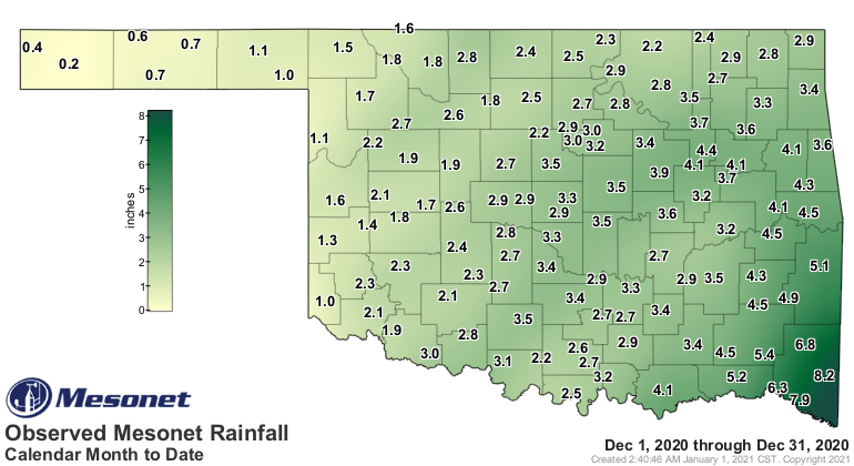
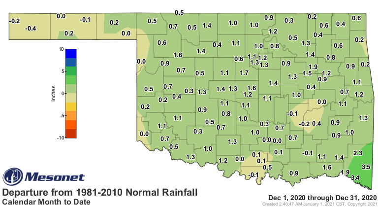
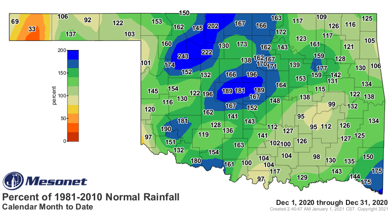
The statewide average precipitation total finished at 2.84 inches according to
preliminary data from the Oklahoma Mesonet. That ranks the month as the 22nd
wettest December since records began in 1895, 0.78 inches above normal. The
entire state saw near or above normal precipitation for the month, save for the
far western Panhandle where deficits continued to accumulate. Heavy rains
provided surpluses of 2-4 inches in far southeastern Oklahoma. Broken Bow’s
8.22 inches led the December totals. Boise City had the lowest total at 0.22
inches.
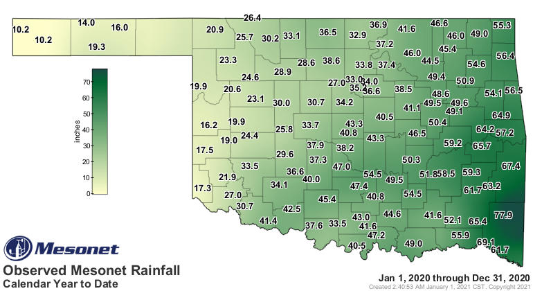
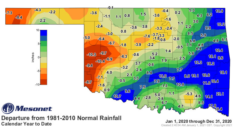
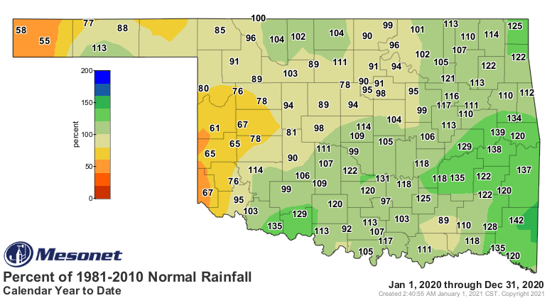
The statewide average total for 2020 was 39.71 inches, 3.21 inches above normal,
to rank as the 20th wettest year on record. Annual rainfall varied tremendously
across the state, however. Southeastern Oklahoma’s average of 65.43 inches was
14.84 inches above normal to rank as their seventh wettest annual total on
record, while the Panhandle saw a deficit of 4.05 inches for their 25th driest.
Individually, The Mesonet site at Mt Herman had 2020’s highest total at 77.86
inches, 23.1 inches above normal. Boise City’s 10.16 inches was the lowest, and
8.4 inches below normal.
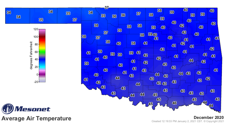
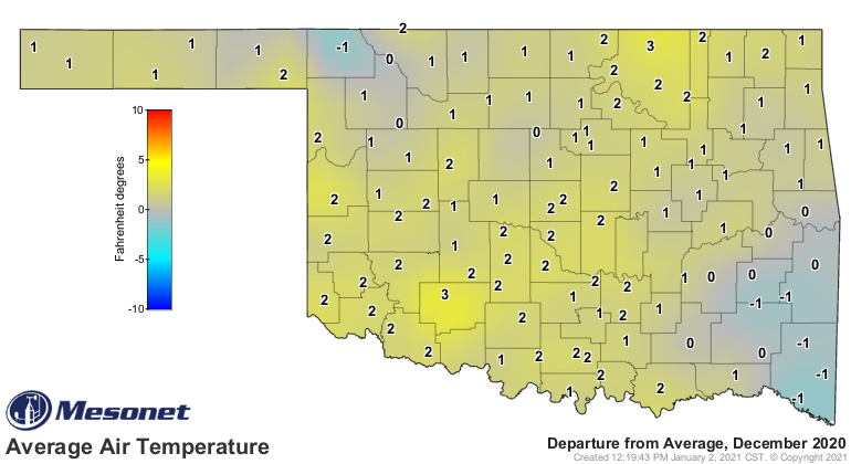
December was warmer than normal despite the wintry intrusions throughout the
month. The statewide average temperature was 40.8 degrees, 1.9 degrees above
normal, to rank as the 45th warmest December on record. The Mesonet site at
Centrahoma recorded December’s highest reading with 80 degrees on the ninth.
Hooker and Beaver shared the lowest reading of 2 degrees on the 14th and 16th,
respectively. The 2020 temperature extremes ranged from 1.2 degrees at Tipton
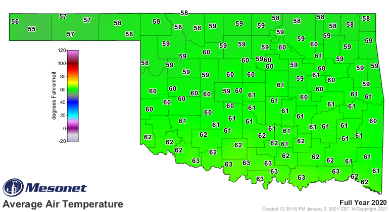
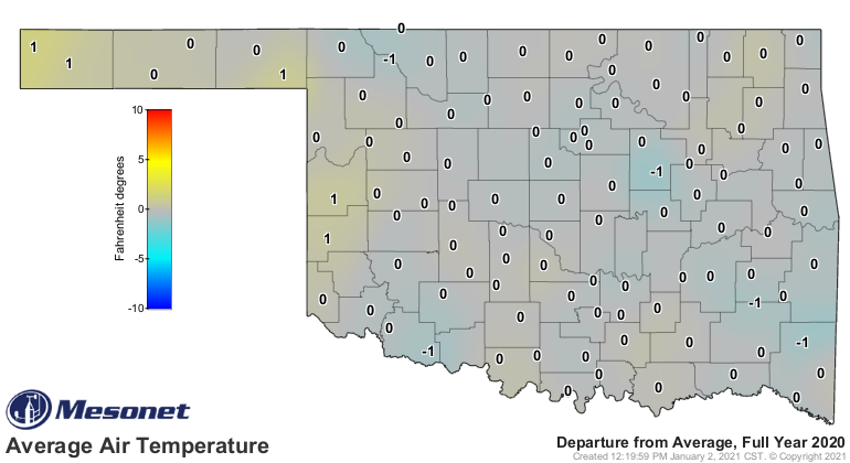
on Feb. 6 to 113 degrees at Hollis on July 14. The 2020 statewide average was
60.7 degrees, 0.8 degrees above normal, to rank as the 28th warmest year on
record.
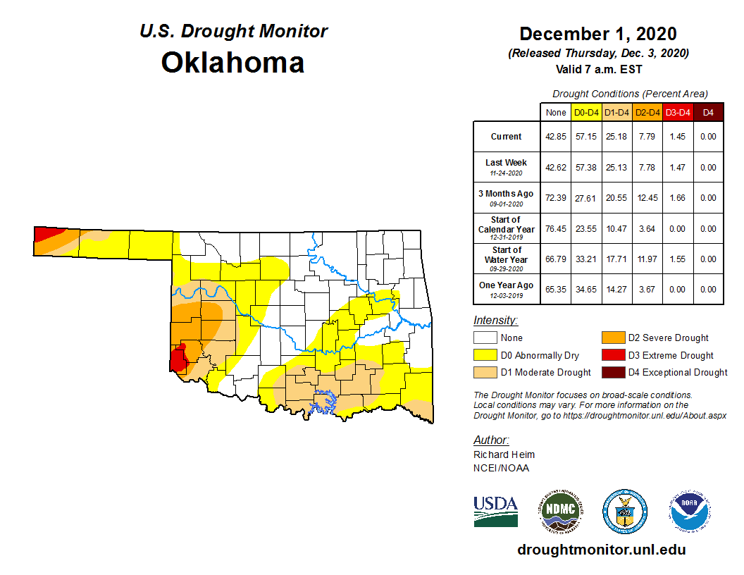
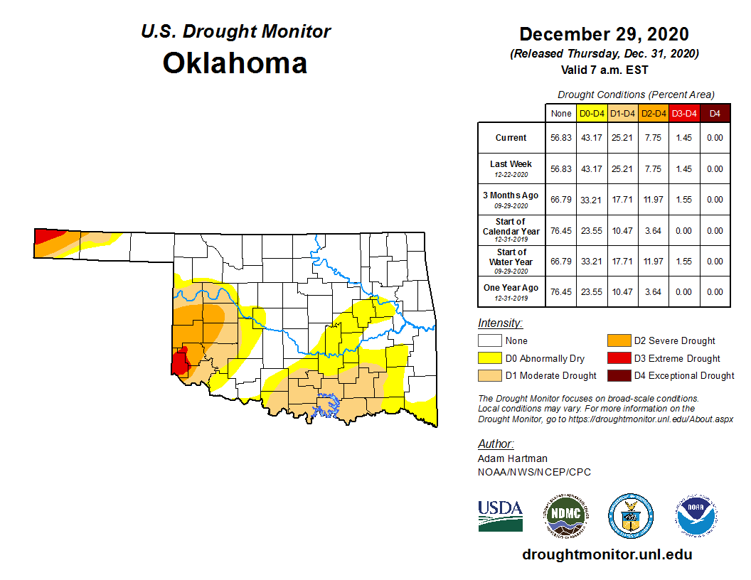
There was virtually no change in the U.S. Drought Monitor depiction for
Oklahoma throughout December, with a little over 25% of the state categorized
in at least moderate drought. The heaviest moisture fell outside the hardest
hit areas in western and southern Oklahoma, and the far western Panhandle.
Improvements were expected in 2021’s first map due to the moisture-laden storm
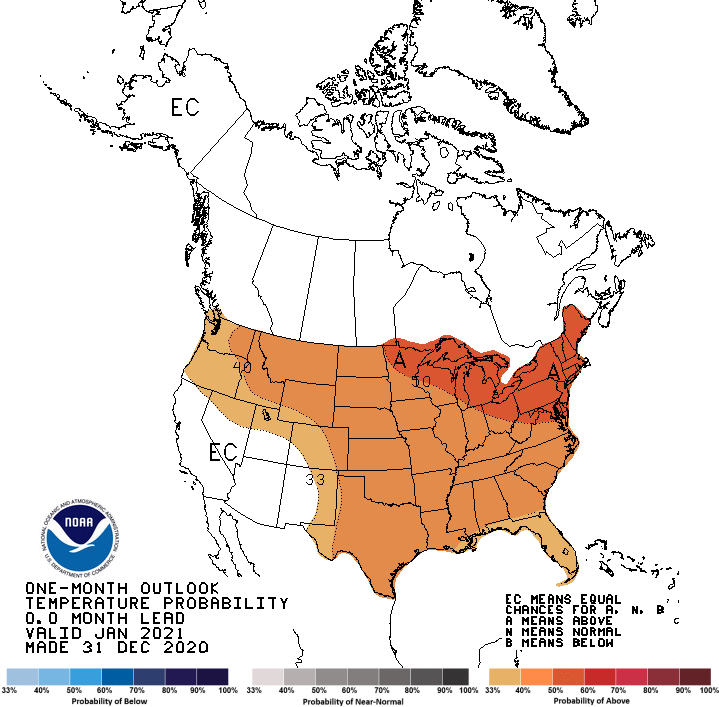
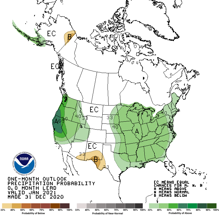
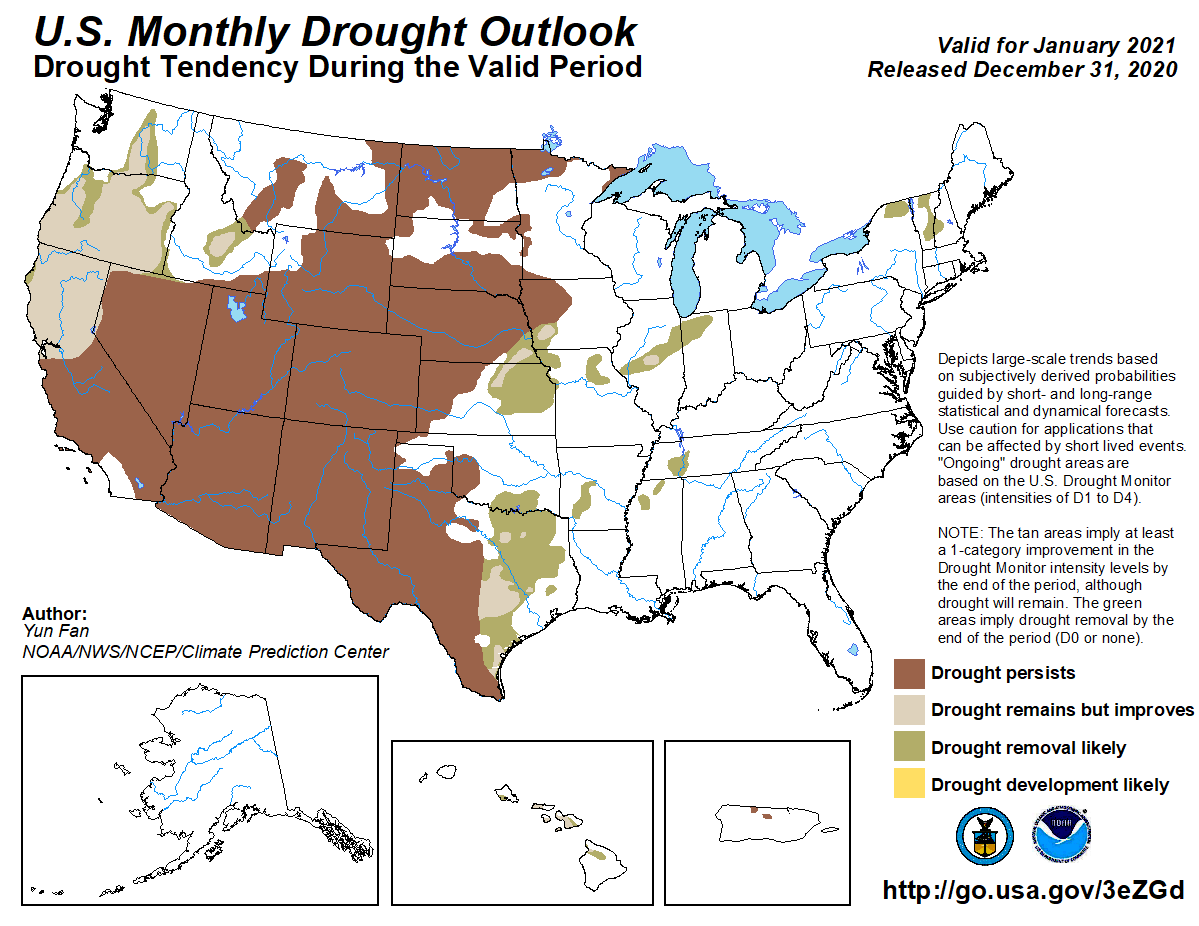
that ended the year. The Climate Prediction Center’s (CPC) January outlooks
indicate increased odds of above normal temperatures across the entire state,
and above normal precipitation over the eastern half of Oklahoma—especially the
eastern one-third. CPC’s January drought outlook calls for drought persistence
in those areas where it exists across western Oklahoma, but drought removal in
the south central section of the state. No drought development is likely during
January according to CPC’s outlook.
Gary McManus
State Climatologist
Oklahoma Mesonet
Oklahoma Climatological Survey
(405) 325-2253
gmcmanus@mesonet.org
January 4 in Mesonet History
| Record | Value | Station | Year |
|---|---|---|---|
| Maximum Temperature | 72°F | HOLL | 2022 |
| Minimum Temperature | -6°F | BOIS | 2015 |
| Maximum Rainfall | 5.42″ | COOK | 1998 |
Mesonet records begin in 1994.
Search by Date
If you're a bit off, don't worry, because just like horseshoes, “almost” counts on the Ticker website!