Mesonet Ticker for July 2, 2026
MESONET TICKER ... MESONET TICKER ... MESONET TICKER ... MESONET TICKER ...
July 2, 2026 July 2, 2026 July 2, 2026 July 2, 2026
Code red hot
Son, we live in a state that has heat domes, and those domes have to be
respected by people with sunscreen. Who’s gonna do it? You? You, Lieutenant
Lawn Chair? I have a greater responsibility than you can possibly fathom. You
weep for the cold front, and you curse the Mesonet. You have that luxury. You
have the luxury of not knowing what I know: that this Fourth of July forecast,
while sweaty, probably saved barbecues. And my existence, while grotesque and
incomprehensible to your thermostat, saves cookouts. You don’t want the truth,
because deep down in places you don’t talk about at the fireworks stand, you want
that heat dome on that map. You need that heat dome on that map. We use words
like “ridge,” “humidity,” “heat index.” We use these words as the backbone of a
life spent defending Oklahoma from surprise outdoor plans. You use them as a
punchline. I have neither the time nor the inclination to explain myself to a
person who rises and sleeps under the blanket of the very air conditioning that
this forecast warned them to maintain, and then questions the manner in which I
provide it. I would rather you just said, “thank you,” drank some water, and
went on your way. Otherwise, I suggest you pick up a spatula and stand a grill.
Either way, I don’t give a darn what you think you are entitled to!
Now, where do we accept that Academy Award? Academy of Idiocracy, but we'll
take it!
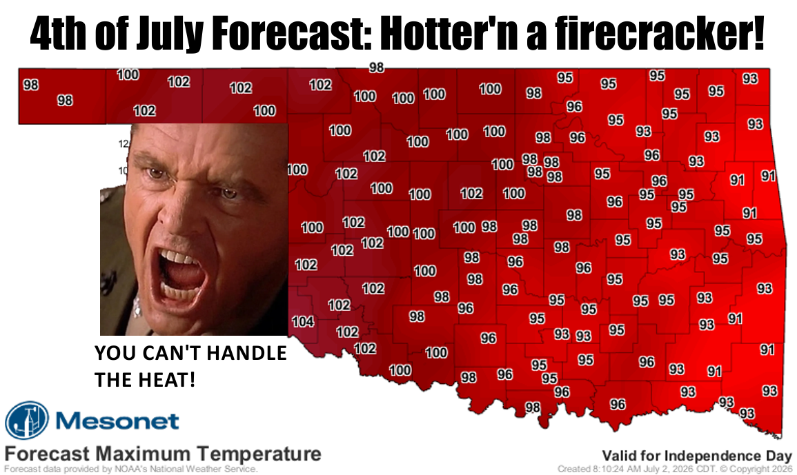
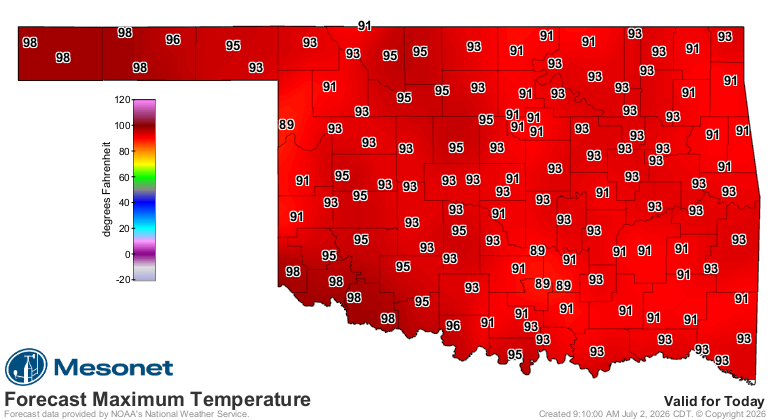
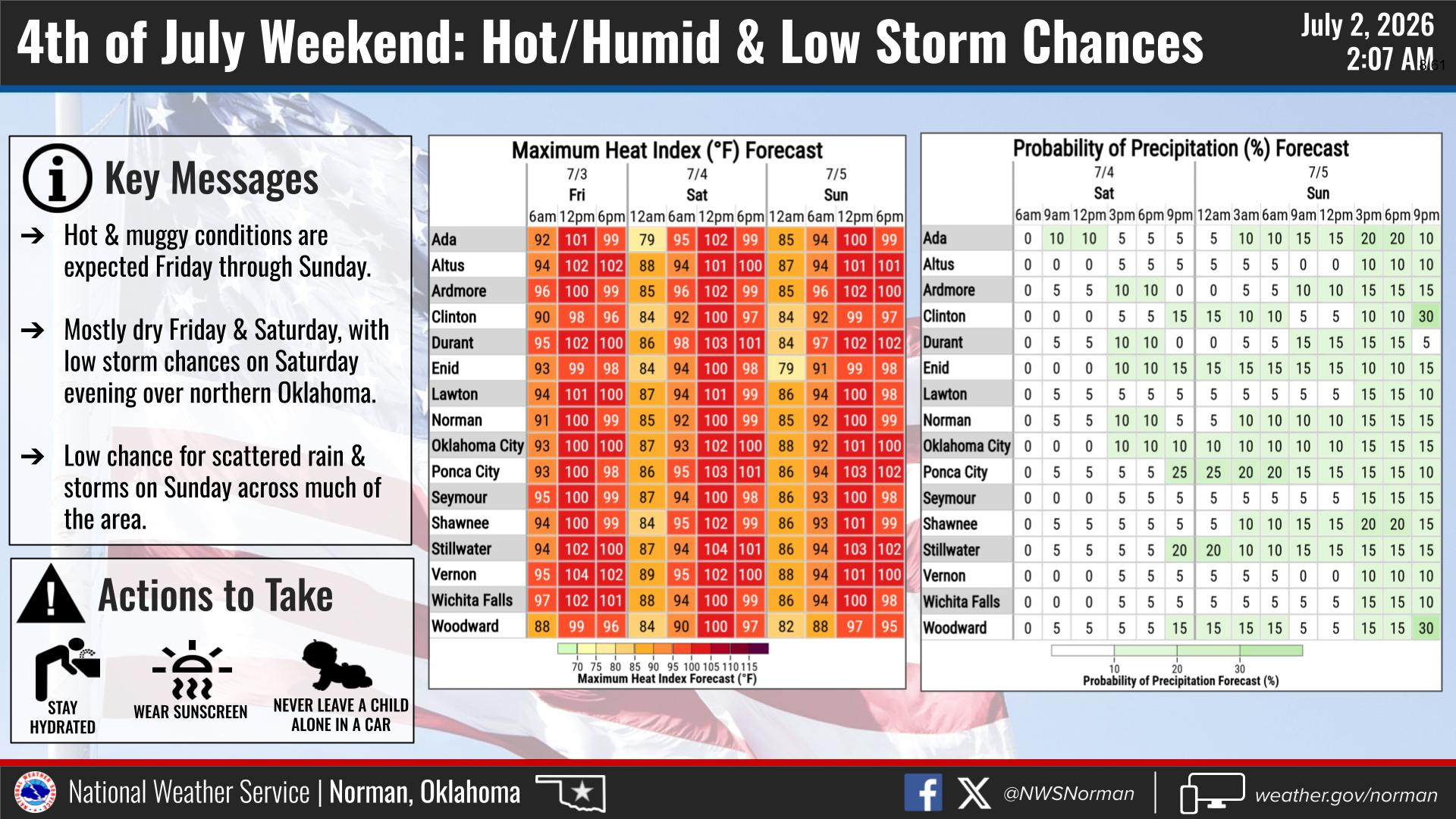
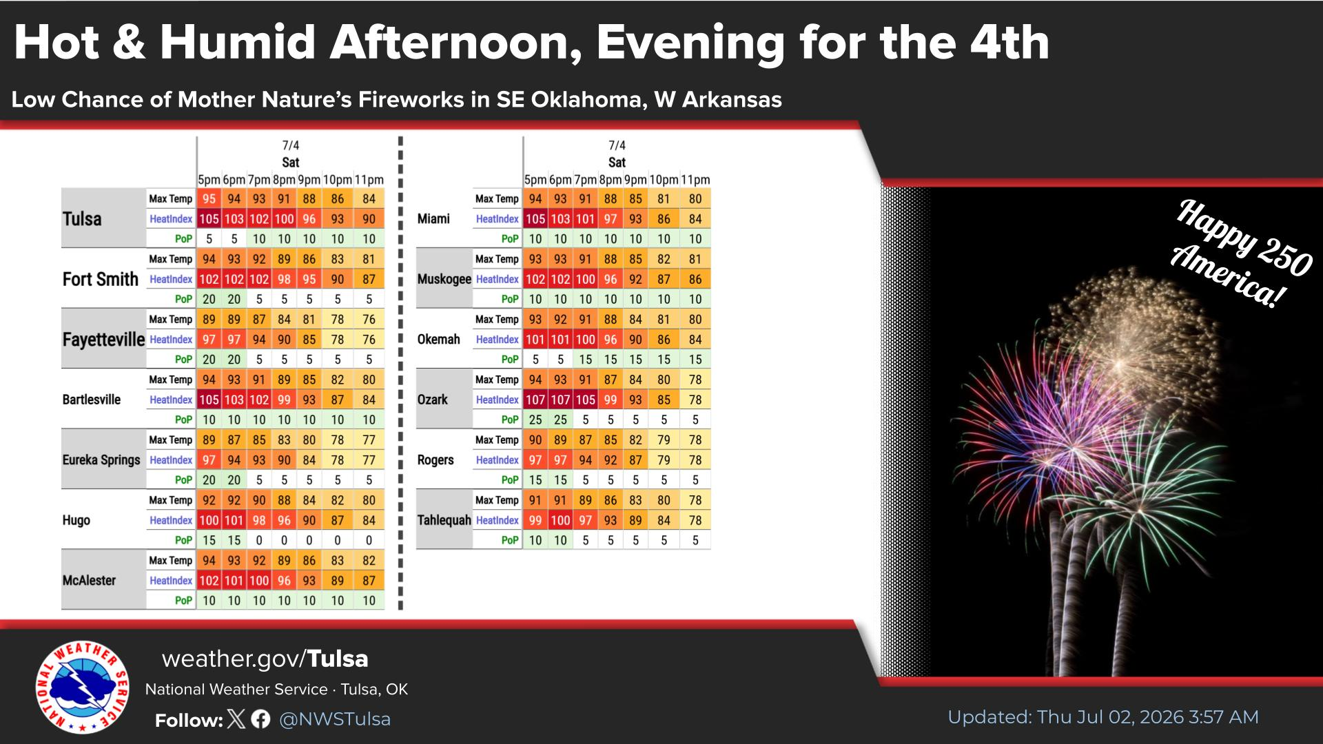
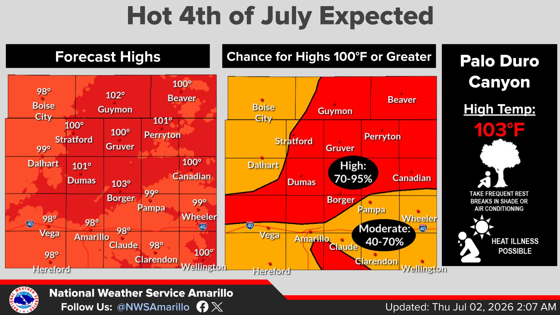
Yes, it will be sorta hot this weekend. Heck, it'll be hot today for crying out
loud! But not TOO hot. Not "ooh, July in Oklahoma sucks" hot.
And July 4th, our nation's birthday (and a certain Ticker writer's birthday,
too!) will also be a bit on the hot side. Add 5-10 degrees to those numbers
above to those top numbers to get the heat index.
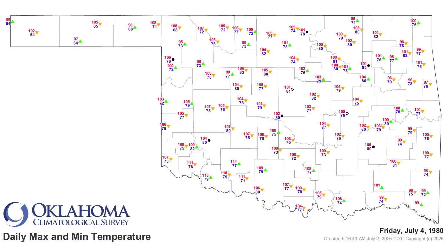
Not really close to the hottest on record, which occurred back in 1980, at least
on the thermometer. No accounting for heat index. Nowhere close to the coolest,
either, back in 1940.

Pretty hot, though. Just be careful, stay hydrated, and don't point those
pop-bottle rockets at your neighbor.
Gary McManus
State Climatologist
Oklahoma Mesonet
Oklahoma Climate Survey
gmcmanus@ou.edu
July 3 in Mesonet History
| Record | Value | Station | Year |
|---|---|---|---|
| Maximum Temperature | 106°F | KIN2 | 2011 |
| Minimum Temperature | 49°F | VINI | 2014 |
| Maximum Rainfall | 6.39 inches | NOWA | 2016 |
Mesonet records begin in 1994.
Contact the Ticker
Follow the Ticker via the Mesonet social media accounts on Bluesky, X, or Facebook, or subscribe to our RSS feed.
To subscribe to or unsubscribe from the Ticker mailing list, or for questions about the Ticker or its content, please contact the Ticker Manager at OCS:
(405) 325-2253