MESONET TICKER ... MESONET TICKER ... MESONET TICKER ... MESONET TICKER ...
June 2, 2023 June 2, 2023 June 2, 2023 June 2, 2023
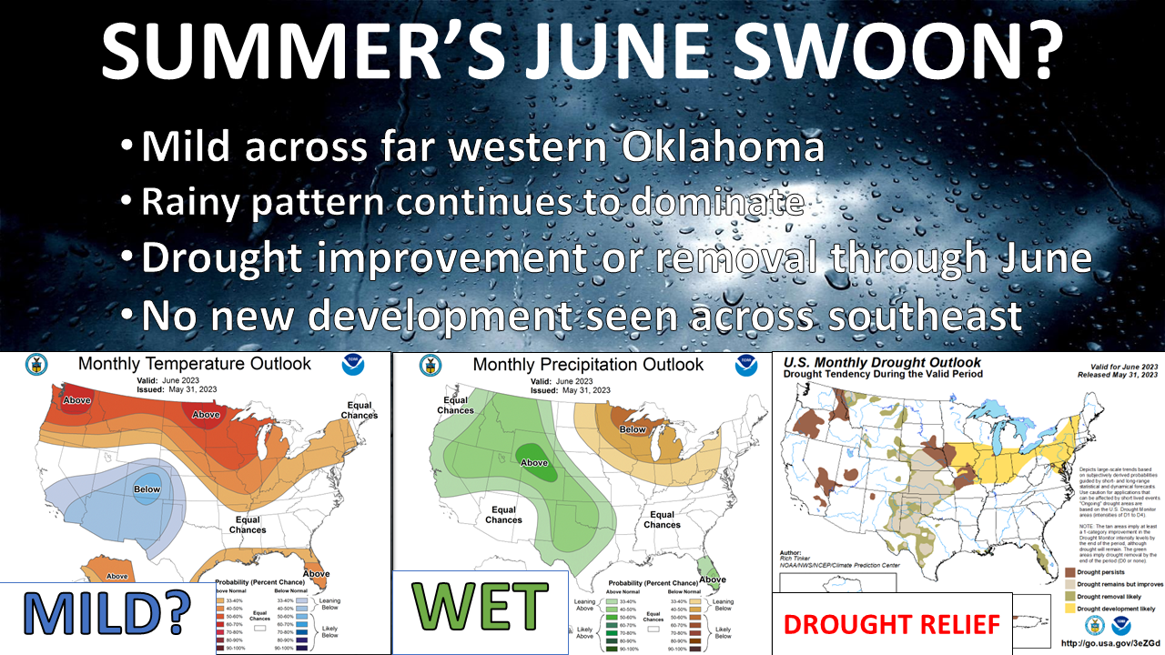
Whither Summer?
https://ticker.mesonet.org/archive/20230602/june-outlook.png
Hey now, the last thing I want to do is jinx either our drought relief or lack of
heat index values in the 120s. I do have a long history of jinxes, as my long-time
readers are aware. The more (in)famous?
"HA HA! Look at that bald guy! I'll be he's jealous of my hair."
"Most sequels are terrible, but 'Caddyshack 2' looks good!"
"Those Dallas Cowboys are gonna win 10 Super Bowls with Jimmy and Jerry at the
helm!"
"No, don't go with Apple stock. That's crap. I'm buying Blockbuster!"
So no, I do not want to invite what I hate the most by talking about it, but I
would like some lovely dry heat. Some 90s, some 100s, just enough to heat the
swimming pools and turn that grass a darker shade of green. As we talked about
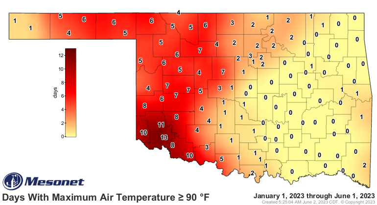
yesterday, some areas of the state are STILL waiting for that first 90, and
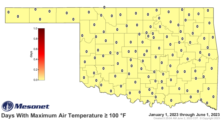
EVERYBODY is still waiting for that first 100.
https://ticker.mesonet.org/archive/20230602/tmax.ge90.png
https://ticker.mesonet.org/archive/20230602/tmax.ge100.png
You know, that lack of 90s isn't TOO unusual, even for eastern Oklahoma. In
1899 (if you were alive back then, go see either a priest or your local undead
eradicator), OKC didn't see its first 90 until July 5, and even back as
recently as 2019 it too until June 20. Tulsa took until June 20 back in 1941,
and even 2021 didn't see a 90 until June 9. In 2007 it took Lawton until June
5. And obviously there were years some folks didn't ever hit 100.
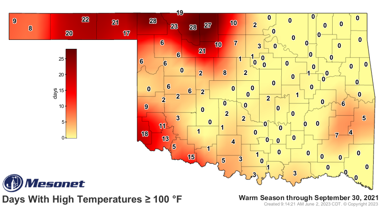
Remember 2021?
https://ticker.mesonet.org/archive/20230602/2021-100s.png
But back to this year...this persistent high pressure ridge to our east has
kept the rains out across the High Plains and far western OK for the most part,
and it looks like that will continue for awhile longer. Our marked lack of
severe weather reflects that due to lack of any jet stream support, which is
also why we've gone into a later-June type rainfall pattern that sees storms
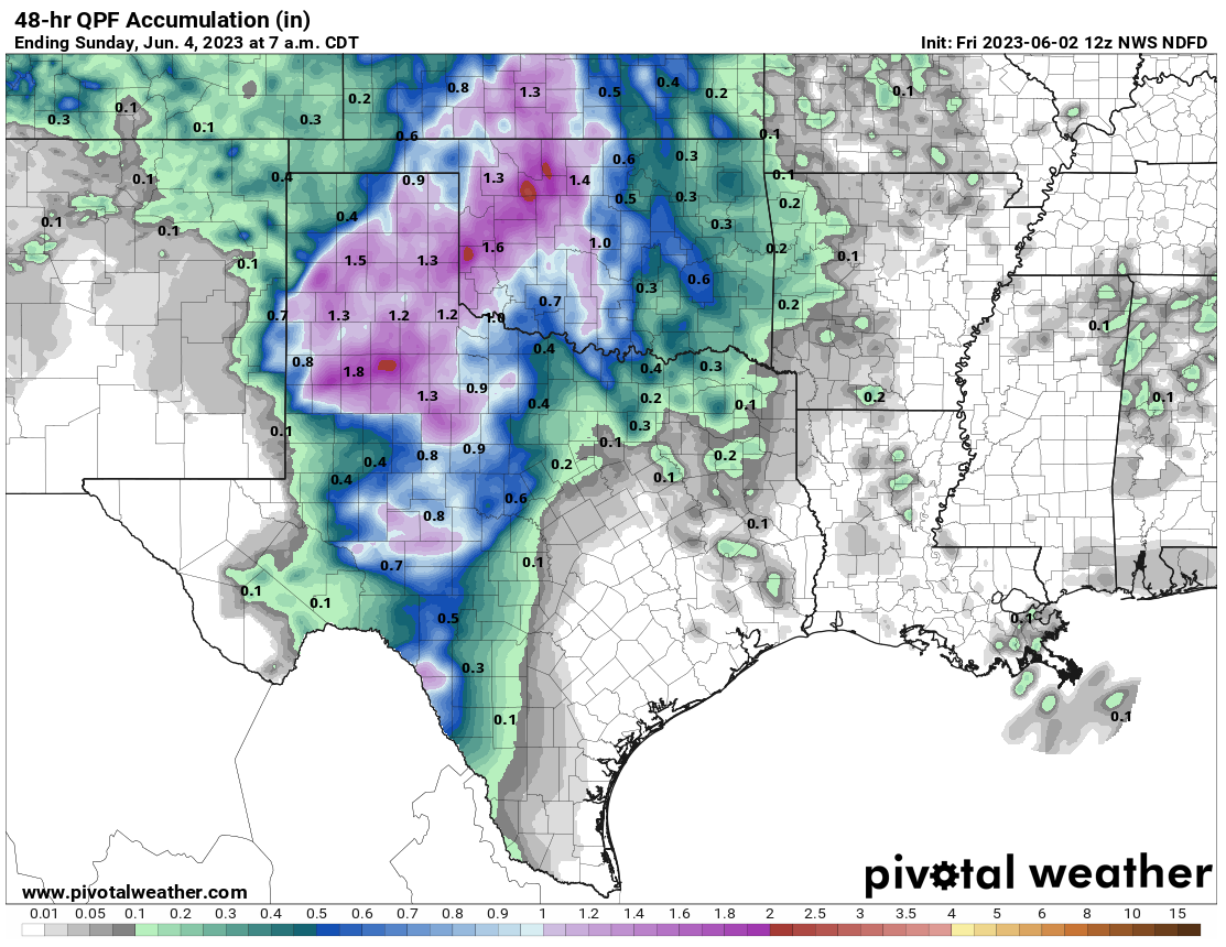
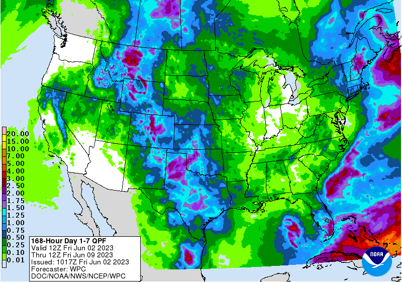
moving all sorts of directions. But, at least it's raining, and it should
continue to rain out west as we go through the weekend (and beyond).
https://ticker.mesonet.org/archive/20230602/friday-saturday-rain-forecast.png
https://ticker.mesonet.org/archive/20230602/7day-rain-forecast.gif
Now as we look at that top graphic and the June outlooks, I disagree with the
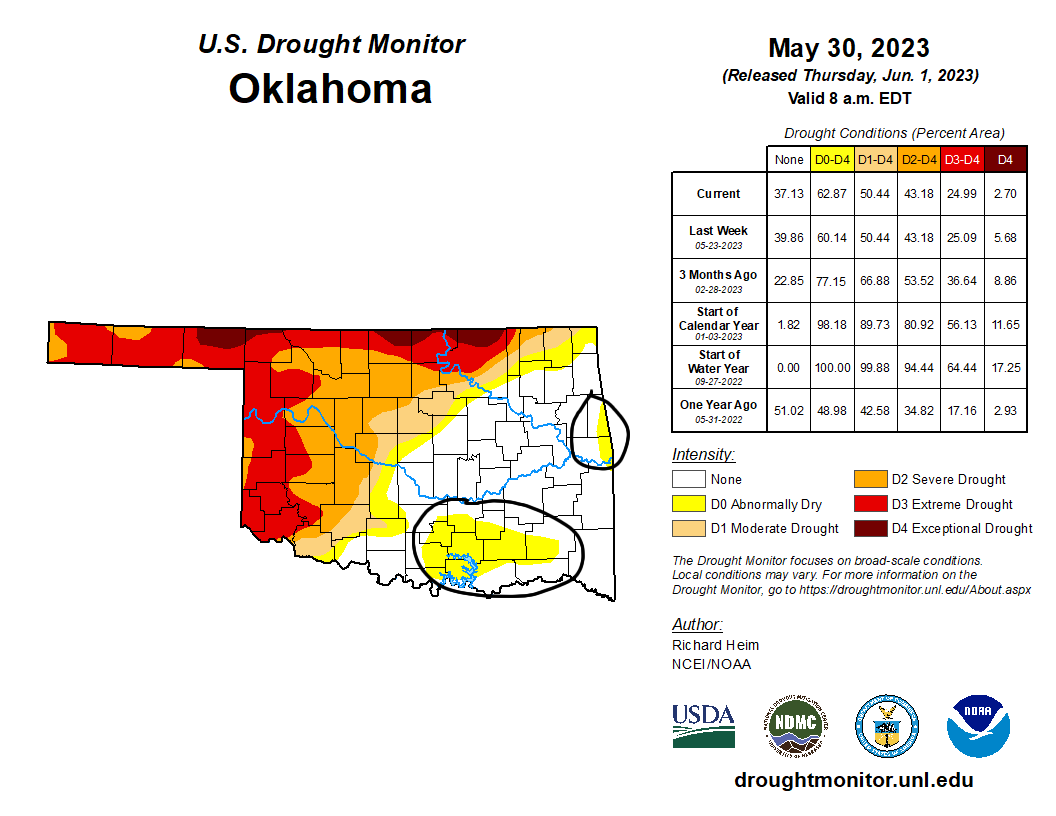
drought outlook to some degree (or inches). If southeastern Oklahoma continues
to miss out on the good rainfall, as has been happening, we WILL see drought
development in that region. Just in the last week or two we've had the drought
precursor designation of "Abnormally Dry Conditions" introduced to a fairly
large area in the southeast and a smaller area along the Arkansas border in
east central Oklahoma.
https://ticker.mesonet.org/archive/20230602/20230530_ok_trd.png
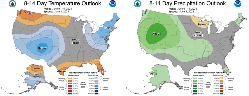
The good news is there does appear to be some hope for eastern OK to get some
decent moisture as we go forward looking at the outlooks for mid-June, and
they don't show much bigtime heat developing that could spur that drought
development forward.
https://ticker.mesonet.org/archive/20230602/june9-15-outlooks.png
But see, THAT statement is prime jinx territory.
Gary McManus
State Climatologist
Oklahoma Mesonet
Oklahoma Climatological Survey
gmcmanus@mesonet.org
==================================================
The OCS/Mesonet Ticker
https://ticker.mesonet.org/
To subscribe or unsubscribe from the Ticker
or for questions about the Ticker or its content
Phone or Email the Ticker Manager at OCS
Phone: 405-325-2253 Email: ticker@mesonet.org
---------------------------------------------------
-C- Copyright 2024 Oklahoma Climatological Survey
===================================================
|


 Tweet
Tweet