MESONET TICKER ... MESONET TICKER ... MESONET TICKER ... MESONET TICKER ...
March 2, 2023 March 2, 2023 March 2, 2023 March 2, 2023
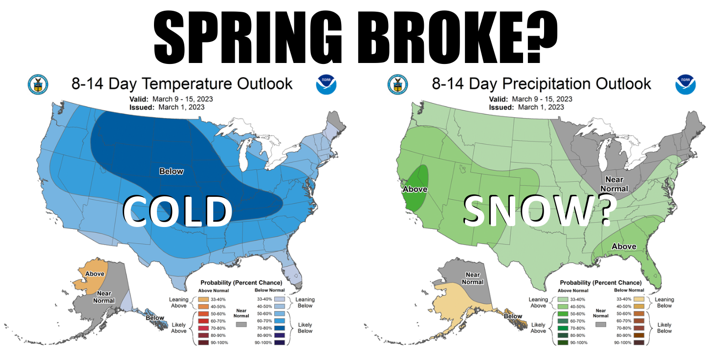
Spring broke?
https://ticker.mesonet.org/archive/20230302/spring-broke.png
Ahh, you must have tasted it, right? All those 70s and 80s over the last few
weeks...errr, months. Coming off the 32nd warmest February and the 20th warmest
winter on record, you had to go and jinx us by declaring spring has sprung a
few weeks ago...and when I say "you," I mean "me." I just didn't want to get the
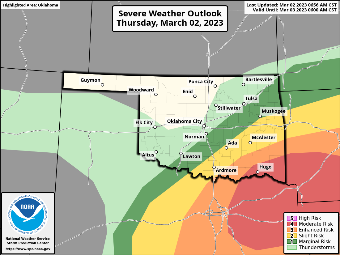
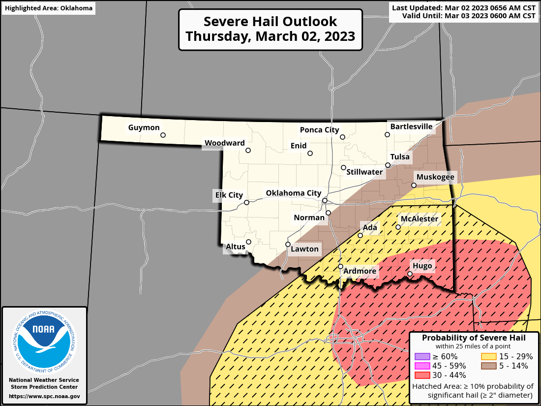
blame. Let's take care of spring today first, however, in that SE Oklahomans are
waking up to one of THOSE days. You know, like last Sunday? One of THOSE days
in Oklahoma where the wind threatens to come sweeping down the plains, with you
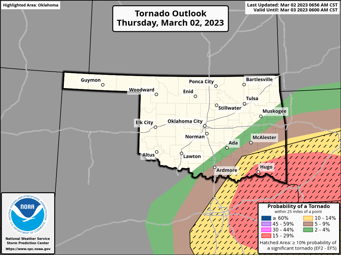
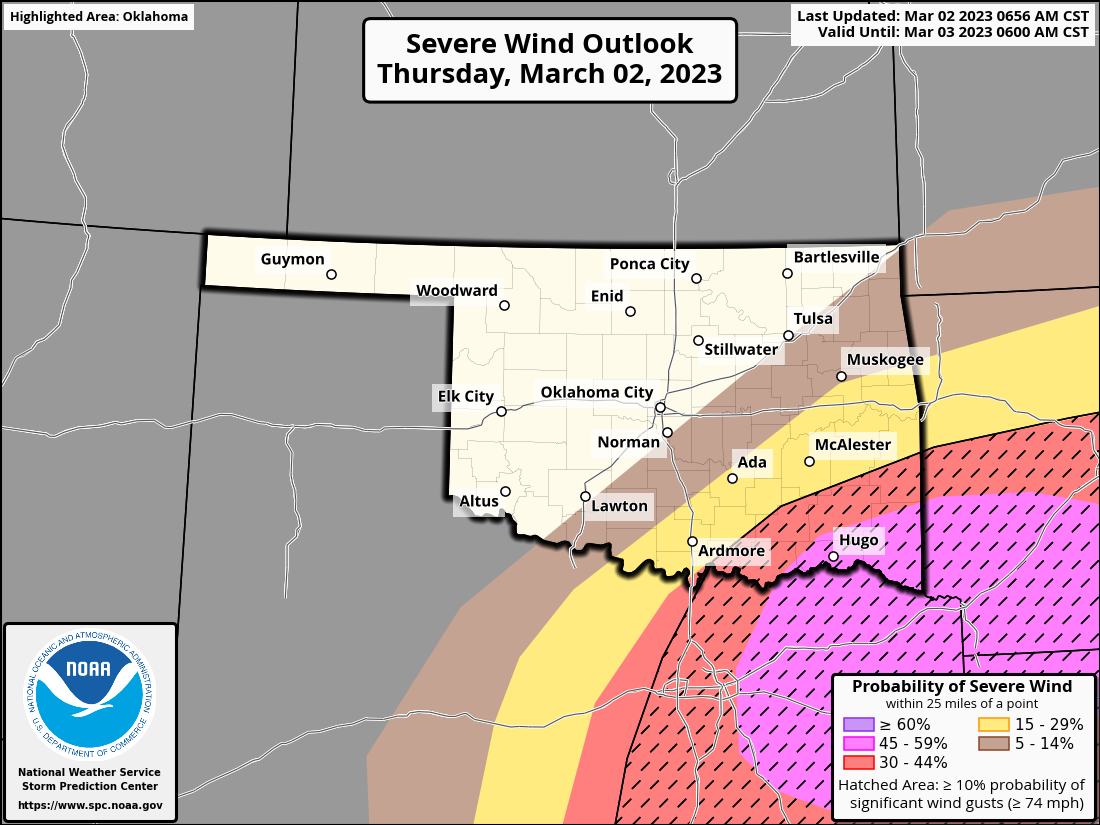
along with it. Once again we will see a moderate risk in SE OK later tonight,
with a chance of "Significant" (EF2-EF5) tornadoes, giant hail (> 2"), and
severe winds (> 74 mph).
https://ticker.mesonet.org/archive/20230302/OK_swody1.png
https://ticker.mesonet.org/archive/20230302/OK_swody1_TORN.png
https://ticker.mesonet.org/archive/20230302/OK_swody1_WIND.png
https://ticker.mesonet.org/archive/20230302/OK_swody1_HAIL.png
OOF! Now that our tornado count is officially up to 11, the last thing we want
to see if March trying to set it's own record. Upstream from the severe weather,
we should see some showers and storms later this morning to kick off the show...
maybe some hail with those. Late tonight into tomorrow, northern OK might see
some snow mixing in with some rain. MAYBE, just maybe, brief bursts of moderate
snow...enough to plop an inch or so on some grassy surfaces. Don't hold your
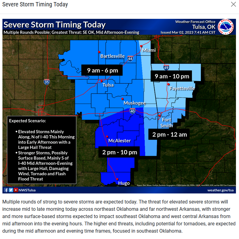
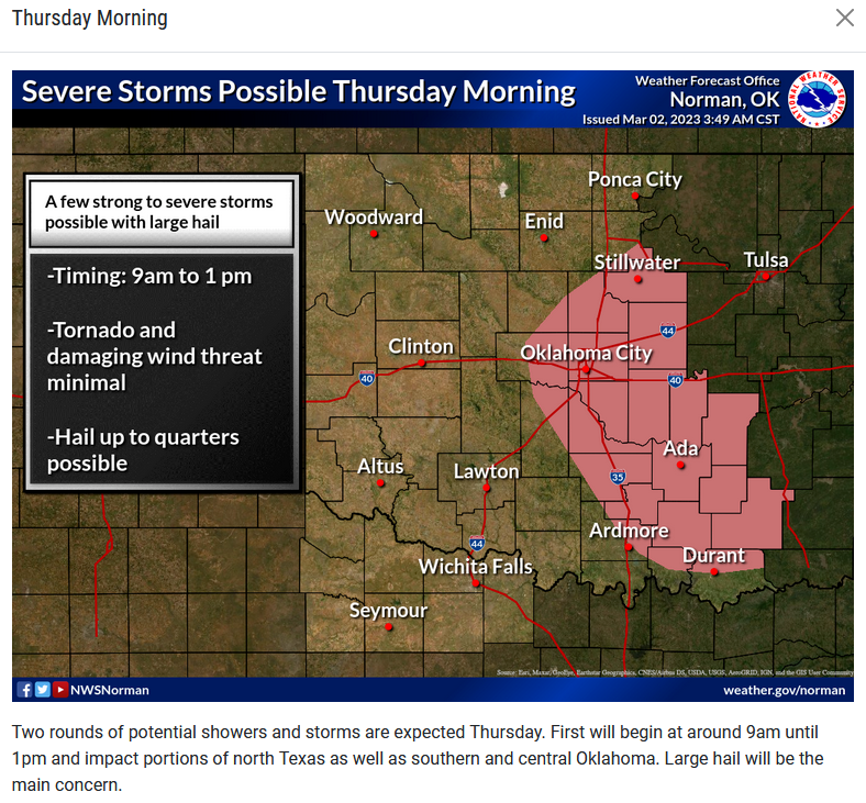
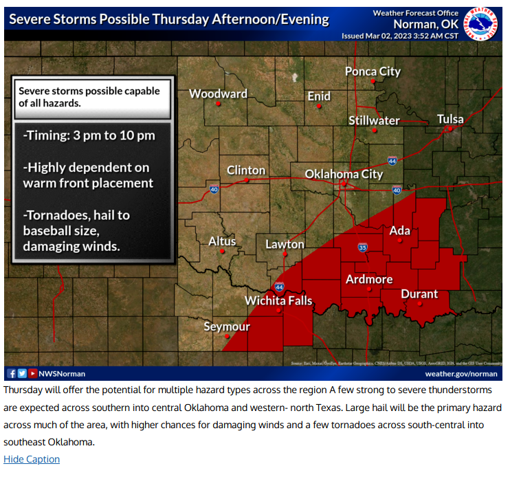
breath though (I tried it...cold front is still coming today). Here are the
timing thoughts on today's weather from our local NWS offices.
https://ticker.mesonet.org/archive/20230302/nws-tulsa-timing.png
https://ticker.mesonet.org/archive/20230302/nws-norman-morning.png
https://ticker.mesonet.org/archive/20230302/nws-norman-aft.eve.png
One of the main threats today NOT related to hail putting knots on your noggin
faster'n you can rub 'em or wind huffing and puffing and blowing your face in
would be flash flooding. Lots of moisture to work with across the SE half of
the state (I can actually hear you cursing through the monitor, NW HALF!), and
we could see some pretty intense rainfall. With the ground being saturated,
we might see some trouble there. Heck, we already have some flood warnings going
on across east central OK, for crying out loud! And a flash flood watch is in
place in a broader area.
https://ticker.mesonet.org/archive/20230302/2day-rain-forecast.gif
https://ticker.mesonet.org/archive/20230302/latest.oklahoma.flood.gif
So a mess today, along with a cold front to keep temperatures down for the
next few days, a warm up, then...spring breaks for Spring Break, it appears.
The Fantasy-Casts are lighting up the state with snow here and there through
the next 14 days. Our (MY!) only hope is it ends up for fantasy than reality.
Gary McManus
State Climatologist
Oklahoma Mesonet
Oklahoma Climatological Survey
gmcmanus@mesonet.org
==================================================
The OCS/Mesonet Ticker
https://ticker.mesonet.org/
To subscribe or unsubscribe from the Ticker
or for questions about the Ticker or its content
Phone or Email the Ticker Manager at OCS
Phone: 405-325-2253 Email: ticker@mesonet.org
---------------------------------------------------
-C- Copyright 2024 Oklahoma Climatological Survey
===================================================
|


 Tweet
Tweet