MESONET TICKER ... MESONET TICKER ... MESONET TICKER ... MESONET TICKER ...
September 25, 2024 September 25, 2024 September 25, 2024 September 25, 2024
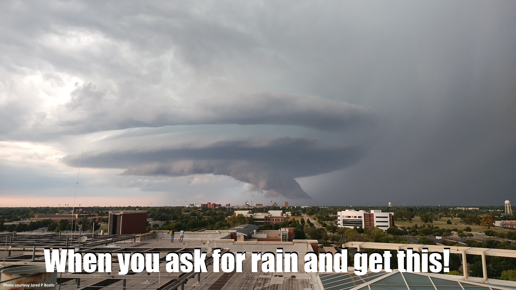
Pulverized
https://ticker.mesonet.org/archive/20240925/mothership.png
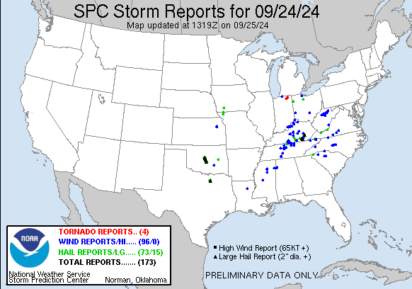
Okayyyyy, that's about enough billion dollar disasters for awhile. Well, I don't
really know if it was a billion dollar disaster, but to me if you have golf ball
to baseball size hail over about 40-50 miles, that seems like that would cost a
lot to repair.
https://ticker.mesonet.org/archive/20240925/yesterday.png
And while we're at it, why is it "golf ball" but baseball is "baseball?" Why isn't
it "golfball?"
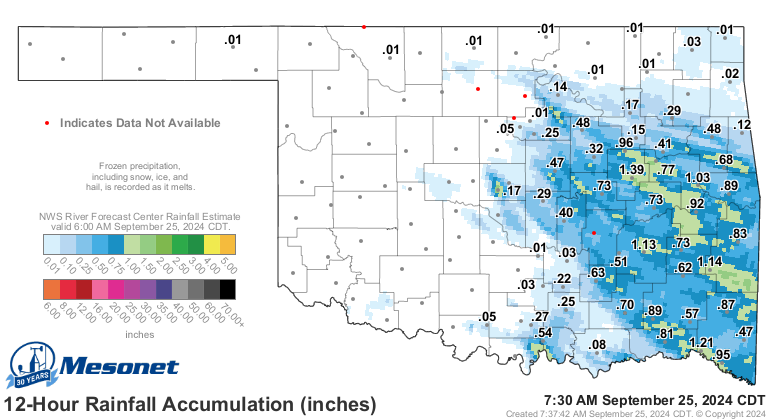
At least some folks over in eastern Oklahoma got some decent rain SANS spherical
frozen missiles of roof and windshield death.
https://ticker.mesonet.org/archive/20240925/rainrfc.12hr.png
As is sometimes (often? usually?) the case due to the convective nature (hey,
"Convective Nature" was my band's name in the French Foreign Legion!) of our
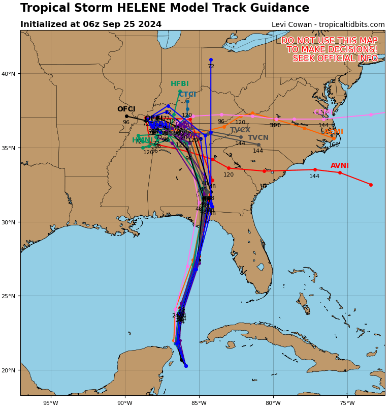
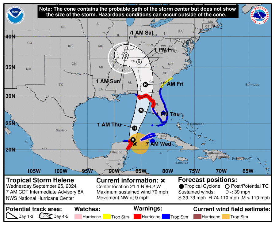
precipitation, it can come with bad things too. So now we hope for even MORE
rain from the remnants of tropical storm--soon to be hurricane--Helene, which
will bring the Gulf Coast loads of misery over the next 72 hours. it does look
like Helene will become a Major Hurricane of at least Cat-3 on the Saffir-Simpson
scale, meaning winds of 111-129 mph. SUSTAINED winds. Personally, I'd prefer
a Cat-3 on the Homer-Simpson scale, which would mean 111-129 jelly-filled
donuts.
https://ticker.mesonet.org/archive/20240925/09L_tracks_latest.png
https://ticker.mesonet.org/archive/20240925/cone.png
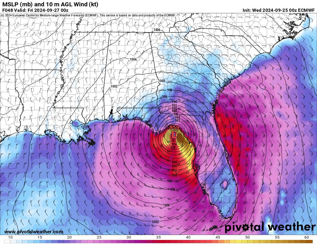
Oh, you want a yikes? Well here's a YIKES!
https://ticker.mesonet.org/archive/20240925/thurs-7pm.png
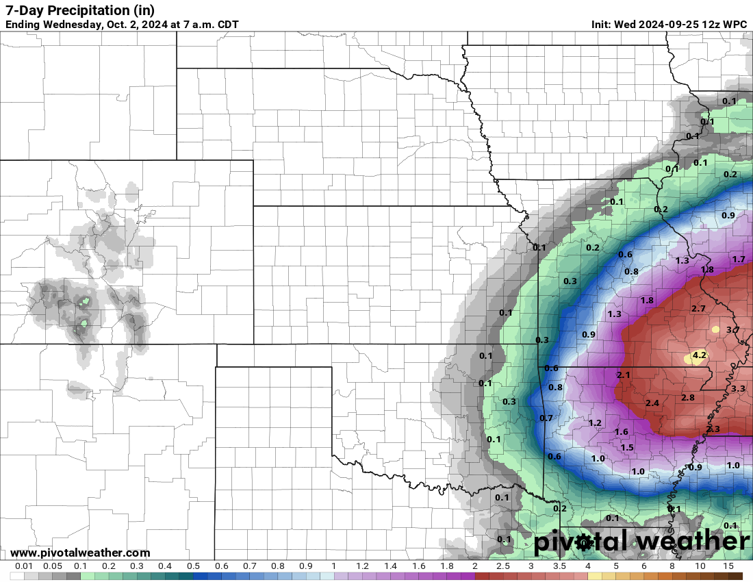
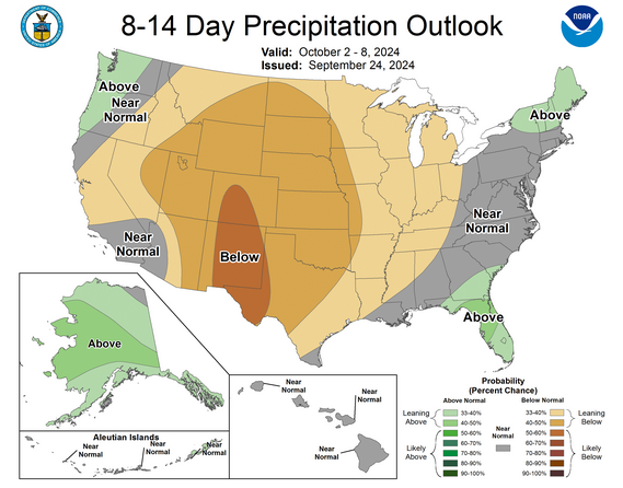
As for us, though...it appears the chances of seeing significant rainfall from
the remnants of Helene are getting a bit slim. In fact, slim for the next
couple of weeks in general.
https://ticker.mesonet.org/archive/20240925/7day-rain-forecast.png
https://ticker.mesonet.org/archive/20240925/oct2-8-precip-outlook.png
We could definitely use the rain, preferably WITHOUT the spherical
frozen missiles of roof and windshield death, please.
Gary McManus
State Climatologist
Oklahoma Mesonet
Oklahoma Climate Survey
gmcmanus@ou.edu
==================================================
The OCS/Mesonet Ticker
https://ticker.mesonet.org/
To subscribe or unsubscribe from the Ticker
or for questions about the Ticker or its content
Phone or Email the Ticker Manager at OCS
Phone: 405-325-2253 Email: ticker@mesonet.org
---------------------------------------------------
-C- Copyright 2024 Oklahoma Climatological Survey
===================================================
|


 Tweet
Tweet