MESONET TICKER ... MESONET TICKER ... MESONET TICKER ... MESONET TICKER ...
September 23, 2024 September 23, 2024 September 23, 2024 September 23, 2024
Moo dangit!
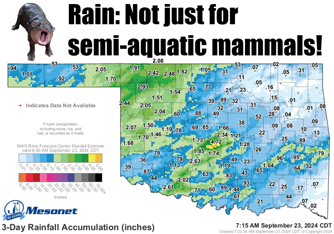
https://ticker.mesonet.org/archive/20240923/3day-rain-totals.png
Some got a lot, a lot got some, and too many got too little...but it was rain,
right? And it DID finally usher in fall. Proof? Well, we have data, of course, but
the biggest sign? I wore SWEATS to the movies yesterday instead of shorts.
SCIENCE!
Oh yeah...data.
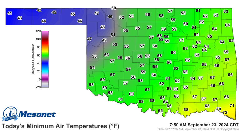
https://ticker.mesonet.org/archive/20240923/todays-lows.png
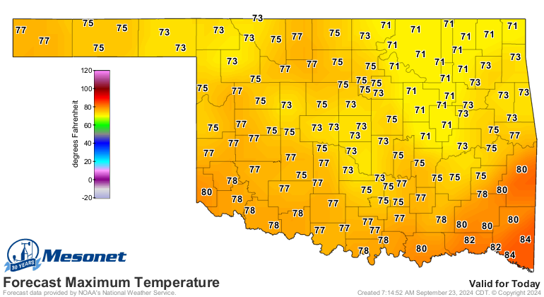
https://ticker.mesonet.org/archive/20240923/todays-forecast-highs.png
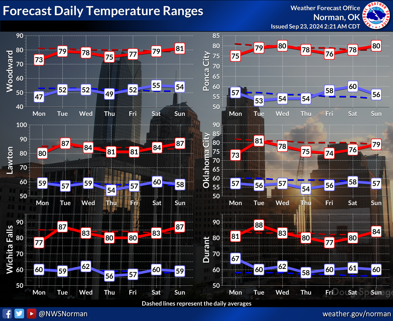
https://ticker.mesonet.org/archive/20240923/nws-norman-7day-temps.png
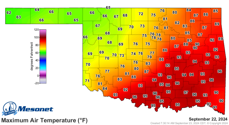
Experiences varied yesterday, of course, depending on where you were relative to
the rain and the front.
https://ticker.mesonet.org/archive/20240923/yesterdays-highs.png
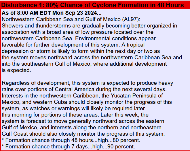
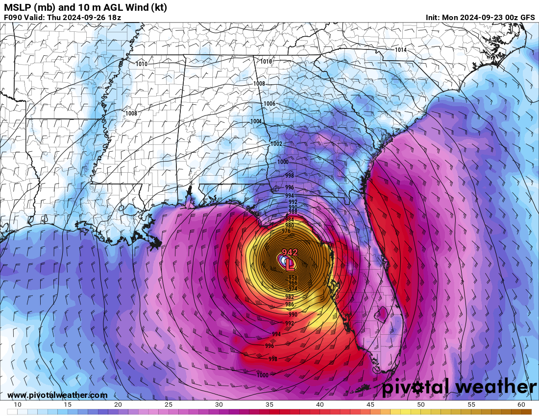
The big news now, other than Fall falling on us, is the possibility of a
tropical system forming into a tropical storm...Helene it will be called if
it does form later this week. And it apparently has the Florida Coast in its
sights.
https://ticker.mesonet.org/archive/20240923/helene.png
https://ticker.mesonet.org/archive/20240923/helene-thur-1pm.png
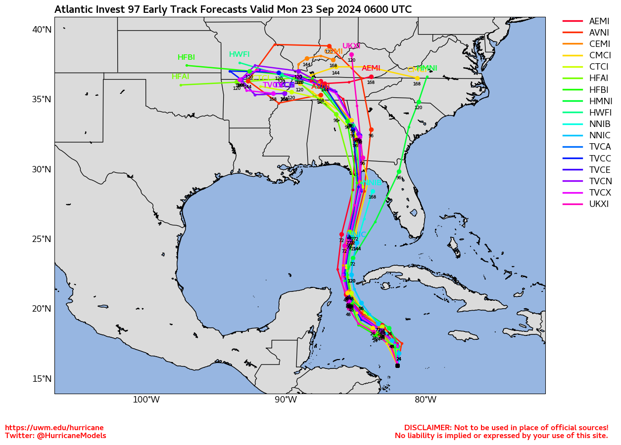
And while we won't see a direct impact here in Oklahoma, some of the model
solutions have it rotating around an upper-low over Arkansas and headed towards
us, which might mean some rainfall...at least across eastern Oklahoma!
https://ticker.mesonet.org/archive/20240923/helene-models.png
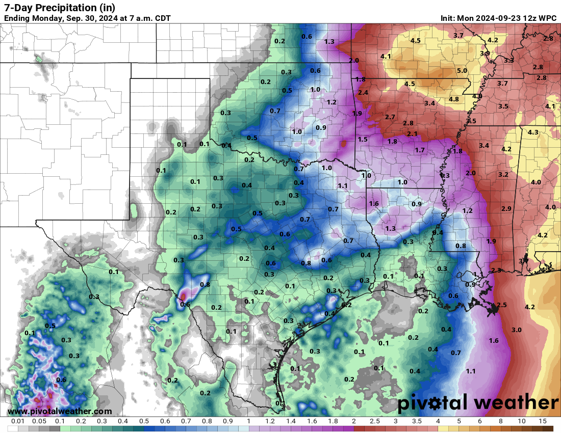
https://ticker.mesonet.org/archive/20240923/7day-rain-forecast.png
That counter-clockwise rotation between the two cyclonic circulations is known
as the "Fujiwhara effect," made somewhat famous in "Twisters," and also it's
believed to have occurred in some recent tornadoes in Oklahoma. It happens when
two cyclones (like hurricanes or tropical storms) get close to each other.
Instead of just moving independently, they start to interact and spin around a
common center, almost like a dance. If they get really close, one storm might
absorb the other, making the combined storm stronger. But if they stay at a
moderate distance, they’ll keep rotating around each other before eventually
going their separate ways.
It's like if you get me and a table of chocolate spinning around each other,
except in this case I will definitely absorb that chocolate.
Gary McManus
State Climatologist
Oklahoma Mesonet
Oklahoma Climate Survey
gmcmanus@ou.edu
==================================================
The OCS/Mesonet Ticker
https://ticker.mesonet.org/
To subscribe or unsubscribe from the Ticker
or for questions about the Ticker or its content
Phone or Email the Ticker Manager at OCS
Phone: 405-325-2253 Email: ticker@mesonet.org
---------------------------------------------------
-C- Copyright 2024 Oklahoma Climatological Survey
===================================================
|


 Tweet
Tweet