MESONET TICKER ... MESONET TICKER ... MESONET TICKER ... MESONET TICKER ...
December 28, 2017 December 28, 2017 December 28, 2017 December 28, 2017
But it's a dry cold
http://ticker.mesonet.org/archive/20171228/happy.new.year.png
Ahhhh, winter. The dry, crackly hair. The cracked lips. The Texas-sized boogers
in your nose (yeah, I said it). Hey, I'm not the one that wished this upon us.
Y'all did that! And so ever since one week ago, we've been awash in all the
delights and wonders that are normally reserved for the arctic. But wait, Mother
Nature is saving the best (worst) for last AND first with another blast of the
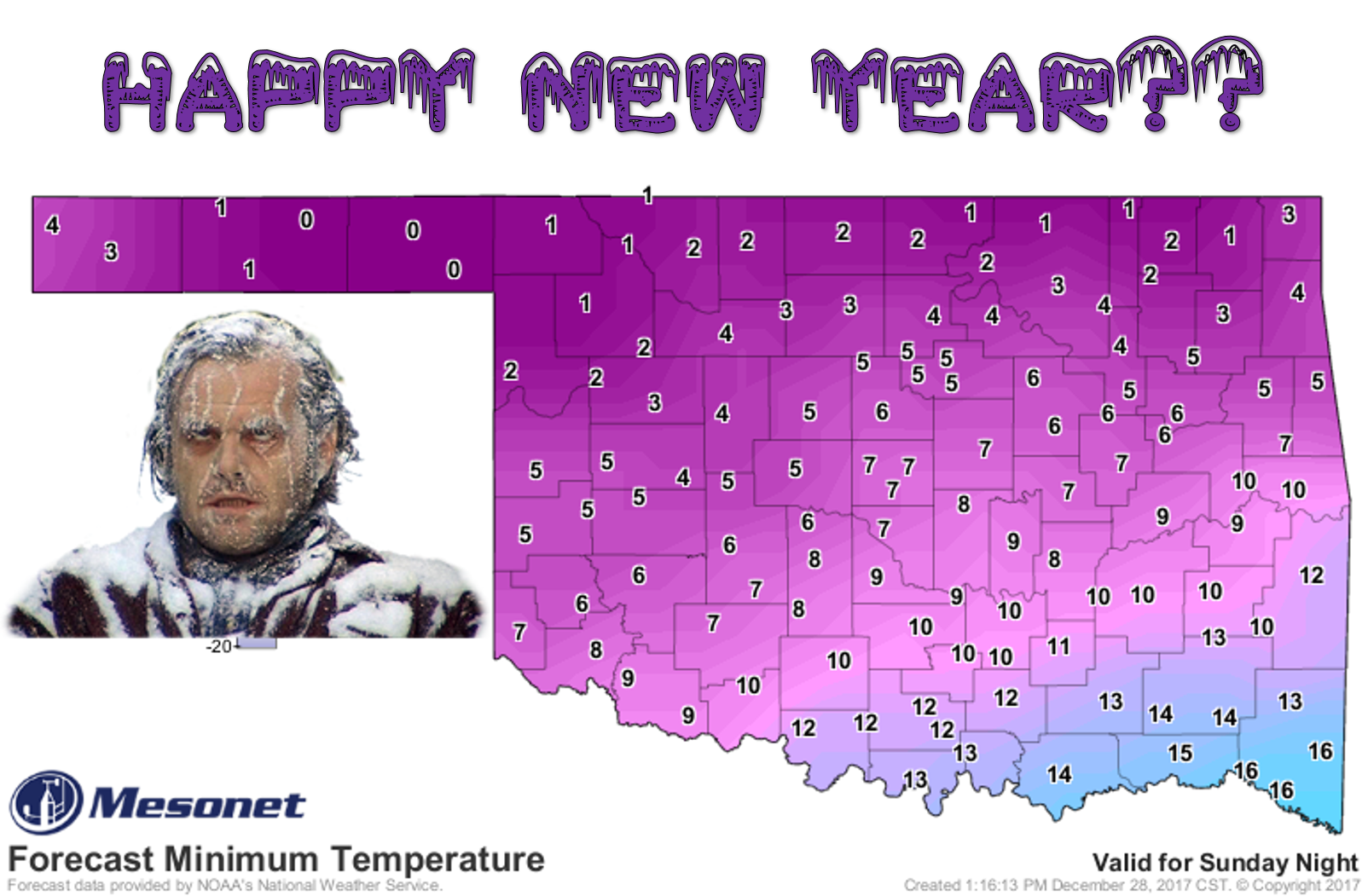
North Pole for New Year's Eve and New Year's Day. The above map with your frozen
maniacal madman shows the lows for New Year's Day, and so you can imagine what it
will be like if you add wind. Here are a few helpful graphics from your local
NWS offices.
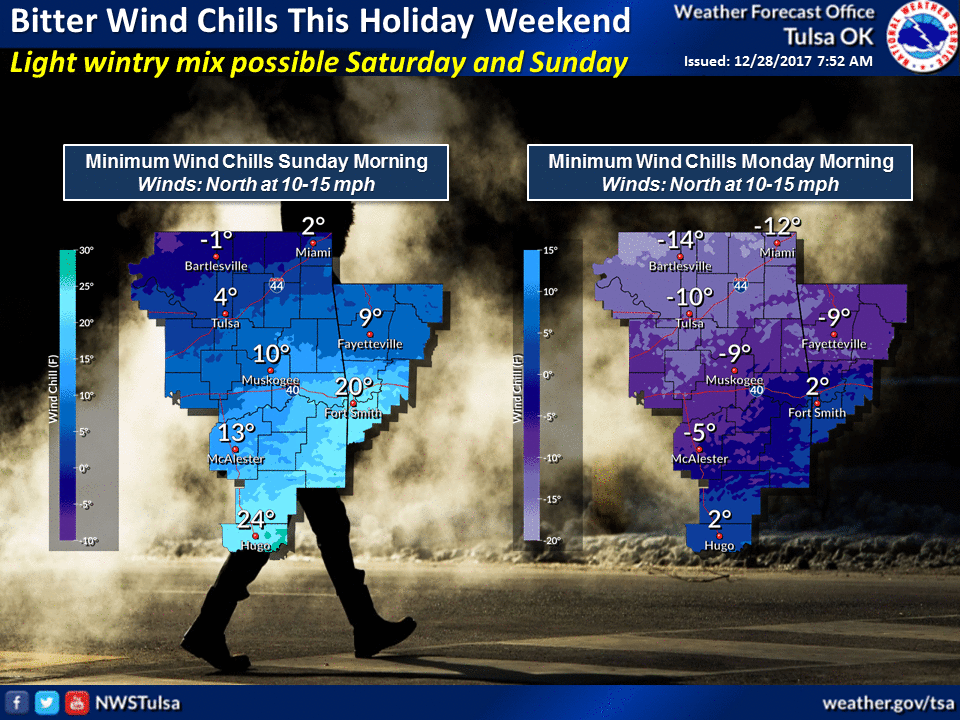
http://ticker.mesonet.org/archive/20171228/nws-tulsa-weekend.chill.png
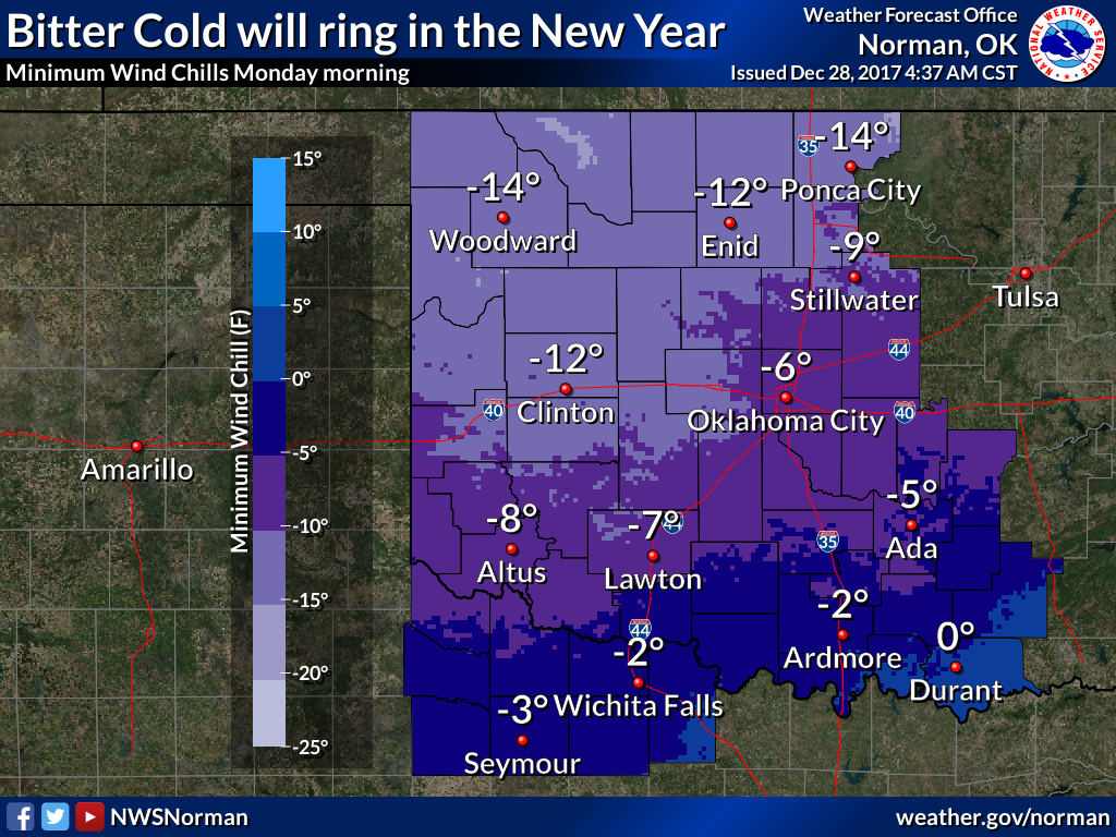
http://ticker.mesonet.org/archive/20171228/nws-norman-Jan1.wind.chills.png
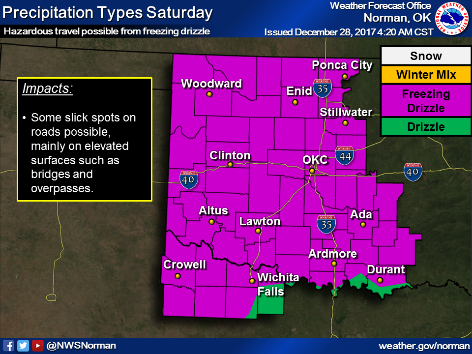
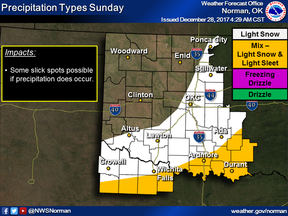
And with that cold air in place, there will be a chance of some frozen precip as
well this weekend.
http://ticker.mesonet.org/archive/20171228/nws-norman-saturday.png
http://ticker.mesonet.org/archive/20171228/nws-norman-sunday.png
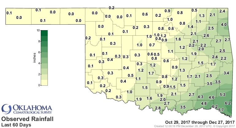
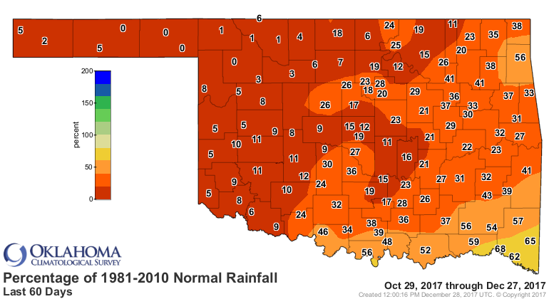
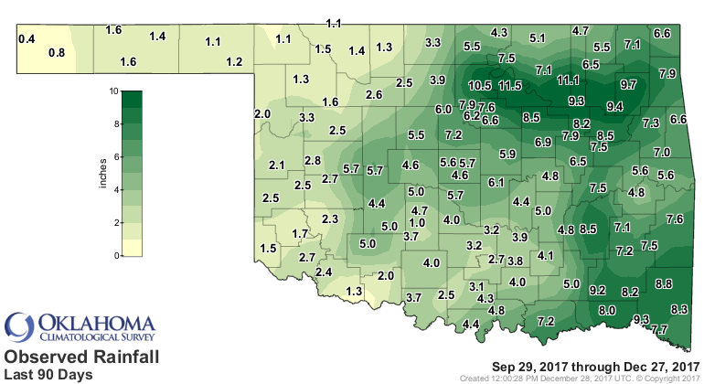
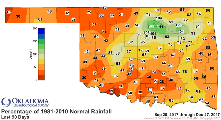
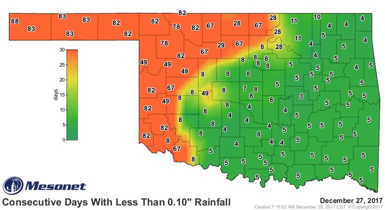
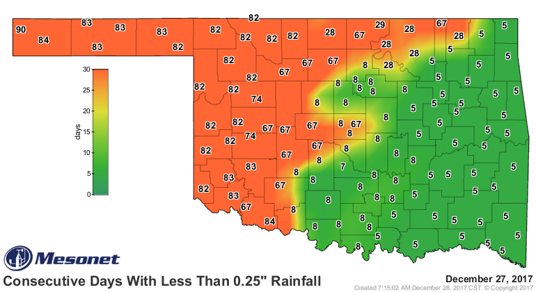
Speaking of precip, that's something we've lacked across the NW half of the
state now for going on 80+ days in some cases. The SE got a bit lucky with
a couple of storm systems, however, so bully for them. Here are the good, the
bad, and the ugly precip maps.
http://ticker.mesonet.org/archive/20171228/60day-totals.png
http://ticker.mesonet.org/archive/20171228/60day-pct-normal.png
http://ticker.mesonet.org/archive/20171228/90day-totals.png
http://ticker.mesonet.org/archive/20171228/90day-pct-normal.png
http://ticker.mesonet.org/archive/20171228/mesonet.rainfall.tenthinch.png
http://ticker.mesonet.org/archive/20171228/mesonet.rainfall.quarterinch.png
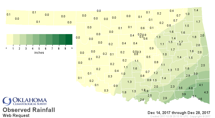
But we can see the good news for SE OK over the last couple of weeks.
http://ticker.mesonet.org/archive/20171228/dec14-28-totals.png
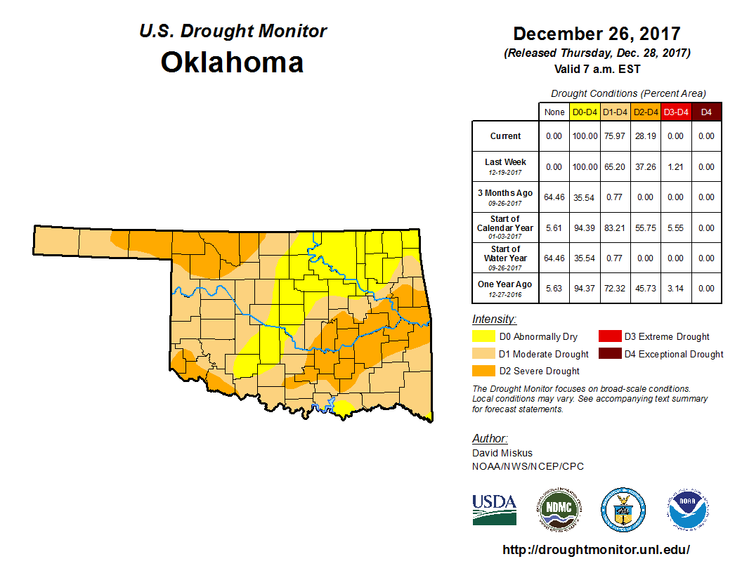
So the NW half of the state is looking ugly on those maps, and not so bad for
the SE. That has led to some improvement for SE OK on the Drought Monitor, but
a somewhat slow but steady deterioration across the NW.
http://ticker.mesonet.org/archive/20171228/20171226_OK_trd.png
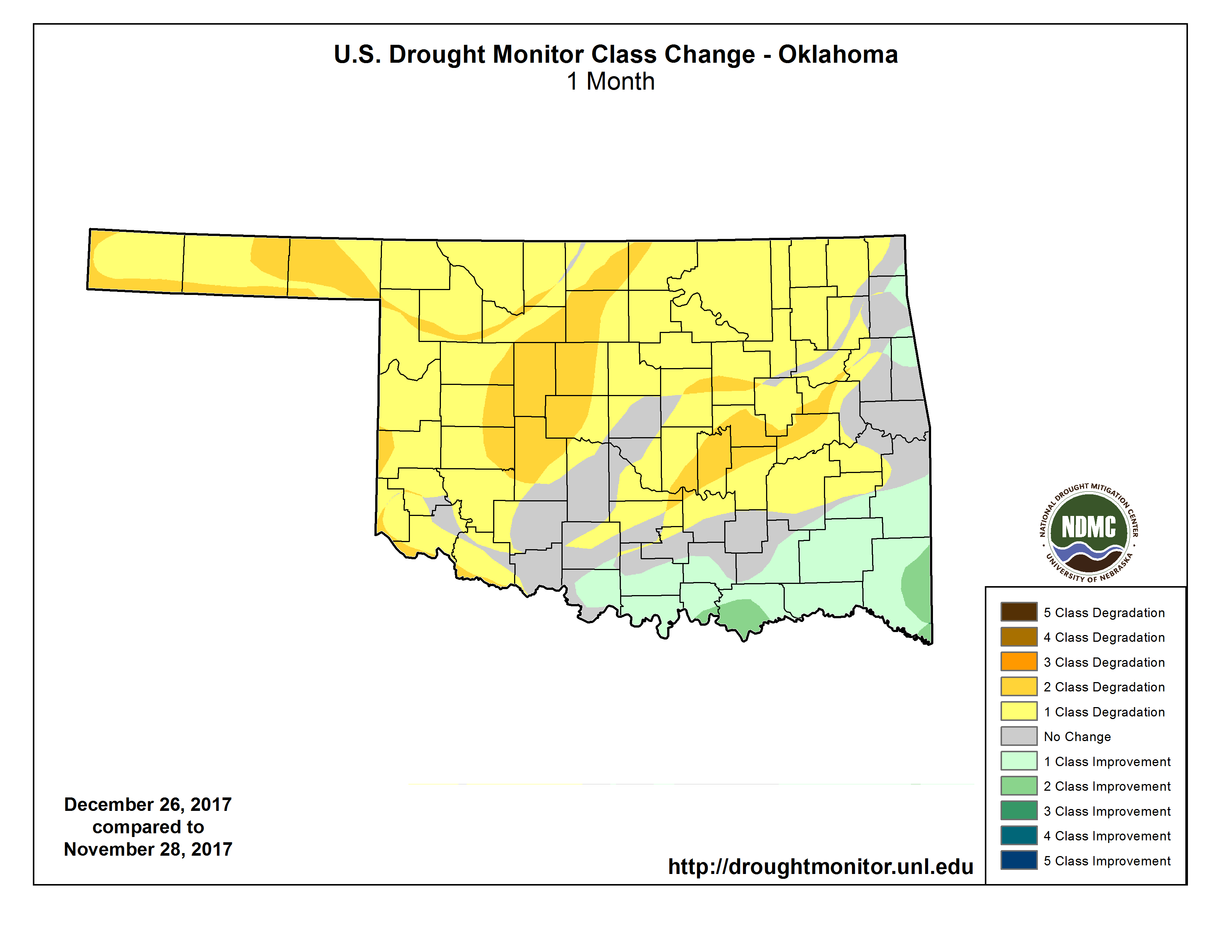
Overall, an increase in drought across most of the state over the last month.
http://ticker.mesonet.org/archive/20171228/4week-change.png
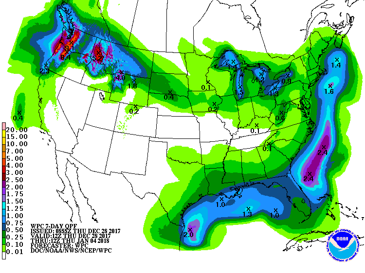
Prospects are not high for quick improvements, with the 7-day precip forecast
looking rather bleak for this part of the state.
http://ticker.mesonet.org/archive/20171228/7day-precip-forecast.gif
Maybe some better moisture after that, but an attempt at that forecast denotes
madness. If anything, the cold weather should start to limit the increase in
drought, but remaining mindful that there is a winter wheat crop out there that
still needs a drink of water despite being in its semi-dormant state.
Now, how do you take care of Texas-sized boogers? A normal sized Kleenex I
guess (thought I was gonna say "finger," didn't ya!).
Gary McManus
State Climatologist
Oklahoma Mesonet
Oklahoma Climatological Survey
(405) 325-2253
gmcmanus@mesonet.org
==================================================
The OCS/Mesonet Ticker
https://ticker.mesonet.org/
To subscribe or unsubscribe from the Ticker
or for questions about the Ticker or its content
Phone or Email the Ticker Manager at OCS
Phone: 405-325-2253 Email: ticker@mesonet.org
---------------------------------------------------
-C- Copyright 2024 Oklahoma Climatological Survey
===================================================
|


 Tweet
Tweet