MESONET TICKER ... MESONET TICKER ... MESONET TICKER ... MESONET TICKER ...
November 26, 2012 November 26, 2012 November 26, 2012 November 26, 2012
On the road again
You know after enjoying a nice Thanksgiving break that your reverie would be
spoiled by a Debbie Downer, but I saw too much bare dirt (and much of it was
blowing in my face following the cold front) over the long weekend to stay
quiet. My latest drought talk comes tomorrow in Altus (at the Southwest
Technology Center, 711 W Tamarack in at 7pm ... be there or be a rectangle having
all four sides of equal length), so it will be good to get an eyes-on perspective
in the southwestern corner of the state. However, from what I saw driving out
west, things are in extremely bad shape in wheat country, punctuated by the blowing
of dust following the front and the strong winds on Thanksgiving evening.
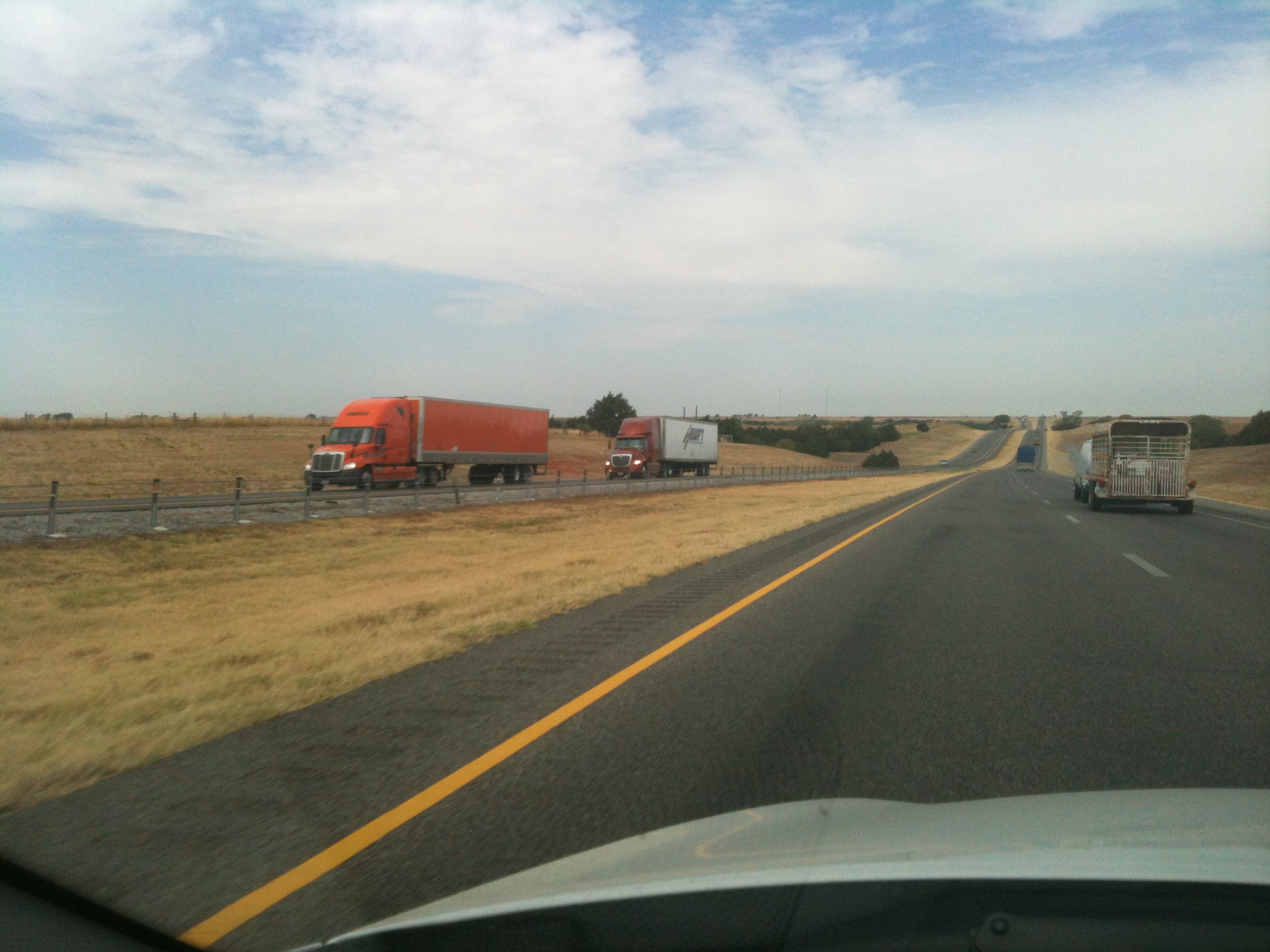
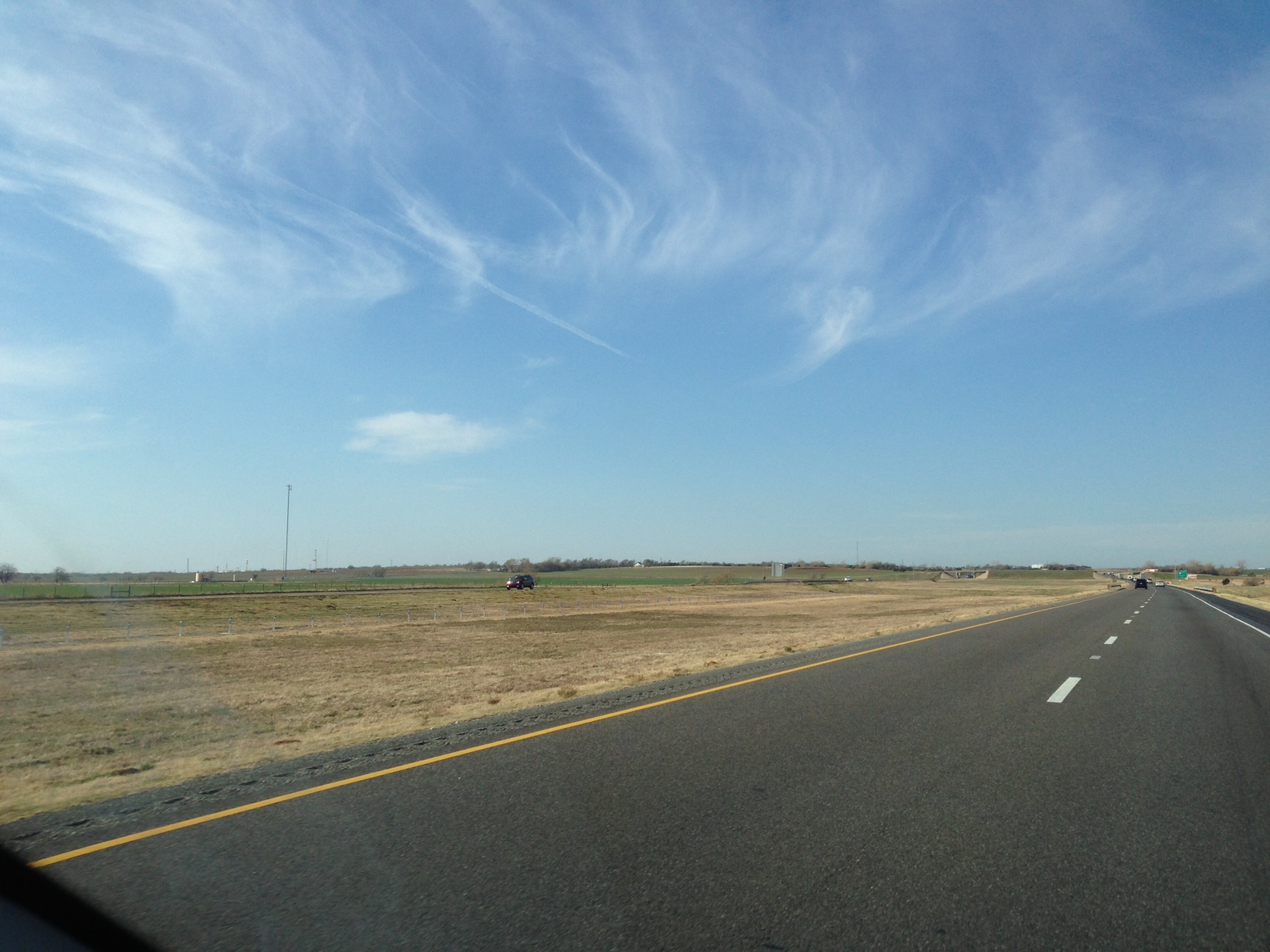
By the way, here's a quiz for ya. I took a picture on I40 on my way to Grandma's
house on Thanksgiving, and I also took one back in August. Can you tell which
is which? The date on the link will give it away, but still pretty telling.
August or late November ... still coming up mostly yellow.
http://ticker.mesonet.org/archive/20120806/I40.jpg
http://ticker.mesonet.org/archive/20121126/also-I40.jpg
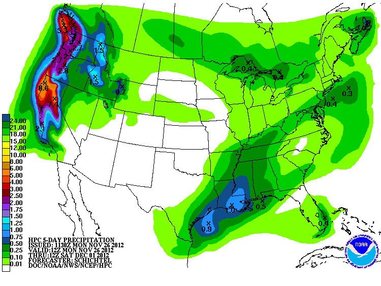
Unfortunately, there doesn't appear to be much hope in the near future for a
good dousing. The latest 5-day forecast from the HPC still shows us mostly green-
free.
http://ticker.mesonet.org/archive/20121126/5day-rain.gif
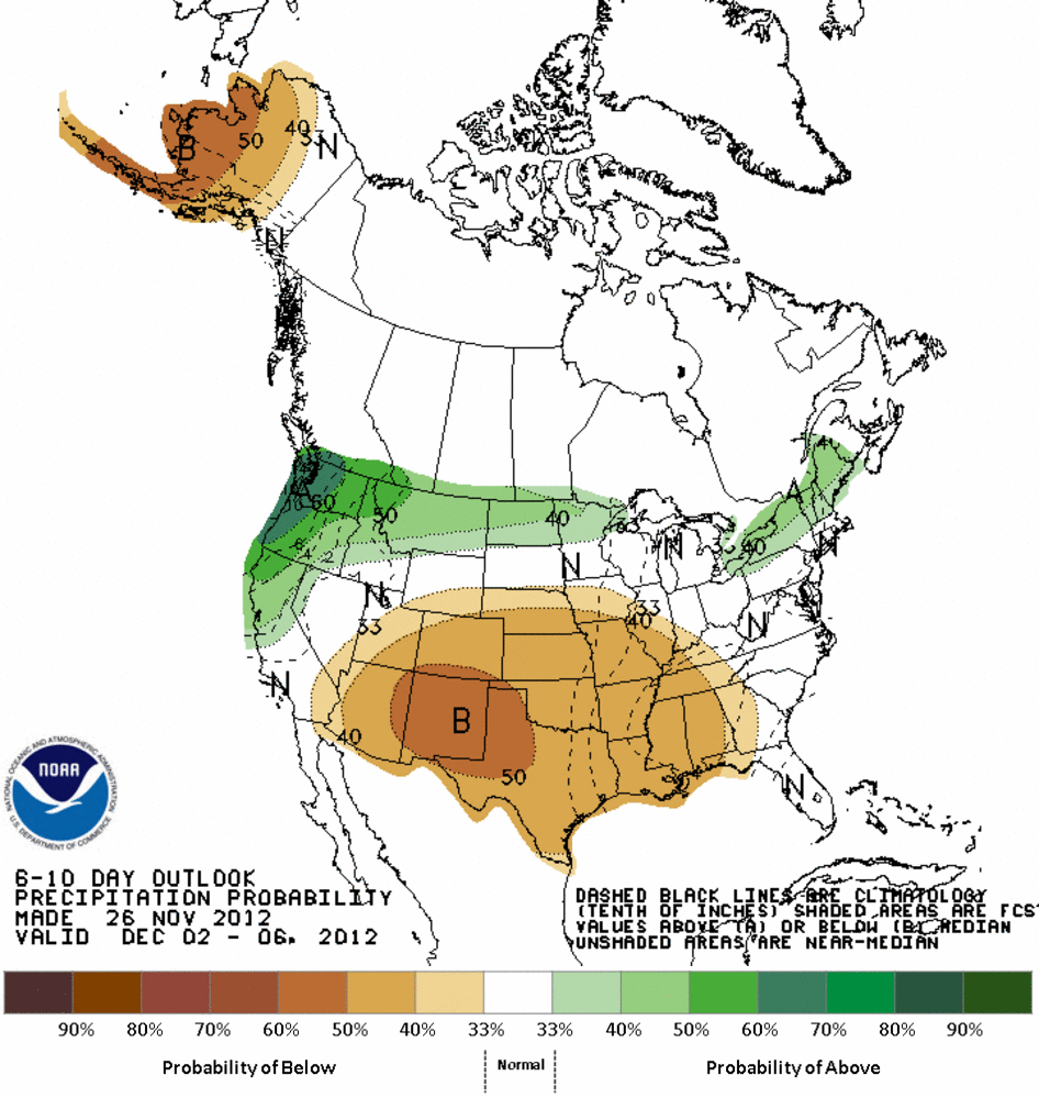
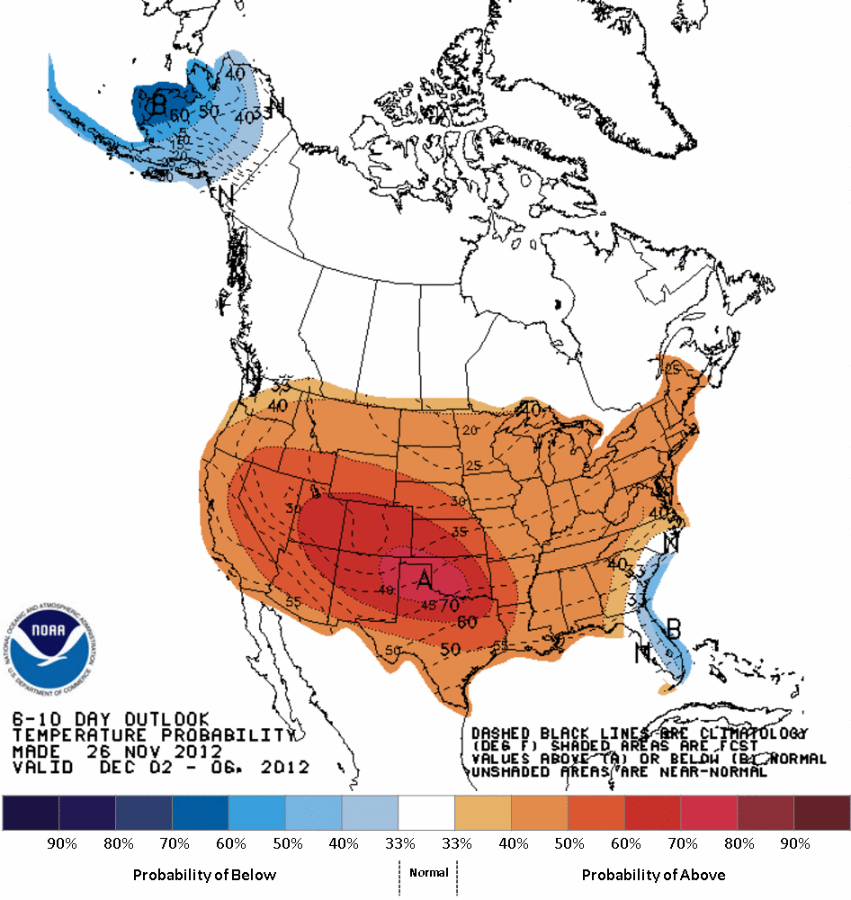
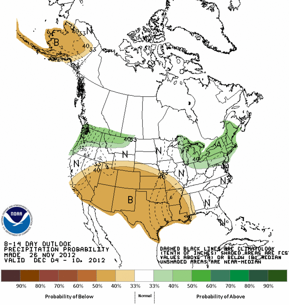
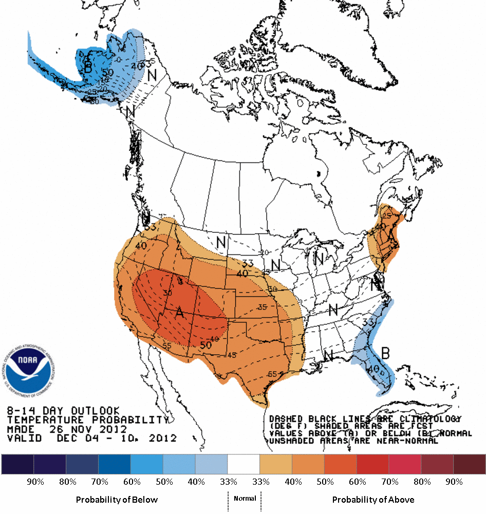
The medium-term also looks rather bleak with increased odds of below normal
precip (and above normal temperatures, which doesn't help).
December 2-6 Outlooks
http://ticker.mesonet.org/archive/20121126/610prcp.new.gif
http://ticker.mesonet.org/archive/20121126/610temp.new.gif
December 4-10 Outlooks
http://ticker.mesonet.org/archive/20121126/814prcp.new.gif
http://ticker.mesonet.org/archive/20121126/814temp.new.gif
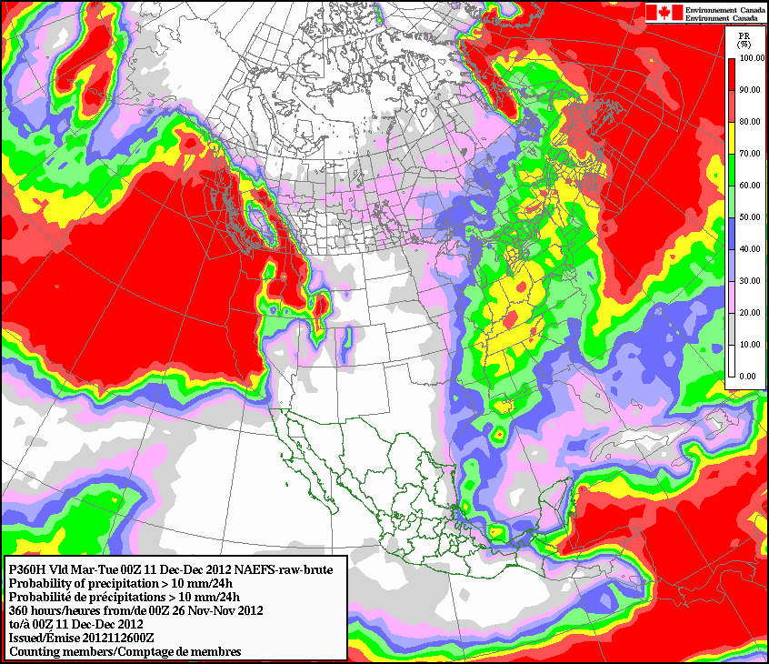
The odds of Oklahoma seeing more at least an inch of accumulated rainfall for
now through December 10 are practically nil, at least according to Canada's
North American Ensemble Forecast System (NAEFS).
http://ticker.mesonet.org/archive/20121126/NAEFS.gif
It's not like we're missing out on May rainfall here, but the problem is we
already DID miss out on May rainfall. The extreme dry conditions since Oct. 1
combined with the unusually warm weather (I am still getting flies in my
house, for crying out loud!) are allowing for more drought intensification.
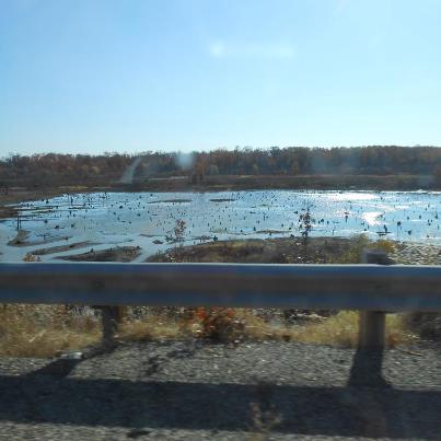
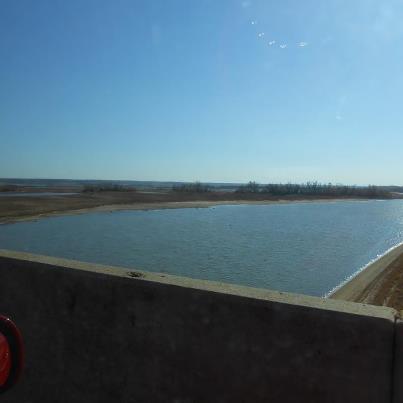
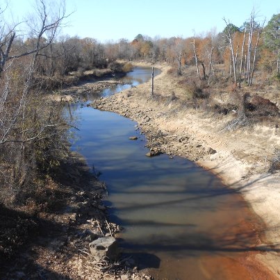
Speaking of Altus, the lake down there is at 17% of capacity. But that's not
the only lake in southern OK that is hurting. I received these pictures of
Hugo Lake today and for southeastern Oklahoma, this is probably equally as
bad. For the record, Lake Hugo is now down to about 38% of capacity. Here are
the pictures...the titles tell the subjects.
http://ticker.mesonet.org/archive/20121126/hugo_lake_20121125.jpg
http://ticker.mesonet.org/archive/20121126/kiamichi_river_channel_of_hugo_lake.jpg
http://ticker.mesonet.org/archive/20121126/frazier_creek_feeds_into_hugo_lake.jpg
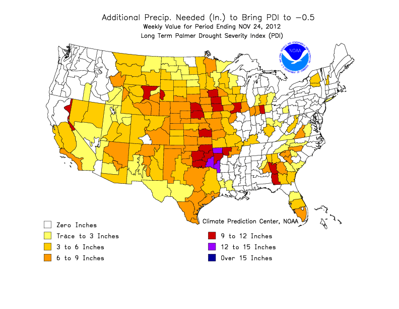
Rest assured, there will eventually be good news. Any day now those long-term
outlooks will start to turn green and the good times will roll again. Hopefully,
at least. All we need is a nice soaking rainfall of 6-15 inches across the state
over the next few weeks and all will be forgiven.
http://ticker.mesonet.org/archive/20121126/precip-needed.gif
Gary McManus
Associate State Climatologist
Oklahoma Climatological Survey
(405) 325-2253
gmcmanus@mesonet.org
==================================================
The OCS/Mesonet Ticker
https://ticker.mesonet.org/
To subscribe or unsubscribe from the Ticker
or for questions about the Ticker or its content
Phone or Email the Ticker Manager at OCS
Phone: 405-325-2253 Email: ticker@mesonet.org
---------------------------------------------------
-C- Copyright 2024 Oklahoma Climatological Survey
===================================================
|


 Tweet
Tweet