MESONET TICKER ... MESONET TICKER ... MESONET TICKER ... MESONET TICKER ...
October 16, 2017 October 16, 2017 October 16, 2017 October 16, 2017
CONTEXT!
http://ticker.mesonet.org/archive/20171016/yesterdays-highs.png
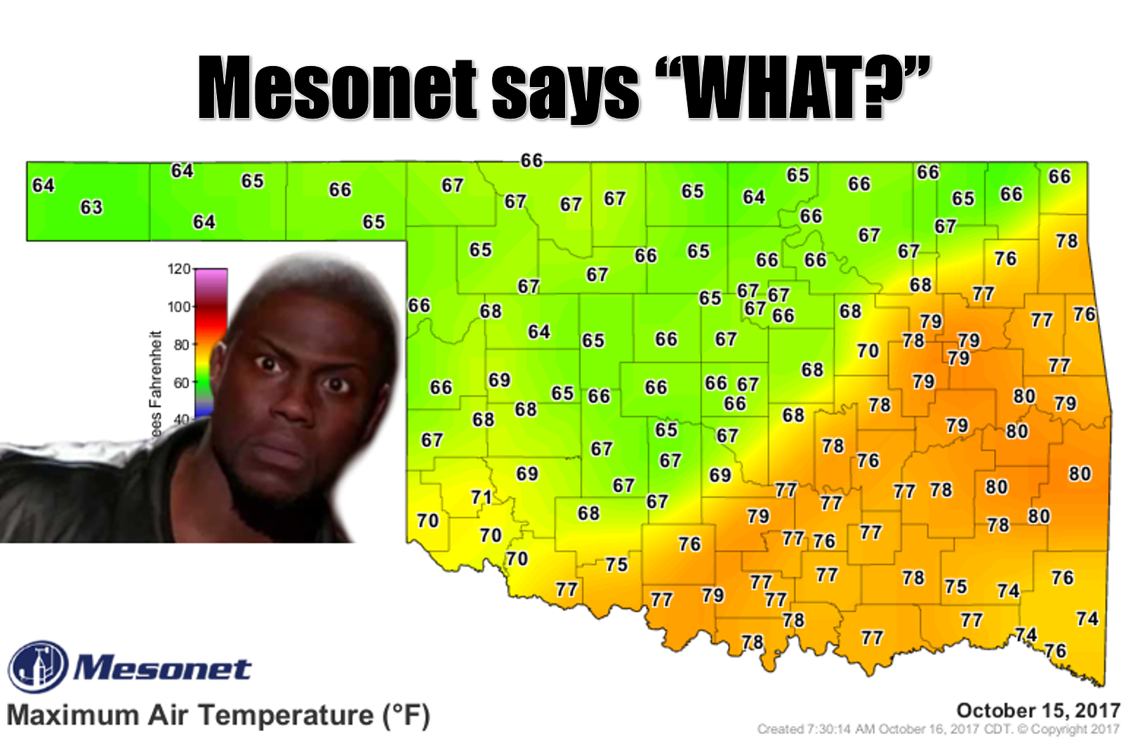
Folks across the southeastern half of the state must look at that maximum
temperature map from the Mesonet for yesterday and scratch their heads. Now when
I scratch my head, I end up with red marks on my scalp, but for those with a
bushy head of hair, feel free...but if you're in places like Wilburton, Stigler,
Webbers Falls and you're wondering where your 80 degrees was, it's all in the
context.
Remember the Mesonet high temperature map works from midnight-to-midnight, so if
you just happen to have a cool front moving through the state around that time,
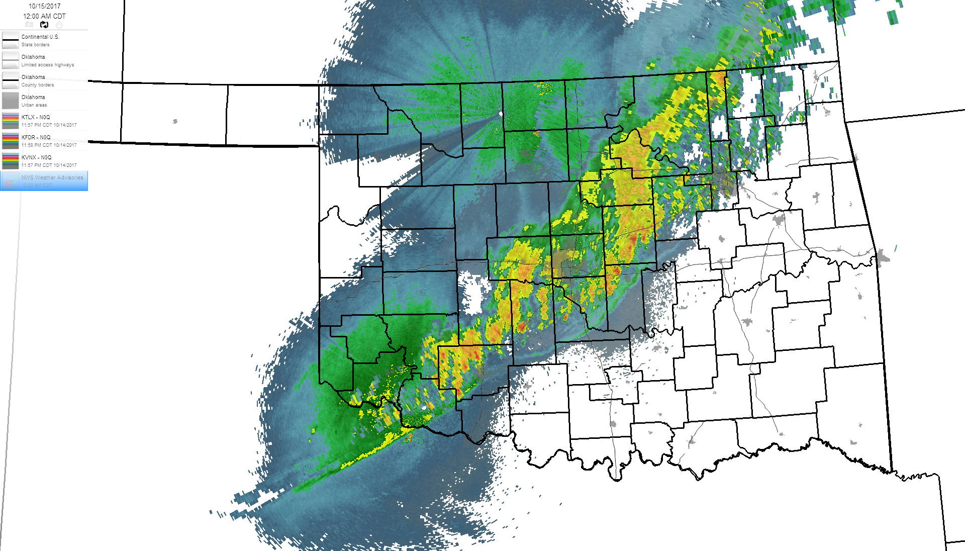
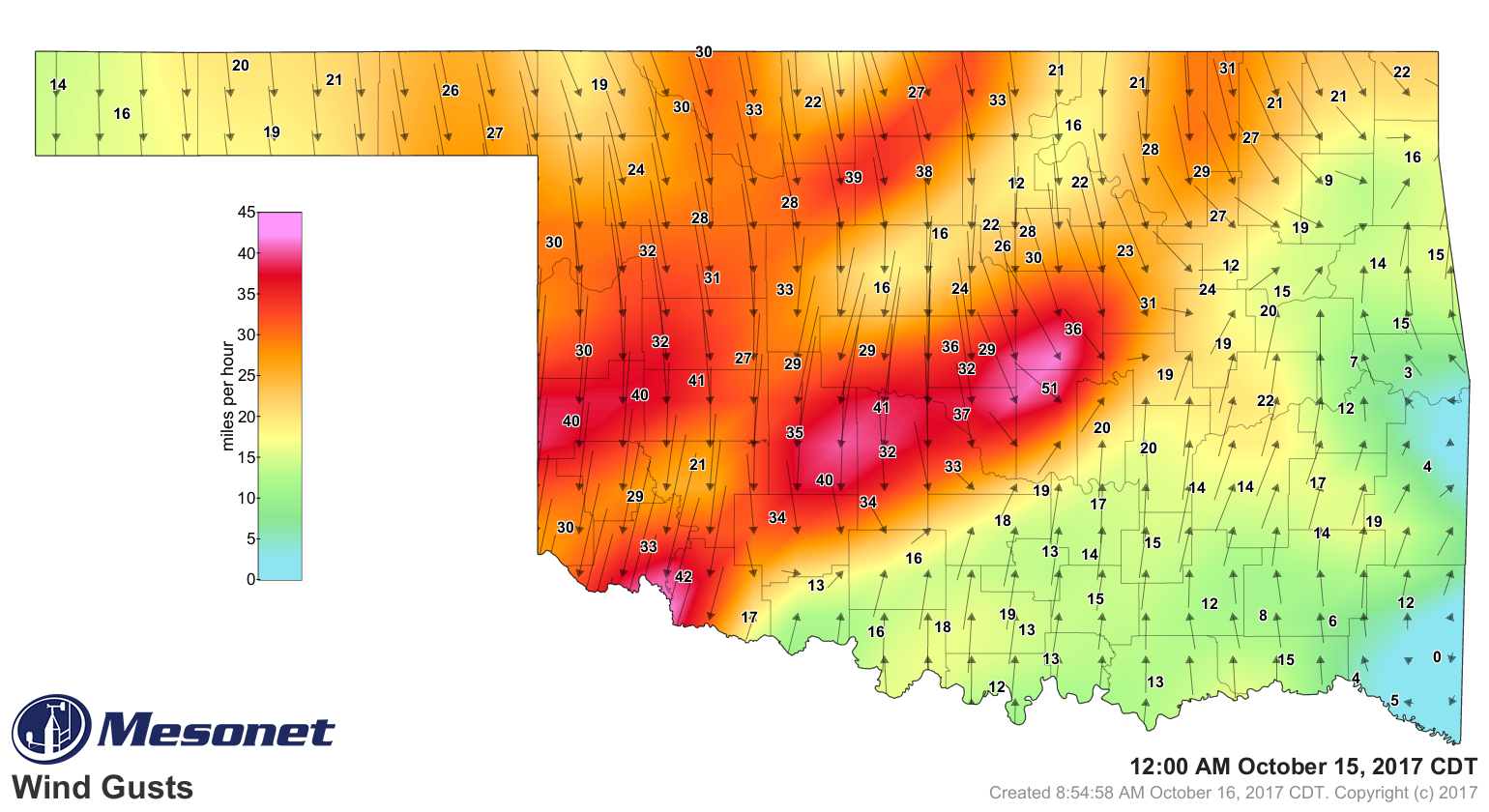
it's gonna screw up your maps. So at midnight, we had a mess of severe
storms moving through the state with a hefty gust front, followed by a nice blast
of much cooler air.
http://ticker.mesonet.org/archive/20171016/oct15-midnight-radar.png
http://ticker.mesonet.org/archive/20171016/oct15-midnight-wind.gusts.png
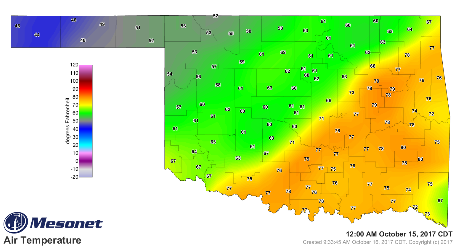
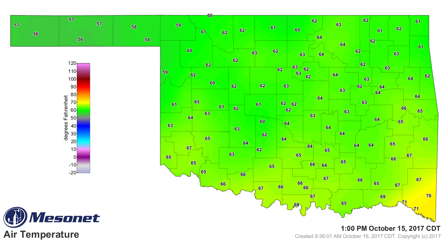
And in fact, if you look at the temperature map from midnight, you'll see that
*closely* (but not exactly) mirrors those high temperatures across SE OK shown
in the first map.
http://ticker.mesonet.org/archive/20171016/oct15-midnight-temps.png
But no need to be too envious of your neighbors to the southeast. And I'll even
acknowledge some folks probably like the 60s more than the 70s and 80s. I don't
understand them anymore than those that like Hormel Chili over Wolf Brand Chili,
but I will acknowledge them. The temperatures did cool down statewide as we
went through the day, however, and by 1pm, much of the state was in the 60s.
http://ticker.mesonet.org/archive/20171016/oct15-1pm-temps.png
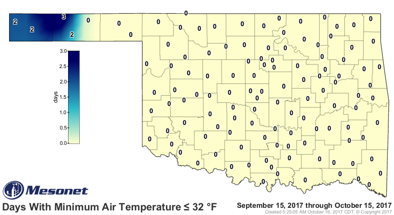
We've now had 4 days (this map will update tomorrow) with temperatures below
freezing in the state
http://ticker.mesonet.org/archive/20171016/tmin.le32.png
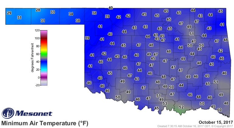
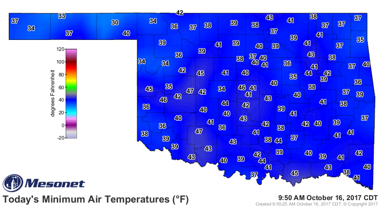
after today and yesterdays chilly start.
http://ticker.mesonet.org/archive/20171016/yesterdays-lows.png
http://ticker.mesonet.org/archive/20171016/todays-lows.png
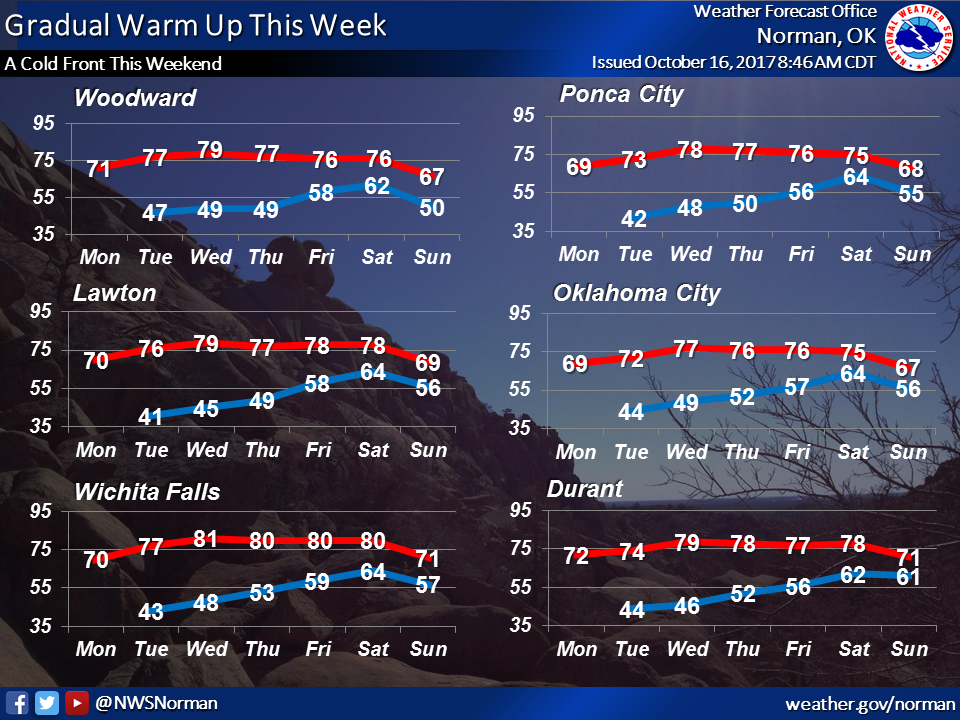
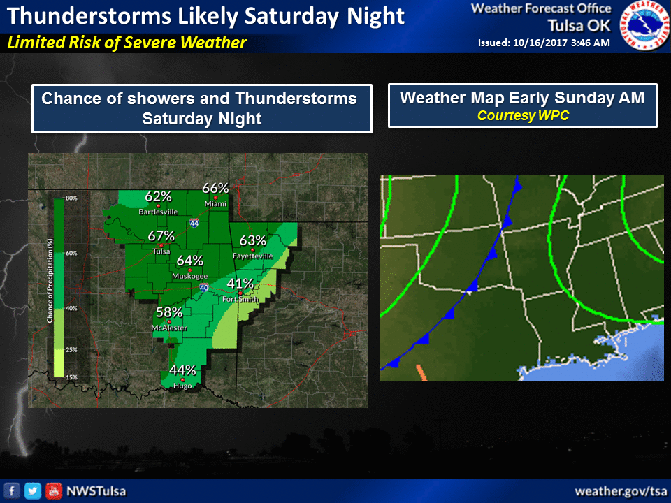
Nothing too earth shattering coming up, just another dry, mild week with a slow
warm up, then perfectly timed for the weekend...another cold front with a chance
of showers and storms.
http://ticker.mesonet.org/archive/20171016/nws-norman-temps.png
http://ticker.mesonet.org/archive/20171016/nws-tulsa-next.weekend.png
Right now the timing for the front is later on Saturday, but that could change!
Gary McManus
State Climatologist
Oklahoma Mesonet
Oklahoma Climatological Survey
(405) 325-2253
gmcmanus@mesonet.org
==================================================
The OCS/Mesonet Ticker
https://ticker.mesonet.org/
To subscribe or unsubscribe from the Ticker
or for questions about the Ticker or its content
Phone or Email the Ticker Manager at OCS
Phone: 405-325-2253 Email: ticker@mesonet.org
---------------------------------------------------
-C- Copyright 2024 Oklahoma Climatological Survey
===================================================
|


 Tweet
Tweet