MESONET TICKER ... MESONET TICKER ... MESONET TICKER ... MESONET TICKER ...
October 11, 2012 October 11, 2012 October 11, 2012 October 11, 2012
Drought Monitor time! How are the lakes doing?
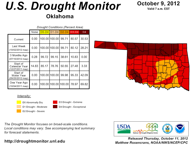
Here is this morning's regular Thursday release of the U.S. Drought Monitor map.
The numbers are holding pretty steady, although we did see a bit of an increase
of exceptional drought over into northeast Oklahoma, and a bit more in the
Panhandle. So we're still at 100% of the state in severe-exceptional drought,
81% in extreme-exceptional, and up to 31% in exceptional.
http://ticker.mesonet.org/archive/20121011/ok_dm.png
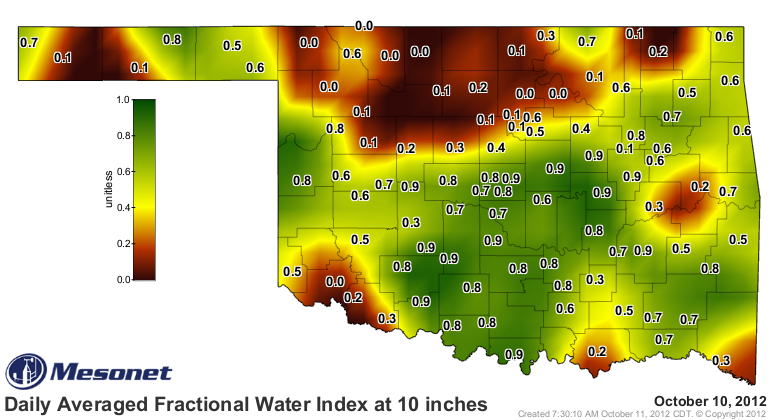
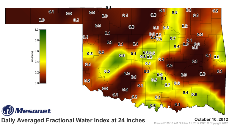
As we looked more and more at the deficits up there in Osage County and down into
Payne, Creek and Tulsa counties, it wasn't a difficult decision to bump the D4
over, especially given the soil moisture deficits at 10- and 24-inches.
Mesonet Soil Moisture
http://ticker.mesonet.org/archive/20121011/10inch-soilmoisture.png
http://ticker.mesonet.org/archive/20121011/24inc-soilmoisture.png
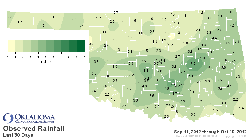
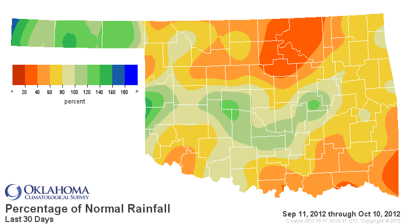
30-day Mesonet Rainfall
http://ticker.mesonet.org/archive/20121011/last30daystot.png
http://ticker.mesonet.org/archive/20121011/last30dayspct.png
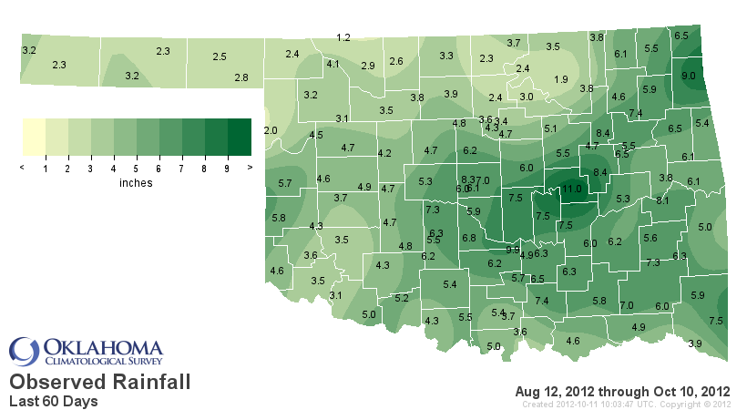
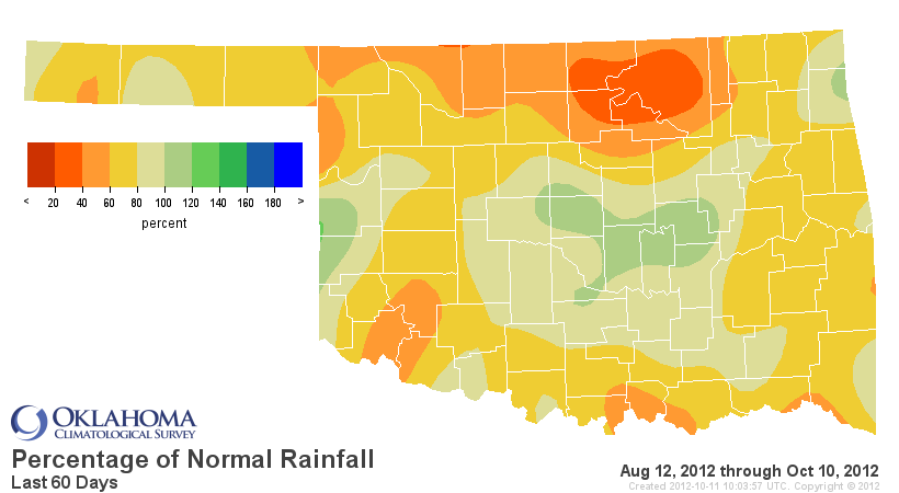
60-day Mesonet Rainfall
http://ticker.mesonet.org/archive/20121011/last60daystot.png
http://ticker.mesonet.org/archive/20121011/last60dayspct.png
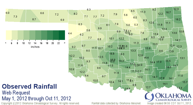
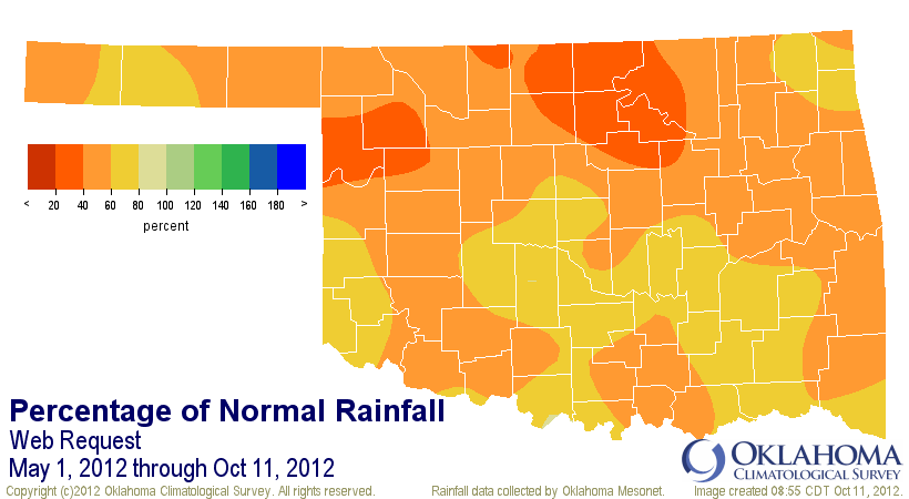
May 1-Oct. 11 Mesonet Rainfall
http://ticker.mesonet.org/archive/20121011/may1-oct11-tot.png
http://ticker.mesonet.org/archive/20121011/may1-oct11-pct.png
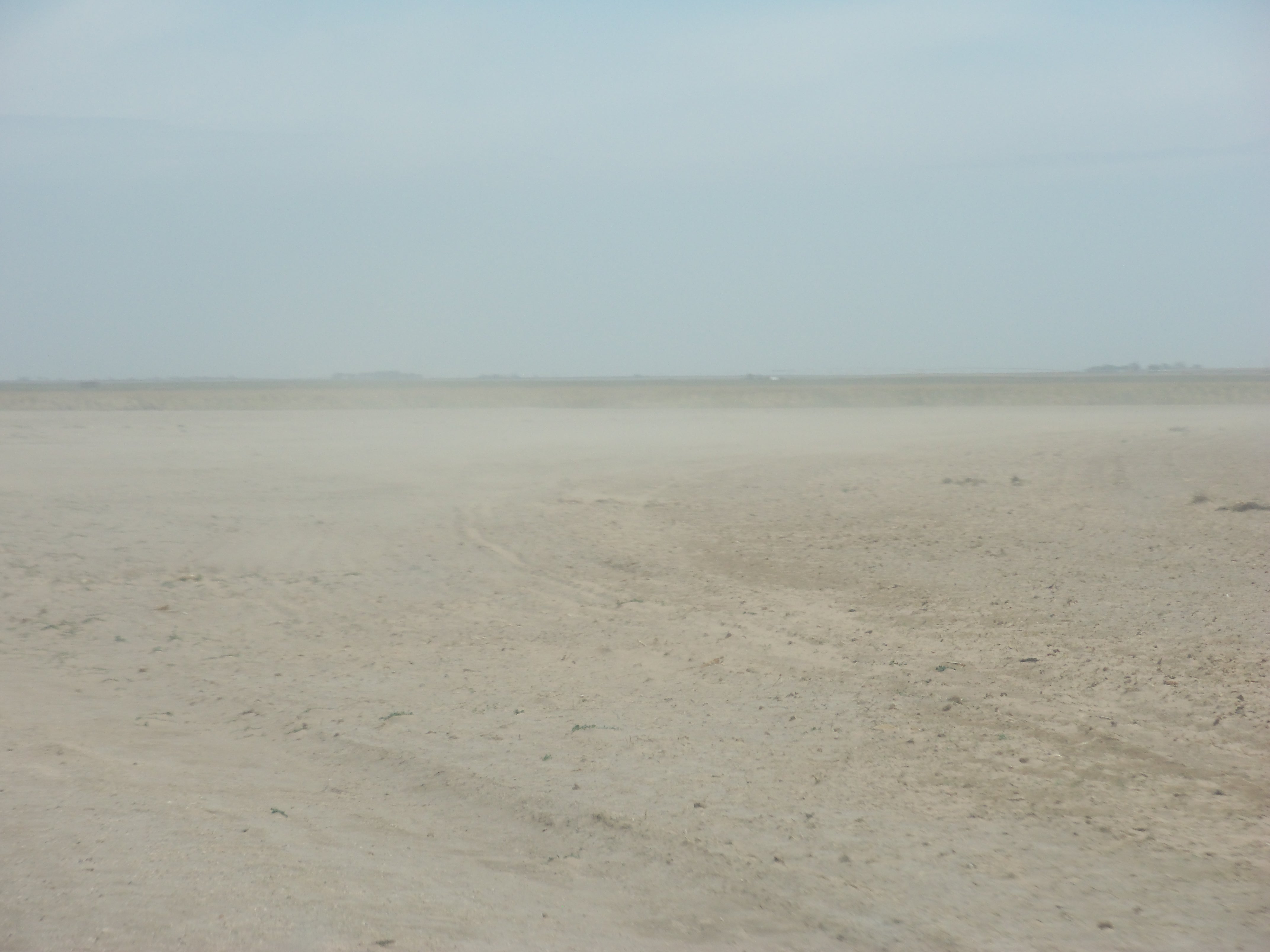
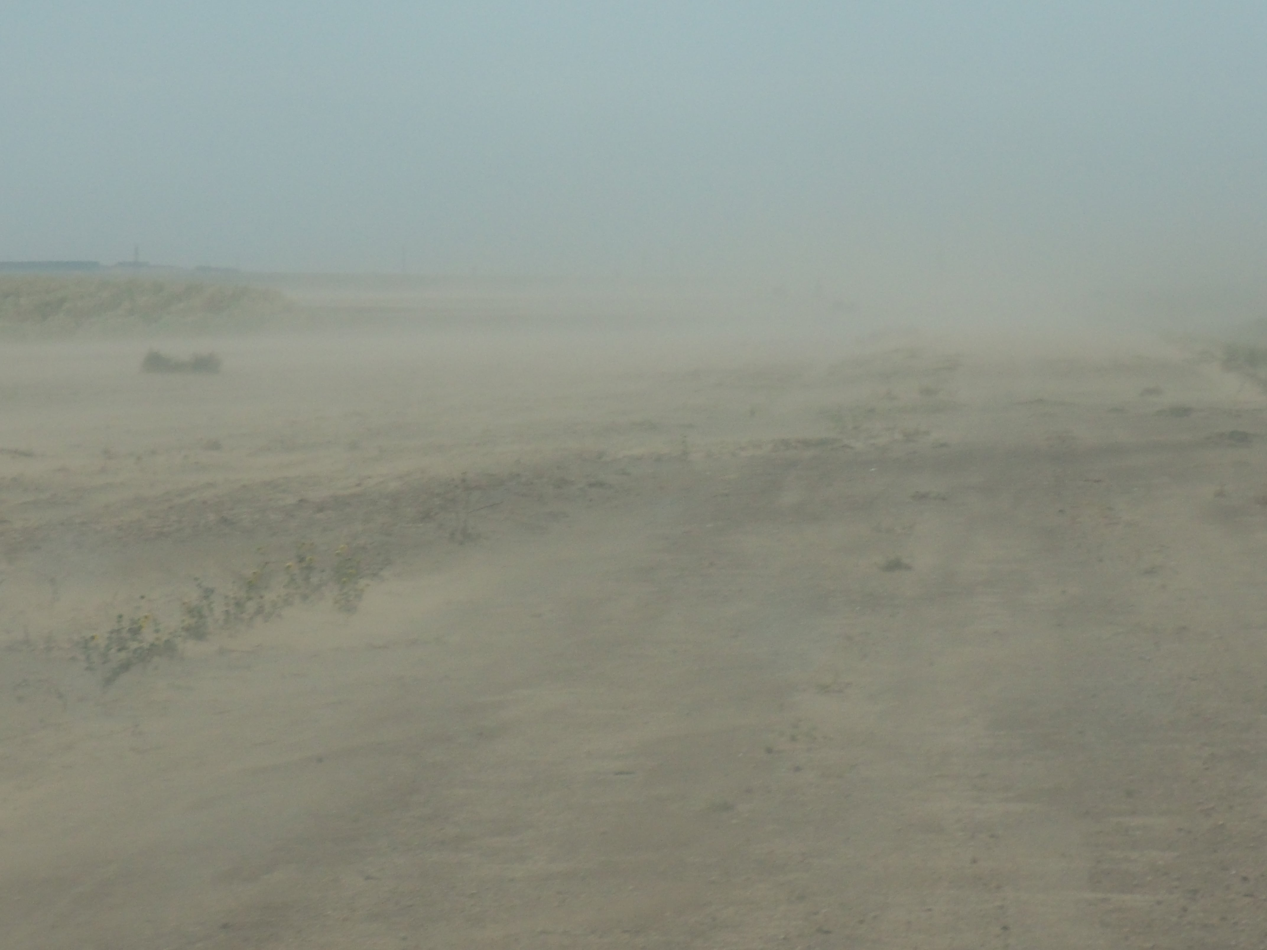
And we think the soil moisture has recovered pretty well in some areas (yeah,
we're talking about you, Cimarron County), and then we get pictures like this:
http://ticker.mesonet.org/archive/20121011/100_0255.jpg
http://ticker.mesonet.org/archive/20121011/100_0260.jpg
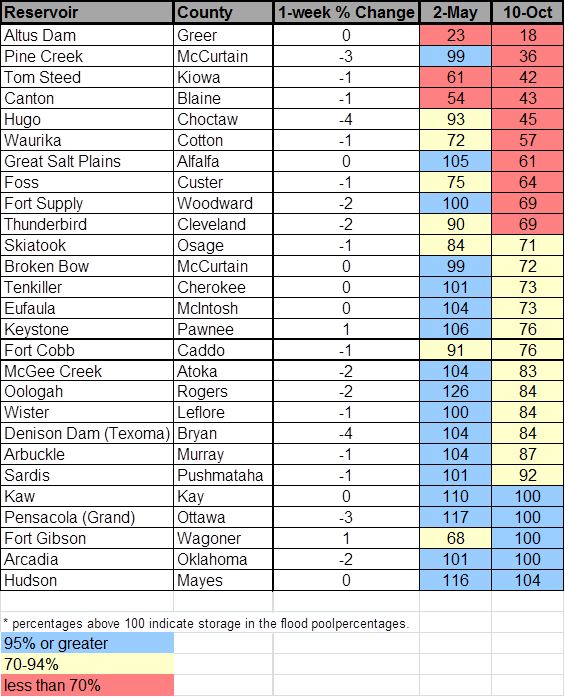
One of our major concerns right now would be our reservoir levels. We detailed
these last week and we had hoped that the rains would have provided just a tad
more runoff, but the numbers did not improve. I've thrown the early May
elevations in there as well so you can see where we were before the dry-down
began in earnest (poor Earnest!).
http://ticker.mesonet.org/archive/20121011/Oct11-lakelevels.png
While those levels are pretty gloomy as we head into our driest time of the
year, it could be a lot worse ... we could be heading into summer! So yes, it
is our driest time of our year, but it's also the time with the least amount
of water stress. Evaporation is way way wayyyyyyy down (it's cool, not as much
sunlight), vegetation isn't gobbling it up like during the growing season
(winter wheat still needs its fair share), and we're not using it to fill
swimming pools or water lawns (fescue still needs its fair share).
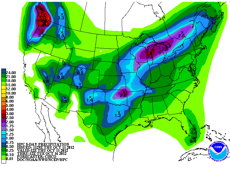
Luckily, we have more chances to fill those lakes. There's quite a fuss being
raised about this next storm system approaching the state, and it's really
lighting up the HPC 5-day forecast.
http://ticker.mesonet.org/archive/20121011/5day-rain.gif
That local maximum up in northeastern Oklahoma is just what the doctor ordered
up there (remember the previous Mesonet rainfall maps!), but the entire state
needs that type of rain and then some. Luckily we're going to remain in a
springtime pattern and keep the temperatures up. That's a vital part of getting
a small rebound in our vegetation and pastures before the REAL end to the
growing season arrives. That freezing weather last week didn't do anybody many
favors in the regard.
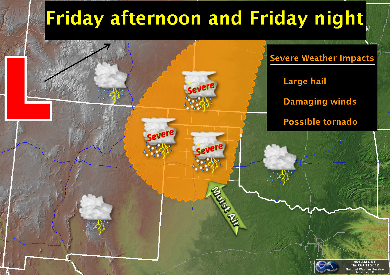
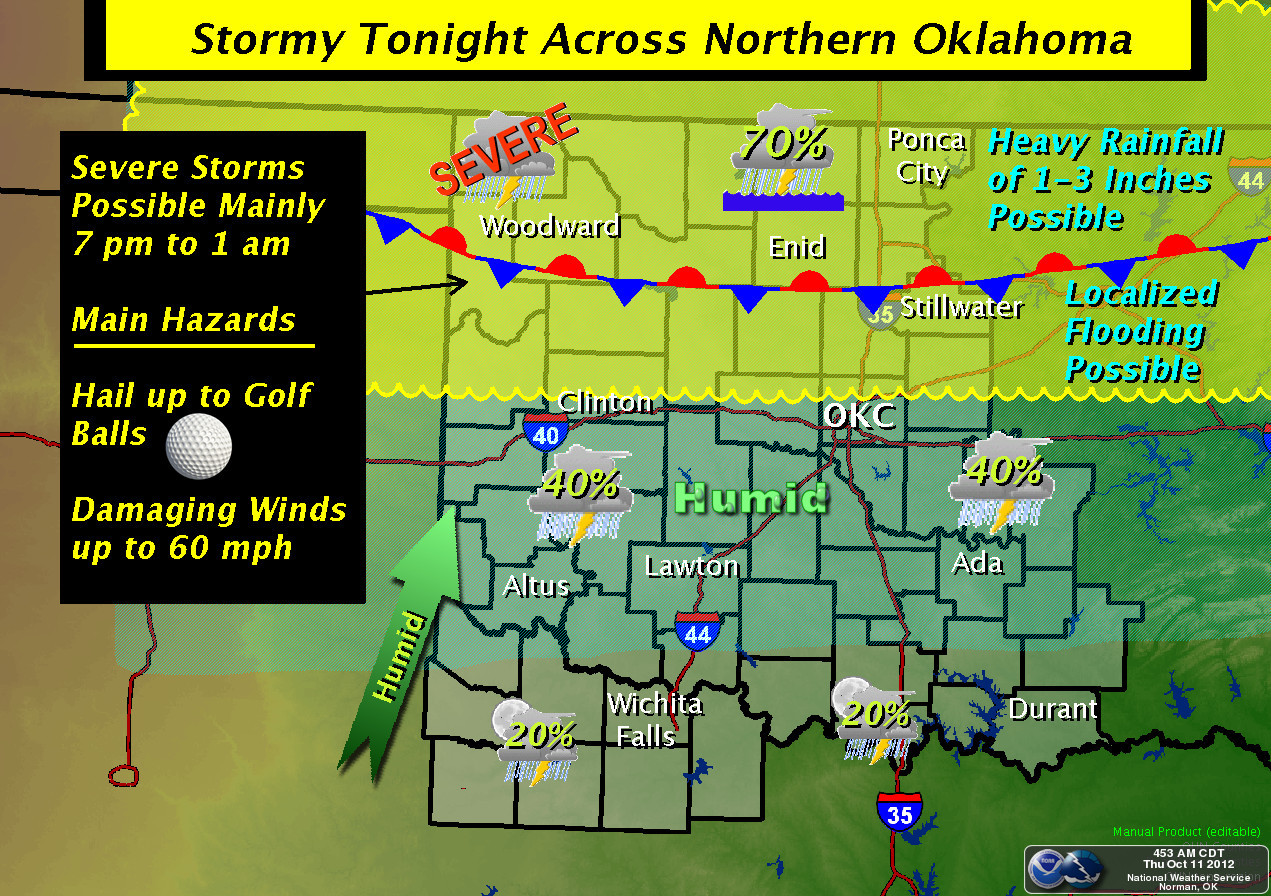
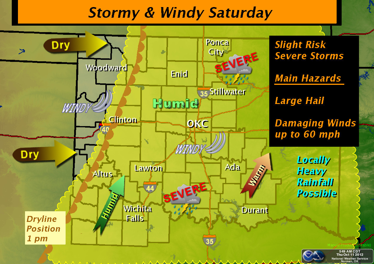
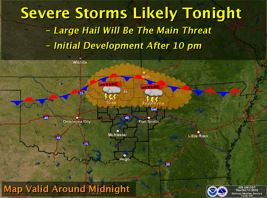
Unfortunately, this spring-like weather might come with some spring-like
weather, if you know what I mean. Take a clue from your favorite local NWS
office and stay weather aware tonight (and tomorrow).
http://ticker.mesonet.org/archive/20121011/nws-amarillo.jpg
http://ticker.mesonet.org/archive/20121011/nws-norman-1.jpg
http://ticker.mesonet.org/archive/20121011/nws-norman-2.jpg
http://ticker.mesonet.org/archive/20121011/nws-tulsa.png
Just try to remember how badly we need the rain as Mother Nature beats you
upside your favorite head with noggin-size hail.
Gary McManus
Associate State Climatologist
Oklahoma Climatological Survey
(405) 325-2253
gmcmanus@mesonet.org
==================================================
The OCS/Mesonet Ticker
https://ticker.mesonet.org/
To subscribe or unsubscribe from the Ticker
or for questions about the Ticker or its content
Phone or Email the Ticker Manager at OCS
Phone: 405-325-2253 Email: ticker@mesonet.org
---------------------------------------------------
-C- Copyright 2024 Oklahoma Climatological Survey
===================================================
|


 Tweet
Tweet