MESONET TICKER ... MESONET TICKER ... MESONET TICKER ... MESONET TICKER ...
May 8, 2014 May 8, 2014 May 8, 2014 May 8, 2014
More rain, no pain
Simply put, no? What a difference 300 miles makes after my trip to Cimarron
County and the Dust Bowl-like conditions out that way (a trip unfortunately cut
short, by the way ... even in dust and 50 mph winds, the Panhandle is the best
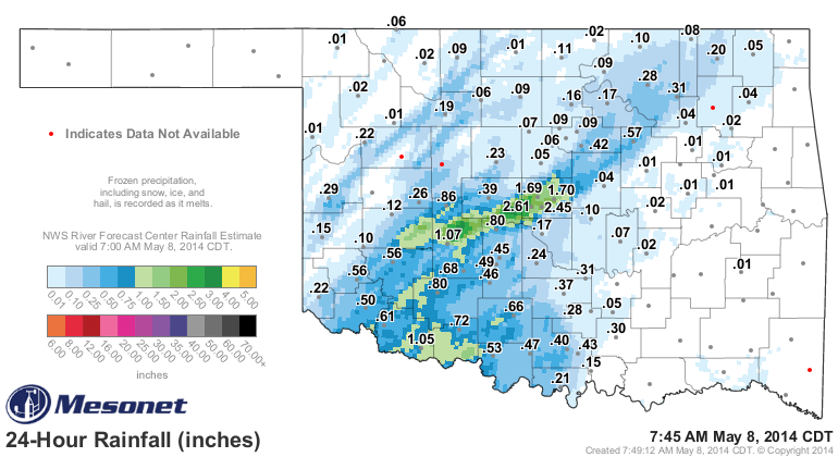
place in the universe), to rain-drenched central Oklahoma. Let's take a look at
the rainfall map and the current rainfall totals first (and this will continue to
change throughout the day since it is raining -- yep, mind like a steel trap!)
since the newest Drought Monitor map is going to be UGLY!
http://ticker.mesonet.org/archive/20140508/current-radar.png
http://ticker.mesonet.org/archive/20140508/rainrfc.24hr.png
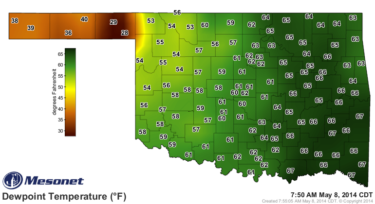
So that rain shield continues to push to the east which will allow some clearing
later possibly. Add that heat and moisture still available for the dryline
situated out in western Oklahoma (out in the Panhandle currently, it appears)
that will push to the east later today
http://ticker.mesonet.org/archive/20140508/current-dewpoints.png
and you get the possibility for storms (some possibly severe) and rainfall later
today.
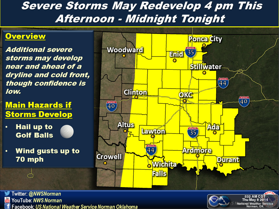
http://ticker.mesonet.org/archive/20140508/nws-norman.jpg
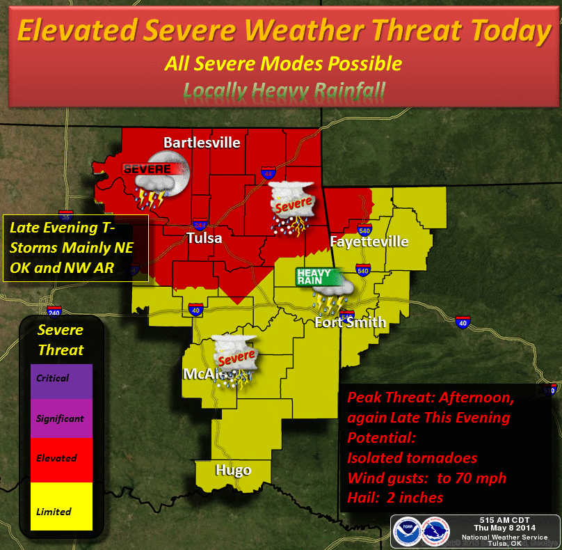
http://ticker.mesonet.org/archive/20140508/nws-tulsa.png
So there is still a chance for more rain later today, and some of that shows
up in this rainfall forecast (but it also shows some that has already fell,
since it was issued at 5am). Unfortunately, not much on tap for far western OK
and the Panhandle. That area still DESPERATELY needs rain to alleviate
intensifying drought conditions.
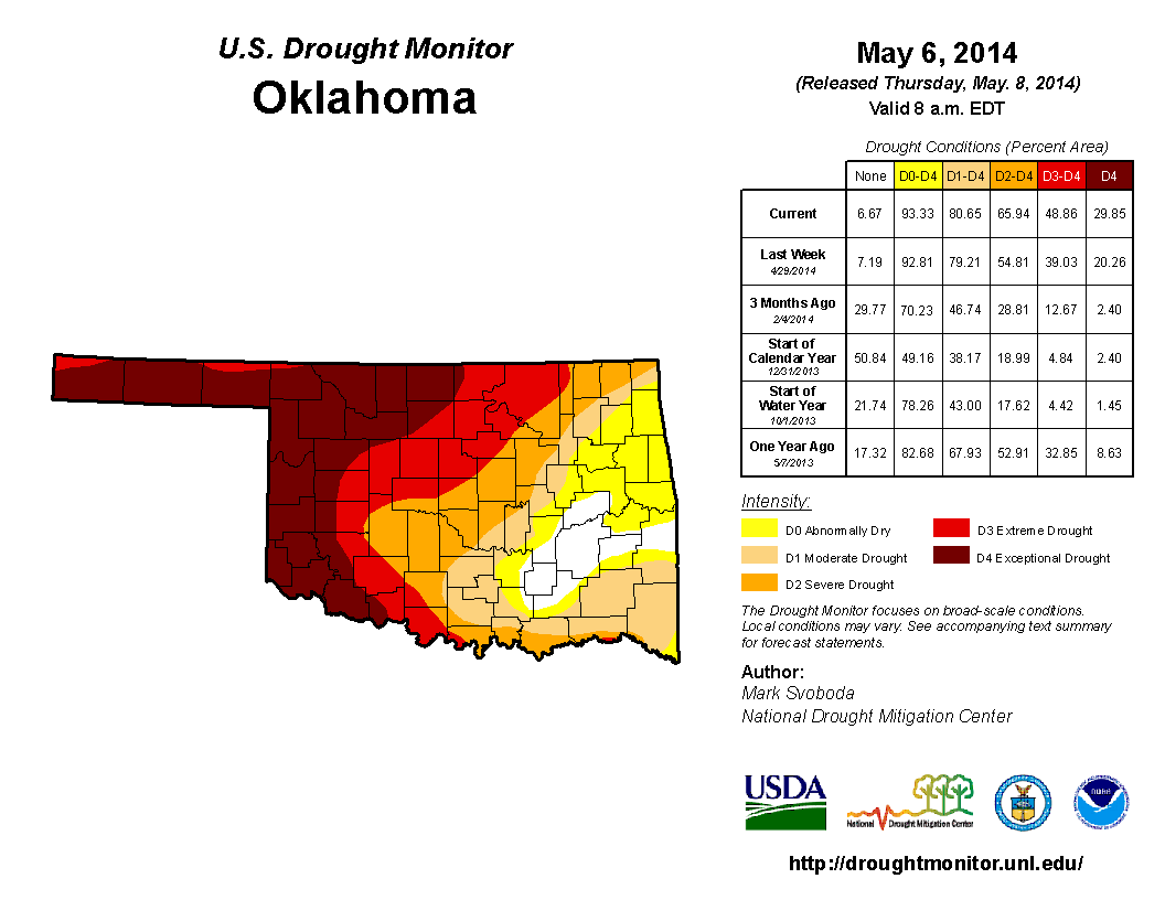
Speaking of drought (what a segue!), the latest U.S. Drought Monitor map released
this morning shows the effects of the record-breaking heat, low humidity,
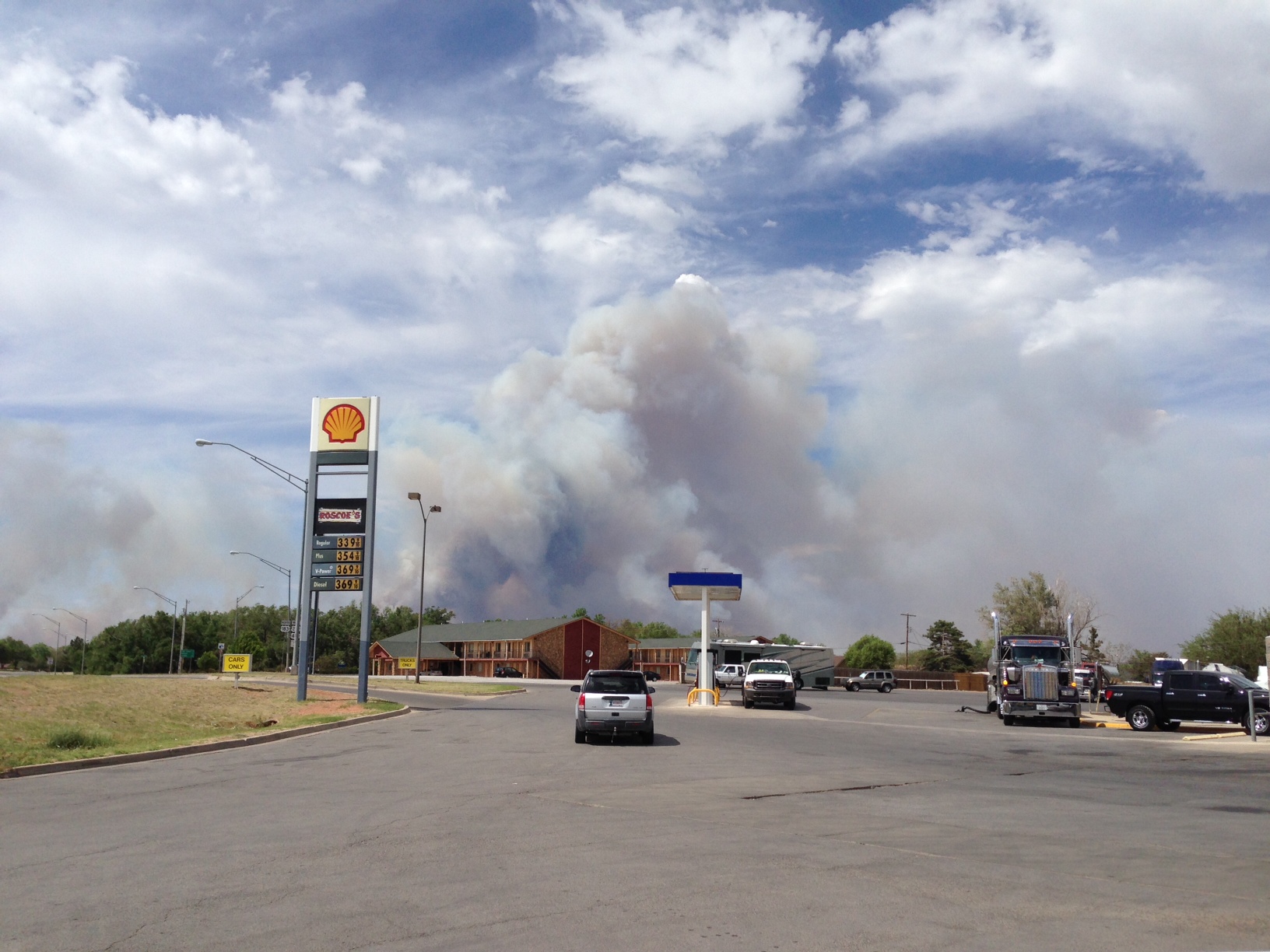
and daily 40-50 mph winds (all of which helped spark the fires in the past week,
like this monster out in Woodward County Tuesday)
http://ticker.mesonet.org/archive/20140508/woodward-fire1.jpeg
http://ticker.mesonet.org/archive/20140508/woodward-fire2.jpg
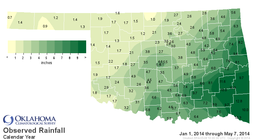
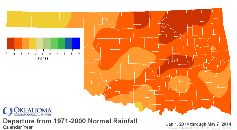
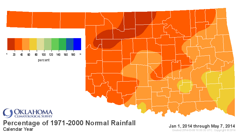
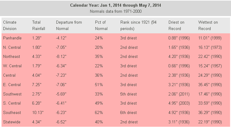
And the rainfall statistics we need to look at are numerous, but we'll just
choose since the first of the year, a period in which many of our western and
northern stations continue to see some of their driest weather ever from
January 1-May 7.
http://ticker.mesonet.org/archive/20140508/caltot.png
http://ticker.mesonet.org/archive/20140508/caldel.png
http://ticker.mesonet.org/archive/20140508/calpct.png
http://ticker.mesonet.org/archive/20140508/cal-stats-table.png
Okay, finally on to the drought map.
http://ticker.mesonet.org/archive/20140508/20140506_OK_trd.png
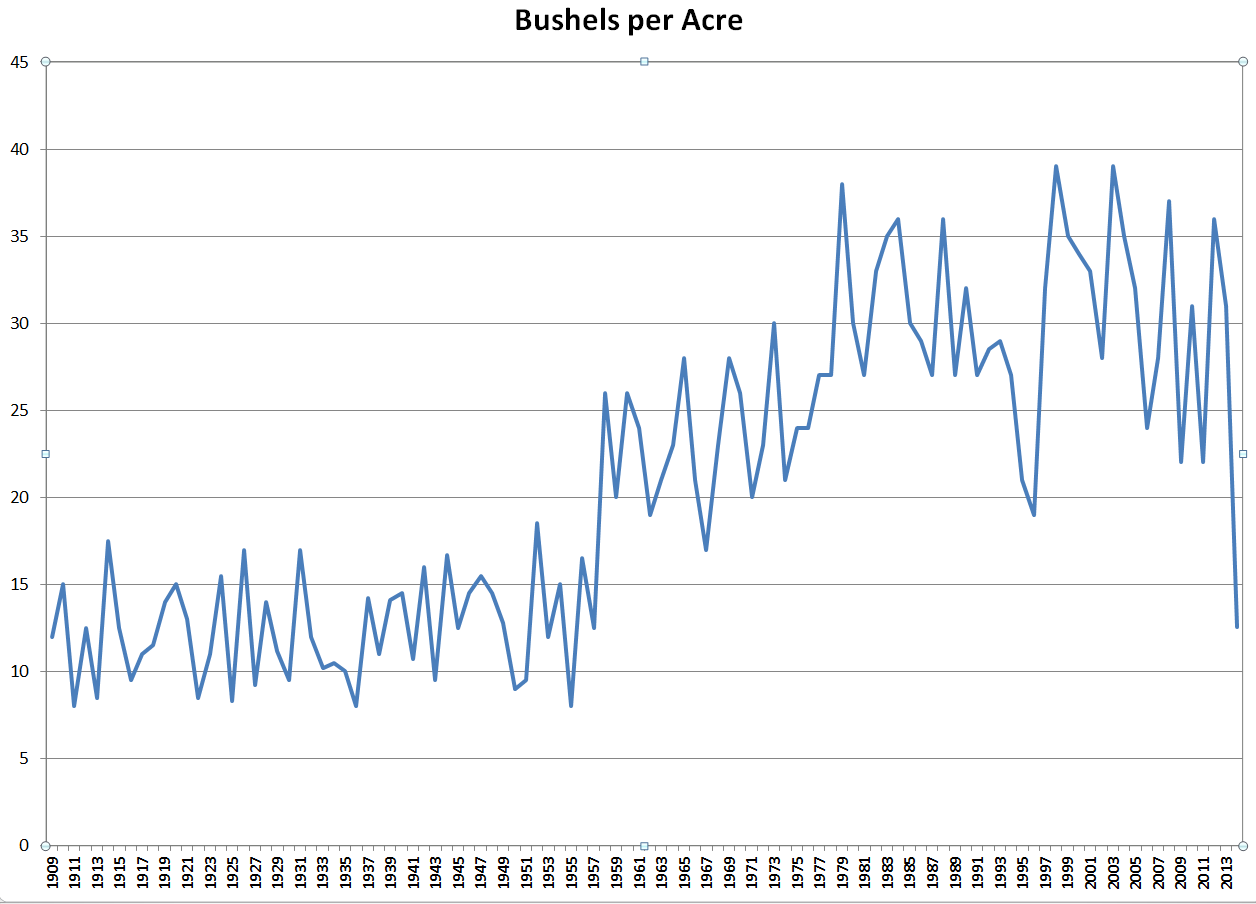
Another large expansion of D4 Exceptional drought across northern Oklahoma and
the Panhandle, where the wheat crop is deteriorating rapidly, and if estimates
are correct (66.5 million bushels), this year's wheat harvest will produce the
least amount of grain since 1957, the end of the horrible 1950s drought.
http://ticker.mesonet.org/archive/20140508/projected-wheat-harvest.png
The total amount of drought stayed the same, but the amount of at least D2
Severe drought increased from 55% to 66 percent, and the amount of at least
D3 Extreme drought went up from 39% to 49%. Hopefully we can see a reduction
thanks to the recent rains, at least in central Oklahoma.
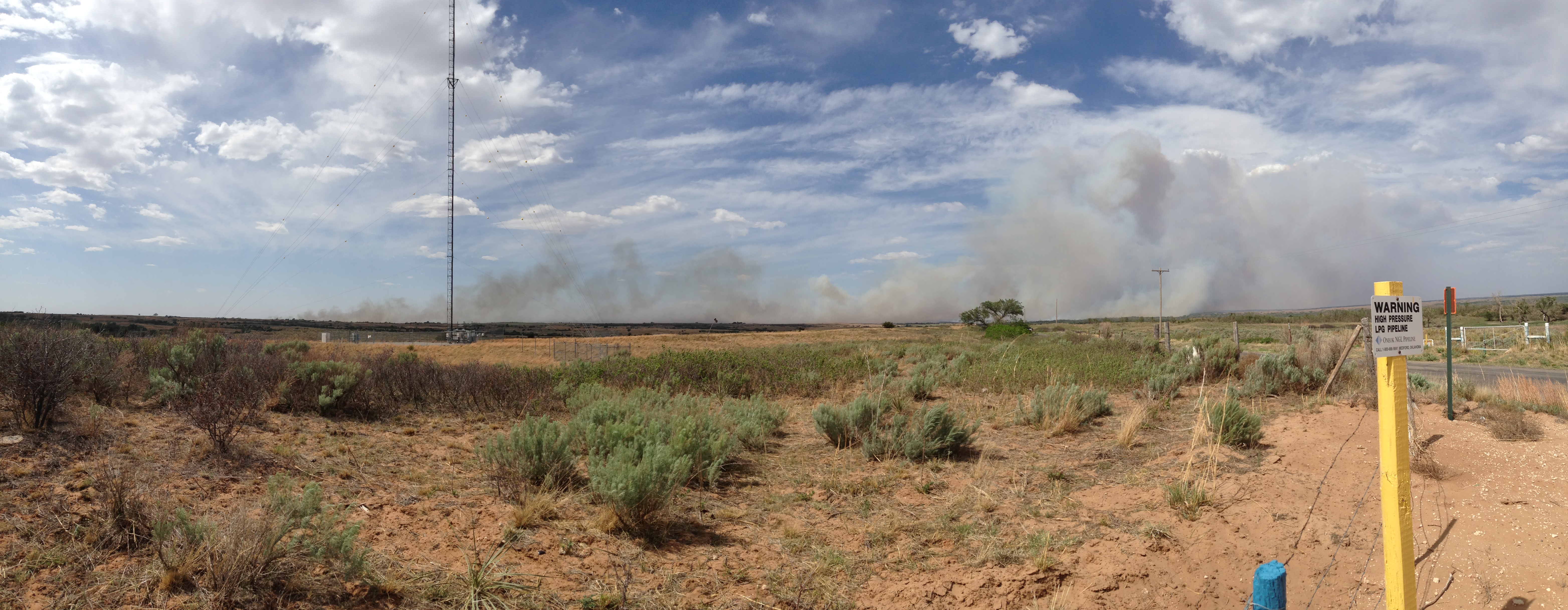
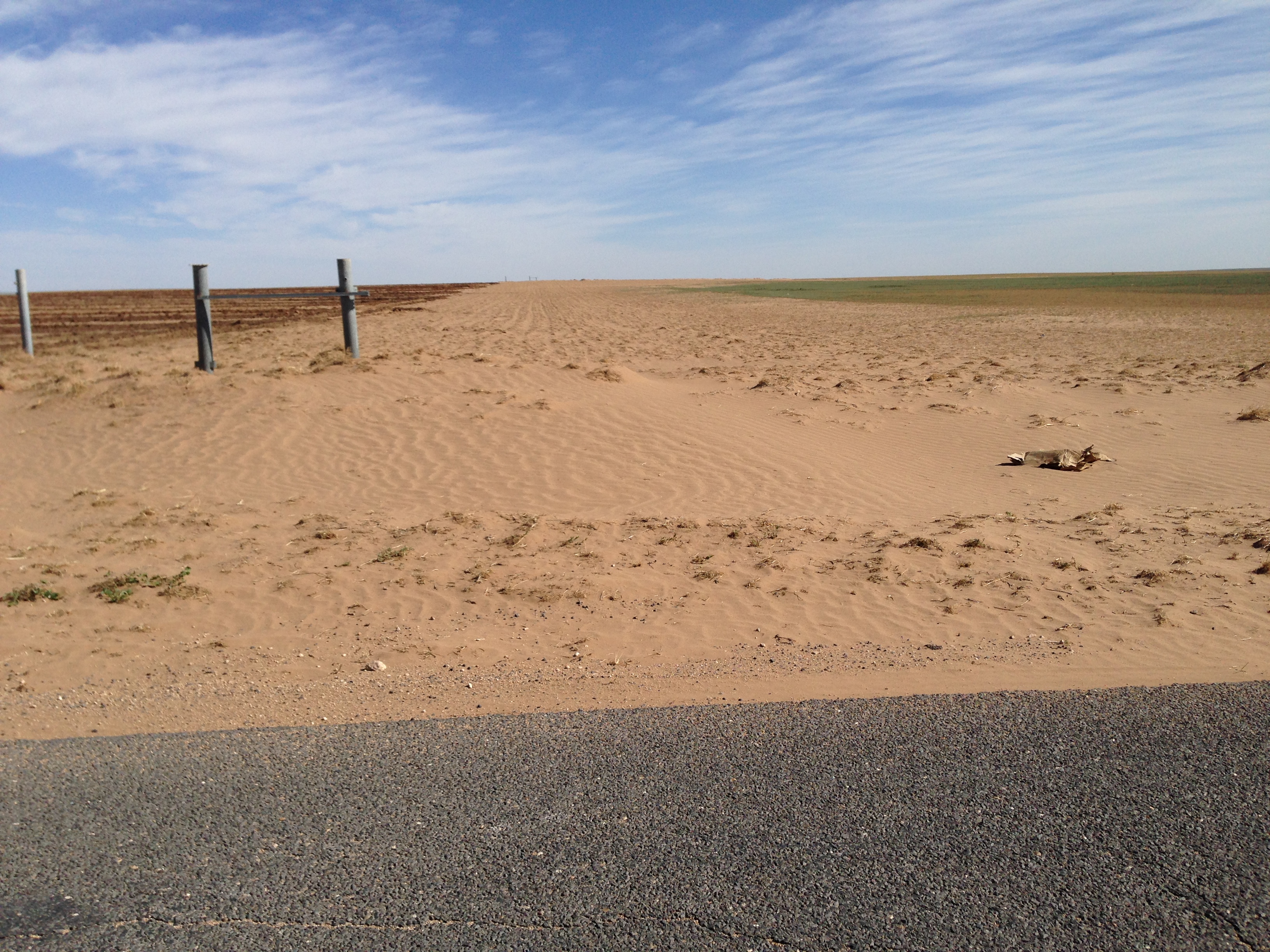
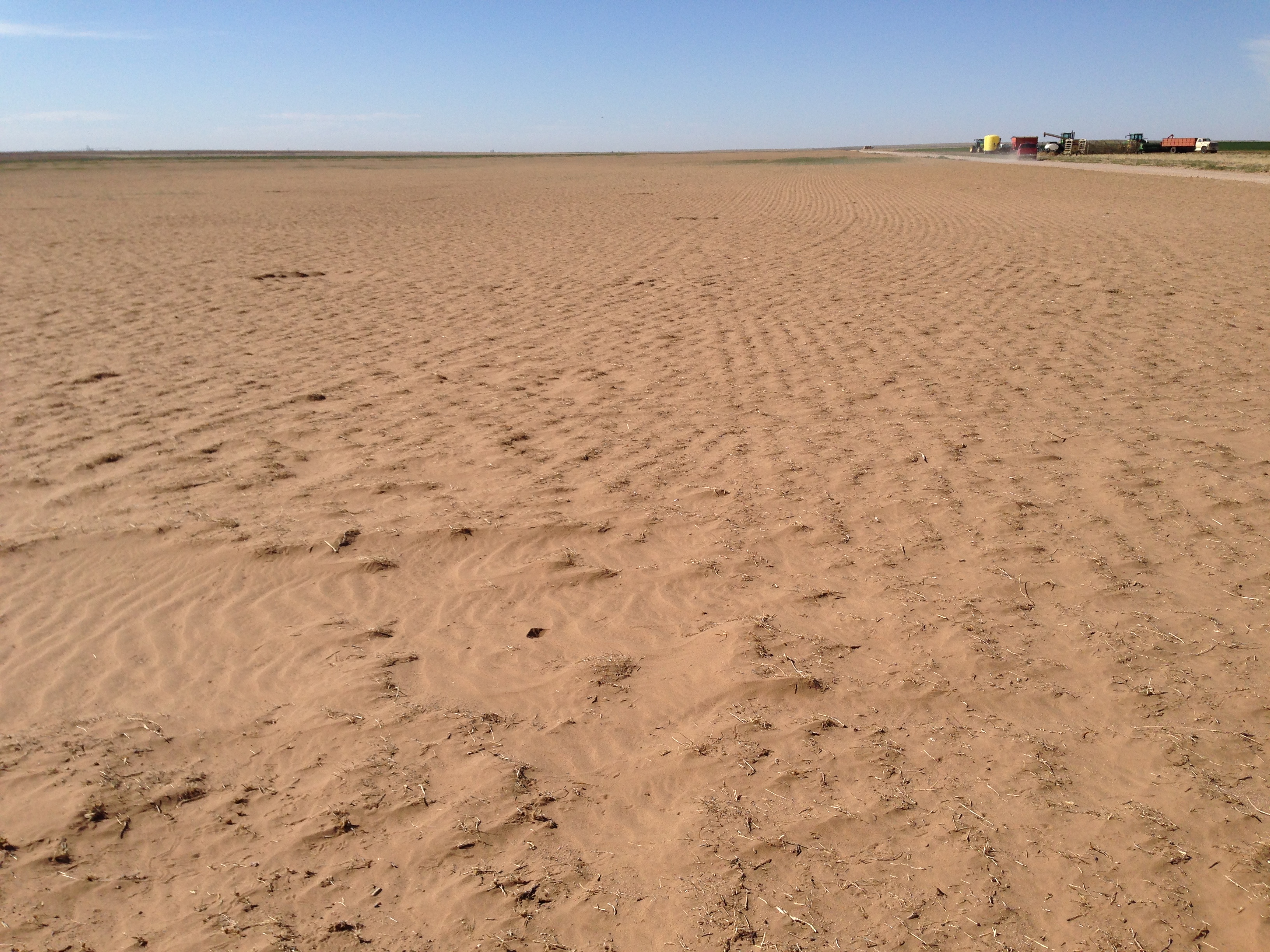
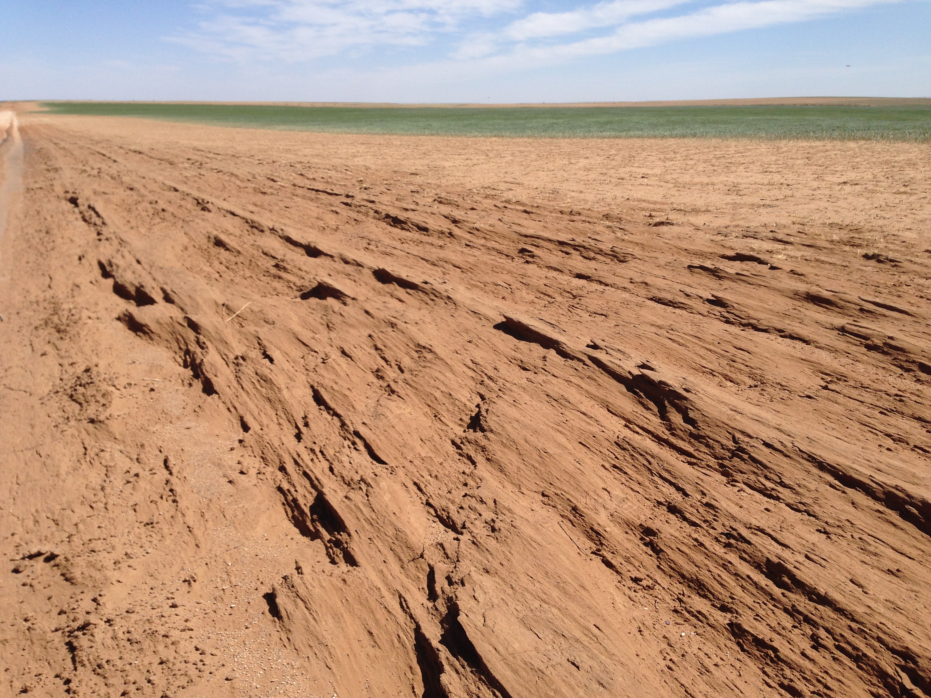
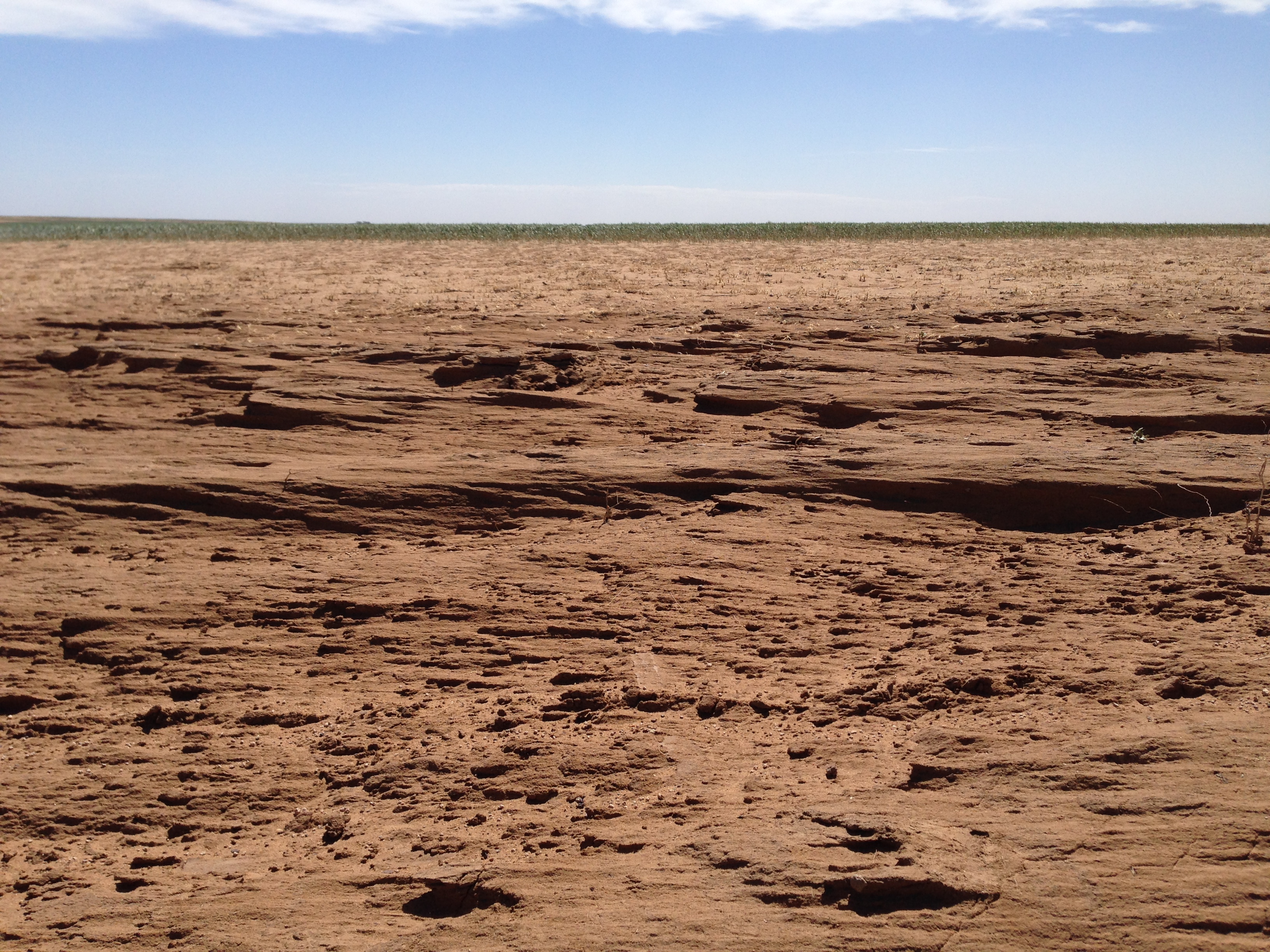
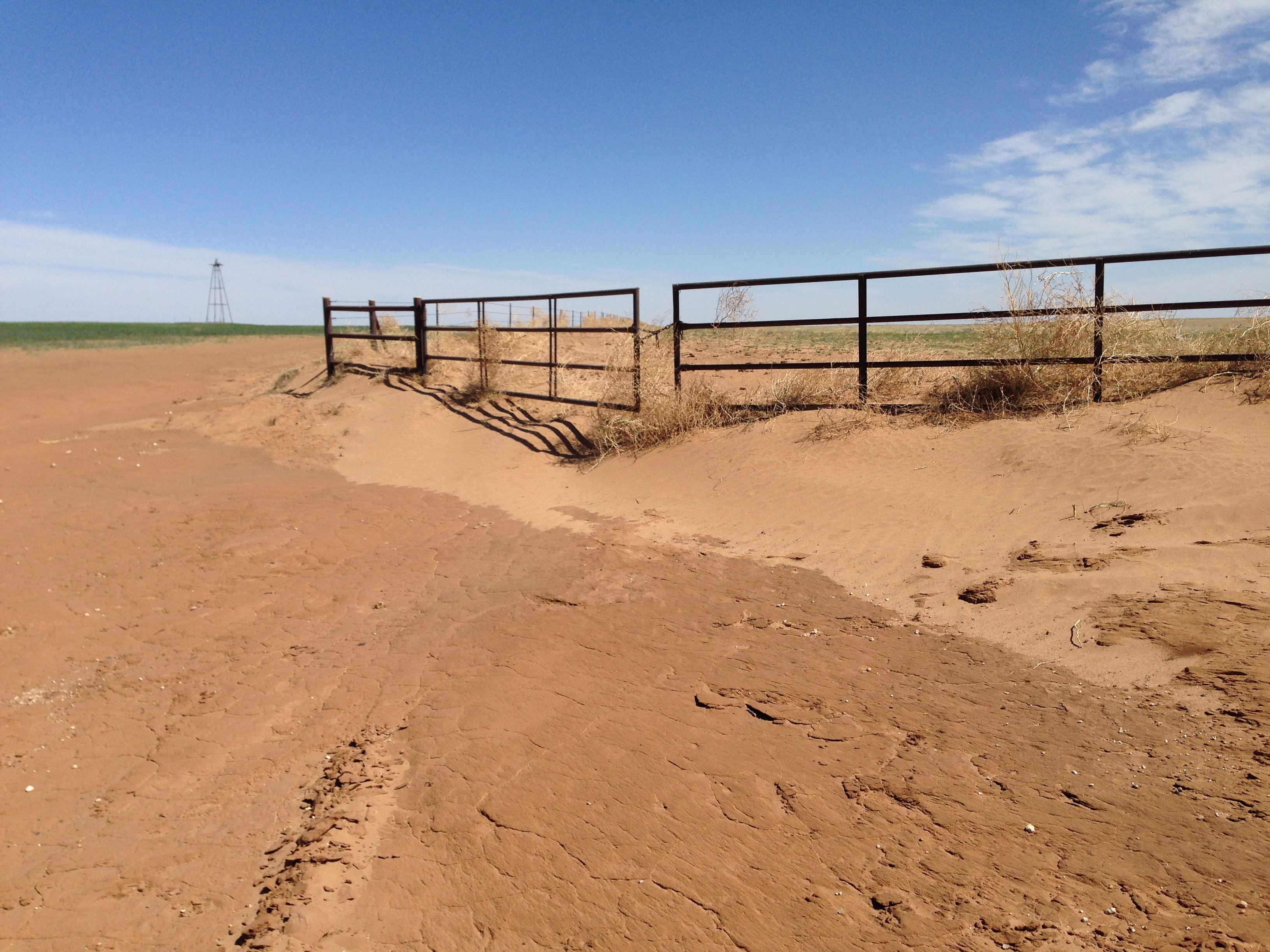
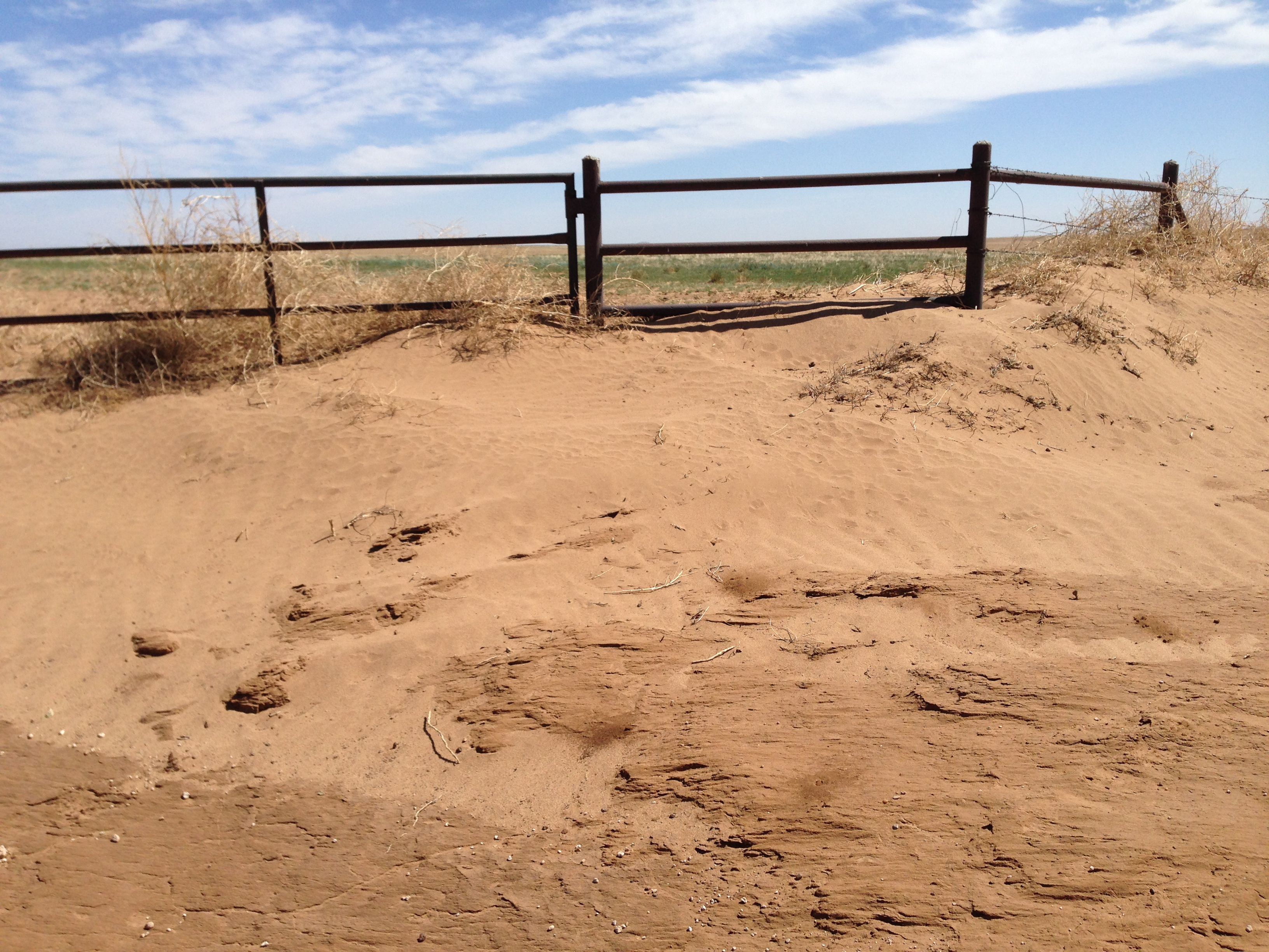
Speaking of the Panhandle, these pictures tell a thousand words, I think.
http://ticker.mesonet.org/archive/20140508/IMG_2387.jpg
http://ticker.mesonet.org/archive/20140508/IMG_2388.jpg
http://ticker.mesonet.org/archive/20140508/IMG_2390.jpg
http://ticker.mesonet.org/archive/20140508/IMG_2391.jpg
http://ticker.mesonet.org/archive/20140508/IMG_2393.jpg
http://ticker.mesonet.org/archive/20140508/IMG_2395.jpg
Gary McManus
State Climatologist
Oklahoma Mesonet
Oklahoma Climatological Survey
(405) 325-2253
gmcmanus@mesonet.org
==================================================
The OCS/Mesonet Ticker
https://ticker.mesonet.org/
To subscribe or unsubscribe from the Ticker
or for questions about the Ticker or its content
Phone or Email the Ticker Manager at OCS
Phone: 405-325-2253 Email: ticker@mesonet.org
---------------------------------------------------
-C- Copyright 2024 Oklahoma Climatological Survey
===================================================
|


 Tweet
Tweet