MESONET TICKER ... MESONET TICKER ... MESONET TICKER ... MESONET TICKER ...
April 15, 2010 April 15, 2010 April 15, 2010 April 15, 2010
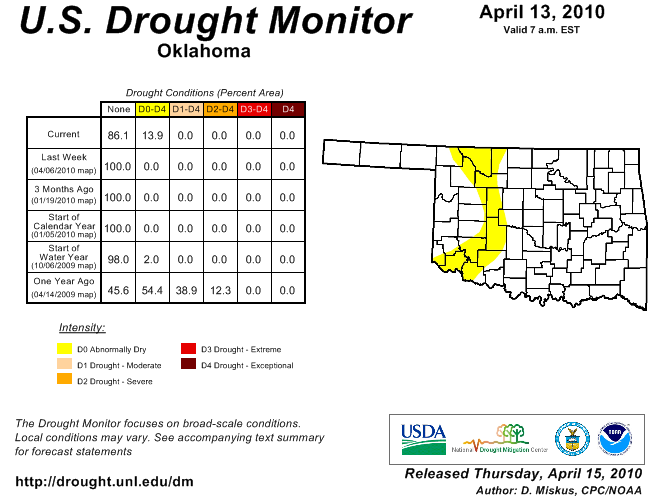
Bring on the rain...
because dry weather is back. The latest U.S. Drought Monitor which was released
this morning shows "abnormally dry" conditions have been reintroduced over
Oklahoma.
http://ticker.mesonet.org/archive/20100415/ok_dm.png
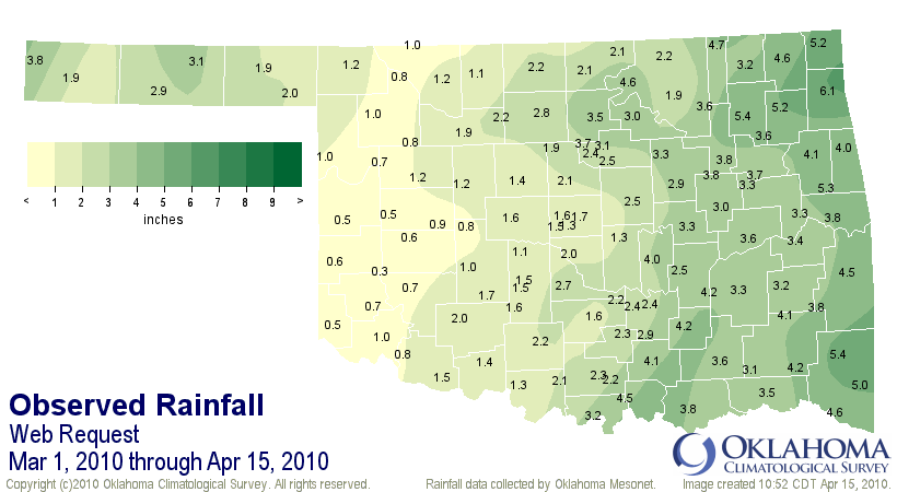
While so many of us were hoping for warm weather, we forgot to wish for rain as
well, so important for the beginning of spring as things begin to green up. Who
could blame us though after such a dark and dreary winter season? It has become
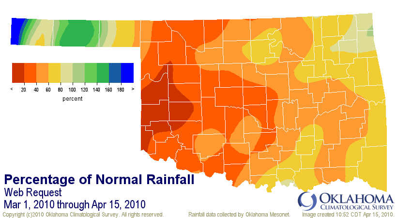
dry, however, as indicated by the Oklahoma Mesonet rainfall totals from
March 1-April 14.
http://ticker.mesonet.org/archive/20100415/March1-april14_total.png
http://ticker.mesonet.org/archive/20100415/March1-april14_pct.png
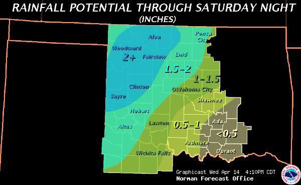
So we need the rains that are forecast for this weekend, especially in western
Oklahoma.
http://ticker.mesonet.org/archive/20100415/precip_forecasts_April15-20.gif
http://ticker.mesonet.org/archive/20100415/normanNWS_Rainfall_Totals.jpg
http://ticker.mesonet.org/archive/20100415/amarillo_graphicast.gif
Snowfall totals
Okay, now that the trauma of this past winter and all that horrible white stuff
that fell from the sky is past, time to take a look back at some preliminary
(PRELIMINARY!!) totals from the NWS COOPerative observing network, so the names
of the stations might throw you a bit. These totals are from December 2009-March
2010. Please keep in mind they are preliminarily preliminary.
GUYMON MUNI AP 28.6
OKLAHOMA CITY WILL ROGERS AP 23.2
TULSA INTL AP 22.8
SEDAN 21.0
MUTUAL 20.3
SEMINOLE 19.5
GUTHRIE 18.9
BLACKWELL 18.6
NEWKIRK 14.0
WEATHERFORD 13.7
GRADY 13.1
ARNETT 12.5
JEFFERSON 11.8
COLONY 11.5
MORAVIA 11.5
SAYRE 10.9
ALTUS IRIG RSCH STN 10.5
CRESCENT 10.5
WATONGA 10.4
BILLINGS 10.0
NORMAN 3SSE 9.2
ALTUS DAM 9.0
WILLOW 9.0
CENTRAHOMA 2 ESE 8.5
LOOKEBA 8.4
BATTIEST 8.2
HEADRICK 8.2
ATOKA 8.0
ERICK 4 E 8.0
CHATTANOOGA 3 NE 7.4
HELENA 1 SSE 6.9
PERRY 6.7
BROKEN BOW 1 N 6.3
HENNESSEY 4 ESE 6.0
MARSHALL 5.6
WICHITA MTN WR 3.8
HOLLIS 5E 3.4
Gary McManus
Associate State Climatologist
Oklahoma Climatological Survey
(405) 325-2253
gmcmanus@mesonet.org
==================================================
The OCS/Mesonet Ticker
https://ticker.mesonet.org/
To subscribe or unsubscribe from the Ticker
or for questions about the Ticker or its content
Phone or Email the Ticker Manager at OCS
Phone: 405-325-2253 Email: ticker@mesonet.org
---------------------------------------------------
-C- Copyright 2024 Oklahoma Climatological Survey
===================================================
|


 Tweet
Tweet